


 By Pepper Parr
February 4th, 2020
BURLINGTON, ON
What kind of a city are we going to have three, five or ten years hence?
City council told the SGL consultants that they were content with the work done so far and then endorsed that work with a unanimous vote. The work being done is referred to as the “preferred concept” which sets out what the city would like to see built.
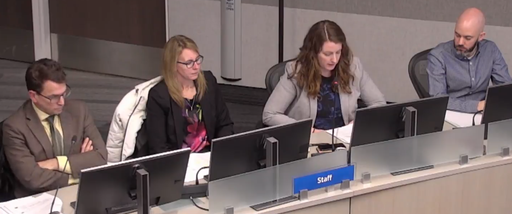
After months of work with the community and hours of thinking by the SGL, the consultants and Planning staff they were ready to put it all on the table. From the left: Paul Lowes, Catherine xxx, Alison Enns and Charles Walker
The reality is – the developer has to look at what the city wants to see and work through what they want to build. The end result is usually somewhere in between.
The consultants, the people from the Planning department working on this file, now return to their desks and begin developing the policy statements that will make the endorsement law sometime in April.
Not actually law quite yet.
When the scope stuff is completed and inserted into the approved but not yet WORD and then gets approved by Council – it then gets sent to the Region where they put their thumb print on the document and send it back – and THEN we have a new bylaw.
Of course everything that was submitted to the planning department under the old, existing and in force bylaw will be judged and interpreted under that Official Plan.
During the discussion and debate on want were presented as “preferred concepts” council made some significant changes.

Architectural model of Village Square; a part of the city that has heritage designation. and a rich past but has floundered during the past decade. Council wanted to build on the unique feel the Village has.
They took a much closer look at the Village Square and at the property on Brant, north of Caroline, where the No Frills Supermarket is located.
They also did a deeper dive on the property at Brant and Ghent where the Molinaro Group owns three of the four corners. Mention is made of a park in this location.
The lands on the north side of Fairview where the Paradigm development is ready to start on the final phase of the five tower development are getting a lot of attention. This is where the GO station is located and is designated as a MTSA with the expectation the high rise will prevail. Metrolinx, the authority that runs the GO train system owns a considerable amount of land within the boundary and, the city planners think Metrolinx is going to want to do some development of their own.
There is a lot of Metrolinx parking space on the north and south side of the railway tracks that could meet the criteria for the kind of development the current city council campaigned for in the October 2018 election.
The area that developers have been crawling all over is bound by Brant on the west, Fairview on the south, the railway tracks on the north and Drury on the east.
The following photo essay focuses on the No Frills location on Brant.
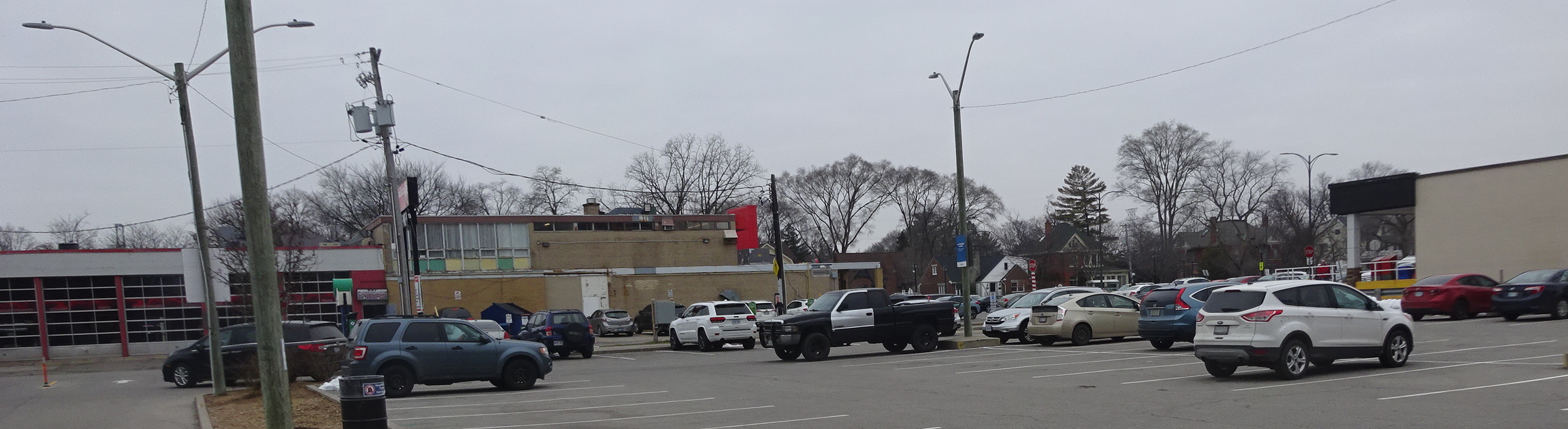
The land to the immediate south of the plaza property has a city parking lot on the east side and rear entrance to Joe Dogs and a tire dealer plus a convenience store. These could be included creating a very strong commercial centre.
John Street runs right into the property. The city has a large parking lot on the south east side of John, which at that point is actually a lane and not a street. Lanes get treated differently.
Council agreed that whatever John is going to be should be extended north to Victoria.
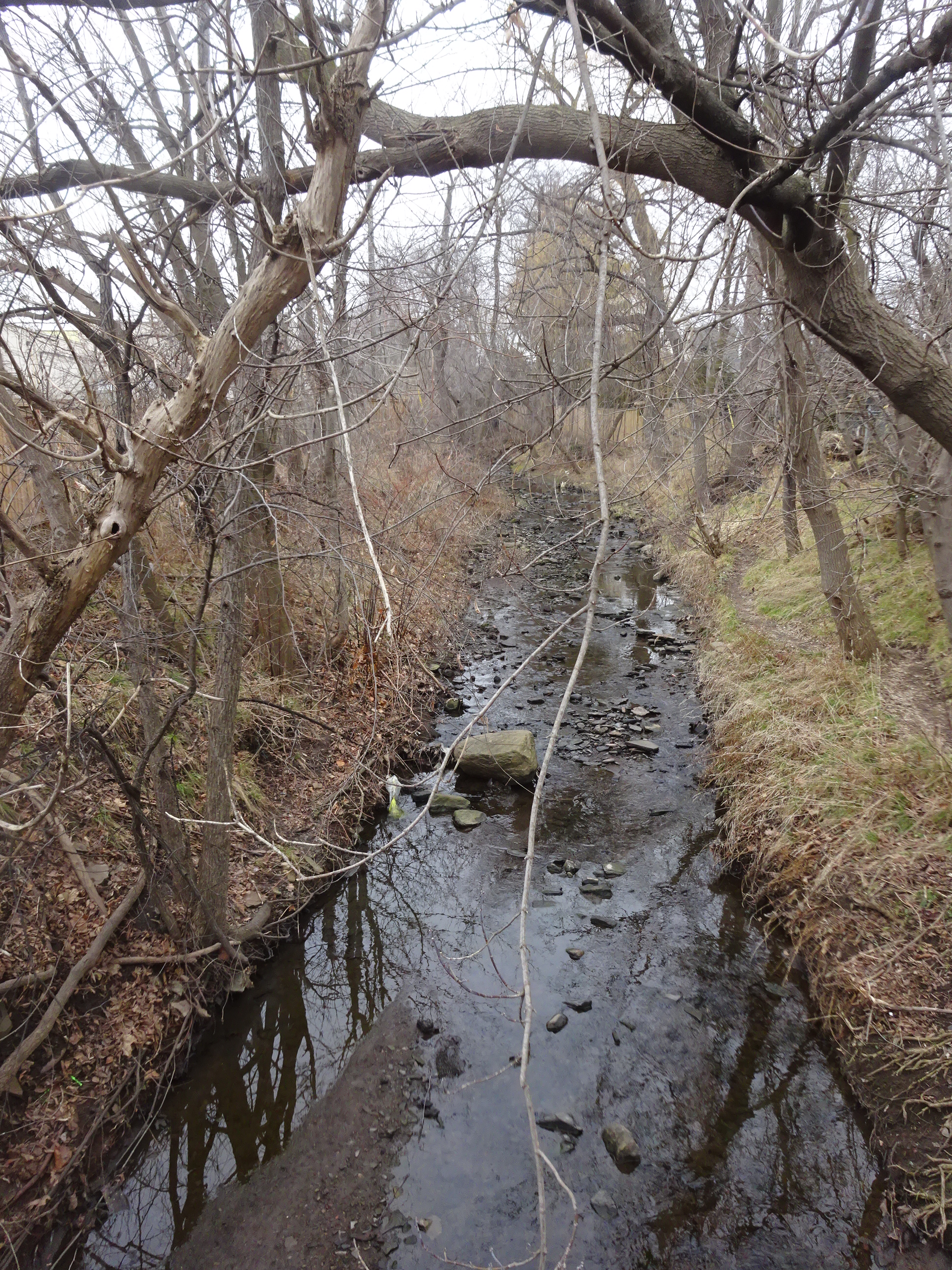
Rambo Creek could get an upgrade – maybe a place for swans?
Rambo creek is the eastern boundary. Plans are to clean up the space along the edge of that creek and turn it into a park like setting with benches.
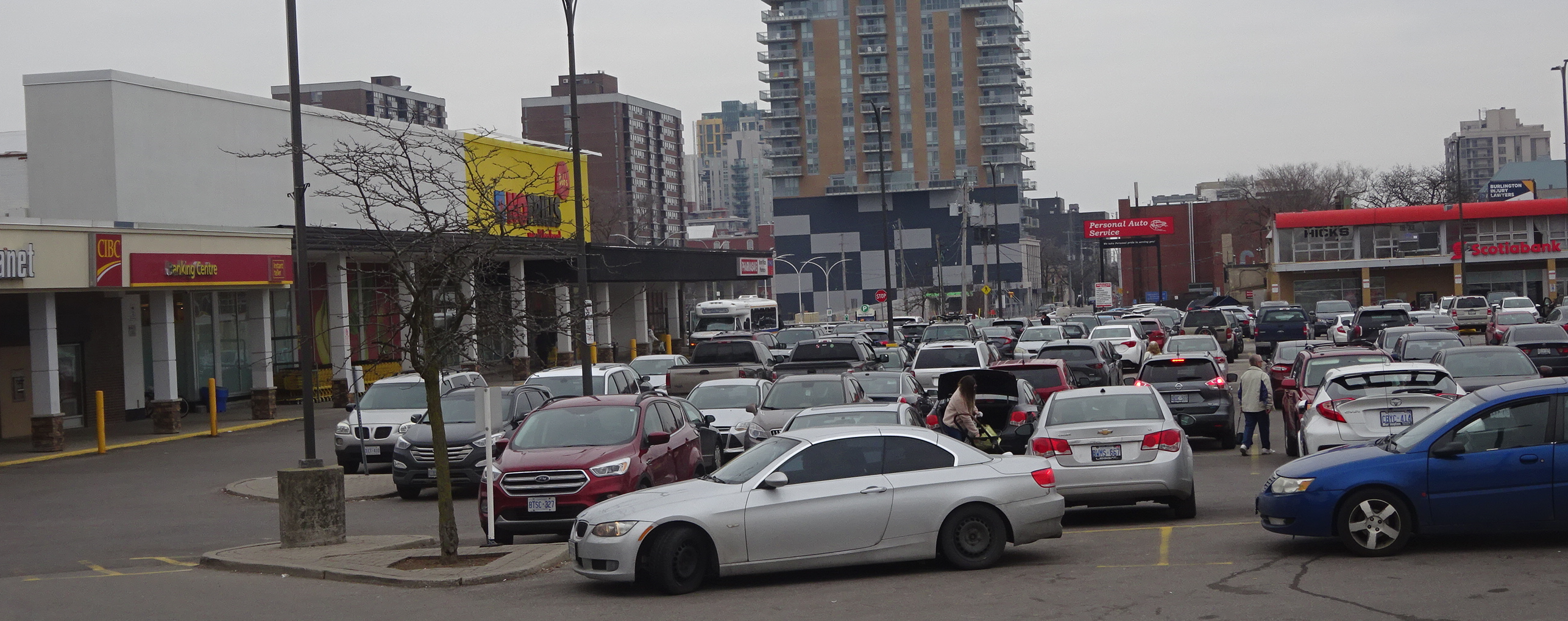
Mayor Marianne Meed Ward was very keen on the idea of a park in that immediate area. There are currently two banks, a dry cleaner, a nail shop, a Dollarama, a pharmacy and a Tim Hortons along with a building that has office space.
The city has yet to receive a development application from anyone. The Planners are setting out what the city will be asked to approve.
The property from the southern edge of the plaza to Caroline Street has another bank, two hospitality locations (Joe Dogs and an Italian restaurant and the Bell Telephone switching station on the corner of Caroline and Brant.
The switching station isn’t going anywhere soon but everything else has development potential and could become a major commercial focus with high rise residential included.
A super market would be moved close to the street with higher buildings – up to 17 storeys between the supermarket and Rambo Creek.
The planning consultant thinking would move the supermarket to the Brant street side, put parking underground and put residential reasonably close to the edge of Rambo Creek. This of course is all speculative.
In their report to council the consultants, SGL, with Planning staff cheering them on, recommended:

A transportation corridor, not necessarily a road, would be in the space and a park as well as a trail alongside Rambo Creek.
The Mid Brant Precinct will serve as a mixed-use neighbourhood containing a significant amount of retail space including servicing a food store function.
The precinct will function as a major retail centre that serves the day-to-day and weekly shopping needs of Downtown residents.
To support a walkable community the entire area must provide an accessible and attractive pedestrian environment with wide sidewalks, and greenway connections to adjacent residential neighbourhoods.
Future development will also result in the redevelopment of surface parking lots and the intensification of under-utilized buildings.
Brant Street will be enhanced as a Pedestrian Priority Street with wide sidewalks, bringing buildings close to the street and small urban squares adjacent to Brant Street. The extension of John Street will reduce the number of driveways necessary along Brant Street and help to improve the pedestrian priority of Brant Street through this precinct.
An increased open space buffer will be provided along Rambo creek with a walking trail along the west side of the Creek. John Street will be extended north as a local road abutting the open space. Together the open space and John Street will create a significant separation from the low-rise neighbourhood to the east.
To create an appropriate height transition to the neighbourhoods to the east, a 45 degree angular plane will be measured from the western property line of the creek block.
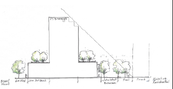
Rambo Creek is on the right.
A new public urban park will also be created in the block. A detailed block plan study will be required prior to applications with the block from Caroline Street to Victoria Avenue to identify the size, location and configuration of the public park; the boundary of the open space along Rambo Creek; the configuration of the John Street extension and the siting of all buildings.
Max. 3 storeys for 20 m. from Brant Street.
3 storeys abutting Rambo Creek
Max. 17 storeys in centre of the block subject to a 45 degree angular plane from the western property line of the creek block.
Later this week we look more closely at the plans for the land around the GO station, the Village Square and then the Brant Ghent intersection.


I don’t see much change from the previous plan. 17 story buildings??? No matter how much you try to beautify down town it is still going to be a zoo. You may as well just close Brant and open it to walking only. While you are at it do the same for Lake Shore. The intensification is not supported by the infrastructure.