


 By Staff
May 26th, 2023
BURLINGTON, ON
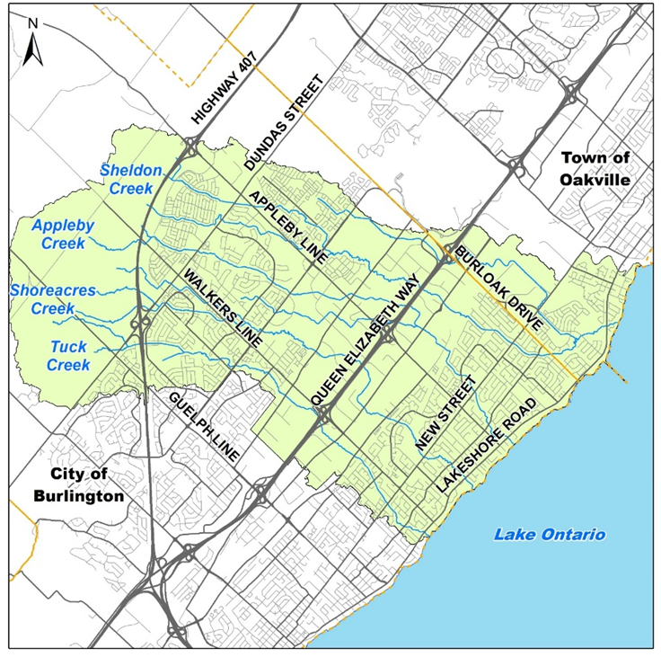
Conservation Halton (CH) is updating flood hazard mapping for Tuck, Shoreacres, Appleby, and Sheldon Creeks that cross through parts of East Burlington and southwest Oakville.
Flood hazard mapping is an important tool that supports CH’s regulatory and planning and flood forecasting and warning programs, as well as municipal emergency management, flood mitigation, and infrastructure design. “Flood hazard” means an area near a river or stream not ordinarily covered by water that is flooded during extreme storm events.
To learn more about CH’s East Burlington Creeks Flood Hazard Mapping Study and updated draft flood hazard mapping, we are inviting the public to join us for a virtual public engagement session on June 6, 2023 at 7:00pm.
This is an opportunity for those looking for further information to learn more and ask questions. To register for the virtual public engagement session, please visit
https://www.conservationhalton.ca/mapping-and-studies/ and click on “East Burlington Creeks Flood Hazard Mapping Study”.
Draft mapping and reports, as well as a recording of the public engagement session, will be available online for comment until July 6, 2023.
After the public engagement session and 30-day public review period, CH will review all feedback received and make any necessary revisions to the draft flood hazard mapping. It is anticipated that the final draft mapping and study will be presented to CH’s Board of Directors for their approval and inclusion in CH’s online Approximate Regulation Limit (ARL) mapping later this year.
To register for the virtual public engagement session, please click here: https://us02web.zoom.us/webinar/register/WN_sl19iHNURcerow1W3mK8PQ
An important exercise to better understand how the several creeks that run through the city have to be monitored now that we are undergoing a climate change.
Should you have any questions about the study or upcoming Public Engagement Session #2, please contact CH via email at floodplainmapping@hrca.on.ca or call (905) 336-1158 ext. 2296.

Discover more from Burlington Gazette - Local News, Politics, Community
Subscribe to get the latest posts sent to your email.
