


 By Staff
July 2nd, 2024
BURLINGTON, ON
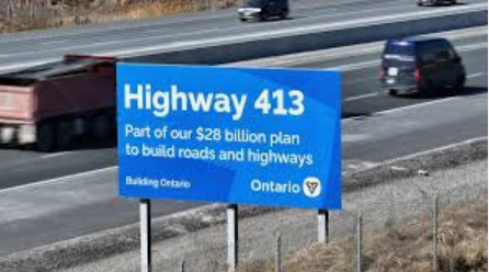
Now that the decision has been made the province wants your thoughts and concerns about the impact construction of Hwy 413 will have on navigable waterways.
A link to the survey the government asking people to complete is HERE
The Environment
Learn about the Environmental Assessment process for the Highway 413 Project and how Ontario protects the environment when building new infrastructure.

The proposed Hwy 413 will cross creeks, streams and small rivers. What are your thoughts on how this might impact you?
Environmental and Agricultural Considerations
Ontario’s Greenbelt Plan recognizes the importance of infrastructure for people’s economic well-being, health and quality of life and it permits new projects provided they service the significant growth and economic development expected in southern Ontario. The province is committed to maintaining strong environmental oversight of the Highway 413 Project to minimize impacts on natural terrain. Ontario is also, taking steps to expand the Greenbelt to protect environmental, groundwater and agricultural resources for future generations.
Public protests and solid opposition within the legislature turned the Greenbelt plans around – same does not appear to be happening with the 413.
The preferred route for Highway 413 was chosen in part to minimize impacts to the Greenbelt, and as the project moves ahead, Ontario would carefully consider all impacts of the project and its construction. For example, the protection of major watercourses, including the Credit and Humber rivers was a top priority when determining the preferred route. Proposed watercourse crossings would be designed with the intent to minimize the impacts to the watercourses, the valley lands, floodplains, fish habitat, wildlife and trail networks. This would help to minimize the project’s impact, maintain fish passage and habitat, minimize vegetation loss and protect Species at Risk.
Protecting agricultural lands is also a top consideration. While a new transportation corridor cannot completely avoid impacting agricultural land, Ontario will be undertaking an Agricultural Impact Assessment to help understand and minimize the impacts on the region’s agricultural land.
Navigable Waterways

One of thew many streams that the 413 will cross.
Plans for work in or around any navigable waterway may require authorization from Transport Canada.
A navigable waterway, as defined in the Canadian Navigable Waters Act (CNWA), is “a body of water, including a canal or any other body of water created or altered as a result of the construction of any work, that is used or where there is a reasonable likelihood that it will be used by vessels, in full or in part, for any part of the year as a means of transport or travel for commercial or recreational purposes, or as a means of transport or travel for Indigenous peoples of Canada exercising rights recognized and affirmed by section 35 of the Constitution Act, 1982, and
- there is public access by land or by water;
- there is no such public access, but there are two or more riparian* owners or
- His Majesty in right of Canada or a province is the only riparian owner.”
* Riparian refers to relating to or situated on the banks of a body of water.
Initial Screening
Within the Study Area, the Project Team has identified 24 stream or river locations that may be navigable.
As part of the assessment to initially determine the navigability of the watercourses crossing the proposed Highway 413, Hwy 410 and Hwy 427 extensions, fluvial geomorphic data (channel definition, hydraulic flow regime, and channel dimensions) were used to set the criteria for this initial assessment. This initial screening assessment is based on a previous navigable waters requirement that a channel must be at least 3.00 m wide and about 0.30 m deep across the channel.
The below mapping provides the results of this initial screening assessment. However, further consultation and field investigations will be needed to complete the assessment for the navigability of the initially screened water crossings. Please use the numbering on the map to identify the corresponding watercourse potentially used for navigation.
Provide Your Input
The Project Team requires input from Indigenous communities and members of the public to confirm past, present, or potential future uses of waterways. Please tell us about waterways within the Study Area that you previously or currently use with a canoe, kayak, stand-up paddleboard or other watercraft. This information will help verify the number of current navigable waterways and develop plans to avoid or mitigate any effects the Project may have during construction or operation.
The Project Team will work to avoid and/or minimize potential impacts to navigation and follow the processes outlined in the CNWA. This process will include ongoing consultation with Transport Canada, Indigenous communities and the public as the Project progresses through Preliminary Design.
The survey will be available for a 30-day comment period from July 2nd to August 2nd Input and feedback will be summarized in a finalized report on the Highway 413 website.
Link to the survey is HERE

Discover more from Burlington Gazette - Local News, Politics, Community
Subscribe to get the latest posts sent to your email.

Like other similar requests from this government for comment, it is unlikely any input from mere citizens will be considered, since the highway is already a done deal.
How many acres of established orchards will be destroyed forever?