 By Pepper Parr
January 10th, 2019
BURLINGTON, ON
First of a five part series.
Back in July of last year, before the residents of the city decided they wanted a different city council, there was a report that was discussed debated and filed. It was a discussion paper on the draft precinct plans and land use policy directions for the Aldershot GO, Burlington GO and Appleby GO Mobility hubs. The report was received and filed and will, in the near future come back to council.
Mobility hubs were put into the planning lexicon by the provincial government- they wanted to see more intensive development close to the GO stations. For Burlington that meant development in Aldershot, along Fairview next to that GO station and in he east end beside the Appleby Station.
Each of these stations has large pieces of land on which cars park while residents take the GO train to some other location.
Burlington planners didn’t seem to be fully aware of what the term a mobility hub meant; the Mayor at the time certainly didn’t have a firm grip on the concept.
Those days are behind us – those who are aware of what is going on in the city certainly understand the concept – where the differences exist is – do we want what the province is suggesting and who determines the boundaries of each mobility hub?
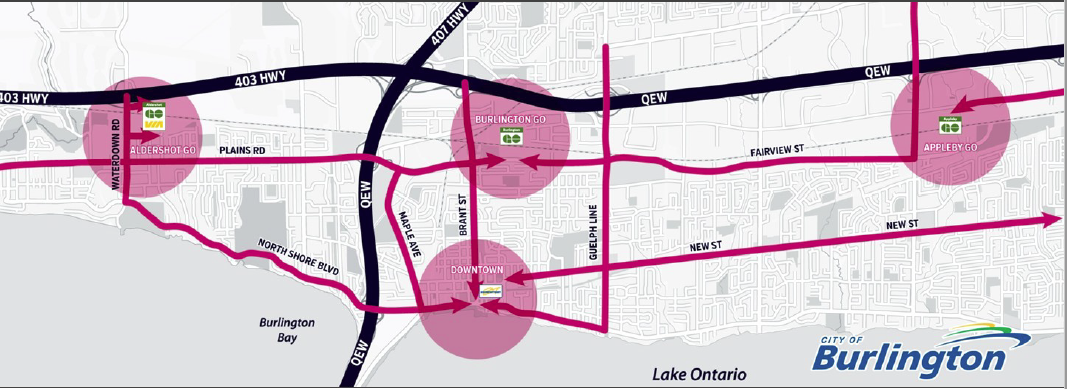
The mobility hubs are part of a much larger picture – there is a Strategic Plan that is going to get some tweaking to make it fit into the priorities of the new council; the Official Plan is back in the hands of the city and that will get a review that most people expect to be significantly, if not radically different than what was approved WHEN
The purpose of the report that went before a Standing Committee, was to present the draft precinct plans for the GO Station Hubs (Aldershot, Burlington and Appleby GO) and associated draft key land use policy directions for community and Council feedback and discussion. These draft precinct plans are key inputs into the creation of the Area Specific Plans (ASPs) for the three GO Station Mobility Hubs.
By undertaking secondary plans or Area Specific Plans (ASPs) for Burlington’s Mobility Hubs, the City continues to implement the objectives of the Strategic Plan and Official Plan to direct intensification, achieve transit-supportive densities and develop pedestrian and transit-oriented mixed uses areas in the downtown Urban Growth Centre and at the City’s key major transit station areas (i.e. the GO stations).
In 2014, through the Official Plan Review process, the City along with consultants from Brook McIlroy completed the Mobility Hubs Opportunities and Constraints Study, which provided a high-level analysis of each of the City’s Mobility Hubs and informed the development of the study areas for future Area Specific Planning work to be done in each of the Mobility Hubs.
In July 2016, Burlington City Council approved a staff report which outlined a work plan, allocation of staff resources and required funding to simultaneously develop four ASPs, one for each of Burlington’s Mobility Hubs. The project was approved with unanimous City Council support; most of that council is now part of the city’s history.
In December 2016, the Mobility Hubs Team undertook a competitive Request for Proposals (RFP) process to retain a consulting team to assist with the development of ASPs for each of Burlington’s four Mobility Hubs, with the goal of supporting the future redevelopment and intensification of these areas.
In April 2017, the Mobility Hubs team initiated the study publicly with a launch party followed by the beginning of a comprehensive public consultation program around the future vision for each of the Mobility Hubs.

The province knew it had to upgrade the GO train service – it will become every 15 minute service in the not too distant future and the longer term plan is to electrify the system.
In addition to achieving City Council’s objectives for intensification and growth, the Mobility Hub ASPs will also support the objectives of Metrolinx’s The Big Move, including the development of Regional Express Rail (RER) service, through the creation of complete communities with transit-supportive densities, as identified through the Province’s Growth Plan for the Greater Golden Horseshoe and in the Region of Halton’s Official Plan (2017).
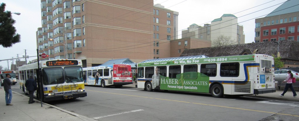
The Downtown mobility hub will be somewhere along John Street – making use of the small station that the Transit department once recommended be removed.
Schedule 1 of The Big Move recognizes two Mobility Hubs in Burlington: the Downtown Mobility Hub is identified as an Anchor Mobility Hub and the Burlington GO Mobility Hub which is identified as a Gateway Hub. In the City’s New Official Plan, all three GO Stations and the downtown are identified as Mobility Hubs and as areas of strategic importance to accommodate the City’s future growth.
The hubs were to be where the growth was to take place which made sense. The problem was that development proposals for the downtown core began to come in that used to creation of a downtown mobility hub as part of their justification. A large number of citizens didn’t see that kind of development as ideal for the city.
The creation of a Downtown hub has been very controversial. Many feel that the creation of this “anchor” hub made it possible for developers to justify more height and density than was felt fit in with the small town feel that people wanted in the core part of the city.
Those developments became the election issue that resulted in a new council who now have to decide what they want in the way of development in the city. MArianne Meed Ward made it clear during the election that she believed the population growth expected of Burlington by the province had already been achieved.
On December 4, 2017, staff brought forward a report which presented preferred concepts and supporting technical memos for the GO Station Hubs (Aldershot, Burlington, and Appleby GO) for community and Council feedback and discussion. The preferred concepts outlined land uses and building heights within each of the three GO Station Hubs. These preferred concepts were based upon public and stakeholder feedback and were intended to prompt discussion regarding the emerging vision for each of the hubs. Since that time, staff have taken that feedback and used it to develop draft precinct plans for each hub which will be further explored in this report.
With this as background let us take a look at the plans for each of the mobility hubs and better understand what is planned and what the impact on the city is likely to be.
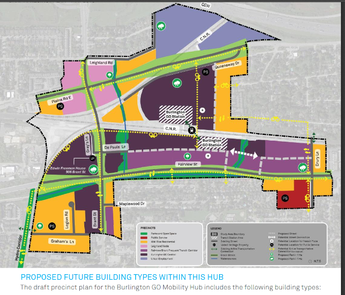
The coloured shading sets out where the different forms of development could be located in the Burlington GO mobility hub,
The objectives for each hub include:
- Directing the highest intensity to areas in close proximity to major transit stations and to current or planned frequent transit corridors;
- Minimizing shadowing impacts on public parks and open spaces and low density established residential neighbourhoods;
- Providing height transitions to established low density residential neighbourhoods outside of the hub boundaries;
- Providing increased permeability for active transportation options to and from GO stations;
- Providing recognition of existing cultural heritage resources;
- Creating feasible opportunities for new parks and open spaces to serve current and future residents and employees in each area;
- Identifying new and existing streets and other linkages to serve as key green, active transportation corridors to facilitate improved connectivity within, to and from the hubs;
- Creating new parks and open spaces that integrate with and enhance the existing city-wide parks and open space system;
- Providing a level of intensity to attract new retail and commercial functions to serve current and future residents and employees;
- Recognizing existing employment functions and providing for a variety of new and expanded employment and commercial opportunities;
- Planning for a variety of housing forms to attract a broad range of
- Identifying opportunities for a broad range of future public service facilities in locations that provide the greatest access to future residents and in locations that provide the greatest flexibility to accommodate a variety of functions and uses;
The Aldershot, Burlington and Appleby GO Mobility Hubs each required unique considerations with respect to the location and distribution of building typologies, parks and open space networks, public service facilities, active transportation connections, and streets based on the existing context within and around the hub, which was informed, in part, by public and stakeholder feedback.
The following objectives were developed for the Burlington GO Mobility Hub
The existing area around the Burlington Hub is comprised of large parcels in areas heavily fragmented by rail/spur lines, grade separated overpasses and underpasses and wide arterial City and Regional streets.
The study area is almost void of any existing residential uses, with the exception of the residential Paradigm development on Fairview, that will have residents in the first of five towers in the near future.
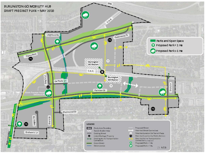
With little to none in the way of parkland within the Burlington GO mobility hub planners are going to have to be creative and ready to do some arm wrestling with the property owners to get parkland.
The area also lacks any functional parks or open spaces. Most of the properties currently contain large-scale and/or auto-centric commercial uses as well as heavy employment uses both within and adjacent to the study area.
Within the Burlington GO Mobility Hub, the following were identified as additional unique objectives for this area:
- Limiting intensity in areas within close proximity to existing industrial uses which continue to have a planned employment function; and,
- Locating the highest intensity developments in locations that will support strong active transportation and frequent transit corridor connections as well as provide new uses and amenities that will support the planned functions of both the Urban Growth Centre / Downtown Mobility Hub and the Burlington GO Mobility Hub;
Within the current and Council-adopted Official Plans, the City utilizes a precinct planning system for the Downtown in place of traditional city-wide land use designations typically found in other areas of the city. For Burlington, this precinct system allows for the recognition, and focused long-term planning of, discrete but inter-related areas, each with their own specific characteristics and/or planned role/function within a concentrated geographic area of the city.
Because of the limited geographic area within which precincts apply, precincts can provide the opportunity to establish highly detailed and customized policies and regulations to address a variety of matters specific to that area.
As a result of on-going public and stakeholder feedback, technical studies as well as discussions with Council at the December 4th, 2017 Committee of the Whole workshop, staff incorporated general changes in terms of mapping and terminology as part of the development of the draft precinct plans which are presented in this report. The following outlines these changes:
- Mapping Changes
- Conceptual Streets/Public Rights-of-Way: Early-stage concepts included the identification of conceptual street locations (including both new streetsand extensions to existing streets) to improve pedestrian and cycling permeability throughout the hub as well as to enable conceptual opportunities for new development on large parcels. For the purposes of precinct planning, the majority of the conceptual streets have been removed from the mapping with only key new or extended arterial streets being retained in mapping.
The location and nature of any additional streets/public rights-of-way will be subject to the outcome of identified transportation/traffic infrastructure requirements resulting from the Mobility Hubs transportation studies and incorporated as part of future draft Area Specific Plan mapping and policies for public consultation in the new year.
- Proposed Parks and Open Spaces: Early-stage concepts included the identification of new park locations as well as the conceptual configuration of such parks. The exact configuration of parks was, in part, correlated to the conceptual street network which has been removed for the purposes of precinct plan As a result, staff have refined the mapping to identify parks with a symbol rather then an exact configuration. However, the general locations of key proposed park locations have been maintained and are reflective of staff collaboration with the City’s Parks and Open Space team.
Upon completion of a more detailed street network, staff will identify any recommended detailed park requirements, including sizes and configurations, as part of the future draft Area Specific Plan mapping and policies for public consultation in the new year.
- Terminology
- Community Use – Public Service Terminology: Early stage concepts included Community Use (CU) symbols to indicate the need for community use facilities in particular locations throughout the hubs. For clarity and consistency, staff have revised the terminology from Community Use facilities to Public Service facilities to align with the terminology included in the City’s newly adopted Official Plan and the terminology used in the Provincial Policy Statement. These facilities will accommodate current and future public services within the hubs including healthcare, education, emergency and protective services, cultural activities, and civic administration, among other things.
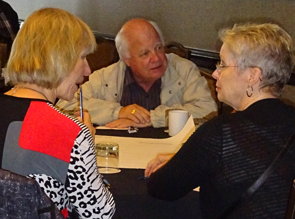
Citizens, developer representatives and members of Council took part in the public sessions. Now retired Councillor John Taylor attended most of the sessions
Since the Fall of 2017 staff have held numerous public engagement events to engage with the community about the future of the GO Station Mobility Hubs in various formats including public open houses, online surveys and individual meetings with various residents, property owners and other stakeholders.
Staff held nine (9) public open houses, three within each of the GO station hubs, to solicit feedback regarding the most recent draft precinct plans presented through this report.
Staff have identified the following recurring topics which have emerged from feedback provided by the community to-date with a corresponding staff response.
Parkland dedication requirements:
Some property owners and developers have expressed concerns regarding the potential need to provide parkland dedication to the City as part of a future development as identified in the draft precinct plans.
Staff Response:
Under The Planning Act and City of Burlington Parkland Dedication By- Law, the City is entitled to a parkland dedication from a development equaling 1.0 hectare for every 300 residential units or 2% of the total land area for commercial/industrial developments. Historically, in urban intensification cases where physical parkland was not deemed to be required, the City has exercised cash-in-lieu of parkland in accordance with The Planning Act and the City’s By-law. In the mobility hubs, physical parkland dedication will be a priority as these areas are being comprehensively planned as transit-oriented urban neighbourhoods that will accommodate a significant increase in residents and employees relative to what exists today.
The provision of new park spaces will be integral to ensuring that the mobility hubs are developed as healthy, active and livable neighbourhoods. As such staff have been highly focused on identifying new strategic park locations which would be the focus of future parkland dedications resulting from redevelopment. In identifying new strategic parks, staff have been cognizant of the potential constraints a physical parkland dedication may have on the overall redevelopment potential of a property. Working in collaboration with the City’s Parks and Open Space team within Capital Works, the precinct plans identify significant park locations within the hubs to ensure park needs for the entire hub are not borne by a single property and to also ensure that park locations are focused on larger parcels which have a greater opportunity to provide a parkland dedication while continuing to allow for significant redevelopment of the site.
Maximum height of tall buildings:
Comments have been received expressing concerns regarding the maximum height peak that could be achieved within the GO station mobility hubs.
Staff Response:
The draft precinct plans provide for a mix of building types at varying heights and intensities. The tallest and highest intensity developments are limited to the “Central” precincts proposed within each of the GO hubs.
Generally, these precincts are located in closest proximity to the GO stations themselves and rail corridor which provide for a significant separation from low density residential areas within or adjacent to the hubs. The draft precinct plans contemplate a maximum building height of 30 storeys within these precincts.
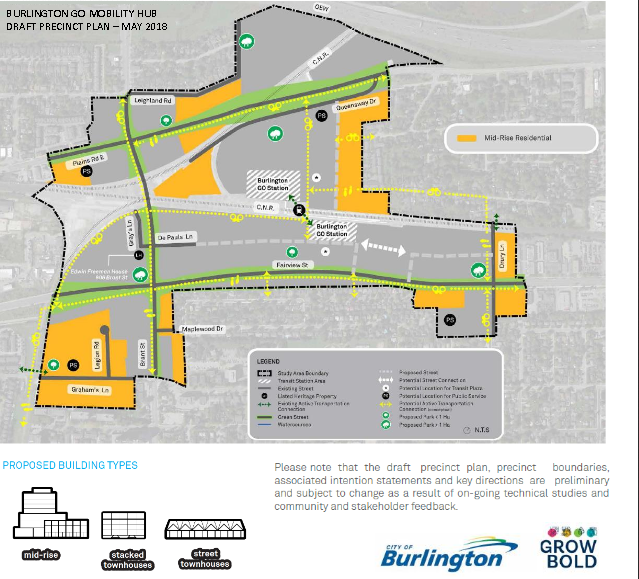
Locations for possible mid rise buildings are defined; will developers push for more height and density?
This maximum building height is intended to recognize the significant opportunity these sites have to accommodate both population and employment growth in close proximity to higher-order transit balanced with the need to ensure that building intensity is limited so as to not permit long-term build-out of the mobility hub to be concentrated to a limited number of properties. Staff continue to review best practices from other municipalities for this precinct and continue to seek community feedback regarding this proposed maximum height for these “Central” precincts.
It must be noted that not all sites within a “Central” precinct, or any precinct contained within the mobility hub draft precinct plan, may be able to achieve the maximum building height contemplated. The ability of a development to achieve the maximum permitted height/intensity will be based on a variety of site specific considerations such as shadowing, transportation impacts and other infrastructure capacity matters, among others, which can only be properly assessed at the time of a development application.
Current and future traffic congestion:
Concerns regarding impacts of future development within the mobility hubs on traffic congestion have been raised consistently throughout mobility hub public engagement.
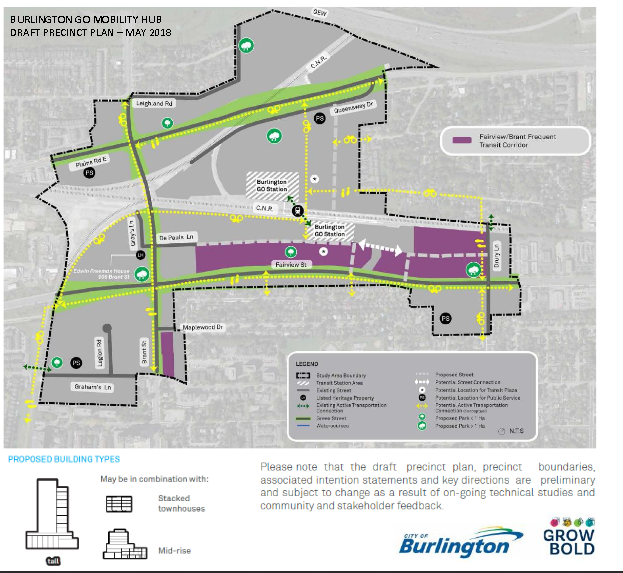
The planners want to see more in the way of traffic along Fairview. Getting into the southern GO station parking lot is a challenge as it is.
Staff Response:
Consultants for the Mobility Hubs project are currently undertaking transportation studies to evaluate the existing traffic conditions within each hub and the projected impacts resulting from the planned people and jobs capacity of the hubs at build-out. This information will inform staff’s development of new transportation policies and new transportation infrastructure proposed for each hub, including potential active transportation connections and new streets, which will be needed to mitigate future impacts. More detail about all technical studies being undertaken as part of the development of the Area Specific Plans, including transportation studies, are provided in Section 6.0 of this report.
Compatibility with established residential neighbourhoods:
Concerns have been raised by residents of established residential neighbourhoods both within or adjacent to each of the mobility hubs about the potential impacts of tall building on their homes and neighbourhoods.
Staff Response:
As part of staff’s development of the draft precinct plans, tall building precincts were located in strategic areas to mitigate potential impacts on any existing established residential neighbourhoods and further refined in response to public feedback received through the various public meetings held. Each of the mobility hub precinct plans also utilizes a variety of building typologies and scales of development, such as mid-rise buildings and low-rise formats, to create transitions between the tallest buildings in the hub and any established residential areas.
As staff develop detailed policies for each precinct through the Area Specific Plans, additional building design and built form requirements will be investigated and established in policy and future design guidelines, to further enhance the compatibility of developments that occur adjacent to established neighbourhoods.
These measures may include, but are not limited to, angular planes, building setbacks and landscaping buffers. In addition, compatibility matters are further reviewed and addressed on a site-specific basis at the time of a development application
Burlington GO Mobility Hub
Supply of public parks and community amenities:
It has been recognized that the Burlington GO mobility hub study area is currently absent of any public parks and community gathering spaces.
Staff Response:
Through the draft precinct plan for the Burlington GO Mobility Hub, staff have focused on identifying numerous strategic parks and potential public service sites to serve new residents and employees of the hub. Given the presence of various rail and spur lines, over/under passes and large arterial streets which result in a fragmented urban structure, staff have focused on distributing park locations and other public use functions throughout the hub to ensure all new residents and employees to this hub will have meaningful access to these integral neighbourhood amenities.
Active transportation connections and permeability:
Residents in the Glenwood Park established neighbourhood located north of the rail line and east of Burlington GO station have identified a need for additional, direct pedestrian and/or cycling connections from the neighbourhood to the Burlington GO station.
Staff Response:
New active transportation linkages have been identified in the precinct plan that would connect the neighbourhood to the GO station. These linkages would be achieved at such time as the intervening lands located between the neighbourhood and the GO station are redeveloped.
Employment land conversion
Within the Aldershot, Burlington and Appleby GO Mobility Hubs, there currently exist Locally and Regionally identified employment lands. As part of the new Official Plan process, the City studied its employment lands. As part of the “Burlington Employment Lands Policy Recommendations and Conversion Analysis Report” prepared by Dillon Consulting, both City and privately initiated employment conversions were considered. The report also included a detailed analysis with respect to employment lands in close proximity to Mobility Hubs.
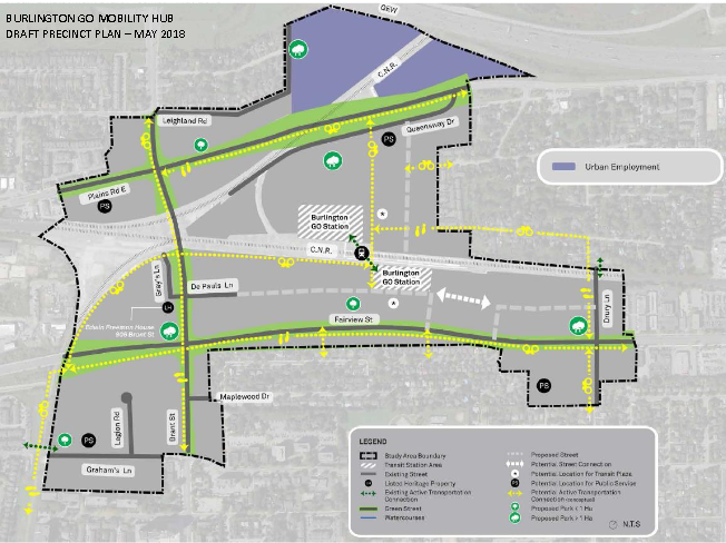
The planners have proposed some urban employment can be located near the rail line in the northern part of the Burlington mobility hub boundary.
The outcome of the analysis was to establish which lands would be preliminarily recommended for conversion. It is critical to note that a recommendation for conversion does not imply that the lands are no longer intended to serve an employment function. Rather, a preliminary recommendation to convert should be understood to mean that the City wants to achieve a mix of uses including employment, commercial and residential. Equally important is to reinforce that a potential mix of uses does not necessarily include residential uses, but could include a broader range of commercial uses.
The City’s recommendations for the conversion of employment lands can be organized into two categories: those conversions to support sites with unique constraints; and, those conversions to support the emerging urban structure. Employment land conversions within the Mobility Hubs support the emerging urban structure and constitute the majority of lands and parcels recommended for conversion.
The new Official Plan presents the Area of Employment overlay which both removes and adds land from the Regional Area of Employment overlay. Lands that are proposed to be removed from the Regional Area of Employment overlay will be deferred and considered subject to the Region of Halton Official Plan Review.
The Area Specific Planning (ASP) process will proceed with planning of these lands in the context of the broader objectives of the Mobility Hubs Study and the guiding principles and unique considerations for each of the hubs. The ASP process also plans to achieve new employment uses within the Mobility Hubs which are compatible in a mixed-use context.
Area Specific Plan (ASP) Development and Timing
The development of the draft precinct plans included within this report are key inputs into the creation of the Area Specific Plans (ASPs) for the three GO Station Mobility Hubs. ASPs are plans that apply to a specific geographic area, such as the City’s four Mobility Hubs. ASPs can include a variety of studies and contain specific policies to guide future development which can form the basis of an amendment to an Official Plan. City Building staff are continuing work on the ASPs for the Downtown and the three GO Station Mobility Hubs. The work will include the development of more detailed policies which are not otherwise developed at an Official Plan level of detail. These include, but are not limited to:
- Site-specific constraints;
- Detailed heritage analysis;
- Phasing of development;
- Infrastructure capacity;
- Stormwater management including floodplains;
- Feasibility of future transportation connections;
- Additional sustainability measures;
- Area-focused community engagement;
- Implementation and incentive tools; and,
- Further area-specific design
In terms of timing, staff will be bringing forward four Area Specific Plans by Q1 2019.
ASP Technical Studies
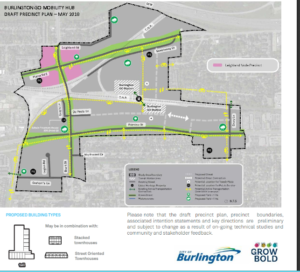
Some development could be added to the Leland community in the upper western part of the Burlington mobility hub.
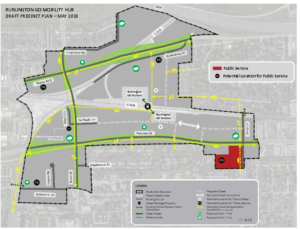
The planners have created a new name for a precinct – “public service”. Is a school proposed for the area?
Preliminary technical information regarding the projected densities; market analysis; environmental studies; stormwater, water and wastewater assessments; cultural heritage resource assessments and archeology were previously provided. . The suite of technical studies consists of the following:
Environmental Impact Studies – A scoped Environmental Impact Study (EIS) is being completed for each of the four Mobility Hubs as part of this planning study. The purpose of each EIS will be to inventory existing conditions of the natural environment (e.g., woodlands, wetlands, valleys, wildlife habitat, watercourses), identify the potential impacts that the proposed Area Specific Plans may have on these features, and develop high-level mitigation plans, where appropriate, focusing on appropriately minimizing or eliminating impacts. The proposed approach for the scoped EIS work is to focus on two key objectives:
- Identifying lands which are not suitable for development based on their significance or related constraints; and,
- Identifying opportunities for ecological restoration, as a number of the lands around the hub areas are heavily
Functional Servicing – The detailed Functional Servicing Study involves a review of the existing water and wastewater services accessible to each of the hubs; confirmation of the capacity of the water and wastewater services accessible to each of the hubs; and preparation of water and wastewater servicing concepts for each of the hubs. This study will inform the Area Specific Plans in regards to water and wastewater infrastructure capital needs.
Air, Noise & Vibration – A Pre-Feasibility Noise and Vibration Study is being completed for the Aldershot, Burlington and Appleby GO Mobility Hub study areas (note: Burlington Downtown is excluded from the Noise and Vibration Study Scope). The Noise and Vibration Study includes reviewing the noise and vibration impact of introducing new sensitive land uses in proximity to existing stationary and transportation noise sources (e.g. industrial, rail, etc.). The Study will identify potential impacts which may exist and identify areas of impact and associated potential mitigation measures which may be required within the study areas. In addition, Provincial guidelines such as the D-6 guideline for compatibility between industrial facilities and NPC-300 for stationary and transportation noise, will provide staff with an understanding of the development constraints which may exist with respect to the introduction of sensitive land uses, such as residential uses, within the mobility hubs
Air Quality Impact – An Air Quality Impact and a high-level Risk Assessment Study for the Aldershot, Burlington and Appleby Mobility Hub study areas is being completed (note: Burlington Downtown is excluded from the Air Quality Study). This Study will review the air quality impacts of introducing new sensitive land uses (clusters of future sensitive receptors) in proximity to existing stationary and transportation sources of air emissions (e.g. industrial facilities, rail, highways, etc.). The Study will review these impacts, which exist within or outside the respective Mobility Hub study areas. Results of the risk assessment will be used to develop strategies to mitigate potential air quality impacts associated with the respective Mobility Hubs.
Transportation – A transportation study is currently underway to identify future transportation needs and parking strategies for all four Mobility Hubs. This Study will review the transportation network and identify improvements and enhancements needed to support the plans and encourage multi-modal transportation solutions. The Study will review the current and planned active transportation networks and identify improvements. Further, transportation demand management (TDM) strategies and policies will be developed for each hub. This work will also include a strategic parking review to identify appropriate parking rates within the mobility hubs and strategies to achieve the desired modal splits. This work will also identify a framework to deal with the changing parking demands over time and appropriate use of off-street parking; municipal parking lots, and shared parking.
This particular study is years behind – it is a critical part of the planning decisions that have to be made
Market Analysis – A market analysis is being completed for each Mobility Hub study area to help guide the planning and urban design aspects of the project. A contextual market analysis of the City of Burlington is being completed along with a more detailed assessment of the four Mobility Hub study areas. For each station area, the assessment will include development trends, land values, and an assessment of how the study areas relate to the Burlington and GTHA marketplace. This will include assessing the nature of residential, commercial and office development including both tenant and buyer profiles. This analysis will give a broad idea of the nature of long term demand and the expected development trends looking forward.
This work will also identify other development opportunities and challenges related to development economics and feasibility, the protection/enhancement of existing employment functions, development phasing, the need for financial incentives, population and employment forecasts for the land use scenarios, and other related market considerations. This analysis will inform and ensure the Area Specific Plans are both marketable and feasible from a development and economic perspective. In addition to market inputs, this study will provide strategies and advice related to overcoming development challenges (e.g. fragmented ownership and prohibitive land values, contaminated lands, land use compatibility concerns, etc.) and achieving municipal objectives (green space, affordable housing, community facilities, appropriate housing mix, etc.).
Fiscal Impact Analysis – The intent of the Financial Impact Analysis (FIA) is to measure the operating and capital cost impacts of intensification within each of the Mobility Hubs, both individually and in aggregate, for various types of residential, non- residential, and mixed-use development. The FIA would be undertaken for City and Regional services and measure the incremental costs for new development, including new infrastructure and associated lifecycle replacement requirements.
Archaeological / Cultural Heritage – The archaeological study will provide information about the history, current land conditions, geography and previous archaeological fieldwork of the hub areas. The Cultural Heritage assessment will focus on conducting and analyzing background research and field survey results for the purposes of identifying impacts of the proposed undertaking on cultural heritage resources.
ASP Implementation
Following the completion of the Area Specific Plans, there will be an implementation phase to the Mobility Hubs project. The implementation phase of the project will include the development of a wide range of tools and detailed discussion of partnerships required to implement the area specific plans over time. This phase may include the development of zoning by-law regulations; form-based codes (i.e. development permit / community planning permit system), urban design guidelines, community improvement plans, etc. Following the conclusion of the implementation phase, it is important to note that other development processes will be required. Development processes may include applications for minor variance, site plan, site-specific zoning and/or official plan amendments or development permits.
The Downtown Mobility Hub Area Specific Planning process has been conducted concurrently to the new Official Plan process. The Downtown Mobility Hub process has resulted in new policies and schedules that have been incorporated into the new, Council-adopted, Burlington Official Plan.
Citizens can expect much more on the Downtown hub once they get into the review of the Official Plan that has been returned to the city by the Region as not being complete.
To achieve the long-term objectives of the four Mobility Hubs including transportation modal split targets, future development in the Mobility Hubs must be supported by other ongoing City initiatives. There is an important symbiotic relationship between the Mobility Hubs Area Specific Plans and the City’s Transportation Plan, Cycling Master Plan, Community Trails Strategy, the Integrated Transit Mobility Plan and the Downtown Streetscape Guidelines, all of which are necessary to ensure that the four Mobility Hubs are connected to city-wide destinations through active transportation networks, a frequent transit network and well-designed complete streets.
Conclusions:
The draft Precinct Plans for each of the GO Mobility Hubs were said to achieve key important city-building objectives including: the provision of a variety of housing forms to attract a broad range of demographics; creating opportunities for new and enhanced public parks and open spaces; the provision of sites for future community and public services; the concentration of tall buildings in proximity to higher order public transit (GO Transit) as well as the frequent transit corridors; the establishment of height peaks and built form transitions; and the provision of development permissions that will attract future population and job growth.
With a demand for more meaningful participation on the part of those who take an active interest in the kind of city Burlington is going to evolve into and a city council that has said it wants to respect the citizens that elected them – what gets built on the mobility hub sites may well be quite a bit different than what the planners have put forward to this point.
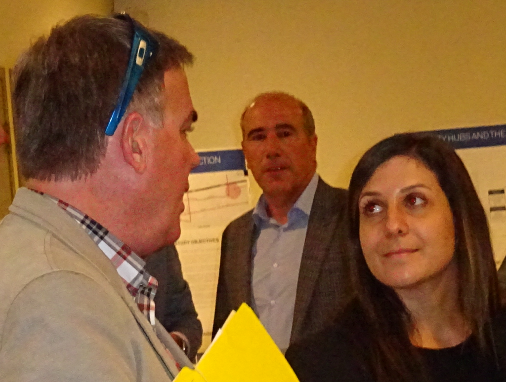
Rosa Bustamante with Mark Bales on the left and Nick Carnacelli of Carriage Gate; the company has three developments in various stages of approvals in the downtown core.
The city is at a critical transition point – whether or not this city council can pull it off is a large part of what 2019 is going to be about.
Planners Rosa Bustamante, Manager of Policy Planning – Mobility Hubs, Phil Caldwell, Senior Planner – Mobility Hubs and Kyle Plas, MCIP RPP, Senior Planner – Mobility Hubs and Samantha Romlewski, M.Pl., Planner II have been the leads on this file.


A little too much to digest in one go. Remember this will not start for at least ten years by which time the rest of the established neighbourhoods will be built out with townhouses, high rises and no trees. And to quote Gil Penalosa, Founder and Chair of 8 80 Cities
“This is not a time for citizens to be spectators; everyone needs to participate creating a healthy and successful community for all. Burlington has a great opportunity as well as responsibility; the city under construction is where many generations will live for hundreds of years.”
When you think about it, we will have construction all over the city, not including road work, continuously for more than just the recently approved developments. In case you haven’t been keeping track, the total units under development applications that exceed OP and zoning regulations is about 3500 in 58 developments over the last 5 years. And. along with it will destroy almost 8,000 mature trees. Then there are the applications that comply with regulations – be it minuscule, nevertheless still construction.
So don’t fret about the GO Station hubs just yet. Take a close look at Burlington GO and let me know when Walmart and the Paradigm will be torn down to make room for the new road extension of De Pauls Lane. If we all have to go vegan to save the planet, destruction of the slaughterhouse at the Appleby GO to make room for a new road there might make sense.