


 By Staff
March 13th, 2018
BURLINGTON, ON
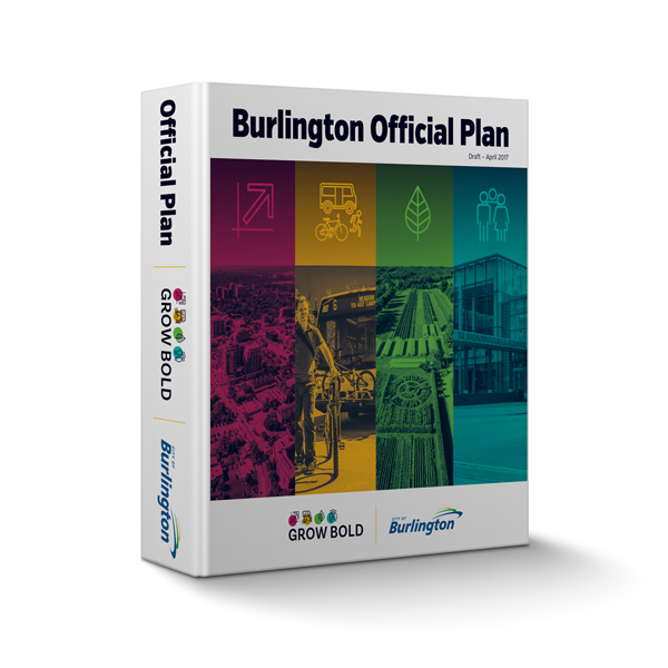
The April 4th meeting of the Planning and Development Committee that was to accept a report recommending adoption of Burlington’s proposed new Official Plan has been moved to April 24 at 1:30 and 6:30 p.m. and, if required, Wednesday, April 25 at 9:30 a.m. at City Hall in Council Chambers.
 The meeting date for the recommendation report has been moved to allow for new provincial maps to be added to Burlington’s proposed new Official Plan. The updated natural heritage and agricultural systems mapping was released by The Province of Ontario on Feb. 9, 2018 as part of its Places to Grow program.
The Official Plan (April 2018) that is recommended for adoption will be released the week of March 26th.
As a result of further discussions with the Province and the Region of Halton a number of refinements to policies and mapping have been required to clearly demonstrate conformity with senior plans. Two main areas are highlighted below.
The Province of Ontario recently released new mapping that relates to the Natural Heritage System and Agricultural System in Burlington. As a result, the City is now adding maps to its proposed new Official Plan to incorporate this new provincial mapping.
Background:
On July 1, 2017, the Province of Ontario approved a revised Provincial Growth Plan for the Greater Golden Horseshoe (GGH), which outlines policies for planning and managing growth in the GGH to the year 2041, and which includes the City of Burlington.
The revised Growth Plan policies recognize the importance of both a Natural Heritage System and an Agricultural System to the GGH. The protection of these resources is vitally important to the Plan’s long term vision for the GGH.
The revised Plan states that the Province will map a Natural Heritage System for the GGH to support a comprehensive, integrated, and long-term approach to planning for the protection of the GGH’s natural heritage and biodiversity. Municipalities are required to incorporate the Natural Heritage System as an overlay in their Official Plans, and apply appropriate policies to maintain, restore, or enhance the diversity and connectivity of the system and the long-term ecological or hydrologic functions of these features and areas.
The revised Plan also states that the Province will identify an Agricultural System for the GGH. Prime agricultural areas, including specialty crop areas, are to be designated in official plans in accordance with mapping identified by the Province and these areas must be protected for long-term use for agriculture in municipal Official Plans.
On Feb. 9, 2018, the Province announced the release of the final mapping for both the Natural Heritage System and the Agricultural System for the GGH to support the Growth Plan. It is now in full force and effect, as of the date of its release. It therefore applies in the consideration of all planning matters, including development applications, within municipalities in the GGH, including the City of Burlington.

Provincial agriculture land base map released February 9th, 2018
(The resolution of the maps available is very low. The Gazette will work at getting higher resolution and a subset map for just the Region of Halton and then Burlington,)
The City of Burlington will now be incorporating the Provincial Natural Heritage System and Agricultural System mapping as released by the Province into the mapping of its proposed new Official Plan, in order to conform to the Provincial Growth Plan.
In implementing the Natural Heritage System and Agricultural System, the Province permits municipalities to refine provincial mapping with greater precision in a manner that is consistent with the Growth Plan.
However, this is only permitted as part of a “municipal comprehensive review,” which is a new official plan or an official plan amendment initiated by the upper-tier or single-tier municipality, in this case Halton Region, that comprehensively applies the policies and Schedules of the Growth Plan.
The refinement of the Natural Heritage System and Agricultural System mapping will be undertaken on a Regional basis as part of the Region of Halton’s next Regional Official Plan Review. The City cannot make refinements to the mapping in the Burlington Official Plan until the Region completes its municipal comprehensive review through its Official Plan Review process.

Discover more from Burlington Gazette - Local News, Politics, Community
Subscribe to get the latest posts sent to your email.

And here’s another thing. When I delegated to the Planning and Development Committee I (only somewhat) facetiously suggested that a lot of controversy could be avoided by just removing the Downtown Mobility Hub from the plan. No need to change any of the Downtown plans or intensification strategies – just take off the label, since it drives everyone crazy and encourages developers to reach for the sky. I was asked by the Mayor if I knew that it would be impossible, since the Hub is also built into the Region Plan. I replied that “Oakville managed to do it” and sat down. But I now realize that We have a Region Council, and our six Councillor and Mayor sit on it, along with seven from Oakville and (I think) six from Milton/Halton Hills. Surely that Council can direct its planners just like our Council can direct our planners. Of course, we’d need another seven or eight of the rest of Region Council to agree, but wouldn’t it be worth a bit of politicking? A good start would be to go hat in hand, and say “We’re finding that we made a horrible mistake, and need your help.” Why not?
Unfortunately the normal reflex of most politicians and staff when they find they’ve dug themselves into a hole is to double down and dig deeper. But one can always hope.
What is driving this rush to finalize the OP? Now they will rush through doing this mapping. The transit, transportation to name just 2 of the many studies are not completed. There are misconceptions and downright errors that have been discovered by Councillors and residents in the proposed Official Plan that need to be corrected.
There is a park showing in an area near the No Frills Plaza, which the developer said at delegation that if the park was there no grocery store would have adequate parking and therefore not be willing to locate there. We need a grocery store in the downtown. Not a Goodness Me, or Whole Foods or a Hasty Mart. One department of the City does not seem to know what the other is doing.
Developers are going around the city bragging to local residents that they got everything they wanted, yet supposedly the report has not gone to Council.
The residents and councillors want a 3D model of what the downtown urban growth centre will look like. No time for that staff says.
Yes there is time to do this – the Region will not be looking at this until late 2019. Where there is a will there is a way. Guess there just isn’t the will on the part of Council to do the right thing.
The OP Gong Show continues. We have a Councillor who explains all the things he does not like about the Plan, yet “has no choice but to aporove it.” Claims of full transparency and consultation with citizens dissolve when examined. Allowed bulding heights are made up on the fly. “Information” colour-coded in maps is published in tiny images, sometimes in black and white. Other maps are only coming to light. Children build a model of the downtown.
One can only hope that more 20-day delays will push approval of the OP into the fall, where those currently in charge can account for this mess.