


 By Pepper Parr
October 2nd, 2017
BURLINGTON, ON
The process a development proposal has to go through is complex – there are dozens of hoop a developer has to go through and each step is expensive.
The developer is at significant risk – they are putting their money on the line and every penny is lost if they don’t get the approvals they need.
The large 20 storey plus projects draw a lot of attention. The smaller developments raise the ire of the neighbourhood they are to be built in but they don’t get the exposure the big ones get.
The city is compelled to grow its population. The province dictates the growth level and the Regional government does the fine tuning that decides how many more people are to be housed in a community or how many new jobs are to be created.
Burlington has focused on the residential development – the Economic Development Corporation does entice some new jobs to the city – but we aren’t celebrating that many new jobs.
There is a development in ward 5 that is drawing a lot of attention in that part of the city.

The level of intensification is evident in the drawing.
The developer is seeking permission to construct 22 residential dwelling units consisting of 8 semi-detached residential dwelling units and 14 townhouse units on Upper Middle Road where five properties have been assembled. These lands are hold outs from the previous subdivision development that surrounds these properties. These lands are located on the north side of Upper Middle Road, east of Appleby Line. The total area of the development is approximately 0.5 hectares (1.23 acres).
To the north of the subject properties are low density (single detached) residential dwellings; to the east are low density (single detached) residential dwellings; to the south is a high school and vacant employment lands (Bronte Meadows); and to the west is a stormwater management pond and a townhouse development. Description of Applications
There was a community meeting in May of this year –comments from that meeting appear below.
The meeting taking place at city hall tonight is a Statutory Public meeting – something the city is required to hold. It gives the public an opportunity to express their views on the suitability of the project.
The report will be received and filed and then be brought before the Planning and Development Committee on October 10th where the real debate takes place. Then it goes to city council where a final decision is made.
The purpose of the report that will be presented Monday night is to provide background information for the statutory public meeting required under the Planning Act for Zoning By-law amendment applications.
The report provides an overview of the proposed application, an outline of the applicable policies and regulations and a summary of technical and public comments received to date.
 The report sets out the start of the “ticking off” of the boxes.
The report relates to the following objectives of the City of Burlington Strategic Plan:
A City that Grows
Targeted Intensification
Higher densities in key intensification areas (including mobility hubs, downtown, uptown and along major roads and commercial plazas) that will build neighbourhoods that are environmentally friendly, infrastructure-efficient, walkable, bikeable and transit-oriented.
Focused and Directed Population Growth
A City that Moves
Increased Transportation Flows and Connectivity
A Healthy and Greener City
Healthy Lifestyles; every resident of Burlington lives within a 15-20 minute walk from parks or green spaces.
All these are set out in the Strategic Plan the city spent more than a year creating and putting in place. That Plan is a hoop that has to be gotten around if not over.
The application got to the Planning and Building Department on May 4, 2017 to permit 22 residential dwelling units consisting of 8 semi-detached residential dwelling units and 14 townhouse units. The townhouse block includes three separate buildings ranging from four to six units.
The semi-detached dwellings are proposed to be freehold units fronting directly onto an extension of Georgina Court. The townhouse units are proposed to be condominium units that would front onto an internal condominium road that would be accessed from the Georgina Court extension. The townhouse condominium is proposed to include five visitor parking spaces. The townhouse blocks will have access from the proposed internal lane; however, the southern blocks would have frontage and pedestrian access directly to Upper Middle Road.
Technical Reports
Another set of hoops that had to be gotten through included a Cover Letter, Zoning By-law Amendment Application, a Conceptual Site Plan Layout, a Planning Justification Report, an Urban Design Brief, a Building Height Certification, a Noise Impact Assessment, a Traffic Brief & Parking Study, a Functional Servicing & Stormwater Management Report, an Environmental Site Screening Questionnaire; a Land Use Compatibility Assessment, a Phase 1 Environmental Site Assessment, and a Tree Inventory and Preservation Study.
The application along with these materials have been circulated to various departments and agencies for technical review.
The next set of boxes that are going to have to be ticked off are various policy framework documents. The proposed Zoning By-law amendment application is subject to the following policy framework:
The Provincial Policy Statement (PPS), 2014;
Places to Grow, Growth Plan for the Greater Golden Horseshoe, 2017;
Halton Region Official Plan;
City of Burlington Official Plan, Orchard Community Secondary Plan
City of Burlington Zoning By- law 2020.

Provincial policy determines what a municipality can and must do.
The subject lands are designated in the zoning bylaw as Residential – Medium Density.
According to the Residential Areas policies, residential areas are intended to provide housing and other land uses that are part of a residential environment, and may take forms ranging from detached homes to high-rise apartment structures.
One of the objectives of the Residential designation is to encourage new residential development and residential intensification within the Urban Planning Area in accordance with Provincial growth management objectives, while recognizing that the amount and form of intensification must be balanced with other planning considerations, such as infrastructure capacity, compatibility, integration with existing residential neighbourhoods, and protection of the natural environment.
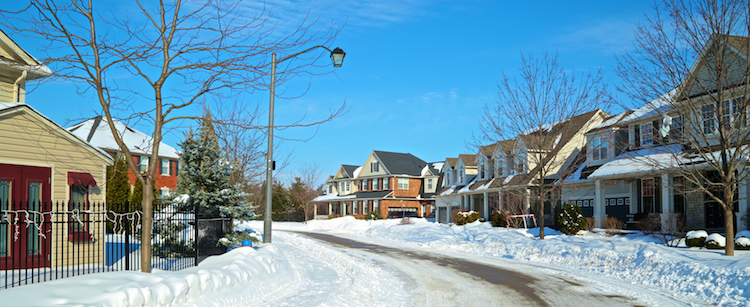
This is what most of the Orchard community is today.
Another objective of this designation is to provide housing opportunities that encourage usage of public transit, pedestrian and bicycle transportation networks and decrease dependence on the car. The designation also encourages the integration of a wide range of housing types and tenure, while requiring new residential development to be compatible with surrounding properties.

OLYMPUS DIGITAL CAMERA
Medium Density designation, either ground or non- ground-oriented housing units with a density ranging between 26 and 50 units per new hectare shall be permitted. Within the Orchard Community, there are site specific policies which permit the following housing forms within the Residential – Medium Density designations: townhouses; street townhouses and stacked townhouses; semi- detached, duplexes, three-plexes and four-plexes. This designation also permits detached dwelling units up to a maximum of 15 percent of the total housing mix on each property.
Draft New Official Plan
The city has been working on a new Official Plan that was presented as a Draft document on April 6, 2017. The document communicates Council’s vision and establishes strategic priorities for the City’s growth management, land use and infrastructure.
 The draft new Official Plan designates the subject lands as Residential Neighbourhood Areas, and more specifically Residential – Medium Density. The Residential Neighbourhood Areas are intended to provide for housing and other residential supportive land uses that are part of an urban residential environment. New residential housing within the Residential Neighbourhood Areas shall be accommodated primarily through infill or intensification, of existing areas, where compatible.
On lands designated Residential – Medium Density, ground and non-ground oriented dwellings including single-detached and semi-detached dwellings, townhouses, street townhouses, stacked townhouses, back-to-back townhouses and low-rise residential buildings may be permitted. Lands within this designation shall be permitted at a density of 26 to 75 units per net hectare,( it was 26 and 50 in the current Official Plan) with a maximum height of three storeys for ground- oriented dwellings and four storeys for non-ground oriented dwellings.
Draft new Official Plan policies were brought to the public and Council for consultation over the spring and summer of 2017. The draft new Official Plan is scheduled to be presented to the Planning and Development Committee and Council in the fall of 2017 for adoption.
Orchard Community Secondary Plan
The Orchard Community Secondary Plan final report, dated February 1995, identified three key elements of the community structure as the transit corridors, residential neighbourhoods and a connected open space system. At the time, the Orchard Community was expected to develop at generally higher densities than those found throughout the existing suburban areas of Burlington.
 The subject lands are located in the southern portion of the Orchard Community and were identified as Residential – Medium Density. In Medium Density Residential areas, either ground or non-ground oriented housing units with a density between 26 and 50 units per hectare shall be permitted. This designation permits housing forms such as street, block and stacked townhouses, semi-detached, duplexes, three-plexes and four- plexes. The designation also permits detached dwelling units up to a maximum of 15 percent of the total housing mix on each property.
City of Burlington Zoning By-law 2020
5219 Upper Middle Road is currently zoned ‘Development (D)’, while the remaining properties subject to this application are zoned ‘Medium Density Residential (RM3-138)’ with a site specific provision. The ‘D’ zone only permits a single detached dwelling. The ‘RM3’ zone permits a variety of dwelling types from a detached dwelling to an apartment building, as well as a retirement home or community institutional use. The site specific provision applying to the vacant parcels (138) sets out zoning regulations for detached dwellings, semi- detached dwellings and street townhouse dwellings, and limits a maximum of 15% of the total of all dwelling units located within all lots and blocks zoned ‘RM3-138’ to be detached units.
The applicants are proposing to amend the Zoning By-law by changing the zoning of the subject properties from ‘D’ and ‘RM3-138’ to a site specific ‘Orchard Community Residential to permit the proposed semi-detached and townhouse development.
Technical Review
On May 5, 2017, staff circulated a request for comments to internal and external agencies, including Halton Region. Agency comments will be addressed in the subsequent recommendation report.
Burlington Economic Development Corporation (BEDC):
BEDC has no comments.
Halton District School Board (HDSB):
HDSB has no objection to the proposed application, as submitted.
Halton Catholic District School Board (HCDSB):
In response to the application which seeks to permit the development of 8 semi- detached and 14 residential townhouse units, the HCDSB has no objection.
Parks and Open Space:
Adequate parkland is available to accommodate this development as Brada Woods Park and Orchard Woodlot are located within the 0.8km distance for a neighborhood park and the 2.4km distance for a community park. As such we recommend cash-in-lieu of parkland dedication be applied for this development.
We note a driveway in the east side of the proposed development. This driveway is immediately adjacent to the existing service road/walkway access around the storm water pond facility. The city will not permit snow to be deposited on the storm pond lands and or trail. We would recommend a buffer between the development and the city storm water facility be incorporated to ensure there is space for snow disposition. We will also require a chain link fence be placed on the city side of the property line. Please note gate opening through the fence will not be allowed.
Site Engineering:
Prior to providing a recommendation, Site Engineering requires further information to be submitted for review.
Finance Department:
Property taxes must be paid in full, including all installments levied.
Transportation Planning:
Transportation Planning has reviewed the Transportation Brief for 5219 Upper Middle Road & 2004-2005 Georgina Crt and is satisfied with the Conclusions.
In response to feedback received at the neighbourhood meeting (May 23rd 2017) regarding the potential for a traffic signal at the intersection of Quinte Street and Upper Middle Road, Transportation Services staff conducted a traffic signal review for this location. Based on the traffic data available for this intersection (taking into account the estimated number of trips proposed to be generated by this development in the AM and PM peak hours), it was determined that a traffic signal is not warranted.
City Forestry / Landscaping:
Urban Forestry has no objection to the rezoning of this site. Additional tree planting should be provided where possible, and tree and landscape planting on site should be carefully considered within the context of the site.
Halton Region:
Regional staff has no objection to the above noted application, subject to the provision of a holding provision, until such time that as servicing and environmental matters have been addressed to the Region’s satisfaction.
All the boxes up to this point have the tick in the box.
That’s how intensification development gets done.
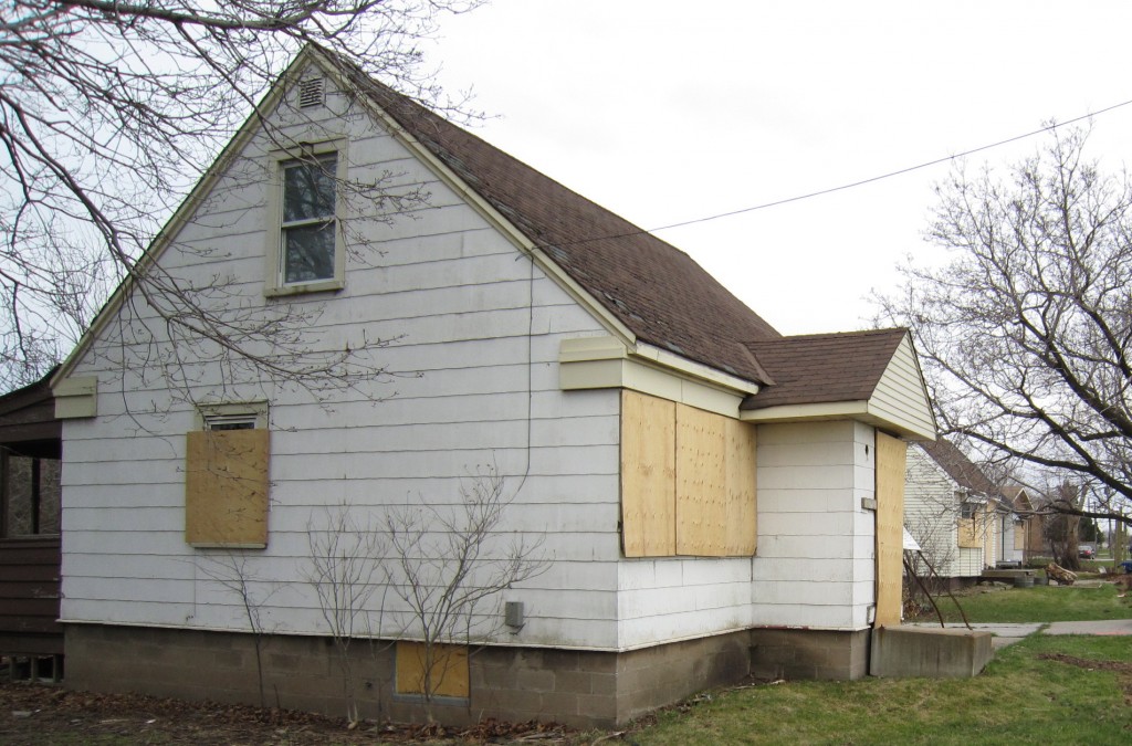
The developer took this …
It was done in the Queensway where six properties were turned into 58 housing units.

… and put up this.
The Burlington that once was – isn’t going to be for much longer.
Not really very much that can be done to prevent it.

Discover more from Burlington Gazette - Local News, Politics, Community
Subscribe to get the latest posts sent to your email.

Wow … The entire GTA is growing and Burlington, just like every other municipality will be taking its fair share. It isn’t like Mayor Goldring could run down the road to Hamilton and ask their mayor if he wants to take Burlington’s share. This is silly. Burlington can only grow up and I really wish the denial would stop so that we can focus on the quality of the developments and the good things that we can get out of it all. Nymbism be dead! Burlington is transforming into a real city not a village.
Why is it that so many people ascribe bad motivations to staff who are trying their best to plot a future for a city that has reached the end of its ability to borrow from the future by sprawling outwards? Some even suggest that anyone who supports limited and well-planned growth as “in league with developers” or somehow on their payroll. The level of discourse continues to fall towards the gutter. What is internationally recognized as good planning somehow gets taken by commenters as deliberate sabotage of our community.
We have been through “mass social transformation” already – the one that took cities that were once compact and walkable and made them so that the only choice that anyone has is to drive everywhere.
This transformation has imposed huge costs on us as citizens and taxpayers:
maintaining our infrastructure, pollution, social isolation, delayed independence for our young people and mobility challenges for our seniors. And we haven’t even begun to feel these effects. The whole reason behind “no new roads” is because we can’t even afford the upkeep on the ones we have. You’ve seen the budget! Throw in another $20 million for shave and pave. Starve the bus system to pay for road renewal. Rededicate the “temporary” hospital levy to “infrastructure”. This cycle has got to end.
I’m sure planners would love to provide a utopian system where everyone can drive their cars everywhere they want, whenever they want, without encountering other people. That only exists in the car commercials.
In the real world, driving my car benefits me greatly as an individual. But when everyone makes the same perfectly rational choice you get congestion and the benefits start to dissolve as you add more cars. Widening roads has proven over the past century to be ineffective in solving this problem – we just get more pavement that we have to maintain, encourage more people to drive longer distances, making an inhospitable and ugly environment where no one feels safe outside the confines of their automobile, and act surprised and angry when we end up with the same traffic congestion we started with.
The more people that can use other means of getting around, the better it is for those who have to drive. We all benefit from having a full array of choices.
Yes, this will happen at the margins and will take a long time to change entrenched patterns and correct past planning mistakes.
New residents – especially younger ones will not necessarily use 1.7 cars per household like we do today. People who haven’t developed the conviction that there is no other way for them to live will be attracted only if they have choices. Businesses also need access to employees who increasingly don’t want or can’t afford to be totally dependent on the automobile. We need those new residents if we are to meet our fiscal challenges and support all the crumbling infrastructure we have.
We are in a bind which means we simply cannot grow the way we have grown in the past. But we still need to grow if we are to avoid massive tax increases to keep up the increasingly unsustainable lifestyle we have now.
Burlington’s Grow Bold plan may seem to be a big change. But consider the fact that Burlington will by far be the slowest-growing city in the GTA over the life of this new official plan. We will see much less change than any other city in the region. It is only a radical departure because we have decided we want to protect our rural lands and stop building out. Other cities will no doubt follow our lead in the next few years. The Official plan is only the first step – there are transit and mobility plans being worked on, with ample opportunities for the public to consult on. We need to address these challenges without resorting to demonizing and insulting the people who we are paying to do the heavy lifting.
Except the city is doing none of the things that would actually produce what you are saying Chris. If you were building with proper commercial ground floors in a tight area then – yes you could get the benefits you describe. You could get people that could walk to things – that what I say when I want “localized commercial”
However building all over the place and moving out everything from ground level except 10 by 10 offices is not positive. I just don’t think you are aware of what is going on on the ground level. The city “says” it’s doing one thing, but it’s not actually doing what they say.
They just CUT the bus system for heavens sake. How are people going to get around? The bus systems is crappier than ever. The commitment to “biking” is no greater than a can of paint. The stores and restaurants are all moved far out of walking distance.
People will do – as they do in every place that this has been tried – sit in every greater amounts of gridlock. Spewing every greater amounts of pollution and break dust. People will vote in on street parking and instead of cars stored properly on private drive ways they will be on the street – impeding biking and waking further.
I’m all for reasonable intensification so long as it’s bringing in amenities and in a reasonable place that can be reasonably serviced by transit, walk etc. This is not what is going on.
That’s the thing, Greg. The new plan is looking not to build tall all over the place, it’s concentrating growth near GO stations and downtown – near established commercial. Developers don’t want to provide big retail footprints likely because they know they will have a much tougher time selling…our city is already over-saturated with retail, but it does need places for small independent businesses to set up shop.
You are absolutely right that the city needs to grow its frequent transit and its biking networks beyond what it has today. We desperately need that commitment from residents and from council to improve them. That’s where the “bold” part comes in – despite the fact we’re talking about dramatically slower growth than we have experienced in the past 70 years. And for the first time the plan we have before us is putting the priority in the right places, making mobility not only about moving cars, but moving people.
The updated official plan defines “secondary intensification” as “any property adjacent to an artery or any previous school property”. What rule concentrates growth near go stations? None. It’s just talking points.
Secondarily the commercial space I’m after normally translates into amenities in a city. It’s a café, karate place, a pottery place, etc… It’s not “retail” which I don’t really care about per-say. Beyond nail salons and dental places what do you imagine can be done with a 15×15 office space with one parallel parking space in front? The cities version of “intensification” has closed two restaurants (Foo Hoo and Pizza Royale) replaced by no place where you can even put food services.
We are about to close our last small hardware store – no where for them to go.
What is being built is literally office space and good for nothing else. I can’t imagine your version of transit will be nothing but busses running by offices – it can’t work. I’m fine with actual density building vibrancy – which I think you are as well. The difference is we are getting the density with no bonus now or on the horizon. This is what the city needs called out on.
“Not really very much that can be done to prevent it.”
Well you can elect people that will direct staff to create a zoning system and official plan with real rules. There is a system to prevent overbuilding from taking place – the zoning rules. The problem is the staff are in general in favor of massive overbuilding – for the purpose of creating as many hostages for the go train and other dreamed up transit systems as possible. They work the systems to deliberately create overbuilding and traffic congestion.
Staff in general believe in “mass social transformation” as engendered by them upon the population for “our own good”. That the population will have to “abandon it’s un-sustainable transit patterns” and the faster you create massive gridlock – the faster disaster will in sue and the “enlightenment” can begin.
I realize all this seems crazy to the average person in Burlington trying to go about your businesses – to crazy to be believed. If I’m wrong then you explain to me how Burlington has a Master Transit plan without numbers, an Official Plan so vague that the Home Builders association is against it and a buss system doing worse every year.
All these files are completely miss-managed and the way it changes is the population electing or pressuring existing officials that this is on them. They it is council responsibility to go line by line through the papers the staff are creating and change the rules to benefit the people of Burlington – not people who do not and never intend to live here.