August 25th, 2019
BURLINGTON, ON
Exclusive to the Burlington Gazette. Part 1 of a 3 part series.
It was a decent crowd – even for a meeting that was poorly promoted.
The outcome wasn’t all that clear – what was evident was that the audience didn’t like what they heard and that PERL, Protect the Environment and Rural Lands, the people who fought and won the last battle for Mt Nemo, was not going to lead the charge this time around.
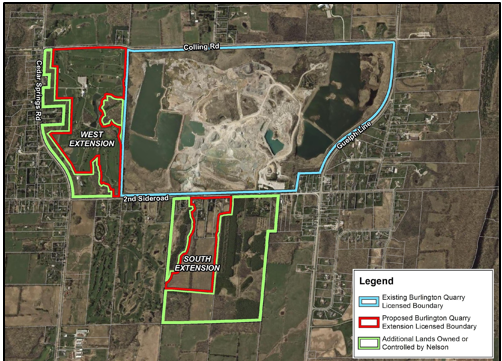
The current Nelson Aggregate holdings: They own the southern portion and have an option on the western portion. The green line is a property boundary; the red line is the extraction boundary.
The operators of the quarry, Nelson Aggregates, had let it be known that they were preparing to make a revised application to mine for aggregate in the southern portion of the site and for the land to the west which is currently Burlington Springs Golf Club.
The Gazette met with the people speaking for the quarry operation and learned much more about the scope and scale of the new plans.
The quarry is owned by Lafarge, Canada’s largest provider of diversified construction materials and a member of the global group, LafargeHolcim. The company has 6,000 employees and 400 sites across Canada.
The operators were taken aback by the 2012 decision to not allow the application to mine on land immediately to the south of the existing quarry. The decision rested on the existence of the Jefferson Salamander that is a threatened species that habitats the area.
It was not an expected decision and resulted in a serious cut back in the number of people employed on the site.
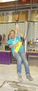
Walt Rickli, raising the belt on a hoist at the studio he once had on the quarry site. They needed the aggregate beneath his building – so he had to move.
Walt Rickli who had a sculpture studio on the land had to find a new home for his heavy equipment – the quarry people needed every square foot of land they could get a back hoe into.
The Nelson quarry people studied the Joint Administrative Review Tribunal (JART) report and worked at how they could resolve the Jefferson Salamander problem and be able to mine the land.
They did their homework and will take their application to the Regional government, City of Burlington and the Niagara Escarpment Commission after which they have to seek a development permit. They will also be seeking a change in the zoning. Three different permits will be required plus a new license from the Ministry of Natural Resources and Forestry.
Mayor Marianne Meed Ward and the Director of Planning has said that before the city even looks at any application they want the decommission work done.
That statement, to some degree, came out of a little bit of ignorance. The license the quarry was given in the 70’s was to mine as much quarry as they wished, or could, on the clearly de-marked site.
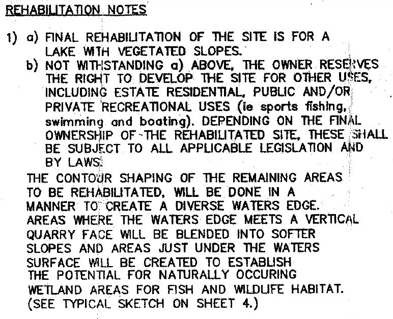
The license the quarry has is unlimited, it does not have to be renewed but does require that the land be left as a “lake”.
The critical note attached to the license states:
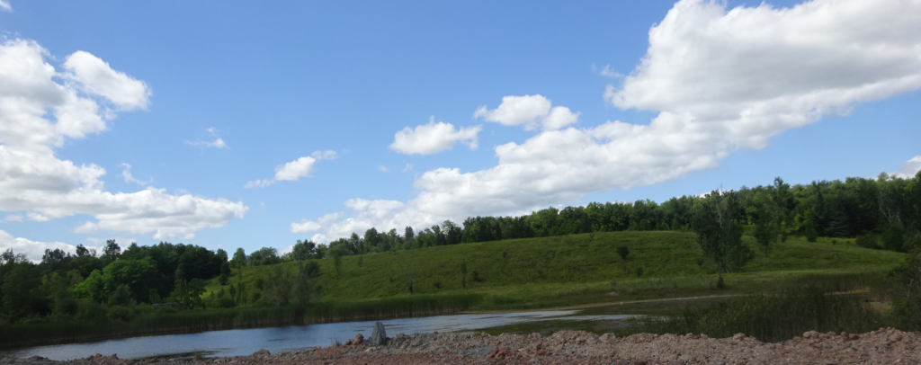
Nelson has already been very proactive in re-rehabilitating the land. When they are finished with one area they begin the rehabilitation. That work is clearly evident when you tour the property which the Gazette did last week.
Before any permit is issued Nelson is fully committed to a dialog with the community. They want to be sure that the residents in the rural area, and those south of Dundas, are fully aware of what the quarry is asking for and offering.
One has to fully understand the quarry’s position. They are in the business of mining and processing some of the best aggregate deposits in the province. They believe they have been good neighbours, which is not a view shared by some.
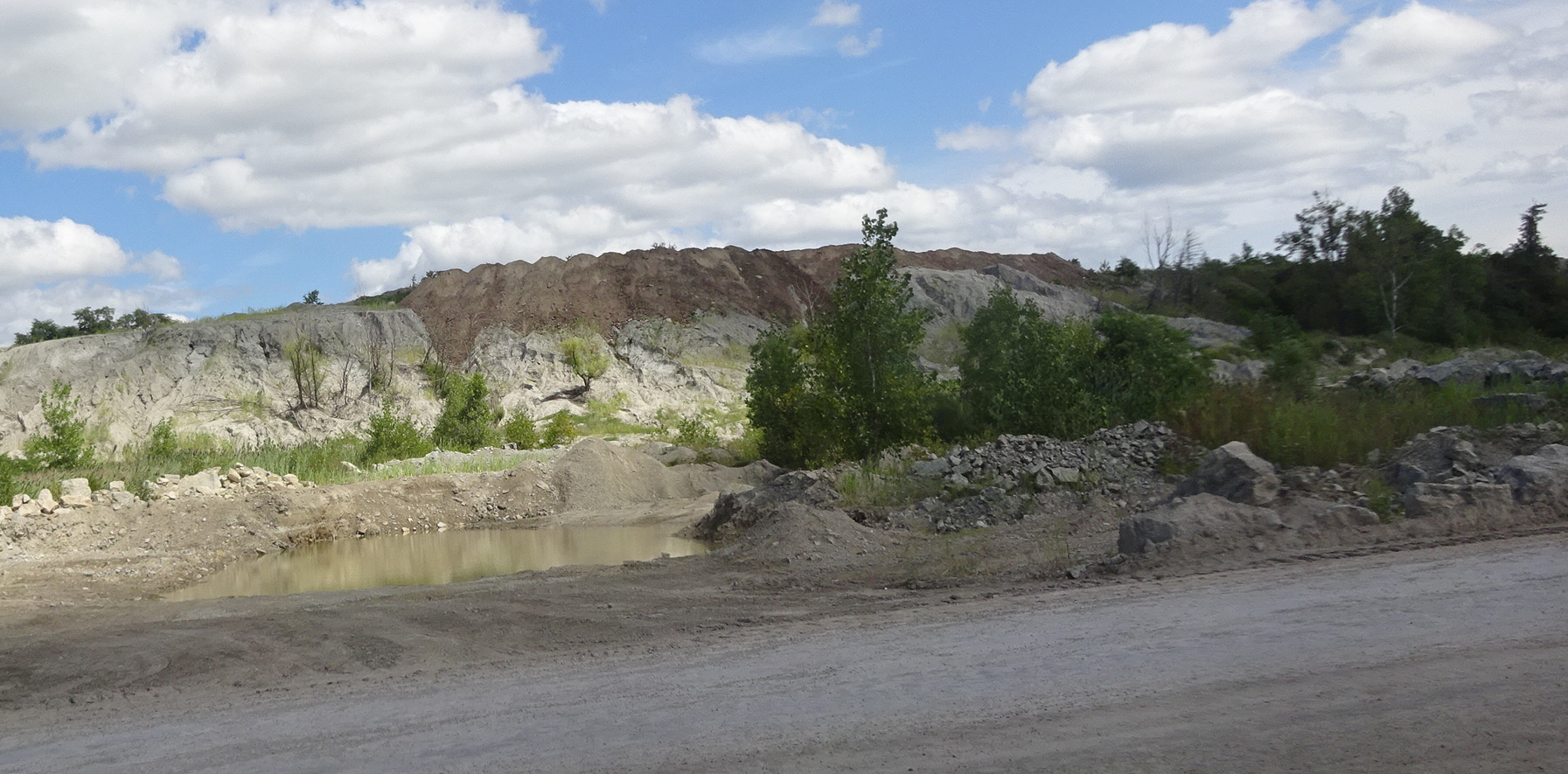
Rehabilitation of the existing quarry is an ongoing task. The dark brown in the center atop the hill is land fill that has been dumped in to the land.
Residents in the past have complained about the damage done by dynamite blasting. The quarry is required to limit blasting to one day a week at a specific hour. They can only blast on Thursday’s between 12:00 and 1:00 pm. As they prepare to file their applications they will do the now obligatory pre-consultations to ensure that they are complying with all the regulations and learn what they have to provide in the way of studies to ensure that the public interest is being met.
Among the studies that will have to be completed are:
Planning / ARA Site Plans –MHBC
Hydrogeological Assessment – Azimuth
Surface Water/Water Balance Assessment – C.C. Tatham
Karst Assessment – D. Worthington
Fully Integrated Groundwater and Surface Water Model – EarthFX
Natural Environment Assessment – Savanta
Agricultural Impact Assessment – MHBC
Built Heritage Assessment – MHBC
Cultural Heritage Landscape Assessment – MHBC
Archeology – Golder
Traffic Study – Paradigm
Noise Assessment – HGC
Air Quality Assessment – BCX Environmental
Blasting Assessment – Explotech
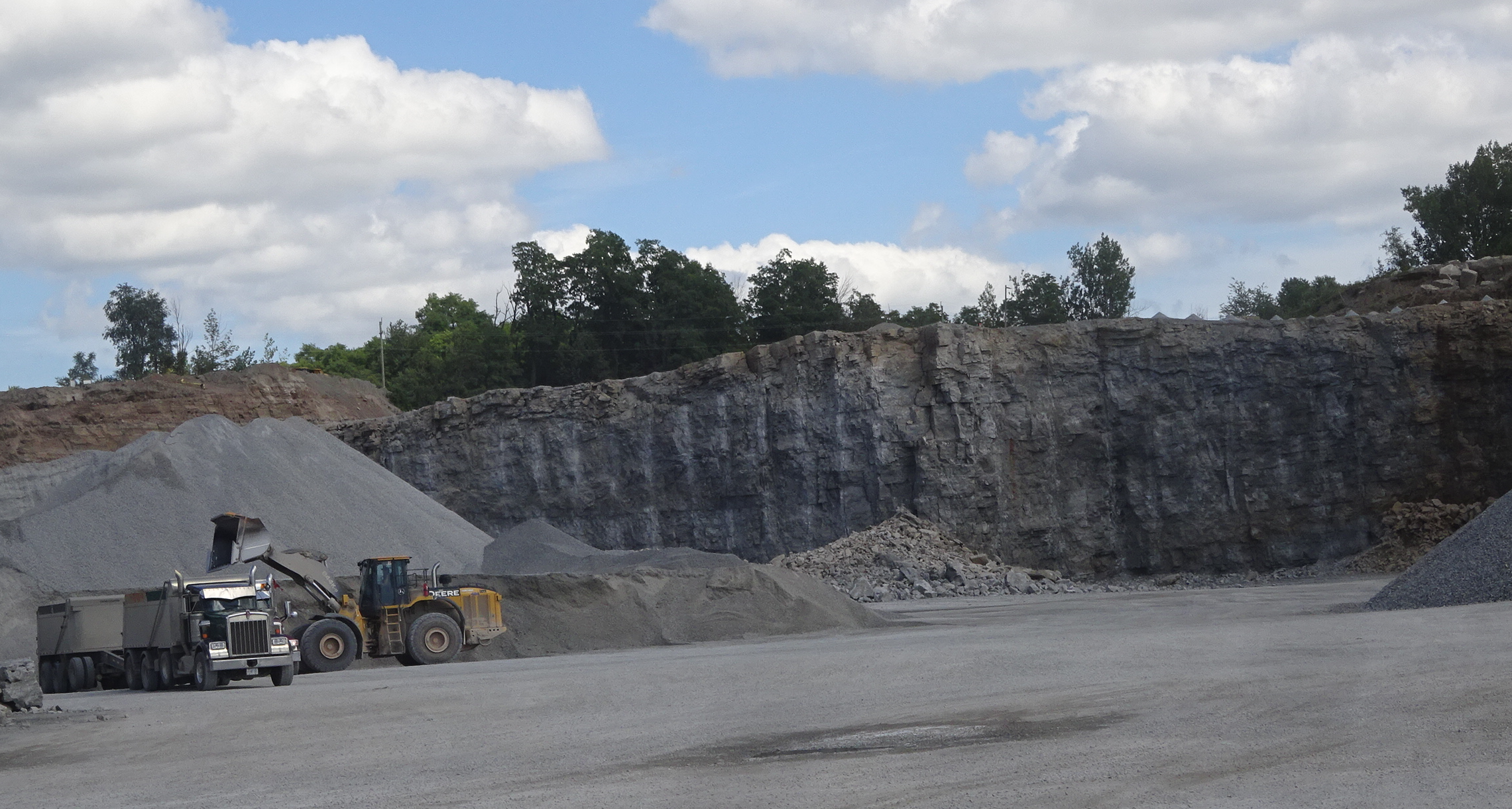
Mining for aggregate is a highly regulated business. The Nelson quarry pumps water out of the site that is some 80 feet below ground level. If those pumps break down they have to immediately advise the Ministry of Natural Resources and Forests and effect repairs as quickly as possible. In order to mine effectively it is vital to keep water out of the site. There are a number of catchment ponds around what is really a huge bowl that has been blasted out of the property from which aggregate has been taken.
Nelson Quarry is proposing that once they have completed the quarrying they will rehabilitate the land and turn title over to the city who will run it as a public park.
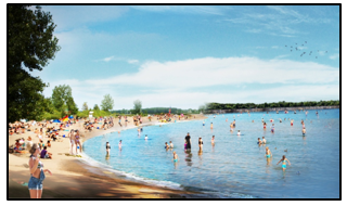
The Nelson people are going one further – they are going to create a 15 hectares lake that will have a large sandy beach. The shallow end of the lake (a little like Wasaga Beach where you can walk out for yards before the water comes up to your chest, will become a little deeper and then get quite deep..
In the application they have completed studies that show where the Jefferson Salamander lives and have undertaken to not only not mine that area but to turn it over to the city the day the agreements and zoning bylaws have been set.
The original 2004 application was on property south of #2 Side Road.
The application that will be submitted in the near future will consist of a 60% reduction in proposed extraction area from the previous application.
The revised extraction area will be designed to address the reason the Joint Board refused the previous application (Joint Board Decision 08-030 issued on October 11, 2012).
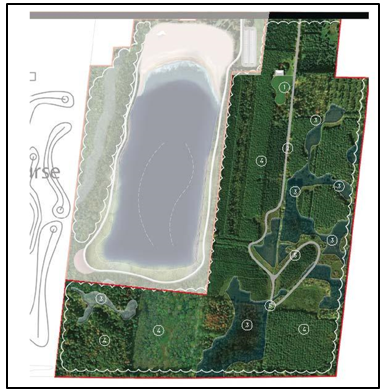
The area to the right was part of the 2004 application. It will be given to the city the day the agreements to permit quarry work has been signed. The area to the left will be turned into a lake for the public once it has been quarried out – which will be between 7 and 10 years.
In the studies and research they have done the Nelson Quarry people point out that their land holdings meet all the requirements of both the Niagara Escarpment Commission and the Region of Halton.
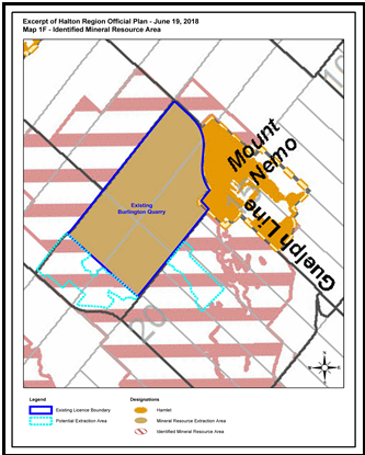
This illustration is from the Regional Official Plan – the area with the pink stripes is suitable for quarrying.
The recently adopted City of Burlington Official Plan (April 2018) identifies the proposed extraction areas as an “Identified Mineral Resource Area.” The adopted city plan Nelson points to was submitted to the Region and returned to the city because it didn’t comply with the Region’s plan. Burlington is in the process of revising that adopted plan.
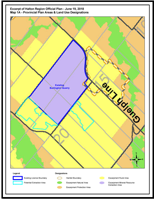
This illustration from the Niagara Escarpment Commission permits quarrying in the area shown in yellow. The portion of this are that Nelson wants to quarry is is shown in light blue.
The sites are also mapped as a High Potential Mineral Resource Area in the Region of Halton Official Plan.
The existing Burlington Quarry represents Burlington’s only source of construction aggregate within the City.
There are three designations that apply to the land in the NEC plans: natural, protected and rural area. The Nelson properties have the designation that allows for consideration of new Mineral Resource Extraction Areas in the Niagara Escarpment Plan.
In the NEC plan the proposed extraction area is designated Escarpment Rural Area in the Niagara Escarpment Plan.
The appropriateness of this designation and objective was confirmed in the recently approved NEP (2017).
The Nelson Quarry people have done their homework and are returning with an application they feel meets all the shortcomings of the 2004 application that was decided in 2012.
They have significantly reduced the space they will mine on the south side of #2 Side Road and have added the 606 acres that make up the Burlington Springs Golf Course that will give the company enough aggregate to mine for the next 30 years after which it too will be turned over to the public.
Burlington is looking at the potential for a park that will be in the 900 + acres realm – bigger than anything most municipalities across the country have.
Nelson Aggregates will be holding an Open House on the quarry site in October and expects to have their applications in to the three levels of government sometime in November.
Just what will the park consist of? Tomorrow we will detail what we learned in our exclusive interview the people at Nelson Aggregates.


