


 By Pepper Parr
October 26, 2015
BURLINGTON, ON
First of a multi part series on how the city thinks intensification could be managed.
What do you think your city is going to look like in 25 years?
The Bridgewater Hotel will have been open for at least 22 years so citizens will have gotten used to the idea of seeing tall buildings.
We don’t know yet if the ADI Development people are going to get to build the 28 storey structure they have in mind for the corner of Lakeshore Road and Martha.
But we can tell you that your city council is taking a long hard look at different heights for buildings as they think their way through the intensification they believe they have to do to meet the Ontario government’s Places to Grow policy.
At a Committee of the Whole workshop, led by a team of consultants, Council and staff went through a series of visualizations last week that presented various scenarios based on planning, urban design and market trend considerations.
There were visualizations of five locations around the city that showed what a particular road or intersection would look like if the full potential of the existing zoning were used and if the zoning was given a bit of an upgrade.
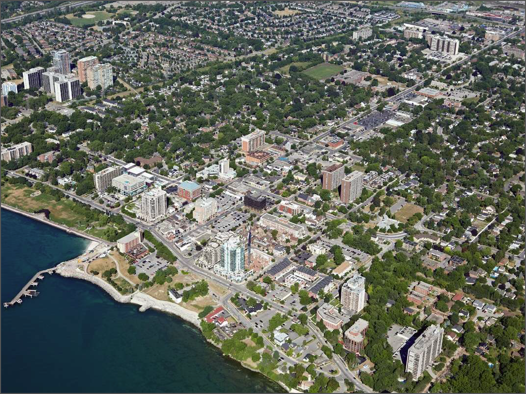
An aerial view of the city before the Pier was completed. The Region of \Halton is expected to grow from half a million people to more than 1 million by 2041 – how much of that growth will take place in Burlington is a key question to those who want the city to stay just the way it is.
The consultants chose a planned mobility hub – (1) Aldershot GO station; (2) an urban centre – Uptown; (3) an urban corridor; Fairview and Cumberland; (4) a neighbourhood commercial plaza – New Street and Guelph Line and an employment area – (5) Harvester Road, east of Appleby Line in one of the Prosperity corridors.
The objective was to give council some idea as to what the city would look like if the properties had their zoning changed or if the owners of the property developed the property to its maximum benefit.
The exercise was necessary because of the Province’s Places to Grow Plan, which calls for higher population densities across the province, will require the Region to grow by as much as half a million people by 2041.
The province will soon announce how many people and jobs have to be added to the Region of Halton. The Regional Council then has to decide how that number of job and population growth is to be distributed between the municipalities.
The exercise council went through was to look at what the city would look like under different sets of circumstances.
Existing Official Plan and Zoning By – Law permit 200 people and jobs per hectare within the UGC by 2031. This amounts to 22,800 people and jobs within the UGC by 2031.
The objective of the intensification exercise was to support the City’s strategic plan process by generating discussion about:
What we want to achieve through intensification
What intensification could look like
How we’ve prepared for intensification to date
How we can prepare ourselves further to manage intensification
Council wanted to know what could be achieved through intensification. Higher density growth within our Built-up areas can:
Reduce pressure for Greenfield growth, protecting rural and agricultural areas
Shift dependency from private automobiles towards walking, bicycling and transit
Create a critical mass of riders to support transit service
Make efficient use of existing infrastructure and services
Provide the opportunity to refine the urban environment and public spaces through urban design
Create opportunities to attract new growth
The visualizations are intended to show what intensification might look like in Burlington, and considered two scenarios:
Scenario 1: Current OP and Zoning Policies
Scenario 2: Hypothetical Intensification
Visualizations were developed through a conceptual block planning exercise relying on: Existing conditions, land use policy and zoning and general opportunities for pedestrian-supportive heights, densities, and streetscapes
The exercise was not conducted as a detailed master planning process, or technical planning exercise and therefore does not consider factors such as: transportation, utilities, servicing, site- specific constraints or general zoning requirements such as parking.
The visualizations are intended to provide a high level understanding of:
What intensification could look like?
The level of development that can be generated through intensification
How well the City’s current planning framework supports intensification
There are a number of key factors which drive intensification:
Access to higher order transit;
Other infrastructure condition/capacity;
Housing affordability;
Proximity to employment and amenities;
Land availability/suitability/value;
Urban character; and
Demographics/labour force characteristics.
What do the pictures drawn tell us?
We start in Aldershot on Waterdown Road which was recently widened after the property at Waterdown and Plains Road was expropriated.

Waterdown Road looking north. The recent widening of the road and a fresh layer of asphalt are almost a “red carpet” for development. The Adi Development group has already stakes out their claim for a combination of stacked townhouses and five high rise residential building on a site close to the Aldershot GO station.

One scenario, possible under existing zoning
Scenario 1. Under the existing zoning 365 people + jobs can be put on 8.8 hectares of property. Note the difference in height between on the right hand side of the street in the two scenarios.

A second scenario of the same part of the city with a hypothetical zoning that would allow for more density.
Scenario 2 – hypothetical intensification would see 450 people + jobs in27.1 hectares.
For those familiar with this part of Burlington these two scenarios are a huge change in the use of the land on Waterdown Road south of the railway tracks. It is not clear if any land assembly has been done in that part of the city.
The longer term plan is to develop a commercial hub around the Aldershot GO station. The ADI Development acquisition of 14 acres that they they want to place both stacked townhouses and apartment buildings on would bring residents into the community that could walk the short distance to these office buildings which would fit into the Live, Work, Play many at city hall have for the city. There would be few complaints about rush hour traffic.
The drawings shown here are what the Planning department thinks could be built on these properties. Now a developer who is looking for an opportunity will have some sense as to what is possible in terms of development.
If this kind of development took place in Aldershot – and that is a very big if – would it take some of the pressure off Plains Road? Many Aldershot residents are noisily opposed to anything over six storeys high.
The next possibility – and realize that these drawings are just examples of what could and might happen in different parts of the Burlington as the city looks at how it is going to cope with the need to intensify. There is no longer any land to grow – so any growth has to be by adding height and density.
The Planning department looked at a variety of locations around the city for these intensification exercises. They chose that part of Fairview east of Cumberland as an example of an urban corridor.

Fairview east of Cumberland – this is what it looks like today. Barren, busy and certainly not people friendly. Not a sidewalk to be seen.
This is what the corridor looks like today. Single storey structures for the most party set well back from the street.

The first of two scenarios – this one under existing zoning would allow for higher structures and much more in the way of open space for the public. with this kind of intensification Fairview takes on a community feel rather than just a road o drive along.
Scenario 1 – using the existing zoning would have 250 people + jobs in what is now a 6.8hectare area. The buildings would range between five and six storeys an be combinations of office and retail or retail and residential. The drawings show dedicated bike lanes and all kinds of trees. There are also a lot of open public spaces with benches and a lot foliage. It is certainly a more civilized looking Fairview Street.

Scenario 2 would require zoning changes and allow for much more height and density.
Scenario 2: Using a hypothetical intensification the street would have eight and ten storey structures that were mixed use allowing for retail, office and rental residential.
During the discussion Councillor Dennison, who is very pro development – within reason for the most part, points out that if intensification is going to be done in locations like Fairview – it makes more sense to go for as much height as possible “because we aren’t going to be able to make those buildings higher ten years later.”
The next part of the city to get a hypothetical makeover was the plaza at the intersection of New Street and Guelph Line. It is a fairly large sprawling plaza with entrance and exists on to two main Streets – New and Guelph Line. Well served by transit but rather barren looking places.
Scenario 1a under existing zoning would have 155 people + jobs on the 2.2 hectare site that would look a lot different than what is there today. Low rise office space with retail at the lower levels and parking at the rear.
Scenario 1b which was detailed in a Commercial Lands staff report would put 210 people + jobs on the site and see buildings that were six storeys and include the public square.
Throughout this visualization exercise of potential intensification sites there was the consistent inclusion of open public spaces with all kinds of foliage. One wonders if Parks and Recreation would create small skating rinks for people to use – that would certainly animate the space.
Scenario 2 for this commercial plaza ramps the population on the 2.2 hectare space to 285 people + jobs and takes the buildings up to eight and ten storeys.
During the discussion on this site Councillor Dennison who apparently knew the owners of the property well enough to say that they probably didn’t have the funds to undertake the kind of investment needed to change the plaza.
Part of what this visualization exercise was about seemed to be to let developers know what the potential in the city was now and could be with zoning changes.
The discussion on these “growth possibilities” was pretty heady stuff – now to learn what the public thinks about the ideas.
There were additional visualizations done – those for an Uptown urban centre – Appleby and Upper Midddle; an employment area, Harvester Road, east of Appleby Line in one of the Prosperity corridors, and an urban employment area – Appleby Line and Harvster Road, will be detailed in a following feature

Discover more from Burlington Gazette - Local News, Politics, Community
Subscribe to get the latest posts sent to your email.

Interestingly I find the slightly higher buildings have a more elegant look. The lowerise ones look more like a suburban wasteland area you see a lot of in the USA.
Fascinating to see it all depicted. Kind of pulls it together as we see buildings go up piecemeal. Pepper please keep us posted !
I am glad to see that the city planners are doing this kind of visioning thing, because, like it or not, “intensification” in some form is coming, and just like the Halton Urban Structure Plan (HUSP) of 20 years ago, total resistance is futile.
I suggested that this kind of city wide view of where, and how much of, the intensification targets could locate several times in formal city engagement opportunities, and I am sure others did too.
One thing to remember is, as Pepper notes, this is a long term planning horizon – 25 years.
But even given that, don’t be indifferent because the future will unfold from this with or without you. If people don’t engage then don’t complain later, because it is sooner or later going to come to your neighborhood.
Something I learned from the redevelopment projects on Plains Rd. is that the OP and zoning rules in force and directing what can be done today, came from the planners review of similar options and visioning exercises that took place 15 or 20 years ago.
If you don’t think that 6 stories are permitted by right on much of Plains Rd, then guess again. This was allowed in 1994 or 1999 depending.
It does not require any OP or zoning amendments that require official public consent processes.
I talked to a planner in charge of one project of 6 stories by right and this idea, that this possibility was decided 20 on years ago, but we are just seeing it manifest, come to pass, now.
So if you don’t like it now, and many people were around 20 years ago, were you indifferent then?
Pepper is doing everyone a great big favour, with a lot of work and effort, in presenting all this information for your reading leisure.
It’s your chance to have a say in what the future might look like as urban form or structure.
Please don’t be indifferent this time if you care at all about this. What do you want to see?
28 storeys and a subway system.