By Staff By Staff
August 5th, 2016
BURLINGTON, ON
If the heat doesn’t get the best of us – something else will.
We are told that a batch of mosquitoes trapped this week in Burlington have tested positive for West Nile virus (WNV).
This is the first WNV positive batch of mosquitoes collected from the city. An additional five batches of WNV positive mosquitoes were collected in Oakville. This year in Halton, there have been seven WNV positive mosquito batches to date.
 “Halton is committed to being safe and healthy and reducing West Nile virus in our communities through both education and preventative programs like larviciding,” said Dr. Hamidah Meghani, Halton Region Medical Officer of Health. “Until the hard frosts of fall set in, Halton residents should continue to protect themselves against mosquito bites and remove mosquito breeding sites.” “Halton is committed to being safe and healthy and reducing West Nile virus in our communities through both education and preventative programs like larviciding,” said Dr. Hamidah Meghani, Halton Region Medical Officer of Health. “Until the hard frosts of fall set in, Halton residents should continue to protect themselves against mosquito bites and remove mosquito breeding sites.”
Urban areas are more likely to have mosquitoes that carry WNV. The types of mosquitoes that transmit WNV to humans most commonly breed in urban areas in places that hold water such as bird baths, plant pots, old toys, and tires.
The following are steps that residents can take to protect themselves and their families from mosquitoes:
• Cover up. Wear light-coloured, long-sleeved shirts and pants with tightly-woven fabric.
• Avoid being outdoors from early evening to morning when mosquitoes are most active and likely to bite, as well as at any time in shady, wooded areas.
• Reduce mosquito breeding sites around your home by getting rid of all water-filled containers and objects, where possible. Change the water in bird baths at least once per week.
• Use an approved insect repellent, such as one containing DEET or Icaridin.
• Make sure your window and door screens are tight and without holes, cuts or other openings.
A map showing the locations of standing water sites that have had larvicide applied this year is available at halton.ca/wnv.
To report standing water at public facilities or for more information about West Nile virus, please visit halton.ca/wnv, dial 311or e-mail wnv@halton.ca.

By Staff
August 5, 2016
BURLINGTON, ON
Might be a little early to make solid plans – but you could pencil this one in as a possible – the city is celebrating the 25th anniversary of its Children’s Festival on Sunday, August 21 from 10 a.m. to 5 p.m. in Spencer Smith Park.
 As they get a little older – they are ready for bigger challenges. This group works there way through a children’s obstacle course. “We are hosting a huge birthday party for children of all ages to help mark this special occasion,” said Chris Glenn, the city’s director of parks and recreation. “This festival is consistently named as one of the Top 100 festivals and events in Ontario and is the perfect opportunity for families to get out, be active and enjoy some time together at Burlington’s beautiful waterfront.”
Presented by Rocca Sisters and Associates, the theme of this year’s festival is a birthday party. Children at the event can enjoy a number of activities and shows on the main stage, presented by Family Jr.:
 Kids + water = fun and noise – all part of a day in the park. • Main stage shows with Interactive DJ, Isabella Hoops, Mega Magic and Mystic Drumz
• Meet the characters from Paw Patrol and Star Wars from 11 a.m. – 3 p.m
• Roaming entertainment with Jungle Jack, Nick’s Juggling Family, CLaroL the CLown and stilt walkers
• Face painting and balloon animals
• Crafts
• Inflatables
• Kids’ marketplace
• Play zones
Admission to this accessible event is free. Consider walking or riding a bike to the festival.
By Pepper Parr
August 5th, 2016
BURLINGTON, ON
Our political correspondent, Ray Rivers, is working up a pair of articles on the United States presidential race and comparing the situation down there with how our democracy is working in Canada.
 When Rivers writes, as publisher he and I trade notes and thoughts on the direction his thinking is taking. My role is to support the writer. As I was reading through my own sources I came across a book On Bullshit, by Harry G. Frankfurt, a professor of philosophy emeritus at Princeton University and recognized as one of the world’s most influential moral philosophers When Rivers writes, as publisher he and I trade notes and thoughts on the direction his thinking is taking. My role is to support the writer. As I was reading through my own sources I came across a book On Bullshit, by Harry G. Frankfurt, a professor of philosophy emeritus at Princeton University and recognized as one of the world’s most influential moral philosophers
Here is what he has to say on that subject:
“One of the most salient features of our culture is that there is so much bullshit. Everyone knows this. Each of us contributes his share. But we tend to take the situation for granted. Most people are rather confident of their ability to recognize bullshit and to avoid being taken in by it. So the phenomenon has not aroused much deliberate concern. We have no clear understanding of what bullshit is, why there is so much of it, or what functions it serves. And we lack a conscientiously developed appreciation of what it means to us. In other words, as Harry Frankfurt writes, “we have no theory.”
Fareed Zakaria, writing in the Washington Post said: “Frankfurt, one of the world’s most influential moral philosophers, attempts to build such a theory here. With his characteristic combination of philosophical acuity, psychological insight, and wry humor, Frankfurt proceeds by exploring how bullshit and the related concept of humbug are distinct from lying. He argues that bullshitters misrepresent themselves to their audience not as liars do, that is, by deliberately making false claims about what is true. In fact, bullshit need not be untrue at all.
“Rather, bullshitters seek to convey a certain impression of themselves without being concerned about whether anything at all is true. They quietly change the rules governing their end of the conversation so that claims about truth and falsity are irrelevant. Frankfurt concludes that although bullshit can take many innocent forms, excessive indulgence in it can eventually undermine the practitioner’s capacity to tell the truth in a way that lying does not. Liars at least acknowledge that it matters what is true. By virtue of this, Frankfurt writes, bullshit is a greater enemy of the truth than lies are.”
This viewpoint and the role bullshit plays in our political lives at every level is not limited to the United States.
The book was a New York Times #1 Best Seller. No bullshit!
By Pepper Parr
August 4th, 2106
BURLINGTON, ON
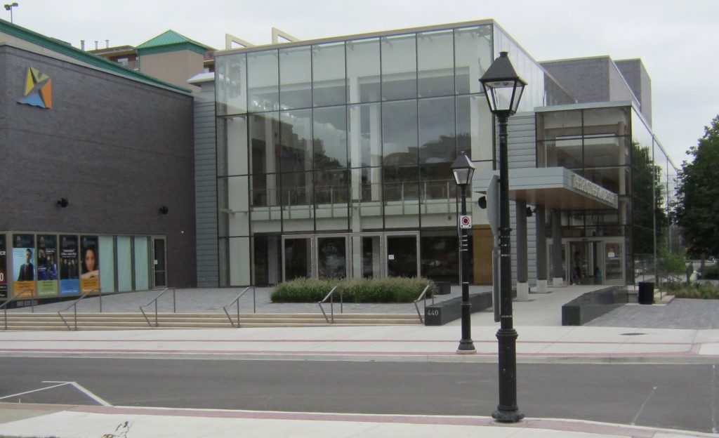
Once you’ve taken in the Jazz event Friday evening at the Performing arts Centre, at which Brian Dean, chief honcho for the Downtown Business Association will be MC – you might want to mosey on over to the same location and try Intersection Dance.
And what, you might ask is that? Intersection Dance is an open air celebration of dance for all! Each event will be part performance and part dance lesson. Come and see incredible dance in a summer setting and learn some moves from the artists.
Saturday, August 6 from 3:00pm – 4:30pm on the Plaza at 440 Locust Street
 One of the most impressive free form dancers we have seen will be leading the group through an original dance piece being created for the by Lisa Emmons, Artistic Director of Form Contemporary Dance Theatre. One of the most impressive free form dancers we have seen will be leading the group through an original dance piece being created for the by Lisa Emmons, Artistic Director of Form Contemporary Dance Theatre.
You will get to see the work in progress. Lisa will be collaborating with a collective of dancers representing three communities: Burlington, Milton and Oakville. After the performance the collective will receive “notes” and invite the audience to comment or make suggestions. These ideas will be considered as the piece is finalized for performances during Culture Days in the fall.
They will certainly be animating Locust Street Saturday afternoon.
By Pepper Parr
August 4th, 2016
BURLINGTON, ON
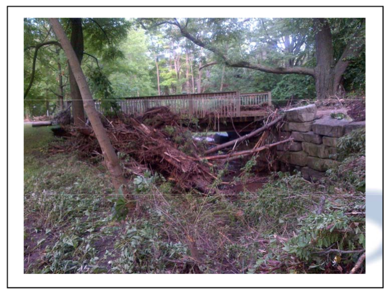
This time two years ago thousands of families in the city were scrambling to recover from a rainfall that flooded their homes while the city moved into serious damage control mode.
The rain began in the early afternoon of the August holiday, it seemed at first, like just another summer rain storm but it shut down the events at LaSalle Park where Joseph Brant Day was being celebrated.– at about 4 pm people began to realize there was a serious problem.
It was a holiday weekend and a lot of people were out of town. The Mayor was at his cottage, the acting city manager was at his cottage and out of cell phone reach. Then city general manager Scott Stewart was holding the fort and pulling in all the senior people he could find.
 The data available several weeks after the storm showed just how local it was. Tony Bavota, the fire chief, was getting reports but wasn’t experiencing as much as a drop of rain where he lived.
Underpasses were filling up with water.
 Every creek in the east end of the city broke its banks pushing branches and tree stumps that became battering rams that did major damage. The creeks on the east side of the city had burst their banks and could not manager the torrent of water that was roaring down.
Tuck Creek, Sheldon Creek along with the others in the eastern part of the had burst their banks and were doing significant damage.
There was very little in the way of media. The publisher of the Gazette was bailing water from the basement of the house he lived in.
The police at the Burlington detachment had to move all their vehicles to higher ground. Officers working at the desk had to walk on squishy floors.
The city got 191 mm of rain in just hours – most of it went looking for a place to flow – the creeks were a natural route to take.
Weeks after the event all kinds of data was available but the days of the flood and several days after that there was nothing but confusion.
 Drivers found the water rising far more rapidly than they expected – many had to abandon vehicles. The Region did move very quickly and made some short term funds available to several hundred people. The city turned to the province for help and learned about a thing called ODRAP – Ontario Disaster Relied Aid Program that called for the city to declare there was an emergency and then create a committee to raise funds locally that would be matched on a two for one basis by the province.
The program rules required the city to back away and let the local community organization handle the raising of funds.
Meanwhile the city began repairing the damage to the city infrastructure – the creeks has to be cleaned up, sidewalks that were literally lifted and moved yards down the road had to be repaired. The city was responsible for fixing the infrastructure – social services was a regional responsibility.
 Retired police officer Peter Hodgson took charge of the Red Cross effort which was to look at every home in the flood area and determine the level of damage. The Red Cross was brought in to do the immediate survey work to determine what the damage was on a house by house basis. The members of council for the east end of the city found themselves wading through basements with water up to their knees – but there wasn’t much else they could do.
The Burlington Community Foundation (BCF) was given the task of raising the funds needed and in a short 100 days raised just shy of $1 million.
 There was no missing the message – the city mobilized itself very quickly to help. There were some delicate backroom differences of opinion between the city and the province over whether or not Burlington was going to get any provincial support. Newly elected MPP Eleanor McMahon had an opportunity to deliver some choice words to her provincial government peers on what Burlington needed.
The BCF did superb work helping people fill in the appropriate forms and convince dozens of corporations to write cheques. All but one of the major banks came through big time. A major consumer products company, who shall go nameless, couldn’t find as much as a dime for the people that clog their store regularly.
 Fortinos turned their fund raising software over to the community and had their cashiers asking for donations. One of the supermarket chains made their back end computer system available for the collection of donations.
There were hundreds of small kind acts done. One woman went door to door with green garbage bags offering to take in laundry for people who had lost their washers and driers.
One citizen found some warehouse space where donated furniture could be stored for those who would need it later.
 The people of Elwood Street lined up to buy the cupcakes and the T shirts and the hot dogs to raise funds for their neighbours. One street decided to hold what they thought was going to be a small fund raiser for a senior who needed some help – the Burlington Teen Tour Band came marching up the street the day of the event bringing tears to they eyes of man.
That small street managed to raise more in the way of real cash than one of the major service clubs. The city was experiencing its citizens coming out to help.
 There wasn’t an arm that Ron Foxcroft didn’t twist to raise the close to $1 million needed in a 100 day period. Ron Foxcroft began to look like that Energizer bunny in the battery advertisements – he was everywhere chasing cheques and badgering people to add a couple of zeros to what they were giving.
What was remarkable about this natural event was that it ruined some families and at the same time people just blocks away experienced nothing.
It was like one of those tornadoes that ripped through a street, tore out five or six houses and left everything else standing. The city had never experience anything like this before.
We learned that the downspouts that took rain from the eaves troughs were pouring water into a system of pipes that couldn’t manage the flow. We leaned that those catch basis in back yards that had been covered by grass really were an important part of storm water management.
We learned that those swales between our houses were there for a purpose.
And we learned how to pull together as a community to help each other.
After some of the finest work any community organization has done – the Burlington Community Foundation did a re-branding and took the word community out of their corporate name – go figure.
By Pepper Parr
August 3rd, 2016
BURLINGTON, ON
This story has been revised – the number of hotel rooms is closer to 300 + than 500 as originally reported.
Frank McKeown has got part of it figured out.
He is tasked with bringing corporations to the city that will employ people in high tech, high paying jobs – the sort of thing that L3 Wescam does on the North Service Road. Few people know they produce some of the best visual surveillance equipment in the world.
Here is how they tell just a part of their story.
WESCAM has an airborne portfolio of multi-sensor, multi-spectral systems that are deployed worldwide, at varying ranges, and with overlapping fields-of-view, creating the opportunity for uninterrupted surveillance of boarders, forward operating bases, airfields and other vital assets.
McKeown wants more of that kind of company here. But, he will tell you, “companies don’t just up and move every day of the week”.
 The structure on the corner is going to be a nine storey building with 150+ rooms and convention facilities. A 2018 opening date is the plan. He knows that Burlington has a great story to tell any organization thinking about a move – and the Burlington Economic Development Corporation does a darn good job of getting the story out – but there is only so much that can be done in terms of promotion.
McKeown will tell you that it is pretty much a belly to belly business. You need to be in front of the people who make the decisions – which isn’t easy.
 Tear this one down – build a new one of at least 20 stories along with a second structure close to the water and you have a small cluster of accommodation that can attract small conventions. But McKeown thinks he has an angle that will work for him and for the city.
The city has a stunning development going up along Lakeshore – the Bridgewater condominium with its 22 stories that will soar into the sky and will be part of a three tower complex that will include a four star Marriott hotel with several hundred rooms.
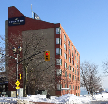
Yards to the west there are plans for a major redevelopment of the existing Waterfront Hotel. The thinking is for a two or three building project that will be oriented to the west with the view right along Spencer Smith Park’s Naval Promenade.
With two hotels that will have something in the order of 300 rooms and a Performing Arts Centre that can hold 700 people in its Main Theatre, Burlington is suddenly well positioned to become a small convention destination.
 Frank McKeown, former Chief of Staff to Mayor Rick Goldring is now the Executive Director of the Burlington Economic Development Corporation. Making this work for the city will mean a total transformation of the current Tourism office operation. More selling power on the team – and then getting out there and learning who is holding their convention when and making a pitch for their business.
Burlington has a very unique story to tell and a lovely setting.
 A great locale for small convention events – has the Performing Arts Centre team begun to think how they will work with the Tourism office and the two new hotels we will have within five years? That Marriott hotel isn’t open yet but it isn’t too early to start pitching for that convention business. Is there anyone in the Tourism office talking to the hotel people and planning on how that convention business can be brought to town?
McKeown will be away for some holiday – and he is said to be taking up Wednesday golf in a serious way. Great business gets done on golf courses.
We will wait to hear what the Tourism office has in terms of a work plan for the balance of 2016 and 2017.
By Staff
April 3rd, 2106
BURLINGTON, ON
The Performing Arts centre people have upped their game. Hard on the heels of a very successful event last summer they have expanded the program from a number of evenings of Jazz on the Plaza to a series of events that includes Sunday programs for families and a Tuesday evening that covers a number of musical genres.
 That plaza will be packed on Tuesday, Fridays and |Sunday during the month of August as the Performing Arts Centre shows its appreciation for the just under $1 million subsidy they get from the city. A free evening of entertainment every Tuesday in August, featuring musical performances across a range of genres. The bar will be open and a variety of snacks available. In the event of rain, the performance will be moved inside.
TUESDAY, AUGUST 2 Stacey Lee Gusé
TUESDAY, AUGUST 9 Dave Barrett Trio with Michael Sadler (SAGA)
TUESDAY, AUGUST 16 Bravura
TUESDAY, AUGUST 23 Poor Angus
Friday is the Jazz evening – on the Plaza from 6:30pm – 8:30pm Bar will be open – cash only.
FRIDAY, AUGUST 5 Ricochet – Led by Adrean Farrugia
FRIDAY, AUGUST 12 Rob Tardik
FRIDAY, AUGUST 19 Barbra Lica
FRIDAY, AUGUST 26 Vincent Wolfe and The VegasNorth Seven
SUNDAY FAMILY FUN Sunday afternoons – 2:00pm – 5:00pm – free family fun, from music, to dance, to games, to sing-a-longs and more, there will be something for everyone! A variety of snacks and drinks will be available to keep youngsters and their parents energized throughout the afternoon. In the event of rain, the performance will be moved inside.
SUNDAY, AUGUST 7 The Monkey Bunch / Mark Correia
SUNDAY, AUGUST 14 Singalong Tim and The Pacifiers / The Sentimentalists
SUNDAY, AUGUST 21 Sonshine and Broccoli / Phil The Magic Guy
The program was very popular its first year – it was hard to get a place to sit.
The city shuts down streets for many events – it would create a lot more space for people to sit and enjoy the music if that short block of Locust was traffic free for these events. It could double the capacity.
By Staff
August 3rd, 2016
BURLINGTON, ON
It is all going to the dogs!
The woof woofs just might be getting one of the places in Burlington with a view that is to almost die for – Bayview Park.
The city is asking: Do you and your canine best friend use the leash-free area in Bayview Park?
If you do, the City of Burlington wants to hear your opinion about a possible leash-free area for small dogs.
We are looking at:
• Expanding the size of the total leash-free area from one hectare to 1.5 hectares
• Creating a separate leash-free area for small dogs only
• New six-foot (two-metre) high chain link fence with two double gate entrances
• Relocating the entrances
• Providing an accessible pathway from the existing parking lot into both of the leash-free areas
• Installing a new shelter in the small dog leash-free area.
Bayview Park at 1800 King Rd. is also known as W.A.G. (Where Animals Gather) Park. If you use the park, please take a moment to answer this short poll at www.burlington.ca/leashfree.
 The park has one of the best views of the Skyway bridge – you can see the ships coming and going. King Road is also the road that the city closes in the spring so the Jefferson Salamanders can do what they do to increase their population. The road closure takes place further up King Road. There is an added feature in taking your dog to this park – it is a nice way to get out of the city and on occasions a model Airplane club sends their small craft soaring through the skies. These guys are serious people and they have some pretty impressive model airplanes.
 This off leash park is in Toronto. The parks offer a different level of civil society – not even a hint of stress. Must be nice. Vote for the park – convince the city to make it as big as they can so the woof woofs have all kinds of space to run around. Convince them to create a shelter as well.
By Pepper Parr
August 3rd, 2016
BURLINGTON, ON
It will take place – right here in Burlington – a simulcast of the CBC broadcast of the last stop on the farewell tour of the Tragically Hip band; an event that is pregnant with the knowledge that Gord Downie, the band leader lives with an incurable brain cancer.
The Hip resonated with a certain demographic – they were our band and they spoke our language and we believed that like the Rolling stones they would go on forever.
 He is giving it everything he’s got – and then some! But it isn’t going to work out that way. The last song that is played on the simulcast will bring tears to the eyes of many – probably most.
While the tears might be part of a life experience, what is really necessary is a donation to the Canadian Cancer Society.
The Burlington Downtown Business Association, which has been a large part of the driving force behind getting the broadcast to Burlington, where it will be put up on huge screen in Spencer Smith Park, have set up an account at the Royal Bank of Canada Branch downtown at Lakeshore and Pearl.
It is a “deposit only” account; funds collected will be equally divided between JBH Foundation (in support of the Hospital’s cancer care clinic” and The Halton chapter of the Canadian Cancer Society (focusing on education and prevention).
 Gord Downie – The Tragically Hip The event is going to be bitter sweet – there will be a man on the stage suffering. The disease that is eating away at his brain is at this point in time incurable. Cancer treatment has come a long way in the past decade – basically because of the continuing ongoing research – which costs a lot of money.
You get a chance to put your money where your heart is going to be on August 20th. Just walk into the Royal Bank and make a donation. The account and transit number is set out below. Just do it.
Account # 100-427-4
Transit # 00622
The BDBA is working quickly to establish a tool for online donations as well. The Gazette will publish those details as soon as they are available.
By Pepper Parr
August 3rd, 2016
BURLINGTON, ON
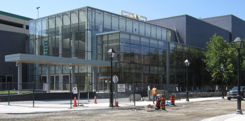
The Burlington Performing Arts Centre is accepting submissions from local artists for the Culture Days celebrations in the Theatre Lobby to take place on Sunday October 2nd, 2016.
These are curated performances event taking place from 12pm -4pm, in conjunction with other activities. The call is for artists in the community to have a 15-minute performance highlight on the lobby stage. There are only eight slots available.
 The Family room being put to spectacular use – the Performing Arts Centre wants to make the space available to local talent during Culture Days in the fall. As part of the Community Initiative for Culture Days in Burlington, we are looking for amateur talent in Burlington and surrounding areas to showcase our local artists or acts and to introduce these artists to our patrons and to a wider audience as well as to showcase culture in Burlington.
This can also assist any local artist or group who are on their way to becoming better known in the community or even pursuing the goal of becoming professional.
There is an honorarium for these performances and the artists will get an opportunity to promote their brand at that time, while reaching a new audience. The artists may also be added to the City of Burlington’s Artists database, with their permission.
We are looking for singer/songwriters, singers of pop, jazz, blues, folk, musical theatre and classical music, bands or combos, instrumentalists and soloists: classical, jazz, etc.
Please submit by email to: BPACsubmissions@burlington.ca with Culture Days in the Subject line. Includde a couple of photos, a short bio and some background information along with a short description of the act or performer, any links to YouTube videos, if you have them, and of course, contact information.
Dateline for submissions is August 26th, 2016.
There are only eight spots available; only those acts or artists selected will be contacted.
Costin Manu, Community Engagement Manager for the Centre, has been working at getting something going in the lobby of the Performing Arts centre since he arrived. It will be interesting to see how this works out – it will also be interesting to see how the city and the Performing Arts centre manage to collaborate on making the Cultural Days event in Burlington work. There didn’t seem to be all that much co-operating between the two – each sort of did their own thing – and it showed.
The Centre has a strong Jazz program on the plaza during August – details in the next edition of the Gazette.
Earlier this year the Art \gallery of Burlington rented the Main Theatre and put the lobby – which we thought was named the Family Room – and put it to excellent use.
 The Burlington Teen Tour Band took over the Family Room of the Burlington Performing Arts Centre the day the city turned the building over to the community. When the Performing Arts Centre opened there was an afternoon when all of the Burlington Teen Tour Band marched in through the east side sliding doors and gave that space life and energy it has never seen before.
The Centre management has yet to “animate” the space as well since.
By Staff
August 2nd, 2016
BURLINGTON, ON
Progress we think – and as one of those people who lived at the intersection of New Street and Guelph Line – we are all mighty pleased that we no longer have to dodge construction equipment and work our way around pot holes that pull hub caps off the vehicle
Many of us think the Regional chair owes us at least one car wash – the dust was incredible.
 Director of Transit for the city of Burlington, Mike Spicer serving as a Court Jester? The city transit people has announced schedule adjustments that begin August 14 upon completion of New Street construction.
Schedule adjustments effective August 14, 2016.
Routes 10 and 20 will return to normal routing upon completion of the New Street construction project. Minor adjustments have also been made to select trips on routes: 1, 11, 80 and 101.
 The intention is to replace water and sewage pipe lines all along New street and add bicycle lanes on a trial basis as well east of Guelph Line. Use the new Trip Planner and Next Bus link to know when the bus will depart in real-time. Add tripplanner.burlington.ca to your favourites or call the automated phone system 905-639-0550 and enter in your Stop ID.
The last we heard was that the Trip Planner and Next Bu link were getting a technical touch up. We never heard back from the transit people.
We will now give that service a test and let you know how it is doing.
By Pepper Parr
August 2nd, 2016
BURLINGTON, ON
It will be interesting to see the look on Mayor Goldring’s face when a poem written by Hanz Mirck, Apeldoorn’s resident poet, is read to him at the Different Drummer Books on August 12th.
The poem was commissioned by the Apeldoorn City Poet Committee, a group that is very active.
Our Mayor is a little uncomfortable with things emotional. Sitting in a room while someone reads a poem directly to him will be a different experience.
 Mayors of Apeldoorn and Burlington Our relationship with Apeldoorn is very strong – city staff have met with Apeldoorn city employees and there is the potential for some economic development between the two cities.
 Apeldoorn has this palace – we have Spencer Smith Park A look at the cultural activity in Apeldoorn suggests they are much more advanced than we are with local culture. It is an older society with a richer and more appreciated heritage and culture.
The event takes place Friday, August 12, 2016, 2 to 3 p.m., at the A Different Drummer Books.
At some point in the future perhaps Burlington will commission Tomy Bewick to do a poetry piece that he can present at the Poetry Slam and then have it read to the Mayor of Apeldoorn
By Pepper Parr
July 30th, 2016
BURLINGTON, ON
The Airpark has served notice on the city that it is going to appeal the decision made in the Superior Court of Ontario which decided that they must file a site alteration plan for the air park where thousands of tonnes of land fill was dumped between 2003 and 2008.
And why are we not surprised?
This is what you do when you need to buy time.
 The black lines show the size of the Air \Park property. The properties on the left side along Appleby Line suffered significant flooding from run off after the land fill had been dumped on Air Park property. The Air Park had 30 days in which to decide what they wanted to do – file a site alteration plan or appeal the decision.
They chose to appeal – and if this appeal is anything like the results of the last court decision the Air Park appealed it will be a very short court case.
After speaking for close to an hour on why the original decision should be set aside (that was the decision that said the air park did have to comply with municipal bylaws) the Court of Appeal decided they didn’t have to listen to the city’s argument. They recessed for a short period of time and chose not to set aside the Superior Court decision.
This second court case had the city of Burlington asking the court to compel the Air Park to file a site plan for the city to approve – and that of course is where the rubber hits the road – what if the city doesn’t approve the site plan that is filed?
The City will now discuss next steps after learning that the Burlington Airpark Inc. has appealed the decision of Mr. Justice M.R. Gibson dated June 30, 2016 to the Ontario Court of Appeal.
 Vince Rossi, president of the Air Park and believed to be the sole shareholder of the private company, met with north Burlington residents. He took all the comments made “under advisement”. The appeal, attached, states:
“THE APPELLANT ASKS that the judgment be set aside and judgment be granted declaring City of Burlington By-Law 64-2014 to be ultra vires, or inapplicable to the operations of the Appellant, Burlington Airpark Inc., and in particular to the placement of soils in and about aircraft runways and aircraft taxiways at the Burlington Airpark (the “Airpark”) prior to April 27, 2013.”
The City of Burlington site alteration bylaw 64-2014 regulates the placing, dumping, cutting and removal of fill or the alteration of grades or drainage on a piece of land. Individuals doing this type of work must first submit an application to the city for a site alteration permit.
 The Air Park at one point had plans to locate a helicopter station on the property. On June 30, the Ontario Superior Court of Justice ruled in favour of the City of Burlington’s application to compel Burlington Airpark Inc. to submit an application for a site alteration permit to comply with the bylaw. With the court ruling, the Air Park was required to file an application for a site alteration permit for the fill deposited between 2008 and 2013 before August 31, 2016.
The court has also ordered the Airpark to pay the city’s court costs.
The Air Park itself is not the issue – it is what the current owner of the air park has dumped on the land. They have argued that the land fill was brought in to level the property for future development.
Most people took the position that the land fill was brought in because it was very profitable to do so – and indeed it appears, with what little evidence there is so far that dumping land fill on the site was profitable.
During the first court case lawyer Ian Blue, acting for Burlington, managed to get on record that there were large sums earned from the land fill that was dumped, but that the corporate records were not available to show just where those millions of dollars had gone.
 All the key players in the Air Park dispute: On the left standing is assistant city solicitor Blake Hurley, seated in front of him is Ian Blue, the lawyer the has hired to represent them in court. Leaning over th chairs is former city general manager Scott Stewart along with Roger Goulet, Ken Woodfruff and Monte Denis. Leaning over th three gentlemen is former ward six candidate Vanessa Warren. At one point in these proceedings the Air Park sued three Burlington residents and a local on line newspaper (the Burlington Gazette) for libel. That case is still churning its way through the judicial system. The defendants, Denis, Warren, Parr and the Gazette have asked the Air Park to show their financial records. The Air Park has refused to do so. A Judge has heard arguments from the Air Park and the defendants on why the Air Park should make its financial records available. They are waiting for a decision.
There are people involved in economic development matters who feel the air park is an important part of what kind of development takes place on the 200 acre site. A small regional airport is seen by these people as a useful and there are reported to be people interested in acquiring the air park which is believed to be wholly owned by Vince Rossi.
There are others who feel the airport should become something owned and operated by the Region. However there does not appear to be much in the way of an appetite at the Region for them to become operators of an Air Park. There are a number of municipalities who have done just that.
Might the air park find itself with new owners? There is more than one individual interested in that possibility.
By Pepper Parr
July 29th, 2016
BURLINGTON, ON
There is a difference in interviewing the local MPP who sits as a back bencher with a couple of pet projects and interviewing a Minister of the Crown who has also been appointed to Treasury Board and runs a Ministry that has three sections: Tourism, Sports and Culture; each important to not only the well-being of the people in the province but significant sectors of the provincial economy as well.
 MPP Eleanor McMahon at her first public meeting after being named a Minister of the crown in Ontario. It has been almost a world wind experience for Burlington MPP Eleanor McMahon and it is far from over. Recruited to the Ontario Liberal Party by Kathleen Wynne personally, McMahon went on to win the riding that had been held for more than 70 years by Conservatives. She brought the ability to connect with people on a deep personal level that was sincere and recognized immediately by people she met with. She is a formidable campaigner.
The public didn’t know all that much about McMahon other than a little about a personal tragedy in her life and a strong commitment to teaching the public to share the road with cyclists.
Her maiden speech in the legislature was pretty standard. Where the city might have seen some of the energy and drive was in August of 2014 when she worked tirelessly to bring the province onside and involve Burlington in the ODRAP – Ontario Disaster Relief and Assistance Program that matched the close to $1 million raised by citizens to aid the more than 300 home owners whose houses were severely damaged.
When the Burlington Community Foundation (since renamed the Burlington Foundation) needed a place for people to be able to donated funds, McMahon was on the telephone and within a very short period of time convinced the national offices of the United Way to let Burlington use their web site. Connections at that level are what McMahon is very good at- she had once worked at the United Way national office.
She can be partisan, listen to her at a campaign meeting, she has a positive streak that exceeds that of Mary Poppins
McMahon works from a strong relationship base with people – but don’t cross her. She has a strong Irish streak in her that remembers. That Irish streak is conditioned by a strong Catholicism and rooted in a family that is very very close. You don’t see much of the family all that often but they are there.
When the Premier let it be known that she was going to change some of the names on the Cabinet room chairs McMahon’s name got mentioned in the media. The Gazette didn’t see McMahon as Cabinet material but when the list came out her name was there.
We saw McMahon as more of a booster and wished that she would come across as more of a legislator.
There are many people that grow into opportunities that let latent skills and talent come to the surface. That seems to be the kind of experience McMahon is having.
 McMahon took to a loom during a tour of the Art Gallery. she has an exceptionally strong working relationship with Member of Parliament Karina Gould – they share a number of public events – they are actually quite a tag team. The Ministry she was given is a good fit for her. Being made a Minister of the crown brought with it a steep learning curve. As she worked her way through the briefing binders we began to see an Eleanor McMahon that hadn’t been visible before.
She wasn’t exactly a policy wonk but she wasn’t going to be a wall flower either. All the signs so far point to a woman who has rolled up her sleeves and getting into the job.
She jumped right in and became a team player picking up where her predecessor in the Ministry of Tourism, Sport and Culture had left off. In unveiling the province’s first detailed culture strategy the public heard her close to flawless French and her ability to get her tongue around the language the aboriginal world speaks when she unveiled the strategy.
“I am all about words” said McMahon in an exclusive interview with the Gazette.
 McMahon wears a quiet smile as she takes part in a cheque presentation during the massive community effort to raise funds for 2014 flood victims. McMahon was a quiet, unrelenting advocate for the city. In commenting on the province’s decision to sell a portion of Hydro McMahon said the government wanted to see a “tougher, tighter” corporation and having the private sector at the table would result in a more responsive corporation. That’s not something a lot of people in the province are going to agree with.
The belief that “change for the better” is what will improve life for everyone works itself into just about everything McMahon does.
She has bought into the advice a former head of the Toronto Dominion Bank, Ed Clarke gave the Premier when he said: Ontario needs to “catch up to keep up” which has led the provincial government into spending $160 billion on improving the transportation system so that goods and people can move efficiently.
McMahon spoke of thinking “beyond the election cycle” which is good news copy but the voters are always the big elephant in the room.
McMahon is a big picture person. Asked what the Brexit (the United Kingdom pulling out of the European Union) decision is going to mean she will tell you that isolationism is not the answer. Partnering with as many countries as possible is what will keep the Ontario economy strong as it adjusts to the changes taking place in the province’s economy and how it fits into a larger North American and world economy.
McMahon will tell you of the trade mission the Premier recently took to Israel that resulted in an agreement that will see students from that country working at the McMaster University DeGroote School of Business here in Burlington.
 MPP Eleanor McMahon and MP Karina Gould do a Cogeco interview at a public meting that dealt with how Burlington would welcome the Syria refugees coming to Canada A number of months ago McMahon sat in on a discussion with parents who had older autistic children. There are a lot of programs in place for younger autistic children but once they pass the age of 18 there is literally nothing for them.
The group of parents took part in a day long exercise to think through just what the problem was and what might be possible in the way of programs for autistic people who are in their forties with parents who are in the 60’s and 70’s.
When the parents are gone – what happens to these now middle aged people who need help? They fall between the cracks which terrifies the parents.
McMahon listened, and then worked with the group to obtain a Trillium grant that would allow them to do some research and come up with ideas and possible approaches to providing the services these autistic people need.
The provincial government has begun to make changes in the services available to young autistic people. We will follow those developments.
The practice of large corporations basically paying for access to Cabinet Ministers was brought up. McMahon said she was not on the committee that put forward the recommendations the Premier appears to want to follow.
She is however now a Cabinet Minister and there are people who will want to bend her ear. McMahon will tell you she will be transparent and adds that unions and corporations and individuals have a right to be heard. “Why shut them out?” she asked.
She points to the large sums that were raised by Vermont Senator Bernie Sanders in his drive to win the Democratic presidential nomination and adds that the American’s have Super Pacs – which are organizations created to raise funds and make them available to candidates that share their views.
I don’t think Ontario has heard the last of how political parties are going to handle the raising of funds to pay for their elections. It was interesting to note that McMahon didn’t talk in terms of spending less on elections.
 During the 2014 flood McMahon was out into the community meeting people and listening to their concerns. she was instrumental in convincing the provincial government to march the funds raised locally. She didn’t do it all by herself but when she made those phone calls few could say no to her. The Ministry McMahon leads has a deputy minister and four associate deputy ministers; that run a Ministry that may not seem all that vital on the surface. Tourism, culture and sports reach into every municipality in the province. It is clear to those who have thought it through that culture is an economic driver and that it is tourism that brings people to Ontario.
Canada will begin its sesquicentennial celebration in 2017 – the federal government will go nutso on this one and Ontario will be running alongside them to make the celebration a sound success.
McMahon was recently appointed to the Treasury Board – that’s the table at which the financial decisions are made. No fuzzy thinking at that table. Someone has recognized the McMahon talent.
Ontario Place is part of the file McMahon manages. She recalled riding the water slides when she was younger and wants to see the Children’s Park, which were closed some time ago, put back into Ontario Place that is going through a major upgrade.
The Toronto International Film Festival is something she has a small hand in and she is interested seeing an NHL Winter Classic take place in our part of the world.
And she mentioned that she is working on seeing more “tailgate” parties during Grey Cup week
Expect McMahon to promote local festivals; next year the promoters of the Lowville Festival might manage to get her to one of their events.
 McMahon gets out into the community – she speaks straight from her hart and listen with both ears. She can also glam up when she needs to – but for the most part what you see it shat you get. The demands of the job are close to brutal. McMahon has a very supportive family and a tight circle of friends and associates that are there to help out.
Most weekends she finds herself taking a shopping bag filled with Briefing books to her cottage where she can share time with her family, refresh and get caught up.
There is more to tell you about what McMahon wants to get done and how she thinks she can “change for the better”.
By Pepper Parr
July 28, 2016
BURLINGTON, ON
The craft maker residency is more than a year away – but the opportunity is something worth looking at – the – applications are due September 30, 2016 .
The Art Gallery of Burlington (AGB), in collaboration with Craft Ontario (CC), is hosting a residency for up to six makers who work in craft disciplines as part of the inaugural Canadian Craft Biennial and Canada 150 celebration.
 Former MP Mike Wallace on a tour of the Art Gallery – looking at bowls made by potters. The residency will take place at the AGB in Burlington, Ontario. The AGB is home of seven guilds—Potters, Woodcarvers and Sculptors, Photography, Fine Arts, Fibre Arts, Rug Hooking Craft, and Handweavers and Spinners.
Each guild has their own fully equipped studio including ceramics with three different types of kilns (Raku, gas and electric), and a weaving studio with looms of many sizes. The residency aims to engage with the themes of the Biennale which include identity, materiality and the topical issues concerning Canada today.
 Six residencies are being created for craft makers at the Art Gallery The residency will provide a unique opportunity for the selected makers to exchange processes and ideas of their own medium and try new ones. A large open studio will provide each participant with a working table and materials, outdoor space will also be available, as well as access to the AGB studios and the possibility to work and exchange with guild members. We are looking for a range of makers both in terms of experience, and materials and processes used. A writers’ residency will take place at the same time doubling the opportunities to exchange with curators, scholars and critics.
Residents will:
Reside in shared accommodation with other members of the residency.
Attend workshops in various mediums
Engage with craft practitioners and theoreticians in a variety of settings
Actively participate in discussion with co-residents (makers and writers) in both structured and informal environments.
Attend the 2-day conference, part of the Can Craft? Craft Can! Biennale.
At the conclusion, residents will have the opportunity to discuss their experience as part of a round-table discussion that will be presented during the 2-day conference.
The residency will pay for travel to Burlington, Ontario, housing for the 10-days of the residency and will provide a per-diem allowance.
 Denis Longchamps, Curator at the Art Gallery of Burlington. To apply, submit the following by September 30, 2016 to Denis Longchamps, Artistic Director and Chief Curator, Art Gallery of Burlington, by email at denis@agb.life
A CV (3 pages max.) outlining your education, and working and exhibition experience as you see it relating to this residency.
A 300 word letter of intent outlining your hopes for the outcome of your attendance and how the residency fits into your broader career aspirations.
Written documents should be in Word or PDF and PC compatible format.
Up to 5 images of your most recent works (JPG, 1024 x 768 dpi) and a list of images.
By Staff
July 28th, 2016
BURLINGTON, ON
The Burlington Bandits are part of the bottom three in the InterCounty Baseball League standings. Hamilton and Guelph are beneath Burlington.
The London Majors won their fifth straight game and can still finish first after their 12-3 win over the Burlington Bandits Wednesday night.
 London (25-9) trails Kitchener by a game but has two games remaining, including a showdown at home Friday against the Panthers. London (25-9) trails Kitchener by a game but has two games remaining, including a showdown at home Friday against the Panthers.
Michael Ambrose led the offence against Burlington, going 3-for-5 with two singles and a triple. He added two RBI and a run. Chris MacQueen also had two singles and a triple, driving in a run and scoring twice. Keith Kandel had two hits, two RBI and two runs, while Kyle Gormandy and Tristan Buntrock each had two hits, an RBI and run.
Byron Reichstein had an RBI, and Carlos Arteaga added three hits and three runs.
Oscar Perez (6-3) went six innings for the win, scattering eight hits and two earned runs while striking out five without walking a batter.
Ryan Beckett (2-6) took the loss, allowing six runs (five earned) on 11 hits over seven innings, striking out five and walking three.
At the plate, Kevin Hussey singled, tripled and scored twice as Burlington fell to 10-24 and is locked into sixth place heading into playoffs next week.
Canice Ejoh had three hits, Robert Tavone doubled twice and drove in a run, Julian Johnson had an RBI, and Carlos Villoria singled twice and scored once.
In Brantford Brandon Dailey had three hits and three RBI to lead the Brantford Red Sox to a 7-1 win over the Guelph Royals Wednesday night.
Benjamin Bostick, Chris Dennis and Mike Burk all had a hit, RBI and run, Wayne Forman drove in a run, and Tyler Patzalek had two hits and a run.
Nathan Forer (7-2) picked up the win, throwing five innings and giving up a run on three hits, striking out six and walking two.
Fourth-place Brantford is 20-14 but three games back of Barrie.
Jeff MacLeod had the Royals’ RBI. Matt Schmidt picked up two hits and scored the lone run, while Adam Rossit singled twice.
Marc Andre-Major (0-1) took the loss, allowing five runs on six hits in five innings, striking out seven and walking five.
Seventh-place Guelph is 7-27 and tied with Hamilton at the bottom of the standings.
Future games
Thursday, July 28
Hamilton at Barrie, 7:30 p.m.
London at Burlington, 7:30 p.m.
By Pepper Parr
July 28th, 2016
BURLINGTON, ON
If there was any doubt as to what is going to happen to this city in the next 20 years – that doubt was dispelled in a media release issued by the city today.
We are going to grow and we are going to do it as boldly as possible.
 Director of Planning coined the phrase: Bolder, Smarter, Beautiful. That is how she plans to lead development in the city and has the full support of city council behind her. Director of Planning for the city Mary Lou Tanner underlined that point at a recent city council meeting when she said we will build “Bold, Smart, Beautiful.”
City City Council approved the Official Plan Review reports that lay the foundation for how and where the City of Burlington will grow for the next 20 years, inspired by Burlington’s 2015-40 Strategic Plan.
Two Official Plan Review reports that will help establish how and where the City of Burlington will grow over the next 20 years were given the stamp of approval.
Those reports set out where growth will take place and the kind of growth that will take place. There are a couple of locations that are intended for one type of growth when the owners of the property want to do something different. Is that another “OMB here we come?”
“This is an important time for our city,” said Mayor Rick Goldring. “We have the opportunity to plan the type of growth we want in the locations we want to ensure we continue to be a thriving city. We will grow responsibly, with detailed planning that will result in new neighbourhoods that provide public amenity space, walkability, cycling infrastructure and public transit options, while minimizing the carbon footprint.”
Getting all that done is critical if the city is to be the kind of place the public seems to want. Sitting in on public meetings and hearing what a developer wants and noting how much they vary with what the city has set out as its model points to some stiff battles ahead.
 The Air Park learned that a developer cannot do whatever they choose to do nor can they apply their own interpretation to the regulations. It has been said that you can’t beat city hall and the Air Park has certainly learned that lesson. There are developers putting up impressive, large in scale projects that are well within what the city wants to see. There are others battling the planners at almost every yard. The city asked residents what to call the new direction for growth in Burlington. Two-thirds of the hundreds of people surveyed chose “Grow Bold” over the other option, which is “We Are All In.”
“After months of engagement with the community, City Council made the decision earlier this year, in the city’s Strategic Plan, that Burlington is going to grow,” said James Ridge, Burlington’s city manager. “With this direction, the city’s planning team has been hard at work updating the city’s Official Plan, the blueprint that defines where and how growth will happen over the next 20 years.”
Of the two reports approved by City Council, the Urban Structure and Intensification Policy Directions report contains a policy direction for an intensification framework that clearly outlines the parts of the city that are being targeted for growth and those areas that will not see a significant amount of development. Among the primary locations for intensification are the areas around Burlington’s GO stations, called mobility hubs.
The second report, Burlington’s Mobility Hubs: A Work Plan for Area-Specific Planning, addresses the need for a dedicated mobility hub planning team.
 Mobility hubs at the GO stations is close to a no brainer. Which of the four identified hubs should be first – thatis what planners will be figuring out in the immediate future. City Council approved $2.5 million in funding for four full-time staff who will work to ensure future developments around the mobility hubs reflect the city’s vision for new neighbourhoods that are walkable, offer a variety of affordable housing choices and have easy access to transit, shopping, parks and recreation centres.
At one point it looked as if Aldershot was going to be the first mobility hub for the city. They seem to have backed away from that and are looking at all four hub locations to determine which should get the focus and attention
“We have the opportunity to plan the type of growth we want in the locations we want to ensure that Burlington is a vibrant 21st-century city,” said Mary Lou Tanner, chief planner and director of Planning and Building with the city. “We are going to grow bold, which means we are going to build up, we are going to build smart and we are going to build beautiful.”
These are exciting times for the planners. Will enough of the work have been done to have something to take to the public before the next election in 27 months?
By Pepper Parr
July 27th, 2016
BURLINGTON, ON
Well – they know how to put a damper on a vacation – don’t they?
The city wants to know what you think about the two budgets they are preparing. The Capital budget which covers the cost of the things they build and repair and the Operating budget which covers the day to day expenses for all the departments.
The average taxpayer might want to pass along the following words: “Less would be better.”
 In election years public budget meting attendance is pretty good. Candidates for office show up while everyone goes through a workbook the city prepares on what they plan on doing. Rarely do the comments made at the public meetings make into into the budget. For the most part they are a public relations exercise. Burlington’s Finance department is exceptionally good at pulling in the numbers from the different departments and then crunching those numbers and turning them over to the Leadership Team that works at cutting where they think they can cut.
“The budget is your tax dollars,” said Mayor Rick Goldring. “It is the basis for all our city services and everyone should have the opportunity to review and provide comment before the budget is approved.”
The 2017 capital and operating budgets are in the early stages of development. They are expected to go to City Council for approval in December 2016 and January 2017 respectively.
Lori Jivan, co-ordinator, budget and policy, “… encourages more people to learn about the budget and provide feedback”. “We hope to do this by surveying the residents to better understand the ways they would like to become involved in the budget process.”
A short survey is available at www.burlington.ca/budget, or through Insight Burlington and Let’s Talk Burlington until Aug. 12, 2016.
The rub for those people who follow the budget setting process is that the budget is basically determined and all but cast in stone by the time the city holds the Public Information meetings.
 Lori Jivan, co-ordinator, budget and policy, standing, explaining a piece of information in the handbook that was prepared for the meeting Any changes made to a budget get done at the Standing Committee level at which people can delegate but they aren’t allowed to ask questions of Council members
The city does have a Committee of the whole where the rules are more relaxed and there is a much more open flow of information.
If Burlington is serious about getting input from the taxpayers then hold the meetings at which the public can comment before the budgets get to the Standing Committee level.
This is one of those things the Mayor could actually show some leadership on.
The early projections for the 2016-2017 budget nudge the 4% level.
By Pepper Parr
July 26th, 2106
BURLINGTON, ON
The drive to work each day for Halton Regional Police Service Detective Joe Barr is not easy these days. The question – where is she, comes close to haunting his thoughts
 Helen Robertson. Helen Robertson has been missing since 12:45 PM on Tuesday July 5th
In a telephone conversation with Detective Constable Joe Barr he said “what baffles me is that with all the resources we have available to us – we still have not been able to find this woman.”
Barr spends a good part of his time reviewing videos of places Helen might have been.
“The woman was a walker” explained Barr – “we’ve no idea just how far she could have gone. It is worrisome, it is very hot out there and she has been missing a long time.
“This is emotionally hard work and it isn’t what we signed up for but it is what we do.
“We try very hard not to invest ourselves in this kind of a situation emotionally – what everyone needs is clear, sharp minds that look at the evidence.
“She is out there somewhere.”
Just about a year ago the Regional police unveiled a Security Camera Registration and Monitoring program, ( S.C.R.A.M), a community based crime prevention opportunity and investigative tool that enlists the help of Halton residents.
S.C.R.A.M. enables community members to voluntarily identify and register their residential video surveillance equipment.
Joe Barr would love to see anything in the Millcroft area where Helen lives. “We might see her on video captured by a home security system and be able to get some idea of the direction she might have been going in.
 Helen Robertson loved to walk and frequently slipped out of the house to walk. She has been missing since July 5th “We need access to every tool we can get.” Detective Constable Barr can be reached at 905-825-4747. If you can’t reach him – ask for Detective constable Julie Power, she is his partner on this case.
A number of people wonder just what giving police access to your home security means. You are not giving the police any access when you register – what you are doing in letting the police know that you have an electronic security system. Your camera may have captured an image of Helen Robertson.
By Pepper Parr
July 26th, 2016
BURLINGTON, ON
Canadians find it rude to talk about money – and those with a lot of it take offence when you ask just how much they have.
For the rest of us – knowing what we are going to have to shell out in the months ahead is of both interest and concern.
Burlington has a Finance department that is seen as the best in the city. It pulls together the numbers and lays it all out and is very good about making the information available.
We are sometime away from actually striking a budget for 2017/18 but the documents that lead up to that happening have for the most part been put together.
Set out below is a chart the Finance people call their Program Source summary – which means how much money each of the program areas the city operate is going to require.
Some detail, provided by the city is set out beneath the chart.
 The amount the city spent in 2015/16 in each of their program areas and what they propose to spend in 2016/17 Human Resources costs are up 2.8% primarily due to increases to union and non‐union compensation.
Operating/Minor Capital Equip. The 0.6% increase is primarily due to higher electricity rates and increased costs for parts and equipment. These increases are partially offset by lower expenses on general office equipment.
Purchased Services Decrease of 0.9% is attributable to lower external service requirements. These savings are partially offset by higher computer, software and vendor hosted solutions as well as increased snow removal expenses.
Corp. Expenditures/Provisions Increase of 6.7% is mostly due to the infrastructure renewal levy and debt charges incurred for the accelerated renewal program. Additionally debt charges for the Joseph Brant Hospital are offset from the reserve fund (offset by recovery in General Revenues & Recoveries).
Controllable Revenues Controllable Revenues are down 0.6% due to realignment of Transit Fare revenue to be in line with actual receipts, which is partially offset by improved revenues in other services.
General Revenues & Recoveries The increase of 4.2% in General Revenues & Recoveries is mostly due to increase in Hydro dividend and Federal Grants, in addition to a recovery for debt charges from Joseph Brant Hospital reserve fund.
 City manager James Ridge is guiding his team in producing the first budget that is all his – the last budget had major development done before Ridge took up his position. He gets all the credit or the blame for this one.  Director of Finance Joan Ford does a great job of providing the data and her department does a good job of collecting the taxes as well. It’s the spending side that is causing the long term financial stress. Ms Ford doesn’t determine the spending. Seeing those number in a slightly different way we see what the spending increase is year over year. From 2015/16 to 2016/17 the increase will be 4.89% Well over inflation.
 The 2015/16 budget on the left, what is going to be spent to arrive at the proposed 2016/17 budget.
|
|


 By Staff
 “Halton is committed to being safe and healthy and reducing West Nile virus in our communities through both education and preventative programs like larviciding,” said Dr. Hamidah Meghani, Halton Region Medical Officer of Health. “Until the hard frosts of fall set in, Halton residents should continue to protect themselves against mosquito bites and remove mosquito breeding sites.”


 When Rivers writes, as publisher he and I trade notes and thoughts on the direction his thinking is taking. My role is to support the writer. As I was reading through my own sources I came across a book On Bullshit, by Harry G. Frankfurt, a professor of philosophy emeritus at Princeton University and recognized as one of the world’s most influential moral philosophers
 One of the most impressive free form dancers we have seen will be leading the group through an original dance piece being created for the by Lisa Emmons, Artistic Director of Form Contemporary Dance Theatre.


 London (25-9) trails Kitchener by a game but has two games remaining, including a showdown at home Friday against the Panthers.