 By Staff By Staff
March 6th, 2020
BURLINGTON, ON
The developers who are either building residential towers that are 20 stories plus or have applications to build have a point of view.
Few of them do interviews but they do have trade journals that will publish what are really “canned” paid-for articles setting out their view of developments in Burlington.
Nick Carnicelli, president of the Halton Hamilton Home Builders Association, gave his view on the Outlook for 2020.
Carnicelli is a major Burlington developer with one project completed, another with shovels in the ground and a third that is a concept at this point.
 Nick Carnicelli, President, Carriage Gate Homes He was interviewed by Condo Life, a magazine that promotes developments and provides background information for people in the housing market. We are reprinting that article.
Condo Life: How do you see the outlook for the new home industry in 2020?
Carnicelli: We are going to see a very positive market. Spring will be very strong, with a number of very exciting projects coming forward. A diverse selection of housing will be available that will meet the many needs of new-home buyers. With interest rates remaining relatively low, and a strong influx of immigration, the economy will remain strong.
CL: And for your company?
Carnicelli: We think 2020 will be Carriage Gate‘s biggest year, following a very exciting 2019, with the launch of our Roxborough Park development. This is the largest development we have ever been involved in. The project will feature a dynamic and affordable mix of housing types in Hamilton’s east end – three-storey towns, back-to-back towns, affordable and market rental apartments.
CL: What is your company doing to address the issues facing the home-building industry – namely, affordability and new home supply?
Carnicelli: Carriage Gate continues to innovate and bring new products to market to address housing supply and affordability. We work with a talented team of individuals and many of the industry leaders to meet homeowners’ needs. Our newly expanded construction team will lead, our renowned architects and creative consultants will innovate, and our customer-centric team at Carriage Gate will push the envelope to find new creative approaches to homeownership. The Roxborough Park master-planned community coming in spring 2020 will introduce a wide variety of home styles and address more affordable housing options.
CL: What more could the industry do to address these issues?
 Nick Carnicelli – the man with four towers either built, under construction or at some stage of application Carnicelli: The building industry must not be complacent. We must continue to work with all levels of government to spearhead many of the changes needed to support our ability to provide affordable, high-quality housing to meet the needs of a diverse range of home-buyers. Our industry does more than just build housing. We must work together with our municipal partners to create “whole” communities with a full complement of services and amenities to improve the quality of life, not only for the existing residents but for future generations.
Now more than ever, municipalities must work together to bring forward the changes needed. In many instances, the municipalities may not have a staff complement that is familiar with the types of development and redevelopment proposals that we’ll be bringing forward. These municipalities need our continued support. At Carriage Gate, we work closely with our municipal colleagues to promote the efficient review and consideration of new applications and many of the new and emerging municipal initiatives that fundamentally impact our business. We encourage the building industry to do the same.
CL: What should prospective new-home buyers know about your company for 2020?
 Carnicelli’s proposed development for Lakeshore Road and Pearl Carnicelli: We are committed to continuing to bring innovative and high-quality projects to market. Construction will move into high gear
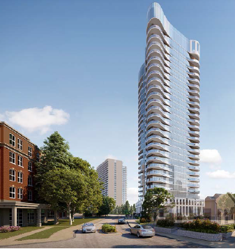
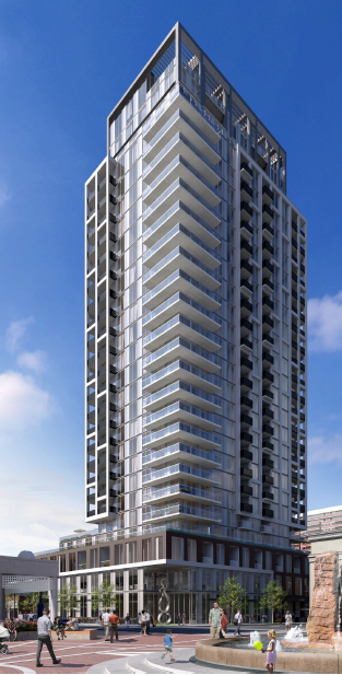 The Gallery – under construction opposite city hall at Gallery Lofts + Condos in downtown Burlington, with occupancy planned for 2022. Roxborough’s new master-planned community will come to market, in which Carriage Gate will play an integral role in the revitalization of downtown Hamilton, with the launch of one of the city’s biggest inner-city developments. We will forge ahead with the planning of a number of new condo projects through public engagement and consultation with our key stakeholders, and are looking forward being a part of downtown Burlington’s exciting evolution.
CL: Why should prospective new-home buyers consider buying from Carriage Gate in 2020?
Carnicelli: Burlington may just be the best place to live in Canada. It offers residents a safe and friendly environment as well as fabulous restaurants, shopping, festivals, events, a culturally rich arts community, and access to the Niagara escarpment.
 Sold out – occupied. The development was part of a three phased project – the other two are going nowhere at this point. Carriage Gate’s first downtown condominium, The Berkeley, geared to transitional buyers who appreciate a luxurious hotel-style environment, occupied earlier in 2019.
Our next project, Gallery Condos + Lofts at 421 Brant Street, is now under construction, with occupancy to begin in 2022. Located directly across from City Hall in the heart of downtown, Gallery Condos + Lofts is within walking distance of everything you could imagine.
 On Lakeshore as you enter the downtown core. If built it will be stunning. and change the way Burlington is seen as a city. Available suites range from 500 to more than 1,600 sq. ft., with layouts that will appeal to everyone from young buyers looking for their first home, to mature adults seeking to downsize, but who still want space for entertaining family and friends. Carriage Gate continues to be an integral part of downtown Burlington’s exciting evolution, with a number of projects in the planning stages.
Specializing in the construction of high-quality homes, modern condominiums, commercial developments and urban high rise communities, we embrace the future, appreciate the past and celebrate the dedication that has brought us to this point, where we can ensure our commitment of being “Home to New Living.”

 By Pepper Parr By Pepper Parr
March 6th, 2020
BURLINGTON, ON
The frantic emails came in at 5:47 pm; then 5:55 pm and again at 6:04 pm
The writer was frightened – the person had written a comment in the Gazette on the Millcroft story and thought she had to provide her full name for authentication.
Her comment, which is published as Name Witheld said:
Where is this developers conscience? How much money is enough? For residents who have their life savings in their home, with respect Mr. developer, how do you sleep?
These are seniors, couples, families who invested in a dream. We live both on and off the golf course. We are not rich, we work hard because we love our community, our schools, and our greenspace.
Safety? Please do not hide behind this pathetic excuse. Sweet dreams, Mr. developer.
You have one hell of a fight coming your way!
The emails to us went:
I am a resident of Burlington who today wrote a Letter in response to the MAD story. I did not know that you would use my full name. Could you please remove my last name and just call me xxxx. I am very frightened as I’m alone with two kids right now. I did not intend for my full name to go out there. Please can you help me. It says it is being reviewed.
Minutes Later
Please do not use my name in the opinions column currently being moderated. I thought I had to put my full name just for you to authenticate. I am a scared mother of 2. Please either remove or change my name to xx.
Thank you! Please let me know ASAP
Later
Hello I mistakenly used my full name in your editorial option section about Millcroft March 4.
Could you please remove the opinion or at least write me as xxx not my full name. I thought I had to leave my name for authentication. I did not want my last name used. Please help me.
Please understand I’m terrified.
Later
Hello, I wrote an opinion on the mad article. My name is xxx xxx can you please not use my last name. I am a scared mother as it is. Please just call me Please. I’m going to lose sleep over this. I thought I had to put in my full name.
Thankyou… please either erase it or just use my name xxx.
 The full colour is part of the housing stock Argo Development wants to add to the Millcroft community. The grey part is development that already exists. We published the comment and find ourselves asking: what kind of a city is this – that a person would fear that they would be harmed for saying what they think.
The number one city in the country eh!
Related news story:
Scope and scale of the development
 By Pepper Parr By Pepper Parr
March 5th, 2020
BURLINGTON, ON
Those troubling 31 appeals to the city changes in the Official Plan?
Here is what we know.
On January 30th, the city passed an amendment to the Official Plan and made changes in the zoning for some of the property.
The city had the power to do that. Most of the current council was elected to bring about a change in the Official Plan and the zoning bylaw.
 The Mayor declared at the time that it was an historic day for the city. It may well be historic – but for a different reason. The Mayor declared at the time that it was an historic day for the city. It may well be historic – but for a different reason.
Anyone who doesn’t like the change in the bylaws, in this case the Official Plan and the existing bylaw regimen, has the right to appeal.
No one expected or was prepared for the 31 appeals that were filed within the 20 day appeal window.
 Heather_MacDonald, Executive Director – Planning. Executive Director Heather MacDonald did say that appeals are not unusual and there were hints from some of the planners and legal counsel that were delegating to city council that appeals might be forthcoming.
But 31 of the things? That is astounding and troubling on several levels.
We do not yet know just what the appeal documents say. We do know, or suspect, that they are appeals against the change in the Official Plan and the change to the zoning bylaw. Even that is speculation – the public has not seen the documents. The Mayor has, the Executive Director of Planning Heather MacDonald has, as has Nancy Shea Nicol, the Executive Director – legal.
We know that the members of Council have been briefed – to what degree is not certain. They have all lost their tongues.
The 31 appeals that were filed were delivered to the City Clerk. The Clerk has 15 days to send the appeal documents along to Local Planning Appeal Tribunal ( LPAT), the body that hears the appeals. That 15 days is reported to end on March 12th.
The members of LPAT are appointed by the province who, recently, appointed additional hearing officers and, troubling, decided not to re-appoint some hearing officers who had the reputation of being concerned about the environment but appointing several that come from within the development industry.
 Marianne |Meed Ward: A Mayor with a vision and an agenda that has run into some heavy waves. The Mayor has said she would make the appeals public but has yet to do so.
At some point the specifics of each appeal will become public.
In the meantime people in Burlington who pay attention to these things are concerned about:
1) What is it going to cost the city to fight 31 different appeals?
2) What if the city loses at the LPAT level – going to Cabinet with a request to overrule LPAT isn’t viable with the current government.
3) Will losing the appeal mean that all the work done on a new official plan for the city is now all for naught?
4) And what if, adding insult to injury, the city is stuck with the costs of the appellant?
It is the uncertainty that bothers the people the Gazette is hearing from: “Can’t the Mayor say something” is the phrase we are hearing most often – and not from just a handful of people. Scores is a better unit of measure.
Was the Mayor in over her head with the approach she took?
Did she ask the hard but appropriate questions to staff – like what could go wrong?
Risk is now a hot topic for the bureaucrats at city hall: was the risk on the approach taken by the city fully considered?
These are not polite questions but the answers are critical.
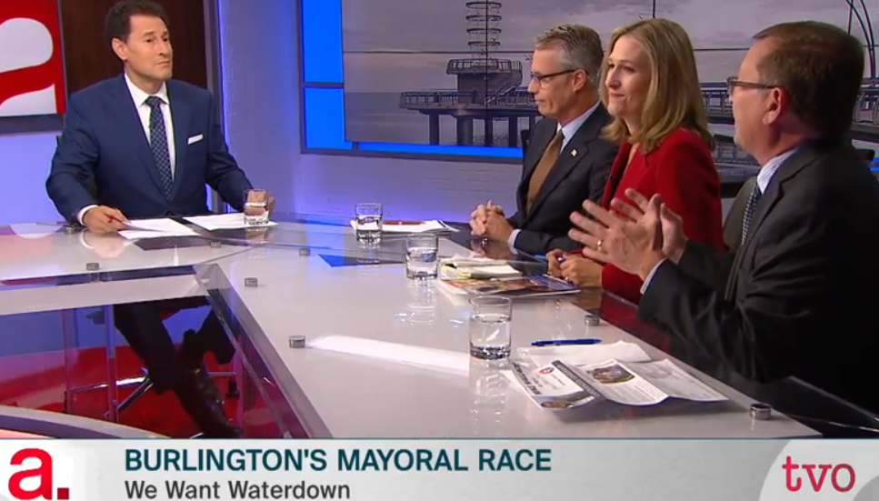 Meed Ward was superb in the TVO debate – well prepared and new when to pounce. The city isn’t seeing that same person during the troubles with the Official Plan amendment appeals. Marianne Meed Ward talks frequently about the need for media that serves the wider community and makes mention of her experience as a journalist. She was never a journalist – she has been an editor and did write a column for the Toronto Sun. She is very effective on television panel discussion programs. She was stunning on the TVO election debate.
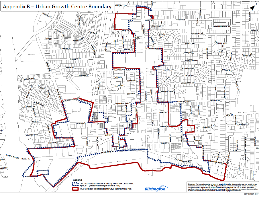
Developers looked at the rules that were put in place when the Urban Growth Centre was accepted back in 2006. The city didn’t have to accept what the province handed out – Oakville didn’t. They negotiated different boundaries for the UGC.
The Mayor has hinted strongly that she intends to approach the province for a shift in the UGC boundary to something that begins at about Caroline Street rather than the current Lakeshore as the southern boundary.
 Nick Carnacelli, centre, listening in on a conversation between Mark Bales on the left and Rosa Bustamente a city Planner. Bales is a senior vice president with the Carnacelli real estate interests. The appeal situation is troubling – we don’t believe anyone expected the volume. The development community is making this their stand on what the current Mayor, and most of her council, want for the city.
The odds at this point are not on the side of the city.
Is the Mayor fiddling while the city burns?
She does use social media to get her story out but has yet to hold a media event where direct questions can be asked. Social media is, unfortunately, a one way tool – the writer says what they want to say and while you can comment there is really no give and take. The politicians love it that way – but it isn’t healthy for a democratic society.
Salt with Pepper is the musings, reflections and opinions of the publisher of the Burlington Gazette, an online newspaper that was formed in 2010 and is a member of the National Newsmedia Council.
By Staff
March 4th, 2020
BURLINGTON, ON
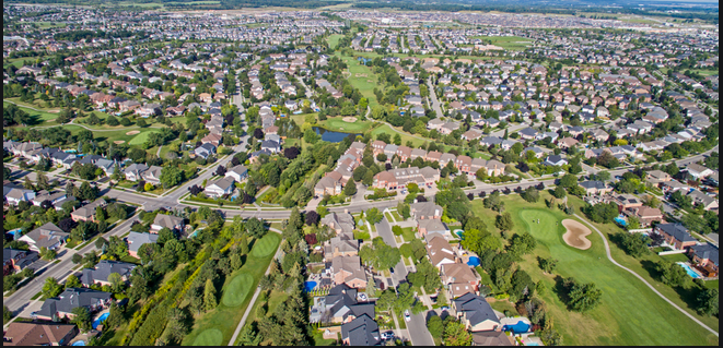
If you live in Millcroft – you know all about this issue – Millcroft Greens is proposing a residential development on the Millcroft golf course. This development has the potential to significantly decrease existing property values, increase traffic, disrupt ecosystems and wildlife, reduce green space, lead to the rezoning of existing school districts, overburden infrastructure, and alter the character of one of Burlington’s most iconic neighbourhoods.
 The residents set out to create a non-profit organization called “Millcroft Against Development” (MAD) with a mission to preserve the integrity of the existing Millcroft golf course and retain its original and current zoning of “Zone O1 – Open Space. The residents set out to create a non-profit organization called “Millcroft Against Development” (MAD) with a mission to preserve the integrity of the existing Millcroft golf course and retain its original and current zoning of “Zone O1 – Open Space.
The developer has chosen to portray the development of additional housing on gold course land as a public safety issue – the residents aren’t buying it. They argue that the “recreational green space defines the Millcroft we all chose to make our home. It is the heart of the community and our purpose is to keep it whole. “
The development proposal eliminates the existing 6th and 7th holes entirely, shortens the 1st and 16th holes, and adds 98 new homes and several new roadways to the land. We believe that this proposal is merely the beginning of residential development of the entire golf course, with this phase alone eliminating a staggering 411 mature trees from our neighbourhood.
 It started out as a golf course that housing was built around – the residents loved it and paid a premium to live in Millcroft. The developer held a meeting in February at the Burlington Convention Centre where a development proposal was presented to a select group of residents whose properties would be most adversely affected. The developer cited “safety concerns” of errant golf balls as the impetus for the proposed development – calling it a public safety issue.
The presentation included a compensation package for the invited residents, which many view as a covert attempt to buy approval of its developmental plan.
A public meeting is to take place on March 23rd, at the Burlington Convention Centre.
It will be a doozy. There are 728 people registered on the web site opposing the development.
The City of Burlington has not yet received a formal development application from Millcroft Greens for this property.
Related new articles:
The scope and scale of the proposed development
 By Pepper Parr By Pepper Parr
March 4th, 2020
BURLINGTON, ON
The Gazette prides itself on maintaining a comment section. It gives space to people who have no other way of voicing their concerns. Are they always right? Hell no – there are a couple that are close to certified crackpots who entertain if nothing else; see it as our comics section.
The current flood of appeals to the LPAT has arguments on both sides of the issue. The following are comments that deserve a wider audience – thus our decision to publish them as opinion pieces.
 Albert Facenda, a small Burlington based developer Albert Facenda responding to Gary and Graham:
Gary and Grahame. You are correct that in 2005/2006 council conceded the downtown to the wishes of the Province. I believe it was the Liberals at the time. Our Mayor ran as a Liberal in 2007. Do we have any evidence that she was opposed to these decisions at the time?
Is she protecting the citizens of Burlington from over development in the downtown core as you have pointed out? I think not.
Environmentalists created the Green Belt with their doom and gloom scenarios. The Greenbelt created the shortage of land, creating Intensification the “Build up not out philosophy.” I don’t like intensification. But I will tell you the town of Grimsby was voted 2nd to Burlington as the best City to live in category. Take a drive through there and you will see construction everywhere. I predict Grimsby will be #1 this year. One of the reasons would be that it is the place to raise your family for those who can’t afford to live in Burlington. Remember what the Mayor said: ”The Downtown is only1% of Burlington” a significant number according to her.
 Tom Muir, once described as “acerbic” Tom Muir in reply to Anne and David Marsden.
The appeals will be made public in due course. That is how it works.
In any case, what would you folks do with all the details of all the appeals?
This is a huge number of appeals at once and I would think that this was in fact expected by the city, or at the least, not a surprise. Didn’t surprise me.
The quality of the appeals at this stage is largely irrelevant. They seek to change the entire approved development rights for likely the entire downtown and GO station planning areas to what the appellants want. They want more at any cost it seems – it’s that simple.
It is possible to appeal an entire OP and Zoning. This is not about specific applications and proposals. It’s a grab for the whole enchilada, a saturation bombing.
 By Pepper Parr By Pepper Parr
March 3rd, 2020
BURLINGTON, ON
A source advised the Gazette that “We get our quarterly legal update on March 10th I think …. there will be something in there at least to get the ball rolling.”
 Mayor might want to re-think that “historic day for Burlington” comment when the Official Plan amendments were made. Why, one asks, is the ball not rolling much faster, especially after the Mayor said on February 27th, that the “City will share more information on the ICBL appeal process and timelines as they become available, as well as details about the nature of the appeals where we can.”
The documents are public. The city Clerk was the person the documents had to be given to. The Clerk bundles the data and sends it along to the Local Planning Act Tribunal (LPAT) who schedule a Conference to get the process started.
Nothing confusing about that. All the city has to do is issue a Statement setting out the facts and people can settle down and wait. It may well be that LPAT has never run into a situation quite like this – 31 people appealing the Official Plan Amendment 119 and Zoning By-law Amendment 2020.418 that were passed by council on January 30th, a date the Mayor said was an historic one for the city.
We learned this morning that the city has 15 days to get the Appeals it accepts (they have to accept every appeal) into the hands of the LPAT.
That means LPAT is to have the Appeal documents in hand no later than the 12th of March.
Why does the Gazette have to get this information in dribs and drabs from readers? It is when information is withheld that the public gets concerned.
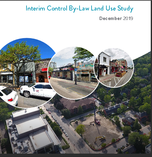
 This is how the system works. It is important to remember that the Official Plan Amendment and the changes in the zoning bylaw came out of a Land Use Study done for the city by Dillon Consulting.
That study was lengthy and full discussed and debated at Standing Committee meetings and at City Council. One of the prime objectives for the city was to come up with Official Plan Amendments that were defensible at LPAT hearings.
The consultants assured Council that in their view the changes being put forward were defensible.
There is no mention that the Gazette is aware of that had the city’s legal department giving an opinion on the defencibilty of the changes nor are we aware of any opinion from outside council on just how defensible the changes are.
Once the LPAT hearings take place we will find out if the consultant was right.
By Pepper Parr
March 3, 2020
BURLINGTON, ON
Many are eagerly awaiting the public release of the corporations or individuals who filed appeals against the amendments and the zoning changes approved by Council January 30th.
The Gazette assumed that it was just a matter of getting the paper work done.
That was until we got the following from a member of council.
“I think you should be digging into why we aren’t allowed to tell who appealed and why. That’s the info I want out.”
Really?
No need to identify the Council member on this one – what is critical is – just why the information isn’t public and who has their thumb on it.
Somewhere within either Planning or Legal (perhaps both) there is a thumb keeping the forms on their desk.
 FormerWard 3 Councillor John Taylor A number of years ago there was an issue that has been discussed in public at the Region that was discussed in Closed Session of Council in Burlington. Then Councillor John Taylor said he would stand in the atrium and release the information publicly if council did not talk publicly.
All it takes is for just one Council member with the courage of their convictions to stand in the atrium and read out the list of names.
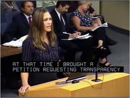 Marianne Meed Ward is on the other side of the podium this time – speaking as the Council member for Ward 2 and using the word transparency. Mayor Meed Ward used to use the word “transparency” at every opportunity – it just might be tattooed somewhere on her. Could the people that voted for her not nudge here and suggest she live up to the promise made on October 18th, 2018
Related news stories:
ICBL not to be repealed – it will just die March 5th.
The 31 appeals are announced with a lengthy explanation.
By Pepper Parr
March 2, 2020
BURLINGTON, ON
In comments made when the Amendments to the Approved but-not-in-force Official Plan were passed by Council they argued that it took some time to get it right to have an Official Plan that could be defended at LPAT hearings.
 Executive Director Heather MacDonald, centre, taking all the questions during discussion on changes to planning policy. In a comment attached to the Media release sent out late last week Executive Director Heather MacDonald, who handles the Planning files, said it is not unusual for there to be appeals to Official Plan changes.
I don’t think she was ready for a total of 31 appeals (and counting?)
Lisa Kearns the Councillor for Ward 2, where much of the planned development is to take place, slipped some comments onto her Facebook page saying it was “important that you know what’s happening at City Hall.” And added that “This week marked the close of the appeal period for the planning policies that were approved by Council on January 30th for the lands in the Interim Control By-law (ICBL) boundaries.
 A detailed explanation on what has and probably will take place – didn’t hear much of this during council debates. When the amendments and the zoning changes were voted on it was hailed as an historic day for the city. “The ICBL (development freeze) will continue as a result of appeals which prevent the policies from going into effect. It is important that your Councillor provides clear and understandable information about the process. Many have keenly followed this year long process as City Hall sought to address issues of growth pressure and how transit designations affect growth
Why are we here today?
“The community asked me to deliver on pushing the city for a more sensible approach to growth and accountability surrounding development. I have been steadfast in keeping residents up to date on the approach Council has undertaken to achieve this.
“We have made it clear there is no simple approach or ‘silver bullet’ to untangle the complex systems that support planning applications that are not compatible with the community vision. A technical process has delivered solid planning policy that tightens zoning controls which address height maximums and podiums, street line setbacks, active transportation elements (ie: bicycle parking, mid-block corridors, streetscaping elements), and community institutional use.
“Through this process, areas within the ICBL boundaries were identified with no zoning designation, particularly near the Burlington GO. This means that the planning process everyone is familiar with through pre-consultation to statutory public meeting, and council decision do not apply to developments in these areas.
“The result is no public engagement, no community benefits, and no limits beyond the Building Code; applications go straight to technical Site Plan Approval. We have brought tighter zoning controls that the community supports in the land generally being downtown and at the Burlington GO.
 Councillor goes long winded then buries her remarks on a Facebook page. What does this mean to Residents?
“Burlington has committed to community responsive growth management that ensures growth respects council approved height and density for land use as set out in its planning instruments. For clarity, this includes the existing municipal planning policies, and any revisions from the Official Plan and Zoning Bylaw (ICBL) studies and recommendations. The resulting policies, that are now appealed, seek to deliver this for residents.
“This means residents can be confident that their elected officials are working in their best interest using the resources and tools best available. We will continue to defend these policies that represent good planning created by independent consultants.”
Councillor Kearns makes no mention whatsoever about what the city is really up against. The public has yet to actually see the appeals that were filed and thus don’t know what the appeal documents say. Nor does the public know who is representing the developers.
Has one law firm taken on the task of asking for the same thing in the appeals or will the city have to face 31 different lawyers?
A resident who managed to have discussions with the developers, said that they are very upset and believe they have a strong case. Only time will tell.
 Mayor’s claim “Burlington is Open for Business.” What we do know for certain is that nothing is going to get built inside the boundaries of the Interim Control Bylaw. And that cannot be good for business despite the Mayor’s claim that “Burlington is Open for Business.”
Councillor Kearns asks if the decision to make the Official Plan amendments and the zoning changes “was rushed”.
Her answer is no. Here’s why: “An interim control by-law is rarely enacted by a municipality because of the sheer magnitude of freezing development. Council voted to support Staff’s recommendation to enact this tool in the Planning Act as a response to:
• Growth pressures that continue to emerge for the lands in the study area where multiple pending developments propose intensities that are significantly higher than those anticipated by the 2018 Adopted Official Plan
• The role and function of the John Street Bus Terminal as a Major Transit Station Area (MTSA). Its designation as a MTSA was relied upon by the Ontario Municipal Board in its decision to allow a 26-storey development that was opposed by Council in 2016, citing that as a MTSA, the terminal could support intensities well in excess of those contained in the Official Plan.”
 Everything in that dotted red line is frozen territory from a development point of view. No cranes in those parts of the city. Kearns said: “I continue to stand by this decision and appreciate the strong position Staff bought forward for consideration. In the clearest terms, Staff would have been mandated to continue accepting and processing planning applications that vastly exceed in-force planning permissions. Essentially, it would be difficult to ever conclude a planning application for final recommendation without creating a new planning precedent. This is not an effective way to manage our city’s growth intentions.
“Were appeals expected?” Some yes but the 31 that came in the door in a few days must have been a shock.
“Did the City decide to extend the ICBL?” No, it didn’t. The moment an appeal came in the ICBL was locked and would stay in place until every last appeal is fully heard.
 A great day for all of them – now they get to sweat out the hard stuff. When the amendments were passed on January 30th, “Two scenarios were possible at the close of the appeal period on February 26th, 2020. The first would see no appeals to either the official plan amendments (OPA#119) or the zoning by-law amendment (ZBA 2020.418) that was approved by Council bringing the new policies into effect, and the subsequent lapse of the ICBL on March 5th, 2020.
“At that time, all new planning applications would be reviewed against said policies, resulting in a planning recommendation report either supporting or refusing the development application.
“… the second scenario has taken place. All it took was a single appeal to the zoning by-law amendment (ZBA 2020.418) approved by Council to extend the ICBL until such time the appeal(s) were dealt with by LPAT. The result is effectively extending the freeze on development for the entire land use study area.
The problem with this explanation by Kearns is that the impact of an appeal was never really discussed, unless Council did so in a closed session. The level of risk Council was taking was never detailed.
City staff did work diligently to meet Council’s commitment to complete the work within one year and lift the freeze on the lands within the ICBL boundary.
Here’s what happens next:
The City Clerk will compile the appeal record for all of the appeals filed and send them to the Local Planning Appeal Tribunal in order to schedule a Case Management Conference (CMC) at a future date under the LPAT which adjudicates conflicts during the process of land use planning.
Transparency:
“This council has committed to integrity and transparency on all issues, including the ICBL. Significant effort has been made to keep the public fully engaged and aware of each step of the process.” That doesn’t explain why Councillor Kearns published these comments on just her Facebook page.
To her credit she did say something. When asked by the Gazette for comments, Councillors Nisan, Sharman, Kearns, Bentivegna and the Mayor went mute.
 Councillor Stolte – listens and speaks when she knows what she is talking about – fiscally prudent as well. Councillor Stolte did send in a comment saying Councillors were informed of the appeals on the 27th and they were told then what that means – the ICBL would stay alive until all the appeals were heard. Councillor Galbraith said the original Gazette report and the clarification set out his position.
This story is far from over. It will plague council and might take a hunk out of their hides.
We will know more when the city releases the content of the appeals. You can bet that there is a lot of strategizing going on at city hall these days. Know too that the Legal department budget either has or will be getting a major boost.
 By Staff By Staff
March 2, 2020
BURLINGTON, ON
Ann Marsden has filed an appeal against the January 30th council decision to approve amendments and zoning changes to the city Official Plan and the zoning bylaws.
She is one of a reported 31 appeals filed with the City Clerk.
Ann Marsden is not a developer. She has been a candidate for public office on a number of occasions. When she ran for the position of Regional Chair, against Gary Carr who has held that job for a considerable amount of time she garnered 48,136 votes against the 79,775 votes Carr received.
 The Marsden vote was consistent across the Region. Someone was listening to Marsden
In her appeal document Marsden said in a covering letter: “The reason for my appeal is that the January 30, 2020 Special Council Meeting was known by the Clerk (Angela Morgan) and the Chief Executive Officer of Burlington (Mayor Meed Ward) to be held outside Section 240 of the Municipal Act and City of Burlington Procedure By-laws: 64-2016 – current when the meeting was called and 04-2020- current when the meeting was held and were the legal framework for calling a Special Council Meeting.
Marsden will argue that the meeting was not properly called and that the Clerk took some short cuts that were just not kosher. Marsden’s document, like all appeal documents, is detailed, repetitive and at times confusing – but she does have a point – a technical one but nevertheless a point.
 Ann Marsden during an election debate. It revolves around whether or not the public was properly and full aware that there was going to be a Special Meeting of Council and did the members of Council take all the steps necessary to make the calling of the meeting legal.
Marsden has argued that “The Council, therefore, was without jurisdiction to make the decisions they did that lead to 31 appeals being filed before the end of day February 26, 2020.”
“As I understand it an additional 30 appeals to mine were registered by February 26, 2020. Thirty appeals constitute a very large amount of taxpayer, citizen and property owner monies and time being spent before we the taxpayers of Burlington can move on and begin to enjoy our downtown as we should be able to.
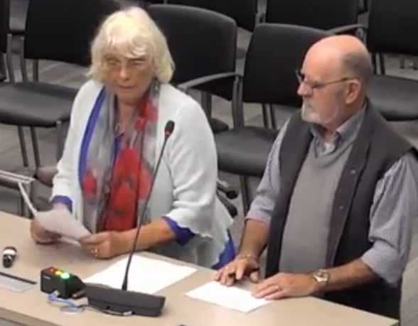 Ann and David Marsden – delegating at city council. She does the talking, Dave takes copious note. They have been banned for a period of time from both the Regional Council and Burlington city hall. But they are back. “Given my appeal deals with there being no jurisdiction for Council to make the decisions on January 30, 2020 that are being appealed I believe in terms of efficiency it would be prudent to hold my appeal first and before the end of March. If I am successful in my appeal the balance of the appeals dealing with the decisions made on January 30, 2020 will be moot as there will be no decisions to appeal and an appropriate order can be made by LPAT in terms of a properly constituted meeting being held to approve the policies that support the Burlington OP. With the benefit of consideration of the points made in the appeals this may well see a better understanding of what can be mutually acceptable policies for developers and citizens that will work in Burlington.
“Further, perhaps progress will have been made in dealing with the John Street MTSA improper designation and moving the boundaries of the Urban Growth Centre to one that better reflects the needs many have addressed at several public meetings and MPP Jane McKenna assured her constituents long ago, can be done.
“I urge you to give immediate attention to my application and the setting of a date so I can submit a factum for the respondent and the tribunal and subpoena witnesses for an oral hearing.”
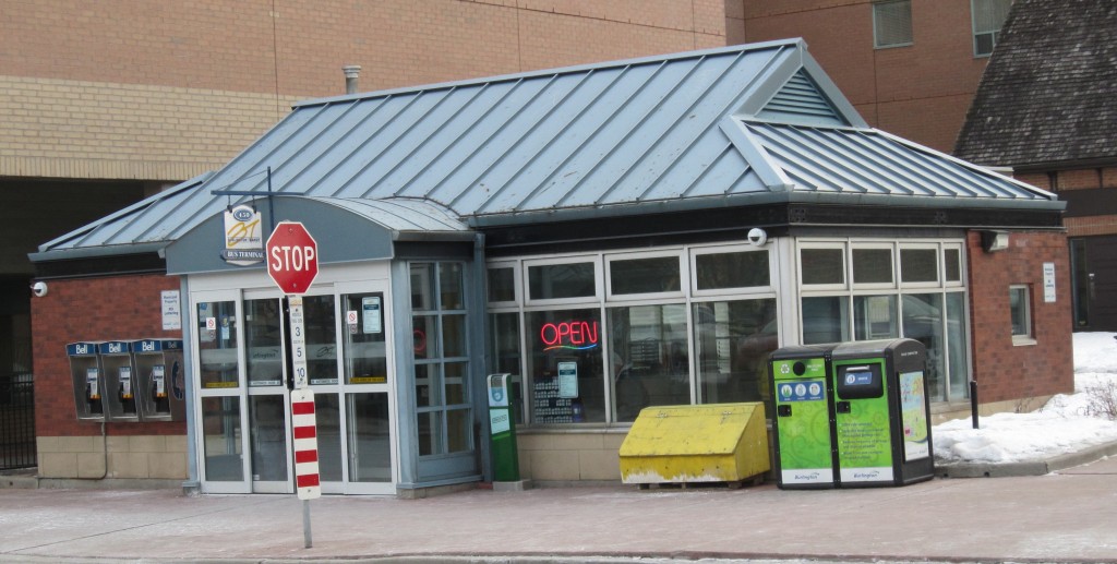 This bus terminal made it possible for the Adi Development Group to get a 24 story tower approved on a site zoned for eight storeys. The John Street bus terminal got defined as a MTSA – Major Transport Service Area, which made it possible to convince an OMB hearing (Ontario Municipal Board) hearing that the existence of a terminal with an MTSA designation justified the building of a 24 story tower on a site that was zoned for 8 stories.
It is those fine, technical points that result in surprising decisions.
The likelihood of Marsden winning her appeal (it may not even be heard) – slim to none – so don’t bet the mortgage money on it. But if you’re the type of person who put $3 on a Lottario 649 ticket – why not?
By Pepper Parr
February 27th,, 2020
BURLINGTON, ON
Comment on just why the city has to keep the ICBL in place is set out below the city media release.
In a media release from city hall it was announced that
The City of Burlington continues its work to ensure land-use development is well managed as outlined in Council’s Vision to Focus 2018-2020 strategic workplan. The Interim Control Bylaw (ICBL) Land Use Study, which froze development for one year in Downtown Burlington and at the Burlington GO station, is an important action to meet these goals.
On Jan. 30, 2020, Council approved the revised recommendations from the findings of the Interim Control Bylaw (ICBL) Land Use Study, including the approval of the proposed Official Plan and Zoning Bylaw Amendments resulting from the ICBL Land Use Study.
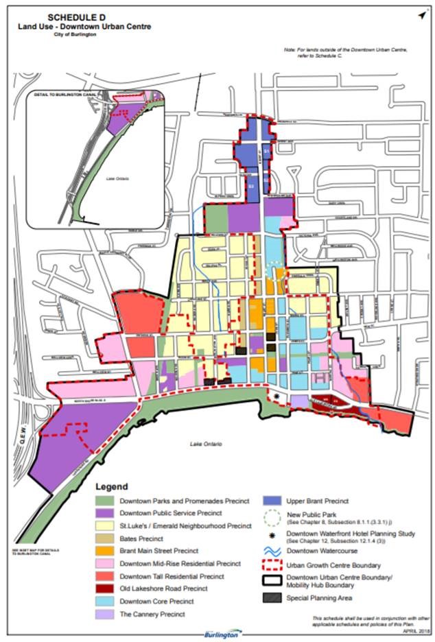
The boundaries of the Urban Growth Centre with the different precincts highlighted in different colours. City staff presented the refined ICBL study report to Council for approval in advance of the initial one-year deadline. The official plan and zoning by-law recommendations are a result of extensive technical review by the City’s external consultants and planning staff, public input including written and oral submissions from the development industry, and Council deliberation.
Urban growth centre
The boundaries of the Urban Growth Centre with the different precincts highlighted in different colours.
The revised recommendations were based on the land-use study undertaken as a result of the ICBL, passed by City Council on March 5, 2019. The purpose of the ICBL was to restrict the development of lands within the study area for a period of one year, including the Downtown Urban Growth Centre (UGC) and lands near the Burlington GO Station to undertake a land-use study.
As per the Planning Act, appeals to the Local Planning Appeal Tribunal (LPAT) must be filed 20-days after notice is given. Notice of Decision for Official Plan Amendment 119 and Notice of Passing of Zoning By-law Amendment 2020.418 was provided on Feb. 6, 2020. The last day of appeal was Feb. 26, 2020.
The City has received 31 appeals to the LPAT for both Official Plan Amendment 119 and Zoning By-law Amendment 2020.418 which have been filed with the City Clerk. As a result, the Interim Control Bylaw (ICBL) remains in effect and will not end on March 5, 2020. The ICBL will remain in effect until the Local Planning Appeal Tribunal has issued a final decision on each appeal of Zoning By-law Amendment 2020.418.
The recommendations from the findings of the ICBL study include proposed amendments to Burlington’s current in-force-and-effect Official Plan and Zoning Bylaw. The staff recommendation report and proposed amendments can be viewed online at burlington.ca/icbl.
The City is also working closely with Halton Region to confirm with the Province the requirements and next steps for approval of changes to the downtown UGC and Major Transit Station Area (MTSA) designations. City Council has directed the Chief City Planner to report back in May 2020 with recommendations.
The City will share more information on the ICBL appeal process and timelines as they become available, as well as details about the nature of the appeals where we can.
City Executive Director Heather MacDonald said at a council meeting that the Interim Control Bylaw, put in place March 5th would be allowed to expire in March 5th, 2020. That was the intention.
Developers impacted by the ICBL had 20 days after the end of the one year ICBL to appeal the decision that was made in 2019.
More than 30 developers chose to do just that – which meant the city could not repeal the bylaw until all the appeals were heard by the Local Planning Appeal Tribunal (LPAT). How long that will take is something over which the city has no control. All the city can do is appear at the LPAT hearings and defend their original decision to put the ICBL in place back in March of 2019.
With all due respect to the person who wrote the media release – it does not explain why the ICBL has to remain in force. It is not something the city actually did – the process made it necessary. Once an appeal is filed – the ICBL remains alive and whatever decisions made come from the LPAT people.
By Staff
February 26th, 2020
BURLINGTON, ON
CLARIFICATION: City Executive Director Heather MacDonald said at a council meeting that the Interim Control Bylaw, put in place March 5th would be allowed to expire in March 5th, 2020. That was the intention.
Developers impacted by the ICBL had 20 days after the end of the one year ICBL to appeal the decision that was made in 2019.
More than 30 developers chose to do just that – which meant the city could not repeal the bylaw until all the appeals were heard by the Local Planning Appeal Tribunal (LPAT). How long that will take is something over which the city has no control. All the city can do is appear at the LPAT hearings and defend their original decision to put the ICBL in place back in March of 2019.
The announcement that the city was not going to let the Interim Control Bylaw (ICBL) die a natural death on March 5th, surprised many.
 Mayor Marianne Meed Ward in front of city hall where she is making Burlington a much different city. Mayor Marianne Meed Ward said; “Burlington remains open for business and the city honoured our commitment to complete our work within one year and lift the Interim Control Bylaw (ICBL) that affects 1% of our total land.
The appeals will now extend the ICBL. We will fight vigorously to defend the policies we have created. They are founded on sound planning principles based on evidence and a one-year independent consultant study.
They also reflect the vision of staff, council and our residents for the future of our city. We remain steadfast in our commitment to ensuring the right development in the right place at the right scale.”
Executive Director Heather MacDonald at a Standing Committee with city manager Tim Commisso on the left and Jamie Tellier, a planner on the right Heather MacDonald, Executive Director of Community Planning, Regulation and Mobility said: “Given the significant level of development interest in Burlington, and in particular the Burlington downtown and lands in the vicinity of the future mobility hubs, I am not surprised by the number of appeals that have been filed. It’s not uncommon for a significant change to an Official Plan to attract a number of appeals.
“After listening to the submissions made as part of the public meeting held on Jan. 14, 2020, staff did work hard to resolve issues raised and make changes to the planning instruments where possible.”
Obviously the work done by staff wasn’t sufficient and they decided to fall back on the ability to extend the ICBL. Hackles will be raised within the development community – and billable hours will rise within the legal community that serves the interests of the developers.
Quick Facts
• An interim control bylaw (ICBL) is a tool available to Ontario municipalities as part of the Planning Act. An ICBL places a temporary “freeze” on the development of certain lands while a municipality is studying or reviewing its land use policies. The restrictions can only be imposed for one year, with a maximum extension of a second year. An ICBL may not be appealed when it is first passed, however the extension of the ICBL to a second year may be appealed.
• Developments in the study area that submitted applications for site plan approval, in accordance with the approved zoning bylaw, prior to March 5, 2019, were exempt from the ICBL study area.
• During the one-year “freeze” on development in the study area, the ICBL Land Use Study:
o Assessed the role and function of the downtown bus terminal and the Burlington GO station on Fairview Street as Major Transit Station Areas
o Examined the planning structure, land use mix and intensity for the lands identified in the study area
o Proposed updates to the Official Plan and Zoning bylaw regulations as needed for the lands identified in the study area.
• On Jan. 30, 2020, Council approved the revised recommendations from the findings of the Interim Control Bylaw (ICBL) Land Use Study, including the approval of the proposed Official Plan and Zoning Bylaw Amendments resulting from the ICBL Land Use Study.
• On Feb. 6, 2020, the public was notified of plans to lift the ICBL and the 20-day window for appeals. Appeals were due to be filed with the city clerk on or before Feb. 26, 2020.
The avalanche of appeals appears to have been the justification for extending the ICBL deadline.
No mention is made of possible exemptions for some of the developments that have been hard hit by the ICBL decision.
By Pepper Parr
February 21st, 2020
BURLINGTON, ON
Sometime during Mayor Goldring’s second term he said that the intensification that was going to take place would not change the character of the city.
Guess what – intensification is smacking Burlington where it hurts – in the middle of those upper middle income communities that have made Burlington the city it is.
Residents of the Millcroft community learned this week that the owners of the property are going to apply for permission to add as many as 100 homes to the community by re-arranging the golf course that was the reason for the creation of the community in the first place – back in the mid 1980’s.
A meeting took place recently – it was “private” only for invited Millcroft home owners affected by the changes. The developer is Argo.
 The alphabet letters indicate where the developments would be located. A Millcroft resident reports that “The letter sent to us was cryptic and the meeting scripted.”
Every household in Millcroft got a hand delivered letter inviting them to the meeting.
“When we got there we were met by security guards” which resident Louise Taylor, a retired nurse said she and her neighbours found “kind of scary”. “Our names were checked off on a list.”
“After a presentation, that really didn’t say very much, we were broken up into five groups – each group was one of the areas that were going to be developed.
“During the presentation we were told that safety was an issue and then shown a graphic showing how many window complaints there had been. One woman stood up and asked the people in the room if anyone had had a window damaged by a golf ball. No one stood up.
 The red dots indicate where the operators of the golf course maintain there were complaints of golf ball damage. “When the group presentations were done there wasn’t an opportunity to gather as a large group again and ask questions.”
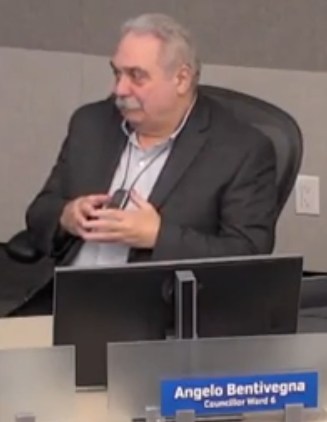
The audience was told that the ward Councillor was “on side”. Councillor Angelo Bentivegna has said he had not formed an opinion on the development. The Gazette has reached out to him for comment.
Bentivegna won the ward seat by a slim 41 votes in 2018. The challenge for him will be to shore up his support for the people in Millcroft.
We could find nothing on either the Bentivegna Facebook page or his Twitter account.
 Councillor Bentivegna was asked if he had any comment. We could find nothing on either his Facebook page or his Twitter account on the development. The Gazette is hearing that “There are a lot of very angry residents”, angry over the “butchering of our beautiful neighbourhood. We paid a premium for our home to back onto a golf course – and we won’t even be on the course if this plan goes through.”
 An aerial rendition of where 33 homes are planned. This is block A “Hole number 6 and 7 are getting wiped off the map (behind Country Club, Hadfield and Parklane) .
The feeling in the community is that the “value of our houses lost hundreds of thousands of dollars in one night.”
Residents believe this “this has all been couched as a safety issue by the course owners when it is truly a plan to jam many more homes into green space area with huge profits for the company – all on the backs of all of the present homeowners.”
There is talk about forming a homeowners association to work together to stop this plan.
 An aerial rendition of Block B – where 42 homes are planned.  A rendition of Block B where the 42 homes would be located. The community meeting takes place March 23rd at the Burlington Convention Centre on Burloak. We assume the Mayor has been invited to this one.
The development was done by Monarch Group in the mid 80’s; they who were bought by the Mattamy Group in 2015.
The Mattamy interests were apparently sold to Argo who are 50% partners with the people who own the golf club – which we assume means the golf course itself. It is golf course land that is being used for the development of the the 100 additional homes.
That creates some serious hurdles for the developer. Land that is zoned for recreation doesn’t just get changed to land that is zoned for housing without approval from city council.
Burlington is currently working with an Official Plan that is more than a decade old while they complete the revision of an Official Plan that was approved but not adopted by the previous city council.
This development proposal looks as if it will have to get cleared by the Conservation Halton authority as well.
Related news story:
Integrity of the Millcroft community threatened.
By Pepper Parr
February 20th, 2020
BURLINGTON, ON
This morning, at around 10:00 am, the Mayor and a councillor issued a joint statement related to some development on the Millcroft Golf course property. Within minutes of the statement from city hall there was a media release from the public relations people working for the golf course owners.
There is an interesting situation developing. Mayor Marianne Meed Ward and Councillor Angelo Bentivegna jointly said:
 Councillor Bentivegna joined the Mayor in issuing a statement on the development plans at the Millcroft Golf Course. “Some residents in the immediate vicinity of Burlington’s Millcroft Golf Club have received a notice from property owner Millcroft Greens Corporation outlining an intent to redesign parts of the golf course and develop small parcels of land for residential uses.
“Millcroft Greens is a joint partnership between the Millcroft Golf Club and Argo Development Corporation. The partnership was created with a mandate to continue to operate an 18-hole golf course while introducing select parcels of land for new development.
“The property owner has noted for reasons related to safety and the length of the course, it would like to reduce the size of the playing area.
 The Mayor was not invited. “It is our understanding that Millcroft Greens met with selected residents earlier this week and that this meeting was an introductory conversation about their preliminary plans with the community. This was an invite-only meeting that I and Ward 6 Councillor Angelo Bentivegna did not attend.
“Separately, Millcroft Greens met with me and Councillor Bentivegna, along with city staff, to provide an overview of its preliminary concept.
“The City of Burlington has not received a development application from Millcroft Greens for this property and has not even held a per-consultation meeting to discuss a proposal.
“A second neighbourhood meeting with the community will be required by the City before any applications are submitted. At this second meeting, City staff will be able to provide details about application requirements and conditions, and Millcroft Greens will collect feedback that can be used to inform any future development applications. This meeting will be taking place on Monday, March 23.
“Once a development application is submitted to the City, it will trigger a formal process that includes additional public engagement prior to any Council decision.
 A well designed community that was started in the mod 80’s “Any property owner has the legal right to submit an application and the City has a legal obligation to process any applications submitted. City staff review and make recommendations to Council to either approve, modify or deny the development proposal.
“Input from the public is always welcomed and considered throughout the application process.
“We will continue to update the community throughout this process, including once details for a general public meeting are finalized. Formal notice of that meeting will be mailed out to all homeowners in the vicinity of the golf course.”
Minutes later the public relations agency for the land got its side of the story out. KG&A, a corporation the Mayor will certainly know something about, sent the following.
“Representatives from Millcroft Greens, a new 50:50 joint venture between Millcroft Golf Club and Argo Development Corporation, are pleased to announce their intention to redesign and develop select portions of the Millcroft Golf Club. The golf course will continue to operate and offer a new challenging, executive 18-hole experience for golfers.
 The development has a golf course mixed in with the housing. “Millcroft Golf Club has enthusiastically served golfers in the Burlington community and beyond for approximately 30 years,” says Ed Liptay, owner, Millcroft Golf Club. “However, throughout our history, the property owners surrounding the course have faced numerous challenges including damages directly related to stray golf balls.”
“This new partnership gives us an opportunity to address longstanding issues with the golf course, while introducing a few parcels of residential development that respect the existing fabric and residents of this community,” says Gord Buck, Principal, Millcroft Greens.
“To mitigate property damages experienced by community members for decades, the redesign of the golf course by Millcroft Greens will include complete hole redesigns, changes to course length, repositioning of tee boxes, strategic removal and replacement of bunkers, and additional tree planting, while maintaining an 18-hole course. Based on these golf course improvements, five select areas have been earmarked for residential development, focusing on new, high-quality, single family homes to extend and elevate the existing community.
 The aerial view of the proposed redesign and development of Millcroft Golf Club, which will improve the course and introduce new, single family detached homes keeping in character with the community .
“Located between Upper Middle Road and Dundas Street, Millcroft Community is a premium neighbourhood in the city of Burlington. With nearby schools, retail businesses, parks and recreation, and calming natural landscapes, the Millcroft community is connected, convenient, and an attractive option for couples, families with children, and empty nesters.
“The redesign of Millcroft Golf Club is still in the conceptual stage; Millcroft Greens will be formally consulting and then making an application to the City of Burlington in the coming weeks.”
“Millcroft Greens is eager to collaborate and cooperate with the City of Burlington, Halton Region and residents. A public open house will be held on March 23rd at the Burlington Convention Centre.”
Noses are out of joint at city hall for not being invited to those early meetings; the owners of the golf course see an opportunity to do something about the safety issues, and you can never go wrong talking about safety in Burlington, and at the same time put up some very tony and high priced homes in a very desirable community. These will be million dollar plus homes that will sell very, very quickly.
The corporate web site for the golf course is: www.millcroftgreens.com
Some background:
Launched together with the Millcroft Golf Club course in 1986, the Millcroft project in Burlington was a Monarch Development flagship community for more than a decade.
The 650-acre community already includes more than 2,400 single-family houses and townhouses, which wind their way around the rolling greens of the golf course. And as the community moves toward the 20-year milestone, Monarch launched the final phase of executive, single-family homes in the community, called Classic Greens.
They comprised of 166 houses on large lots. Some will back on to the 18-hole, semi-private golf course, and others will have basement walkouts. Homes will range from 2,051 to 3,778 square feet, and lots will be 50 and 60 feet wide.
 A large, safe community with a golf course built into it and now has a superb community centre, high school and library on the northern border. Bungalows on 50-foot lots start at $422,900 while two-storey homes on 50-foot lots are priced from $427,900. The prices of houses on 60-foot lots range from $475,900 to about $585,900.
Millcroft residents will be able enjoy attractive natural surroundings, and be conveniently close to schools and shops. In addition to golfing, residents will have access to a 32-acre community park, which includes tennis courts, baseball diamonds and soccer fields. A short distance away is the Tansley Woods Recreation Centre.
Square footage: from 2,051 to 3,778
Price: houses on 50-foot lots from $422,900; on 60-foot lots from $475,900
Prices like those haven’t been seen in Burlington for some time.
The Monarch Homes Corporation was purchased by Mattamy in 2015
 By Staff By Staff
February 20th, 2020
BURLINGTON, ON
Beside the issue of buildings that too many people thought were just too high – the issue of the boundaries for the Urban Growth Centre and the bus terminal on John Street were what irked people.
 There was once a proposal to close the terminal and tear it down. Had that happened would the Nautique have ever gotten OMB approval? Who drew those boundaries and who in their right mind would describe the bus terminal as an MTSA (Major Transportation Service Area)?
A number of well-informed people delegated to city council urging that swift action be taken on both issues.
In a report to her constituents the Mayor recently said:
 Mayor Meed Ward: “Our decision, and one I stand by, was to let evidence and independent study inform our discussions.” “Council recognized from the beginning of our review of the downtown the need, and the desire in the community, to review the MTSA and UGC designations which have been used to justify overdevelopment. The question was when to initiate that review.
“Our decision, and one I stand by, was to let evidence and independent study inform our discussions.
“To let the community know our process, council passed a staff direction last May to review the appropriateness of downtown’s Major Transit Station Area and Urban Growth Centre designations at the end of the Interim Control Bylaw/Official Plan review studies. The OP review study will be complete after new policies are considered in April, and after that we will be in a position to initiate the review of the MTSA/UGC designations sometime this spring.
 “Those designations are set by provincial and regional governments, and only those levels of government can make any changes. The two consultant reports position us with solid independent planning rationale for these conversations with Halton Region and the Province. “Those designations are set by provincial and regional governments, and only those levels of government can make any changes. The two consultant reports position us with solid independent planning rationale for these conversations with Halton Region and the Province.
“ We have kept Halton Region planning staff and our local Member of Provincial Parliament Jane McKenna apprised of our studies, timelines and process and all have been involved in and supportive of our work.”
The questions that derive from a very solid position is: So the John Street terminal loses its MTSA status – which would suggest that a developer could no longer rely on that status to justify a high rise development – and there are a few very close to that station which are in the pipe line – they appear to be parked at LPAT hearings.
The Urban Growth Centre boundary was set by the province. They didn’t “impose” it on the city. They set the boundary and the council at the time went along with it. Oakville didn’t go along with the boundary they were given and managed to have theirs changed.
At this point a lot of commercial and development investing has been done based on the boundary – does the city have a hope in ‘hades’ of getting it changed – at this point in time with the current provincial government?
It will be interesting to see how that initiative works out.
 By Pepper Parr By Pepper Parr
February 4th, 2020
BURLINGTON, ON
What kind of a city are we going to have three, five or ten years hence?
City council told the SGL consultants that they were content with the work done so far and then endorsed that work with a unanimous vote. The work being done is referred to as the “preferred concept” which sets out what the city would like to see built.
 After months of work with the community and hours of thinking by the SGL, the consultants and Planning staff they were ready to put it all on the table. From the left: Paul Lowes, Catherine xxx, Alison Enns and Charles Walker The reality is – the developer has to look at what the city wants to see and work through what they want to build. The end result is usually somewhere in between.
The consultants, the people from the Planning department working on this file, now return to their desks and begin developing the policy statements that will make the endorsement law sometime in April.
Not actually law quite yet.
When the scope stuff is completed and inserted into the approved but not yet WORD and then gets approved by Council – it then gets sent to the Region where they put their thumb print on the document and send it back – and THEN we have a new bylaw.
Of course everything that was submitted to the planning department under the old, existing and in force bylaw will be judged and interpreted under that Official Plan.
During the discussion and debate on want were presented as “preferred concepts” council made some significant changes.
 Architectural model of Village Square; a part of the city that has heritage designation. and a rich past but has floundered during the past decade. Council wanted to build on the unique feel the Village has. They took a much closer look at the Village Square and at the property on Brant, north of Caroline, where the No Frills Supermarket is located.
They also did a deeper dive on the property at Brant and Ghent where the Molinaro Group owns three of the four corners. Mention is made of a park in this location.
The lands on the north side of Fairview where the Paradigm development is ready to start on the final phase of the five tower development are getting a lot of attention. This is where the GO station is located and is designated as a MTSA with the expectation the high rise will prevail. Metrolinx, the authority that runs the GO train system owns a considerable amount of land within the boundary and, the city planners think Metrolinx is going to want to do some development of their own.
There is a lot of Metrolinx parking space on the north and south side of the railway tracks that could meet the criteria for the kind of development the current city council campaigned for in the October 2018 election.
The area that developers have been crawling all over is bound by Brant on the west, Fairview on the south, the railway tracks on the north and Drury on the east.
The following photo essay focuses on the No Frills location on Brant.
 The land to the immediate south of the plaza property has a city parking lot on the east side and rear entrance to Joe Dogs and a tire dealer plus a convenience store. These could be included creating a very strong commercial centre. John Street runs right into the property. The city has a large parking lot on the south east side of John, which at that point is actually a lane and not a street. Lanes get treated differently.
Council agreed that whatever John is going to be should be extended north to Victoria.
 Rambo Creek could get an upgrade – maybe a place for swans? Rambo creek is the eastern boundary. Plans are to clean up the space along the edge of that creek and turn it into a park like setting with benches.
Mayor Marianne Meed Ward was very keen on the idea of a park in that immediate area. There are currently two banks, a dry cleaner, a nail shop, a Dollarama, a pharmacy and a Tim Hortons along with a building that has office space.
The city has yet to receive a development application from anyone. The Planners are setting out what the city will be asked to approve.
The property from the southern edge of the plaza to Caroline Street has another bank, two hospitality locations (Joe Dogs and an Italian restaurant and the Bell Telephone switching station on the corner of Caroline and Brant.
The switching station isn’t going anywhere soon but everything else has development potential and could become a major commercial focus with high rise residential included.
 A super market would be moved close to the street with higher buildings – up to 17 storeys between the supermarket and Rambo Creek. The planning consultant thinking would move the supermarket to the Brant street side, put parking underground and put residential reasonably close to the edge of Rambo Creek. This of course is all speculative.
In their report to council the consultants, SGL, with Planning staff cheering them on, recommended:
 A transportation corridor, not necessarily a road, would be in the space and a park as well as a trail alongside Rambo Creek. The Mid Brant Precinct will serve as a mixed-use neighbourhood containing a significant amount of retail space including servicing a food store function.
The precinct will function as a major retail centre that serves the day-to-day and weekly shopping needs of Downtown residents.
To support a walkable community the entire area must provide an accessible and attractive pedestrian environment with wide sidewalks, and greenway connections to adjacent residential neighbourhoods.
Future development will also result in the redevelopment of surface parking lots and the intensification of under-utilized buildings.
Brant Street will be enhanced as a Pedestrian Priority Street with wide sidewalks, bringing buildings close to the street and small urban squares adjacent to Brant Street. The extension of John Street will reduce the number of driveways necessary along Brant Street and help to improve the pedestrian priority of Brant Street through this precinct.
An increased open space buffer will be provided along Rambo creek with a walking trail along the west side of the Creek. John Street will be extended north as a local road abutting the open space. Together the open space and John Street will create a significant separation from the low-rise neighbourhood to the east.
To create an appropriate height transition to the neighbourhoods to the east, a 45 degree angular plane will be measured from the western property line of the creek block.
 Rambo Creek is on the right. A new public urban park will also be created in the block. A detailed block plan study will be required prior to applications with the block from Caroline Street to Victoria Avenue to identify the size, location and configuration of the public park; the boundary of the open space along Rambo Creek; the configuration of the John Street extension and the siting of all buildings.
Max. 3 storeys for 20 m. from Brant Street.
3 storeys abutting Rambo Creek
Max. 17 storeys in centre of the block subject to a 45 degree angular plane from the western property line of the creek block.
Later this week we look more closely at the plans for the land around the GO station, the Village Square and then the Brant Ghent intersection.
By Pepper Parr
January 28th, 2020
BURLINGTON, ON
In the world of politics keeping clear communications paths is vital.
It means being nice nice to people you may not have a lot of time for.
A number of people have commented in the Gazette and asked: why doesn’t the city do whatever has to be done to move the boundaries of the Urban Growth Centre (UGC) which is a boundary the city must have – province says so. However, it appears where that boundary line is drawn is something the city can influence.
When the UGC was created Burlington either didn’t realize they could influence the boundaries or was satisfied with what the province handed down.
As you can see from the map below – that boundary covers all of lower Brant Street which many people don’t believe that’s where the city’s growth should take place.
The precincts that are shown are out of date. The city council elected in 2018 took a much different view and made some tough decisions. They drafted and passed an Interim Control Bylaw which froze development within the UGB – which really upset the development community.
Council also decided to re-write parts of the adopted but not approved Official Plan. That process is close to complete.
Burlington MPP Jane McKenna has written the Mayor offering her services to help with anything the province needs to do. In her letter to the Mayor there were some less than parliamentary comments. The two women have never really gotten along all that well.
Mayor Meed Ward responded to MPP McKenna in a letter dated January 13th.
It starts out politely enough.
Read on.
Dear MPP McKenna,
Thank you for your interest in the Official Plan Review matters detailed in my January 2020 newsletter. We’re honoured to count you among our readers and subscribers!
 Mayor Marianne Meed Ward in front of city hall. We’re gratified that you have found the information useful, as have so many of our residents, and that the newsletter has prompted further dialogue about issues in our city, which is one of its purposes.
Please allow me to take the opportunity afforded by your correspondence to summarize the journey we have been on, where we are at, and next steps in the process of reviewing our Official Plan and vision for downtown.
Our current Official Plan was created in 1997 and has been updated more than 100 times since. Our current plan has enabled the city to be recognized at the Best City in Canada, and the Best City to Raise A Family, as well as achieve – 12 years early – our city-wide population of 185,000 by 2031.
We are also well on our way to surpassing our population and growth densities for the downtown of 200 people or jobs by 2031.
Nevertheless, in 2016, the previous council chose to develop a new Official Plan rather than continue to update the existing one. That led to the 2018 Adopted Official Plan, which the current city council is in the process of revising to better respond to the community’s vision for our city, particularly downtown.
To support the review of both the current and the Adopted Official Plan, council initiated two studies in early 2019: the Scoped Re-examination of the Adopted Official Plan related to the downtown policies, and an Interim Control Bylaw to conduct a land use study to consider the role and function of the downtown bus terminal and the Burlington GO station on Fairview Street as major Transit Station Areas and as well to examine the planning structure, land mix and intensity for the lands identified in the study area.
That work kicked off last February, and the one-year Interim Control By-law expires March 5th of this year.
Given the MTSA and UGC currently exist in Regional and Provincial policy and did so at the time we began our review, our work to update our Official Plan was required to conform to the existing designations.
The transit station on John Street, which was once up for demolition as a cost saving measure, is defined as a Major Transit Service Area. Nevertheless, council and the community are keen to discuss the appropriateness of the designations. As a result, last year, council also directed staff to, at the conclusion of our studies, to review the designations for the MTSA and UGC downtown.
The ICBL land use study has just been completed, with the report released to council and the community in late December 2019. Discussion of this matter is happening at committee on January 14, 2020. The scoped re-examination of the Adopted Official Plan policies is expected to be completed and considered by council in April 2020. After completion of both studies, staff will report to council in May 2020 on any proposed changes to the Urban Growth Centre and Major Transit Station Area designations applicable to the Burlington’s downtown and the Burlington GO that could be recommended as a result of any proposed Official Plan and Zoning By-law amendments arising out of the studies.
Over the past year, the City has consulted with the Region on the status and process steps related to the ICBL land use study and the scoped re-examination of the Adopted Official Plan policies. The City will continue to work closely with the Region of Halton and the Province on any further changes that might be proposed regarding the Urban Growth Centre and Major Transit Station designations as the result of the report directed to be brought forward to Council following completion of the studies. It is expected that the process to seek any changes to provincial legislation will be complex. While a formal request to Province would ultimately be required, there would be several steps that would first need to be completed including reporting back to City and Regional Council for required approvals.
The sequencing of steps is to ensure that our discussion on all planning matters, including these designations, is grounded in good planning analysis, policy and principle. This will be particularly important should the City ultimately seek any amendments to the provincial Growth Plan.
 Burlington MPP Jane McKenna was first elected to the provincial legislature in 2010 , lost the position to Eleanor McMahon in 2014 and regained the seat when she defeated McMahon in 2018. We believe the analysis provided by both studies will be immensely helpful to the Province, Region and City of Burlington as we move into the next step of discussions together about the MTSA/UGC designations downtown.
We welcome and will need your involvement and assistance in this next step and appreciate the offer in your letter to work with myself, the city manager and council on these matters.
I look forward to the next step in this journey and am grateful for your continued assistance in these matters.
Signed The Mayor of Burlington.
When it comes to pecking orders – MPP’s trump Mayors. The city is required to work with the local MPP. Meed Ward does not have the best of relationships with the current MPP nor did she have a particularly strong relationship with the former MPP, Eleanor McMahon. Based on this observer’s experience the chemistry between the Mayor and the MPP’s just wasn’t there.
Salt with Pepper is the musings, reflections and opinions of the publisher of the Burlington Gazette, an online newspaper that was formed in 2010 and is a member of the National Newsmedia Council.
By Pepper Parr
January 27th, 2020
BURLINGTON, ON
How did city council spend an afternoon and well into the evening hearing what Director of Community Planning Heather MacDonald had to say about the process being used to review the material prepared for the Scoped Review of the Downtown portion of the adopted but not approved Official Plan and get to the point where they received and endorsed the document?
Staff presented its report, explained what they did to get input from the community; council then asked Staff and the consultants that were hired to come up with ideas as to how the downtown could be developed – those ideas then had to be codified – put into language that became the rules used when development applications were being considered by the planners.
 The cover of the report sets out the challenge: pictures of the Burlington that is – with a building site ready for a construction crane. Getting input from the community was no small matter. Planner Alison Enns went more than that country mile coming up with ideas that were interesting, innovative and did aide in getting a clearer picture of what the public wanted.
This time Planning Staff did the work – the public could have done more. Burlington has a small stable of people who delegate and comment – that stable could be a lot larger.
Enns is reported to have spent her Christmas holiday writing and revising so that documents were ready in time.
The Planners were first asking that the report could be received – it could have been deferred.
They then wanted endorsement of the report – which Enns explained wasn’t approving everything in the document but it was telling the planners that they were going in the right direction.
However before the endorsement was recommended by the Standing Committee there were a number of amendments that came from Mayor Meed Ward and ward 2 Councillor Lisa Kearns who had spent all of the weekend prior to the Thursday meeting going over the recommendations in the SGL report; combing through them precinct by precinct and writing up the changes they wanted to make.
The Staff report they were working with was titled: Taking a Closer Look at the Downtown: Preliminary Preferred Concept“, January 2020.
The first step was to:
Direct the Executive Director of Community Planning, Regulation, and Mobility to consider the following during the development of policy modifications to the adopted Official Plan:
appropriate built form;
enhancement of transition provisions in the Downtown East Mixed-Use Precinct, to ensure an appropriate interface with the areas to both the east and the north;
enhancement of provisions to protect the existing character and streetscape of the Downtown East Mixed-Use Precinct, with particular attention to the pedestrian experience on Elizabeth Street;
appropriate built form in the V2 area of Village Square Precinct, with appropriate performance standards to avoid or mitigate potential impacts from new development on the existing low-rise buildings on Martha Street and existing low-rise buildings west of Pearl Street;
policy or mapping-based solutions to acknowledge, protect, and enhance existing community institutions or other private organizations that provide public services or amenities; and
Recognize the need for a transportation corridor through the Mid-Brant Precinct without presupposing that it must be a road, to allow consideration of the appropriate function of the new transportation corridor during the block planning exercise; and
 Upper Brant Mixed Use precinct. The numbers refer to the different height limits that were being proposed. The hope was that there be some form of parkland as well. Direct the Executive Director of Community Planning, Regulation and Mobility to consider, during the development of policy modifications to the adopted Official Plan, enhancement of transition provisions in the Upper Brant Mixed-Use Precinct north of Ghent Avenue to ensure an appropriate interface with the established neighbourhoods to the east; and
In order to send the recommendation to council the Standing Committee first had to pass them.
Direct the Director of Community Planning to prepare detailed modifications to the Adopted Official Plan to implement the recommended concept as discussed in community planning department report PL-02-20 and in the report titled “Taking a Closer Look at the Downtown: Preliminary Preferred Concept“, January, 2020, prepared by SGL Planning & Design
CARRIED
Amendment
Moved byMayor Meed Ward
Endorse the recommended concept in PL-02-20, Appendix A, subject to the following modifications:
Exclude from endorsement, subject to the considerations in 2, the recommended concept for the lands identified as:Village Square Precinct V2 sub area; and
Mayor Meed Ward worked through a weekend with ward 2 Councillor Lisa Kearns on crafting amendments to a staff report on what the changes to the approved but not adopted Official Plan would permit.  Ward 2 Councillor Lisa Kearns worked with the Mayor during a weekend to craft amendments to a Staff report. Baggy gym pants were the dress of the day according to Kearns. Downtown East Precinct located east of Elizabeth Street and south of Lions Park, and the block bounded by John Street, Maria Street, Elizabeth Street, and James Street; and
Direct the Executive Director of Community Planning, Regulation, and Mobility to consider the following during the development of policy modifications to the Adopted Official Plan:
appropriate built form;
enhancement of transition provisions in the Downtown East Mixed-Use Precinct, to ensure an appropriate interface with the areas to both the east and the north;
enhancement of provisions to protect the existing character and streetscape of the Downtown East Mixed-Use Precinct, with particular attention to the pedestrian experience on Elizabeth Street;
appropriate built form in the V2 area of Village Square Precinct, with appropriate performance standards to avoid or mitigate potential impacts from new development on the existing low-rise buildings on Martha Street and existing low-rise buildings west of Pearl Street;
policy or mapping-based solutions to acknowledge, protect, and enhance existing community institutions or other private organizations that provide public services or amenities.
CARRIED
Amendment
Endorse the recommended concept subject to the following modification:
 Mid Brant precinct Recognize the need for a transportation corridor through the Mid-Brant Precinct without presupposing that it must be a road, to allow consideration of the appropriate function of the new transportation corridor during the block planning exercise.
CARRIED
Amendment
Moved byMayor Meed Ward
Direct the Executive Director of Community Planning, Regulation and Mobility to consider, during the development of policy modifications to the adopted Official Plan, enhancement of transition provisions in the Upper Brant Mixed-Use Precinct north of Ghent Avenue to ensure an appropriate interface with the established neighbourhoods to the east.
CARRIED
There was concern over what was going to happen to the heritage structures in the Downtown which resulted in a Heritage study staff direction. They resolved that as well.
 The red sites are designated heritage properties. The blue are on the municipal registry Moved by Mayor Meed Ward
Direct the Director of Community Planning, in consultation with Heritage Burlington, to assess the heritage value and appropriate protections (including possible Heritage Act designations) for the potential built heritage resources and potential cultural heritage landscapes identified by ASI in their September 2019 “Cultural Heritage Resource Assessment of the Downtown Mobility Hub”, with funding source to be determined, and report back to Council with the assessment and associated recommendations by Q4 of 2020.
CARRIED
The concern over the development that was taking place at the Lions Park. staff direction
Moved by Mayor Meed Ward
Direct the Executive Director of Legal Services, working with the Executive Director of Environment, Infrastructure, and Community Services, to report back with options for the future of Lions Park.
With the recommendation motions put on the table, voted upon (all the votes were unanimous) the city was days away from having a bylaw that significantly modified an Official Plan pushed through by the previous council, despite a clear signal from the community that the plan did not meet the desires of a very significant community voice.
Was that group of people a majority? The election results suggest there was a majority – there was certainly a group of people who paid attention and advocated for a change.
Appeals are possible of course and something might come “out of the blue” at the Special Council meeting to take place on the 30th of January, but in the words of Standing Committee Chair Shawna Stolte “we are bringing it home” and those of the Mayor who said “we are close but we are not there yet” the city had an Official Plan that they believed met the immediate future needs of the city, gave the development community enough for them to be able to work with the city and was defensible should it get taken to the a Local Planning Area Tribunal (LPAT)
Some would say when and not should.
There are reports of up to three appeal applications to LPAT for non-decision on the part of the city.
By Pepper Parr
January 27th, 2020
BURLINGTON, ON
Metrolinx sent the city a letter outlining their concerns with “the materials presented on January 14, 2020 for the Interim Control By-Law (ICBL) Land Use Study and the related proposed Official Plan (OP) and Zoning By-law (ZB) Amendments being considered by Council on January 30, 2020.”
Metrolinx’s interest is related to the proposed OPA and ZBA on the lands at and surrounding Burlington GO Station within 800m of the station and within 30m of the rail corridor.
 Burlington GO station – south side “Burlington GO Station is served with regional rail service, which will be increased to headways of 15-minutes or better under the GO Expansion program by 2027. To capitalize on provincial investment in regional transit and to realize the intended benefits, Metrolinx is undertaking transit oriented development at and adjacent its stations to increase ridership, improve the customer experience and to offer more choices in modes of travel. Transit oriented development is, at its essence, mixed-used high density development well integrated with transit and all other modes. These objectives are consistent with the policies of the Growth Plan (2019), and 2041 Regional Transportation Plan.
“With regard to the proposed Burlington Official Plan and Zoning By-Law Amendments arising from the ICBL Land Use Study, Metrolinx requests the City:
• retain existing land use permissions and not approve the Official Plan and Zoning By-law Amendments for the study area at this time;
• undertake additional analysis to demonstrate that the proposed land use and height permissions, at a minimum, support the Growth Plan density target of 150 people and jobs per hectare for the Burlington GO Major Transit Station Area (MTSA);
• consider greater densities within the MTSA, in order to incentivize transit oriented development and support the massive investment in regional transit currently underway as part of the GO Expansion program; and
• further engage affected stakeholders and landowners, including Metrolinx, in detennining the proposed land use framework for the ICBL study area, prior to presenting a revised proposal for City Council’s consideration.
More detailed comments on the ICBL Land Use Study and proposed OPA and ZBA are below.
Scope
Metrolinx’s comments on the ICBL Land Use Study and proposed OPA and ZBA are focused on our lands located at 2101 Fairview Street and 2120-2144 Queensway Drive, and those lands adjacent to and/or within 30 m of the active rail corridor where Metrolinx has an interest to ensure safety, operational, and policy compliance.
Comments have also been provided on proposed policies that may impact how future and recent GO customers access mid use Burlington GO Station.
 15 minute service by 2027 – imagine? Land Use
• Metrolinx supports the conclusion in the ICBL Study that the highest and densest buildings be located closest to the GO station. The study however, effectively down-zones lands in the M’I’SA at a time when the Province is-promoting transit oriented development that can leverage the benefits of the significant capital and operating investment in regional transit. This is of great concern to Metrolinx.
• Analysis should be provided by the City to demonstrate that the proposed height and land use permissions, at a minimum, allow for achieving the Growth Plan minimum density target of 150 people and jobs per hectare within 500 to 800 metres the Burlington GO station, which is a designated MTSA.
MetroLinx understands that the exact boundary of the MTSA will be determined through Halton Region’s Municipal Comprehensive Review (MCR) and that an interim boundary may be required for the City’s analysis. The boundary used previously in the Burlington GO Mobility Hub Study should be considered until the limits of the MTSA are confirmed by the Region.
• Metrolinx encourages the City to consider permitting densities above the minimum established in the Growth Plan, taking into consideration:
o the surrounding community context, including the existing land uses and block structure which provide any opportunity to transition between tall buildings on underutilized sites at the core of the MTSA, to lower density residential neighbourhoods:
o the frequent rail service being provided to Burlington GO Station;
o the Provincial interest in incentivizing transit oriented development to support the massive investment in regional transit currently underway as part of the GO Expansion program.
 • In addition, and with regard to the specific permissions proposed in the OPAs, we note the following: • In addition, and with regard to the specific permissions proposed in the OPAs, we note the following:
o Recommendations in Section 14.2 of the Dillon Land Use Study and in Part Ill, Section 7.2.3 of the proposed OPAs in Special Planning Area “A'” significantly constrain feasible development on Metrolinx lands. When combining proposed public space allocations, maximum building floor plates, mid-block public right-of-way, and associated setbacks with existing rail corridor safety standards and setbacks, it becomes difficult to implement transit supportive development. A more fulsome investigation and analysis of the net result of these recommendations, coupled with rail safety standards needs to be undertaken.
o We note that the draft outputs of the on-hold Mobility Hub Study did not restrict development to 24 storeys and that the Mobility Hub Study conclusion was reached through extensive consultation with Metrolinx staff, other landowners, agencies, and the public. Until further consultation and analysis is completed, the existing height permissions should be retained.
Connectivity and Circulation
• Metrolinx supports conclusions in Section 6.2.1 of the Dillon Land Use Study relating to improved mobility and connectivity to Burlington GO Station and between the station and Downtown. Through the 2016 GO Rail Station Access Plan Metrolinx has identified several complementary recommendations that would integrate well with the ones proposed in the Study. It is encouraging to see that sustainable and active travel modes are being prioritized to move people within Burlington and to the station.
 Metrolinx wanted quite a bit more height than the Planning department is proposing. • Metrolinx also supports recommendations in Section 6.2.2 of the Dillon Land Use Study that support improvements to the local transit network and its operations; particularly the implementation of bus priority along Brant Street as this is also identified in the 2041 Regional Transportation Plan.
• Map 4 (Schedule M-1 MTSA Special Planning Area) from the proposed OPAs and Diagram SA from the proposed ZBAs note a new mid-block, public right-of-way running east-west between Fairview Street and the rail corridor. Metrolinx does not support this road bisecting the existing bus loop at the Burlington GO Station. If this proposed road were to be implemented, significant impacts to bus operations could be expected and bays, which are already at a premium, would be reduced. This concern was previously shared with City staff from the Integrated Mobility Team so it is concerning to see the road included in the proposed amendments.
Process
• In Appendix A, the overview and timeline details activities between 2006 and 2022. The anticipated future schedule of the Burlington GO Mobility Hub Study is requested to be included as it is understood the forthcoming Secondary Plan for the Burlington GO Station area would replace the ICBL recommendations.
• Metrolinx requests to be included in the Technical Advisory Committee and Landowners’ Group when the Burlington GO Mobility Hub Study (as well as Aldershot and Appleby GO) resumes.
• Metrolinx also requests further consultation on the delineation of the Burlington GO MTSA boundary and identification of height permissions and density targets through City of Burlington secondary planning and Region of Halton Municipal Comprehensive Review process.
One hopes that the GO trains run on a better schedule than the letter sent to the city. The public meetings on this issue are all but complete – they go to a special session of city council later this week.
At least Metrolinx is on record with their position.
By Pepper Parr
January 17th, 2020
BURLINGTON, ON
They were close to bringing it home.
Standing Committee chair Shawna Stole, who proved she could manage a committee very well, told her colleagues that “we are close to bringing it home” as they worked through the final steps of recommending that the Preferred Concept presented by the consultants be endorsed.
 Mayor Marianne Meed Ward It had been a long day and the group of seven were getting a little giddy. Mayor Meed Ward blurted out “Good Grief” when she spotted something that surprised her. That’s not a phrase heard often from this Mayor. “Awesome” is usually her preferred word.
 Ward 4 Councillor Paul Sharman, aka The Grinch A little later Ward 4 Councillor Paul Sharman said that he would vote for the several amendments the Mayor had put on the table. Ward 2 Councillor Lisa Kearns, who had worked long and hard with the Mayor during the previous weekend on the amendments turned to Councillor Sharman and with a wide smile said: Are we seeing the heart of the Grinch get a little bigger.
This city council is certainly a very different group than what the city had from 2010 to 2018. There are certainly philosophical differences and personalities at times get little awkward but they are getting important things done.
Five people with no previous experience have taken their seats at the Council table and shown that the voters got it right. Some are doing much better than others, some may have chosen the wrong place in which to serve the public – but collectively – the city is getting real value.
Salt with Pepper is the musings, reflections and opinions of the publisher of the Burlington Gazette, an online newspaper that was formed in 2010 and is a member of the National Newsmedia Council.
By Pepper Parr
January 17th, 2020
BURLINGTON, ON
It was a long but very fruitful session of the Community Planning, Regulation and Mobility Standing Committee. (CPRM)
In a phrase, Council recommended the endorsement of the Preferred Concept for the Downtown core section of the approved but not adopted Official Plan.
Alison Enns, who steered the creation of the Taking a Closer Look at Downtown reports, explained that “endorsing” does not mean a final decision has been made. All the endorsement amounts to is being told that they are going in the right direction.
 From the right: Thomas Douglas, Alison Enns, Catherine Jay and Paul Lowes of SGIL Consulting. Enns and Thomas Douglas did more than a yeoman’s job on this file. They were everywhere, trying every community engagement tool they could find. They held Action Labs, Food for Feedback Sessions, Walking Tours; they even managed to convince several Councillors to hang around the library to try and engage people to talk about what they wanted for their city.
For Burlingtonians it was all about the Lake; they wanted a clear view and easy access to the lake and they wanted Brant Street to serve as the frame for that view.
 Suzanne Mammel, of the Halton, Hamilton Home Builders Association (HHHBA) There were seven delegations; the development community, represented by Suzanne Mammel, of the Halton, Hamilton Home Builders Association (HHHBA) resented the short time frame her organization had to respond to the Preferred Concept. She took the view that the 20 metre set back that was being proposed for Brant Street would result in very little actually being built.
The planners settled on a total of seven precincts for the city and took the meeting through what each of the precincts would likely look like once development began to take place.
There was a lot of discussion over the “numbers” how many residences were going to be built, how many jobs would be created, how high might a building be and when would all this actually happen.
The Gazette will report in detail on what the plans are for the precincts.
When it came time to put forward a motion that would approve a recommendation that would go to Council. Mayor Meed Ward, as is her practice, came forward with a number of amendments that were eventually approved.
Those too, will see the light of day once all the documents become publicly available later today.
The Mayor did put up a graphic that she has marked up to give people a sense of what she had in mind.
 A portion of a graphic used during the meeting with scribbles and notations from the Mayor. There was a lot of discussion on the shopping plaza on east side Brant, north of Caroline where the No Frills supermarket is located. The thought was that a park could be put in place, a trail could be added to the edge of Rambo Creek which runs along the eastern edge of the property and John Street would be extended north through the site.
Paul Lowes, the SGIL consultant, told the meeting that what was put in place did not have to be a road but did think there had to be something in the way of a transportation route to take some of the traffic pressure off Brant Street.
The information that came out of the meeting was lengthy, detailed and highly relevant; the Gazette will set out to report in as much detail as possible.
|
|