 By Jim Feilders By Jim Feilders
February 25th, 2019
BURLINGTON, ON
Building height and tree removal are like car speed.
There is no maximum.
After a certain point you pay for it in the form of a fine.
The higher the building, the more you pay the government.
The more trees removed, the more you pay the government.
The more you speed, the more you pay the government.
The Planning Act of Ontario has what is known as a Section 37 which allows a developer to offer a benefit to a municipality for additional height. There is no specific rate for the size of the benefit and the additional height permitted.
Section 37 Benefits
 1 to 5 storeys over the limit, XXX per floor 1 to 5 storeys over the limit, XXX per floor
6 to 10 storeys over the limit, XXX per floor
11 to 20 storeys over the limit, $26,316 per floor*
21 to 30 storeys over the limit, XXX per floor
30+ storeys over the limit, XXX per floor
The Highway Traffic Act of Ontario sets out what it is going to cost when you exceed the speed limits.
 1-19 km/h over the speed limit is a $2.50/km speeding fine. 1-19 km/h over the speed limit is a $2.50/km speeding fine.
20-29 km/h over the speed limit is a $3.75/km speeding fine.
30-49 km/h over the speed limit is a $6.00/km speeding fine.
50+ km/h over the speed limit comes with a court decided fine.
Burlington Roseland Pilot Private Tree Bylaw set out what it will cost to remove trees of a specific size
 30 to 50 cm, $1400 per tree removed 30 to 50 cm, $1400 per tree removed
Over 50 cm, $2100 per tree removed
Specialty and boundary trees, see details
That is the Law
If nothing is done, exit signs on the QEW coming from Hamilton might well say:
Next Exit Burlington Downtown, Brant Street
CAUTION
Tall Buildings
Narrow Streets
No Sun
No Trees
No Oxygen
No Beach
No Parks
No Parking
No Transit (call Uber)
No Grocery Stores
No Community Gardens
PROCEED AT YOUR OWN RISK
Next Exit Burlington GO Station Mobility Hub, Guelph Line
CAUTION
No Development for 20 Years
Next Exit Oakville Downtown, Trafalgar Road
Low Rise Buildings
Wide Tree Lined Streets
Sun
Trees
Oxygen
Waterfront Park
Community Parks
Parking
Public Transit
Grocery Stores
Community Gardens
Boating, Swimming, Museums, Shopping, Libraries
Developers Proceed to GO Station Intensification Area
What can be done to create a vibrant Burlington downtown?
Community benefits increased to $500,000 per floor to pay for infrastructure, affordable housing and sustainable development.
City wide private tree bylaw requiring equivalent caliper diameter replacement on site, with no cash in lieu (same as Site Plan Application Guidelines Section 9).
Rezone employment lands for mixed use with minimum job criteria.
Rezone religious institution blocks for mixed use with minimum affordable housing criteria.
Enforce Sustainable Building and Development Guidelines by passing net zero energy/net zero carbon/net zero waste building bylaw.
 Jim Feilders is an engineer by training and an environmentalist by choice. He drives a hybrid car, heat and air conditions his house at a cost of of approximately $375 a year. The views expressed here are solely his own and not necessarily those of the various organizations with which he is associated. Jim Feilders is an engineer by training and an environmentalist by choice. He drives a hybrid car, heat and air conditions his house at a cost of of approximately $375 a year. The views expressed here are solely his own and not necessarily those of the various organizations with which he is associated.

 By Roland Tanner By Roland Tanner
February 23, 2019
BURLINGTON, ON
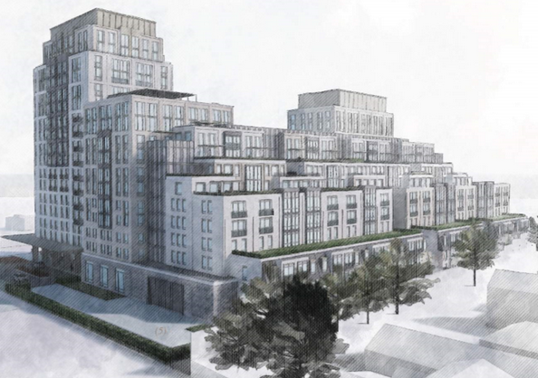
If the new 29 storey proposal for Lakeshore and Pearl is ultimately approved at the Local Planning Appeals Tribunal (LPAT), and forced on Burlington in a form anything like this first proposal, ECoB Engaged Citizens of Burlington, believes we are seeing an Ontario-wide collapse in the ability of municipalities to govern their own planning and development.
The public meeting held for the Carriage Gate development at 2069-2079 Lakeshore Road and 383-385 Pearl Street on January 29th was one of the most heated yet held in Burlington. Over two hours, residents at a packed Art Gallery of Burlington submitted the numerous objections and reservations they had with the proposed 29 storey development. No citizen spoke in favour of the development.
While ECoB continues to stress that it does not oppose reasonable development or intensification, it absolutely believes developers have an obligation to work within the in-force and provincially-approved planning context established by democratically elected councils.
Residents have recently expressed their preferences in unambiguous terms about over-development in downtown. It is therefore dismaying to see proposals coming to City Hall at a rapid rate which don’t just exceed planning maximums, but completely ignore the entire planning context that Council has established over the last decade and a half.
 This new proposal from Carriage Gate (the developer behind the 421 Brant St development which led to the creation of ECoB) suggests a level of massing, setbacks and overall height that massively exceeds both the in force Official Plan and the ‘Grow Bold’ Official Plan introduced by the last council. Regardless of one’s opinions at the 2018 municipal election, this development completely disregards all attempts by Council to moderate development downtown. This new proposal from Carriage Gate (the developer behind the 421 Brant St development which led to the creation of ECoB) suggests a level of massing, setbacks and overall height that massively exceeds both the in force Official Plan and the ‘Grow Bold’ Official Plan introduced by the last council. Regardless of one’s opinions at the 2018 municipal election, this development completely disregards all attempts by Council to moderate development downtown.
Here are just some of the concerns raised by residents, which, according to how the planning process is intended to work, should be addressed before this proposal comes to council for approval.
Increase on already excessive ground-level windspeeds on Lakeshore/Pearl
Loss of commercial space.
Lack of justification for exceeding proposed Official Plan by 12 storeys.
Traffic impact.
Dramatically lower parking provision than required by by-laws.
Need for City Planning Department to respond in time on all applications to avoid automatic appeals.
Practicalities of reversing delivery and garbage trucks.
Lack of respect for residents in proposals which ignore all City Planning objectives and maximums.
Need for 3-D models
Need for any Chapter 37 benefits to be honoured and not reneged on.
Possibility of impact of failure to provide Chapter 37 benefits promised on other developments.
 Pearl Street Cafe was a recent Carnacelli property acquisition – part of a small land assembly that reaches down to Lakeshore Road. ECoB believes this proposal is the most obvious case yet of over-development in downtown Burlington. While we hope, and aspire, to work collaboratively with developers to make their proposals align better with residents’ objectives, there seems little way in which this development, even if scaled dramatically back, would reflect the democratically expressed preferences of the residents of Burlington.
We believe this development is likely to be a test case, not just for the new council, but for the role of municipalities and local democracy in Ontario. The outcome will tell us much about the power of municipalities versus the power of developers to demand, and receive, approval for developments which bear no relation to legally adopted and provincially endorsed Official Plans.
Roland Tanner is an academic, a community activist, a member of the Shape Burlington Report committee and a candidate in the last municipal election. He is also vice chair of ECoB and has a very dry sense of humour
 By Mayor Marianne Meed Ward By Mayor Marianne Meed Ward
February 22nd, 2019
BURLINGTON, ON
Mayor Marianne Meed Ward released the basics of a letter she received recently from the Minister of Municipal Affairs and Housing. We will let the Mayor speak for herself.
My office recently received a letter from Minister Steve Clark of the Ministry of Municipal Affairs and Housing regarding their work on the provincial government’s Housing Supply Action Plan.
Minister Clark outlined their desire “to take swift action to streamline the development approvals system” and “speed up the time it takes to get the right kind of housing built in the right places”. He further explained that “land use planning and development approvals are critical to achieving housing and job- related priorities” in our communities.
I agree with these assertions and am glad to see their continued commitment to expediting these processes. As part of the new Red Tape Red Carpet Task Force that my office has initiated to support local business attraction and growth, I am committed to cutting red tape for development applications that are supported by council and the community.
The Minister’s office continues to consult on proposed changes to the Growth Plan for the Greater Golden Horseshoe and review the Planning Act and Provincial Policy Statement as well, with the intention to bring forward legislation and policy changes in the coming months.
While Minister Clark’s letter advises local municipalities to consider pausing on activities that may be impacted, such as Official Plan reviews, I want to reinforce that until we get more specific details from the Province related to the municipal land use planning process, the City of Burlington will continue to move forward as planned with our review of the Official Plan as per the motion approved by City Council on February 5th.
On a related matter, I am disappointed to learn today that the province has announced the June 30th closing of the Local Planning Appeal Support Centre (LPASC), a resource that offers support to the public in navigating both land use planning matters and the Local Planning Appeal Tribunal. Public participation, a vital part of democratic community planning, should not be sacrificed in the name of ill- defined or non-existent efficiencies.
The best way to save time and money is to eliminate the Local Planning Appeal Tribunal altogether. The tribunal, like the Ontario Municipal Board it replaced, provides unelected and inefficient involvement in planning matters that are best left to local councils, unnecessarily slowing down the development process.
Leaving planning in local municipal hands would not only speed approvals and remove red tape, but also provide more incentives to the development industry to work with municipalities and their residents to plan full communities rather than just build housing.
By Staff
February 22, 2019
BURLINGTON, ON
This will come as a bit of a jolt to anyone who wants to be involved in appeals to decisions made by city council on development applications.
A Gazette reader sent us a notice she got from the Local Planning Appeal Support Centre advising her that: “The Government of Ontario has made a decision to close the Local Planning Appeal Support Centre (LPASC). LPASC has until June 30, 2019 to wind down the business.
 So much for process – how do people navigate through the paper work and the procedures? Effective immediately, LPASC will no longer be accepting new requests for professional services from the public. During this wind down period, LPASC is committed to continuing to serve, to the best of its ability, those clients who have retained its services. LPASC staff will be in contact with those clients with further details shortly.
If you have any questions, please send an email to info@lpasc.ca <mailto:info@lpasc.ca> or call 1-800-993-8410.
The questions should also be directed to Burlington’s Member of the provincial Legislature. You might ask just how this decision came about.
 By Pepper Parr By Pepper Parr
February 19th, 2019
BURLINGTON, ON
The site is just yards away from where Marianne Meed Ward officially threw her hat into the ring for the office of Mayor. Months later she sits in an office on the eight floor of city hall.
 Meed Ward supporters indicating which ward they lived in – representatives from every ward were there. Her campaign was about sensible, responsible development. She spoke to a small, enthusiastic audience at the top of Clearview Avenue overlooking the site on which the ADI Development Group is building what will amount to a new neighbourhood that will align with the mobility hub, the plans for which have yet to be finalized.
An application has been made to change the Official Plan designation to High Density Residential to allow the development of a mid-rise, 6-storey apartment building, with 160 dwelling units at a density of 258 units per hectare. A rezoning application has also been made to change the corresponding zoning to a site specific Residential High Density RH1.
  The lands are currently designated as low density residential in the City’s Official Plan which allows for detached and semi-detached dwellings, and other forms of ground oriented housing not exceeding 25 units per hectare. The lands are zoned R2.1 in the City’s Zoning By-law which allows for detached dwellings and an accessory dwelling unit within a detached dwelling. The lands are currently designated as low density residential in the City’s Official Plan which allows for detached and semi-detached dwellings, and other forms of ground oriented housing not exceeding 25 units per hectare. The lands are zoned R2.1 in the City’s Zoning By-law which allows for detached dwellings and an accessory dwelling unit within a detached dwelling.
A date for the first public meeting has not yet been set.
 By Jim Young By Jim Young
February 18th, 2019
BURLINGTON, ON
In recent Gazette articles and comments, Burlington’s 25 Year Strategic Plan, “Grow Bold”, has garnered much criticism of its name and the plausibility of a vague plan that looks 25 years ahead.
 Grow Bold got the boot – the Mayor had to almost push it out the door. The name really doesn’t matter. Call it Grow Bold, Grow Smart or just The 25 Year Plan; having a plan is important. To achieve anything of consequence we need a longer term view of how our city might look in 25 years. That view is necessarily vague and aspirational; who really knows where we will be by then?
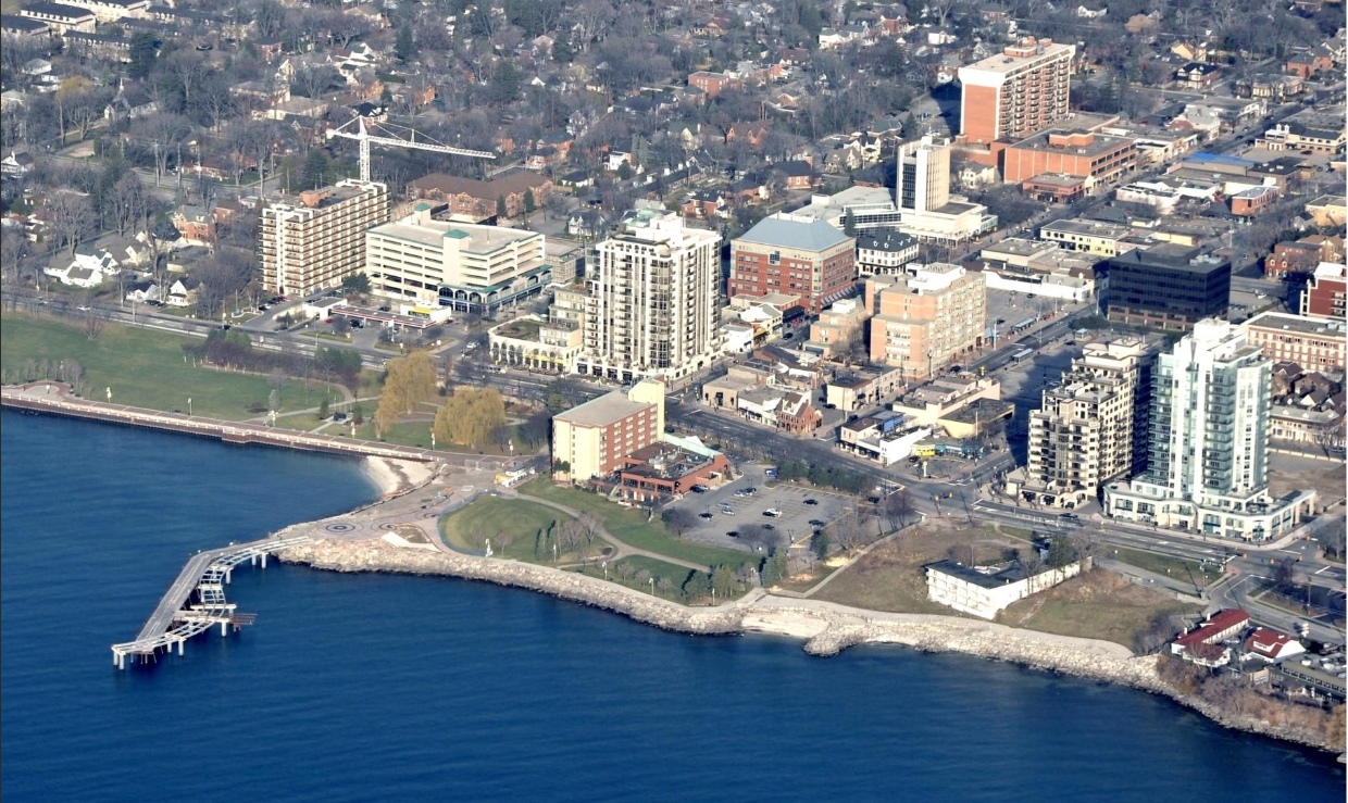 This aerial of the city is going to look a lot different in five years – in a decade you won’t recognize the place, A personal analogy might be a 40 year old planning to retire at 65. How will that retirement look in 25 years? Do I want to travel? Spend time with grandkids? How will I pay my rent? Will I have to keep working? Of course these possibilities may change over the 25 years, but we still need to plan for them. You cannot drive to Florida if your GPS is only programmed to the end of the street. Unless we are extremely lucky, little in life is achieved without a plan. Call this our “Retirement Strategic Plan.”
 The creation of the 2010 -2014 Strategic Plan was a city staff – city council effort that then went to the public. They filled pages of flip chart work but found at the end of the sessions that city staff and council were on different sides of a fence. It was that way for the term and the one that followed. Then we need more specific details: How much should we save and where will that money come from. Will it be RRSPs? Tax Free Savings? Is there a Company Pension? Can I live in my kid’s basement if my Retirement Strategic Plan doesn’t work? This is the meat & potatoes of our planning. Call it our Retirement Official Plan.
Then come the bumps on the road to retirement. When we run into car repairs or the basement floods, when we face short time work or job loss: Changes we must make to our plans. “Amendments to The Retirement Official Plan.” Doubtless we will have contentious domestic debate about these.
Municipalities need plans too. City planners work on at least three levels, with many sub levels in between. The Strategic Plan, The Official Plan and Zoning / Bylaw Amendments to those plans.
 It started out as a four year plan – the term of a city council …. The Strategic Plan: A long term, aspirational view of where we might like to be in 25 years. Obviously no-one really knows where we will be by then; but we must have an idea of how we want our city to evolve over that period. This is the one plan that Burlington consulted citizens on and actually did a reasonable job on.
 … and just sort of grew when a consuklting firm with the compliance of the then city manager took council in a much different direction. The Official Plan; a detailed and much more pertinent document, sets out the steps needed to realize the strategic vision. Mandated by the province for regular review, it re-evaluates the plan to adjust for economic, social, demographic and political shifts that may not be foreseeable but will inevitably take place over 25 years.
This is the plan that should have defined the transit, parking, congestion, intensification plans and area/zone specific heights as they evolved over the next 5 years of that 25 year strategy. Sadly our last City Council failed to provide an Official Plan that met regional requirements and utterly misjudged local sentiment on every level.
Outraged citizens vented their anger in wholesale changes at the last election.
Lastly there are Amendments to the Official Plan and the Zoning Bylaws of that plan. These are often the most contentious and time consuming aspects of city planning. Amendments address those changes to residential, commercial and retail building in our neighbourhoods, which have greatest impact on life and work in our communities.
No matter what the Strategic or Official Plans say about height and density on your street or the plaza at the end of the block, developers can apply to amend the plan or zoning bylaw. These are the matters that are currently the most contentious in our city.
Subject to a 210 day deadline for response by municipalities, there are so many zoning / bylaw amendments active in Burlington that city planners are failing to respond to them in time, opening the door to so many appeals by developers.
These are not failures of the strategic plan. They are failures of process, of consultation and, of course, they must be addressed. In its early actions Council has demonstrated a willingness to address these issues and already there is a feeling that city staff are adapting to this new council paradigm.
We can and should oppose bad planning, we deserve greater say in the plans and the processes, but instead of abandoning the discipline of Strategic Planning, let us work with our new council and city planners to make these plans better. Let us align city plans with citizen visions rather than developer bottom lines in the knowledge that the only thing worse than a Vague Long Term Plan is No Long Term Plan At All.
 Jim Young delegating at city hall. Jim Young is an Aldershot resident who delegates at city Council frequently and has, in a number of cases, given some very wise advice. It was seldom received with much in the way of grace by the 2010 to 2018 city council
By Pepper Parr
February 18th, 2019
BURLINGTON, ON
In October 2017, Burlington City Council approved the development application submitted by Roman Home Builders for 2085 Pine St., permitting a five-storey residential building.
Since that time, the ownership of the property has changed. The new owners are working toward submitting a new development application and concept for 2085 Pine St. that will increase the height from the 5 storeys that have been approved to 11 storeys.
The approved 15 residential units would increase to 40 units.
 The issue for this location has always been the retention of the heritage structure. A development application has not been submitted to the city at this time.
A public meeting is to be held on February 21st at 6:30 pm at the Lion’s Club at 471 Pearl..
The changes the developer wants would require an amendment to the Official Plan and a change to the zoning bylaw.
The immediate area has a number of development applications that have either been approved (ADI at the corner of Martha and Lakeshore 24 storeys) or are in the process of being considered by the city’s Planning department. They include plans for an 11 storey development on the east side of Martha south of the James – New Street intersection, the Mattamy development – 18 storeys at the corner of James and Martha
 The Mattamy development – 17 storeys – has had a convoluted approval path. A proposal for 29 storeys – (the highest so far for the city) at the intersection of Pearl and Lakeshore Road.
This number of developments gives the word “intensification” a whole new meaning doesn’t it.
The Mayor is now looking at a number of developments that challenge the current bylaw – crunch time soon for what kind of city Burlington is going to be a decade from now.
 By Staff By Staff
February 15th, 2019
BURLINGTON, ON
Gary Scobie attended a Local Planning Act Tribunal (LPAT) case conference meeting recently.
It was the follow up to a meeting at which he presented a lengthy document on why he felt the Reserve Properties appeal of a city council decision that permitted 17 stories the developer wants 24 – same as the one on the other side of the street.
The LPAT Case Management Conference was for the 409 Brant Street Appeal. Reserve Properties wants 23 storeys instead of the 17 storeys approved by Council in 2018. Reserve Properties wants to be able to go as high into the sky as Carriage Gate is going to go with their approved 24 story tower on the other side of James Street.
 Scobie expects the location to be called “Twin Towers” should the Reserve Properties win at the appeal hearing. Scobie expects the location to be called “Twin Towers” should the Reserve Properties win at the appeal hearing.
Scobie had applied to be a Participant in the LPAT appeal back in January and he submitted his views to all Parties as required and filled in all the proper paperwork. Those views are the subject of an opinion piece Scobie wrote.
Yesterday the LPAT representative Chris Conti agreed with the Parties that they should all wait for the outcome of a pending trial in Toronto that will better define how LPAT functions going forward. The objective of the Case Management Conference was to set a date sometime in the summer for the next LPAT meeting on the Reserve appeal..
Scobie finds he is still a Participant in the appeal hearing, as far as he understands, but was told that his role may have ended with his submission. He apparently has no ability as a Participant to further expand or comment on the submission he made nor will anyone ask him any questions on the document.
Doesn’t sound as if the LPAT process does anything for citizens than the former Ontario Municipal Board (OMB) process did.
Related article:
Scobie’s presentation to the Local Planning Act Tribunal
By Gary Scobie
February 13th, 2019
BURLINGTON, ON
I am a citizen of Burlington who has taken an interest in the re-development of Burlington’s downtown, delegating at numerous Planning and Development Meetings and City Council Meetings in opposition to the over-intensification of Burlington, particularly our downtown.
I wish to participate in this LPAT appeal, speaking in opposition to the appeal by Reserve Properties Ltd. I have no direct pecuniary interest in this development. My written submission follows.
 Gary Scobie I have delegated at City Hall on this development proposal, on the 421 Brant Street proposal (now approved), on the 374 Martha Street proposal (now approved) and on Burlington’s new Official Plan (unapproved), so I have a history of engaging in development matters in Burlington. I am fully aware of the Places to Grow, Greenbelt and Metrolinx legislation in Ontario and the desire to intensify Southern Ontario municipalities, reduce urban sprawl and protect our natural and agricultural greenbelt.
I understand the minimum density targets assigned to areas designated as Urban Growth Centres and Mobility Hubs. I also understand that there are no building upper height regulations in Provincial legislation. Building height upper limit is left to municipalities and their zoning regulations. Thus municipalities have the obligation and the right to define how they will meet Provincial people/jobs density targets and where high buildings should best be situated to add to density while preserving the urban character and living environment for citizens.
I do take issue with the Provincial designation of Downtown Burlington as an Urban Growth Centre and the Metrolinx designation of the Downtown Burlington Transit Terminal as an Anchor Mobility Hub. They each bring density targets to our downtown that I feel are excessive. I believe that our new City Council will be debating the merits and validity of these designations and consulting with the Province on the ability to move the Urban Growth Centre elsewhere in Burlington and un-designate the Anchor Mobility Hub. I will reference these two issues further in my submission.
I will also reference our new unapproved Official Plan and how it has been used by developers and our former City Council to gain inappropriate building heights downtown while violating our current approved Official Plan. Our new City Council will also be debating amendments to limit height in this unapproved plan before sending it back to Halton Region for approval.
In actual fact, this appeal is not inconsistent with a Provincial Policy Statement and does not fail to conform to a provincial plan. But that is in itself a real problem. The policy statements and plans of the Province place no upper limits on building heights, so when the sky is the limit then there can be no violation or lack of conformity by a developer’s application that involves high rises. With no limits on height, no building adding density in a designated urban area would ever fail a provincial mandate or target. The density targets, whether within a Mobility Hub or Urban Growth Centre or not, can usually be met with mid-rise buildings. But developers like high rise buildings because their motivation is profit rather than public good. Public good (or bad) is just a by-product of the constructed building.
 What a develop wants to build on the south side of James Street on Brant will dwarf city hall even further. Gary Scobie spoke at the LPAT meeting which is hearing an appeal of the 17 storey’s the city approved for the site – the developer wants 24 storeys. Developers can dress their proposals up to look and sound pretty nice and say that the Province is demanding that they build high rises, but that is not true. The Province is simply asking municipalities to build to an area density target, not a site specific one. And yes, the target can be exceeded, but it is not mandated. My understanding is that most cities are well short of their assigned area targets, unlike Downtown Burlington which will reach its Urban Growth Centre Target well ahead of time. And there are no announced penalties for cities that do not meet target. So the Province’s targets are just that; targets that have no teeth behind them and leave the real work to the municipalities to figure it all out. I ask the Tribunal to let the City of Burlington do just that.
Let me use an analogy to make a point. Pretend we’re in a very small room that has a grid pattern of downtown streets on the floor, with electrical connections running along each street. The Province says heat the lower half of the room to a certain average temperature. Developers suggest that 150 watt incandescent light bulbs at most corners should do it. They each produce a lot of heat as a by-product of lighting them. But this creates high heat just at each location, while other parts of the room stay cool. It is inefficient, but it does eventually bring the average temperature up, but with hot areas at street corners and cool areas elsewhere. The average temperature is likely felt by no one.
 How many light bulbs will it take for the decision makers to see the light? The Planning Department and Council have a better idea. Use 40 and 60 watt incandescent bulbs not just at corners but also along some more of the downtown streets, so heat buildup at each bulb location is less, but more bulbs spread this lower localized heat around much more efficiently to bring the same average temperature as the developers’ solution, but spread more evenly across the downtown so more people actually feel the average temperature.
In real life, the 150 watt bulbs are high rises. The 40 watt bulbs are low rises to 4 storeys. The 60 watt bulbs are mid rises to 11 storeys. High rises concentrate people, parking and traffic congestion, shadowing and wind effect in high degrees at major corners. Low and mid rise buildings concentrate fewer people per building across a greater spread of the downtown, so congestion for traffic and parking is lessened because it is spread out in the wider area. There would be less shadowing and wind effect from lower buildings. The ability to fight a fire in such lower buildings would be much easier than to fight a high rise fire, lessening the danger to tenants. Both solutions can reach an area target, but the low to mid rise solution does it in a kinder and gentler way, without packing in hundreds of people in small ground area sites soaring to great heights just to give us a new skyline.
Of course neither solution would have to be considered if our downtown was freed from Urban Growth Centre and Anchor Mobility Hub designations and their growth targets.
 Quite where the city hall fits into the longer term development picture is not at all clear. There is a report in a file outlining what might be possible. Getting back to this proposal, to build to match the height of the tower across the road (421 Brant Street) is simply using as a precedent a poor decision by our former City Council to over-reach in height its own current and proposed Official Plans, against the public outcry and the public good. The idea of the twin towers as a gateway to our iconic eight storey City Hall and its adjacent Civic Square is one great marketing scheme, but fails as suitable to this location. I believe it fails as suitable in any location in Burlington. A gateway is usually a structure far lower in height than 23 storeys. And no gateway is required to our City Hall. The approach along New Street, then James Street is a grand enough gateway.
I ask the Tribunal to keep in mind that the new City Council may succeed in removing the Urban Growth Centre and the Anchor Mobility Hub from the downtown, making a mockery of any claim that we must build this tall building here or anywhere downtown to conform to provincial policy and plan. The old Council assured citizens that no new single building creates a precedent. Yet developers seek to use precedent as a reason to build ever-higher (and in this case near twin) buildings and the OMB has in the past let precedent seep into decision-making. I request that the LPAT not be influenced by precedent-based arguments from developers. Using bad precedents will only produce a worse future.
The Urban Growth Centre can be moved by a municipality – Oakville did so in 2005. An Anchor Mobility Hub is required to have a dedicated rapid light rail connection with a Gateway Mobility Hub. There are no plans for an above-ground or subway rapid transit linkage connecting the Transit Terminal to the Burlington GO Station. Thus, it does not qualify as a valid Anchor Mobility Hub.
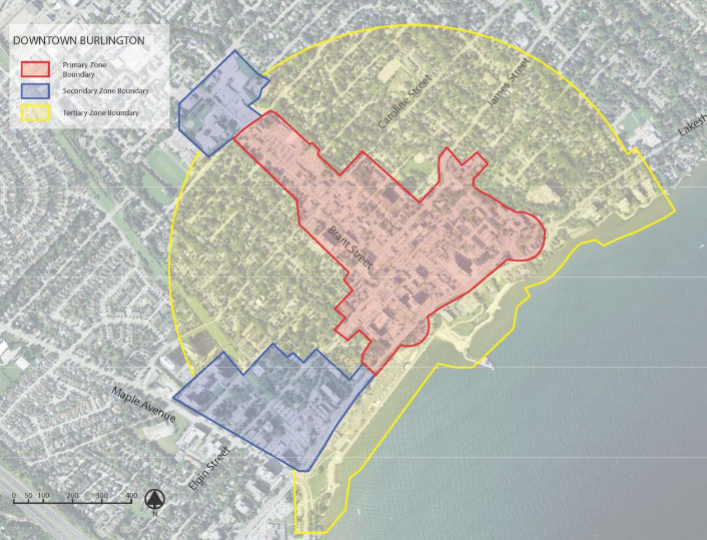 Boundaries set out for the Downtown mobility hub. Scobie argues that the criteria for a hub don’t exist.
Now to the factual reason that the Tribunal should deny this appeal and in fact, if within its power, reduce the height to a mid-rise limit. Our new Mayor, as Councillor for the Downtown in the previous Council, proved that we were on target in moving toward the 2031 density numbers with the current Official Plan and advocated for an easing of height limits that were proposed in the new Official Plan. With a new Council in place, with a majority of members who were elected advocating for such an easing, I am confident that they will support the Mayor in her advocacy for reasonable height downtown.The appeal height request and the previous Council decision to award 17 storeys height both fly in the face of the current approved Official Plan which designates a 4 storey height, moving to 8 storeys with negotiated community benefits. As do the density numbers which are proposed by the developer at 1135 units per hectare.
If we use a conservative average of 2 people/jobs per unit, this would translate to 2270 people/jobs per hectare, where the current Official Plan would allow up to an 8 storey building, roughly one-third as high and therefore holding approximately 700 people/jobs per hectare, still fairly dense and helping move toward the area target of 200 people/jobs per hectare of an Urban Growth Centre.
 Opposite city hall on north side of James Opposite city hall on the south side of James. Developer wants same height as the other side of the street 24 storeys – city approved 17 storeys. An eight storey building on this site would aid the target and impose a much less imposing structure on this neighbourhood. It would be a model to replicate in other downtown core locations that the Planning Department and City Council deem suitable to intensification toward target. It would also agree with the current Official Plan. These are reasons enough to turn down the appeal by the developer and allow the City to decide on height in the downtown core that is more in line with citizen wishes. If possible, I would recommend that the Local Planning Appeal Tribunal not only do this, but rule to uphold current City Zoning at this site if it is within its power.
This appeal is clearly in violation of the Official Plan of our municipality. The past poor decisions of City Council and the OMB on excessive intensification in our downtown cannot be undone, but they can serve as learning experiences to help guide our planning in the future to increase density, in a way that helps our downtown maintain its character and attraction without the over-congestion that comes with high rise after high rise appearing at each major corner and section assembled by developers.
 The former retail location is empty – developer has been given approval for 17 storeys – has appealed to allow 24 storeys.  Once a popular restaurant location – it will be redeveloped and become a 24 story condominium. The history of treating each high rise application as a one-off decision in isolation without looking at future ramifications of the cumulative effect of successive high rise applications in a small area should end here. I’m asking the LPAT to consider this issue and support our municipality in its quest to grow its density in its own way, by rendering a decision that will promote this.
By Pepper Parr
February 12th, 2019
BURLINGTON, ON
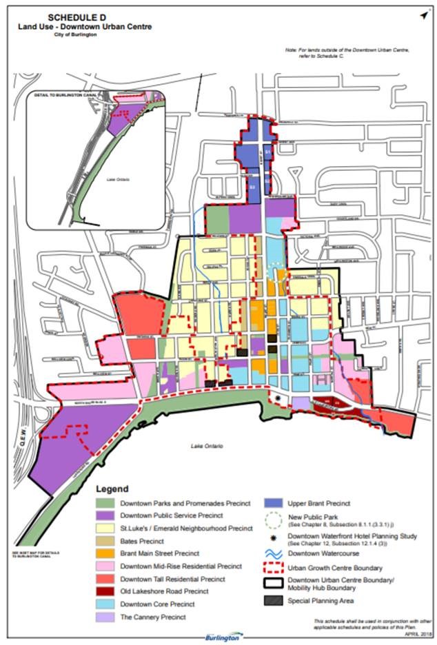
The business of making changes to the Official Plan that was adopted by city council on April 26, 2018 but not accepted by the Regional government has begun.
Changes to the Official Plan was a contentious election issue and resulted in a new Mayor and a decidedly different council. Five of the members are new.
Getting all the changes made is not going to be a simple one step process.
On Feb. 7, 2019, Burlington City Council voted to re-examine the policies in Burlington’s Official Plan, adopted in April 2018. That plan was sent to Halton Region for approval. The Region sent the plan back with some questions without approving it.
 Mayor Meed Ward has taken the position that “Once the Region identified areas of non-conformity, that stopped the clock on approving the new Official Plan and opened the plan up for any other matters of discussion. This allows our new City Council the time to define what areas we want to study, undertake that work, consult with the community, and send back a comprehensive plan. We expect that plan to truly reflect the needs, best interests and vision of the community and it’s elected Council. Mayor Meed Ward has taken the position that “Once the Region identified areas of non-conformity, that stopped the clock on approving the new Official Plan and opened the plan up for any other matters of discussion. This allows our new City Council the time to define what areas we want to study, undertake that work, consult with the community, and send back a comprehensive plan. We expect that plan to truly reflect the needs, best interests and vision of the community and it’s elected Council.
The motion, approved by Council, directs Burlington’s Director of City Building to immediately commence a process to re-examine the policies of the Official Plan adopted April 26, 2018.
Proposed Amendment 1 to the Growth Plan for the Greater Golden Horseshoe, 2017
On January 15, 2019, the Ministry of Municipal Affairs and Housing released proposed amendments to the Growth Plan, 2017 which can be found here. The Province identified that the purpose of the proposed changes is to streamline growth management planning in the Greater Golden Horseshoe to achieve the following outcomes:
• More Streamlined Process: Provide greater flexibility so that municipalities will be able to move forward faster on the implementation of the Plan and meet the deadline to update Upper-tier and Single-tier official plans to conform with the Plan by July 1, 2022.
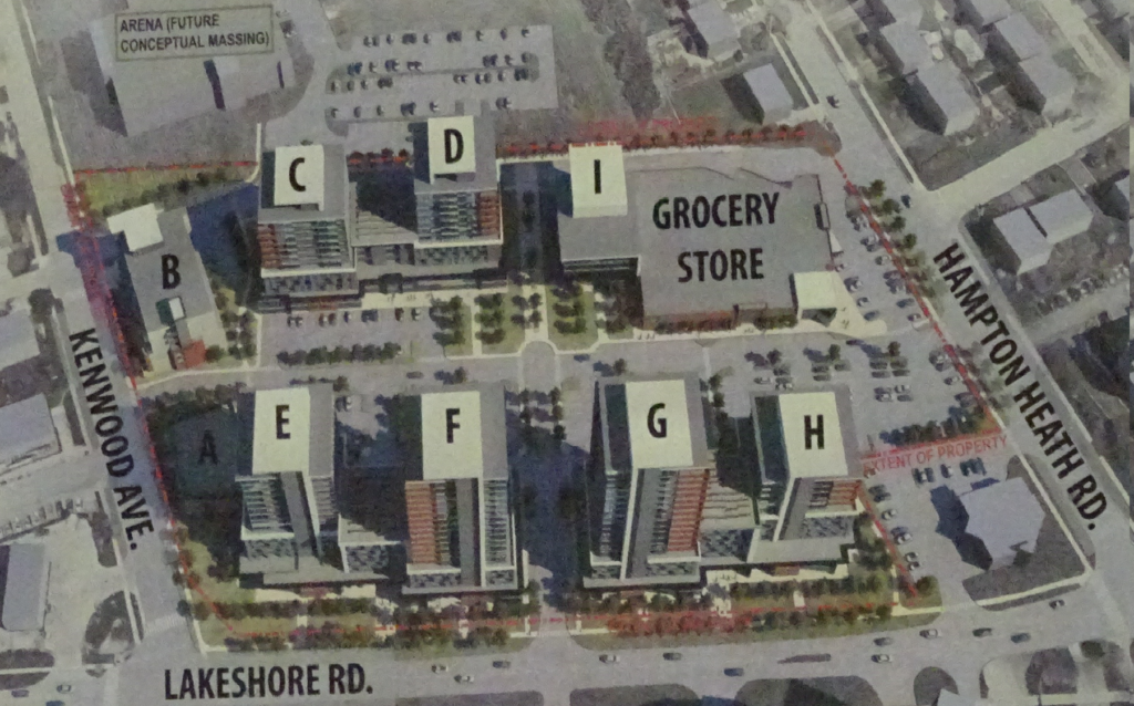
 One of the development proposals that can resolve the housing availability. Nothing affordable about it. • More Land for Housing: Respect the ability of local governments to make decisions about when and where to add new land for housing, to ensure that there is enough housing supply to meet demand.
• More Housing and Jobs near Transit: A more flexible framework for focusing investments around transit infrastructure will enable municipalities to plan to increase the supply of housing and jobs near transit faster and more effectively.
• Greater Local Autonomy and Flexibility for Municipalities: Ensuring that municipalities will have the ability to implement the Plan in a manner that better reflects their local context while protecting the Greenbelt.
A staff report regarding the proposed submission to the Province will be delivered to Planning and Development Committee on February 27th at 1 pm.
It is clear that there are going to be many stages in the re-writing of the plan that was approved in April of last year. What we are seeing now is just the first step. It will be interesting to see how Staff responds to the Direction.
The matter of streamlining the process has a number of Burlington residents who have been trying to take part in Tribunal hearings concerned.
One Gazette reader said in her opinion “the streamlining comes about because there is little or no resident participation.”
 Residents are finding that they have no problem preparing comments – they are accepted and put in the file. But when they ask to be able to be a “participant” they are for the most part being denied. Residents are finding that they have no problem preparing comments – they are accepted and put in the file. But when they ask to be able to be a “participant” they are for the most part being denied.
Gary Scobie delegating at city hall. Gary Scobie asked to be a participant on the Reserve development for the former Elizabeth Interiors property. The developer didn’t have a problem with Scobie and the city lawyer didn’t have a problem – so there he was – a participant. Now what – Scobie doesn’t know – he might have played his role – submitting a document.
A resident of the Dynes Community was told they would not be recognized as participants. To date that group has spent $17,000 to date on legal counsel.
Being a participant you have no liability. If you have status as a Party you could be sued if the developer thinks you have simply tried to delay an application from being approved.
With the OMB – a resident could come to the hearing – and as a participant could basically delegate. The lawyers from both sides then had the opportunity to “cross examine the witness”.
The residents we have talked to get the feeling that the process is going to be “streamlined” because it will consist of lawyers talking to lawyers and arguing fine points of provincial policy. The “local” element and response seems to be missing.
Not a healthy process.
Will the city planners push for better public participation?
 By Staff By Staff
February 12th, 2019
BURLINGTON, ON
The Planning and Development Committee scheduled for this evening – Tuesday February 12th has been CANCELLED. It will be rescheduled.
A Statutory meeting on the Lakeside Village Plaza was on that agenda. There are many people wanting to delegate at that event.
 The proposed plan was just a little too much for most people in the neighborhood. Has the developer heard what the residents thought?
 By Staff By Staff
February 11th, 2019
BURLINGTON, ON
The Tyandaga Environmental Coalition (TEC) continues to focus on the issue of Meridian Brick’s planned development (clear cutting and quarrying the North Aldershot East Quarry in ward 1.
During the election they focused on getting their story in front of every candidate – a mammoth task with 11 people running for the ward 1 seat.
 The quarry operation was part of a corporate amalgamation and was re-named – Meridian Brick. “TEC was delighted” with the outcome at the Mayorality level – they needed some time to get a sensed as to where the new Council member for the ward stood on the quarry issue.
They are now reviewing/resetting their strategy as a result of the new leadership and senior staffing changes at city along with the change in policies and legislation.
In November, 2018 TEC members had an introductory meeting with MPP Jane Mckenna who is open to meeting again.
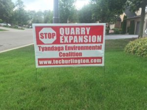 Tyandaga community organizes to prevent the clearing of an estimated 9000 trees behind their homes. On February 6th, members of TEC met with Councillor Galbraith. It was an introductory meeting at which TEC requested that he and the City take the lead and determine a solution that would benefit all involved and stop the clear cutting.
 Ward 1 city Councillor Kevlin Galbraith “We were pleased to hear that this community matter is a priority for Galbraith. We expect he will speak about this at his upcoming ward meeting which will take place on Wednesday February 13 from 7-9pm at NUVO Network, 1295 North Service Road, Burlington.”
Note that due to ongoing renovations, the front door at NUVO Network is not in use – parking and entrance are at the back of the building.
You can find his contact information on the Galbraith website: https://www.burlington.ca/en/your-city/councillor-kelvin-galbraith.asp
By Pepper Parr
February 7th, 2019
BURLINGTON, ON
 There has been a lot of confusion about just where Burlington is in terms of the provincial government Places to Grow policy. That is the program that sets out the longer term population growth plans. There has been a lot of confusion about just where Burlington is in terms of the provincial government Places to Grow policy. That is the program that sets out the longer term population growth plans.
The provincial government set the level to which population is expected to grow and determines where that growth should take place.
A population growth target is given to the Regional governments (they are called two tier set ups) and a number to the single tier government; Guelph and Toronto are single tier governments. Burlington. Oakville, Milton and Halton Hills are part of the Region – making us part of a two tier system.
Burlington’s Planning department has never offered anything firm on just what the city has in terms of population and what is expected in the short term future. The planners just kept saying we are guided by the Places to Grow policy. The developers would claim that their development was part of reaching the Places to Grow target.
Many thought the target had already been met. The then Councillor Marianne Meed Ward kept saying the target for 2031 was being met and that we were in fact ahead of the requirement.
The target for 2041 is known at the Regional level – Burlington doesn’t know what its share of that number is going to be.
Much of the development in the downtown core is being driven by that Places to Grow policy.
Gary Scobie, a retired Burlington resident and frequent effective delegator, did some homework and came up with some numbers that suggest Meed Ward was right – we have reached our 2031 target or are so close that with the developments in the pipeline the city will reach its target handily.
Here is what Scobie had to say in his Growth Targets 101 presentation.
The Urban Growth Centre is where the development is taking place.
The Urban Growth Centre is shown with a red dotted line that is sometimes a solid red line. It extends as far north as Prospect Street. Total area is 104.6 hectares (ha)
In 2016 there were 156 p&j (a combination of people and jobs) per hectare in the Urban Growth Centre.
The goal for our UGC is 200 p&j per hectare – thus in 2016 we had achieved 78% of the goal.
The 2031 target is 104.6 ha x 200 p&j for a total of 20,920 people and jobs in the Urban Growth Centre.
In order to meet the 2031 target the city needs to add 4,540 p&j in the next 12 years.
Is that possible? Scobie thinks so and he offers the following data to make his point

These developments will add 2824 p&j in the not too distant future which will make Burlington short 1626 of the target. Note that Scobie uses an estimate of 1.5 residents per housing unit.
There is more maintains Scobie and he points to projects that are “in the works”.

A development planned for the corner of Pearl and Lakeshore is to be 29 storeys – a record high for the city. Scobie, who shares the view of Mayor Meed Ward, maintains the city does not need 20 storey towers to meet the Places to Grow population target.
He suggests that the projects in the works will add 1355 people and 180 jobs for a total of 1535 p&J and that permitting buildings that are between eight and 11 storeys will let the city reach the objective. No need for the 20 plus storey towers that will destroy the small town feel that residents want.
“We don’t need more 20+ storey buildings to reach the target. Mid-rise building can get the city to the point where it has met the growth requirement and allow a more human scale of development.”
Is Scobie right?
Gary Scobie: Are his numbers right? Hard to tell – none of the Councillors who heard the Scobie delegation asked city staff if Scobie’s numbers were right.
The Gazette has fired off an information request to Mary Loy Tanner, the former Planning Director who oversaw much of the development that has residents upset enough to elect a significantly different council.
Our question to Tanner is:
On Tuesday, February 6th, Gary Scobie made a delegation to Council. A copy of the slides he presented is attached. Are the numbers Scobie presented correct?
If they are incorrect could you set out where his numbers are wrong.
Thank you 🙂
A question we have for the members of council who heard the delegation: Did the cat get your tongues or did you agree with Scobie? At the end of his delegation there wasn’t a single question asked. Not what they were elected to do or did we get that wrong?
By Pepper Parr
February 6th, 2019
BURLINGTON, ON
It may not be case of insubordination but it was a classic case of mis-understanding who calls the shots and how staff should be responding to members of council.
Tuesday evening Mayor Meed Ward asked for some critical information on when a time frame on a development will be reached.
 Mayor was told to google if she wanted to know when the time line for making a decision on this development would be reached. The North Shore Road proposed Amica development had just gone through a lengthy Statutory meeting and there was concern that the city would once again fail to get reports from staff in time to ensure that a decision could be made in time.
The Mayor asked planner Lisa Stern when the 210 allows would have been reached. Google it was the response.
The Gazette reporter wasn’t in the room – so can’t say if there was an audible gasp. We did get a response from a reader who commented: “it shows a total lack of respect for the Mayor. I certainly hope someone will speak to her about it.
Stern is due to take some maternity leave. “I have to wonder” said the Gazette reader, “ when she will go on maternity leave – my question is who will take over this file and will it affect the deadline in June for the North Shore Proposed Development?
Burlington’s Planning Department has a history of failing to get a response to a development proposal completed in time which has the developer making an appeal to the Local Planning Act Tribunal for a decision.
Mayor Meed Ward wasn’t going to let that type of thing happen again. She wanted the time line date included in every report that comes to council. Meed Ward wasn’t certain just how that date was determined. Was Sunday counted?
To ask for the information and be told by a staff planner, a junior one at that, to google for the information is insubordination and reflective of the attitude the department has taken when dealing with this new Council.
 Is there cause for dismissal here? Will the Planning Director have words for the planner? Will there be the much needed cultural re-direction from within the department or will someone with a big broom start doing some sweeping. Is there cause for dismissal here? Will the Planning Director have words for the planner? Will there be the much needed cultural re-direction from within the department or will someone with a big broom start doing some sweeping.
The Interim City Manager might begin using that hard glare he is very capable of directing at those he is unhappy with.
Tomorrow would be soon enough for that to begin happening.
By Pepper Parr
February 6, 2019
BURLINGTON, ON
In a report to a Council Standing Committee Tuesday evening the Mayor said that “Burlington residents have consistently raised concerns about over-intensification and development in our City. During the 2018 election, they made their voices heard and clearly indicated the need to review the scale and intensity of planned development.”
 The Grow Bold, Grow Smart, Grow Beautiful tag line that then Planning Director Mary Lou Tanner (centre in this picture) has now been dumped. Interim city Manager Tim Commisso, on the left has the unenviable task of unwinding that branding. Will he be making staff changes as well? That was the rationalization she used to bring forward a motion to re-examine the policies of the existing Official Plan that was adopted, though not officially approved, in April of 2018, and review matters of height and density.
The approved but not adopted Official Plan was sent to the Region who sent it back to the city noting that there were “identified areas of non-conformity”. City council, and the Planning department needed more in the way of clarity from the Region.
Staff from the Planning department, the legal department along with the interim city manager and the Mayor met at length with the Regional planners – Burlington does not yet appear to have the clarification they are seeking.
 She did win and she is going to do it her way. The Mayor did say that “Once the region identified areas of non- conformity, that stopped the clock on approving the new Official Plan and opened the plan up for any other matters of discussion. This allows our council the time to define what areas we want to study, undertake that work, consult with the community, and send back a comprehensive plan. We expect that plan to truly reflect the needs, best interests and vision of the community and its elected council.”
Mayor Meed Ward presented a motion that she said would “provide absolute clarity to staff and to the community that the City of Burlington staff are not to use the adopted 2018 plan in evaluating current/new development applications. Multiple analyses by staff in assessing development applications, downtown in particular, have made it clear we do not need to over intensify in order to meet our obligations under the Places To Grow legislation.
 Will the Grow Bold “branding” be removed from the office door by the end of the week? The Mayor just might take it upon herself to do that ask by herself. Meed Ward once again put out the word that the city “will immediately discontinue use of the “Grow Bold” term and related branding to ensure we are absolutely clear on our direction.”
The motion brought forward by the Mayor read:
1. Direct the Director of City Building to immediately commence a process to re-examine the policies of the Official Plan adopted April 26, 2018 in their entirety related to matters of height and intensity and conformity with provincial density targets.
2. Direct the Director of City Building to send a letter in respect of the Official Plan adopted by Council on April 26, 2018, to the Region of Halton acknowledging receipt of the
Region’s Notice of Statement of Opinion of Non-Conformity with the Regional Official Plan dated December 4, 2018 and requesting sufficient time to address the conformity issues identified.
3. Direct the Director of City Building that until such time as the modifications that result from the work being undertaken in (1) and (2) above are brought forward and adopted by Council and sent to the Region for approval, that the adopted OP policies not be given weight in evaluating development applications that may be processed in the interim period.
4. Direct the Director of City Building to report back to the Planning and Development Committee meeting in March to provide a progress update on the Official Plan work plan with key milestone dates, public engagement plan, budget and resource requirements.
5. Direct the City Manager to discontinue the use of the “Grow Bold” brand.
In presenting the Motion Meed Ward said she wanted a unanimous vote – she did get unanimity but not without some arm wrestling from Councillor Sharman.
By Jim Feilders
February 4th, 2019
BURLINGTON, ON
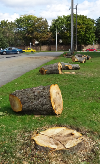
During a presentation at the Burlington Seniors Centre by Burlington Urban Forestry staff and Ward 4 Councilor Stolte said she would like to complete the pilot faster than the two year period.
The Urban Forestry manager indicated many benefits including what Toronto has recognized – shading. Changes since 2013 when Council did not support a private tree bylaw – the ice storm, flood, wind storm and Emerald Ash Borer resulted in Council changing their minds. Roseland was chosen for a number of reasons and data will be gathered for analysis.
A proposed Private Tree Bylaw Pilot was approved at the Committee of the Whole March 19, 2018. The proposed pilot will be a two-year project for the Roseland Area, starting March 2019, and finishing March 2021.

The Roseland area is bordered by Guelph Line to the west, New Street to the north, Roseland Creek to the east, and Lake Ontario to the south.
This exciting initiative is based on a recommendation from the city’s Urban Forest Management Plan that was developed in 2010.
This program will aid in preserving valuable urban forest assets in an effort to maintain and grow a healthy and vibrant community resource into the future.
The bylaw will allow for some flexibility for private property owners, yet includes restrictions based on preserving heritage and “significant” trees. Replacement plantings are important for ongoing sustainability of Burlington’s Urban Forest, and are proposed for trees greater than 30cm (1 foot) diameter at breast height (dbh).
The 30 cm exemption was based on a survey of other municipalities and felt it was a moderate approach.
Boundary trees are also addressed.
Exemptions will be allowed for specific instances including emergency work; trees posing high risk as deemed by a Certified Arborist; ash tree removals, or removals allowed under the Planning Act.
At the end of the two-year pilot period, a review of the Bylaw will be undertaken, with a report to Council, including the feasibility of further rollout city-wide, and resource implications. The bylaw will be enforced by The Manager of Urban Forestry and any designate, who will have the authority to:
• Issue Tree Permits
• Issue work orders directing as to how authorized work is to be conducted. The authority to issue work orders shall also include the authority to order a stoppage of work
Burlington’s Strategic Plan identifies expansion of the urban forest to be a key action item in our strategic direction of a Healthy and Greener city.
The bylaw requires applicants to submit an application to the Manager of Urban Forestry or their designate with the following information:
• A Tree Protection Plan acceptable to the Manager of Urban Forestry or designate, identifying the trees to be injured or destroyed, and including size, species, condition and location; the trees to be kept; and measures to be taken for the preservation of remaining trees on the site
• The permit fee
• A proposed for tree replacement planting plan
• Confirmation that tree protection fencing around city trees is done so in accordance with the city’s Standard Specification for Tree Protection and Preservation (SS-12A)
• A schedule of proposed site inspections to be completed by the project arborist
• Project scope including but not limited to an explanation of proposed demolition (if applicable), construction, equipment used, timing, detailed explanations of any applicable work within tree preservation zones
• Boundary trees located within three metres on both sides of a mutual lot line require a letter of agreement signed by the adjacent neighbor(s); or documentation from the Project Arborist that the proposed work will not negatively impact the tree in question
• Any additional relevant information
Applications and all necessary paperwork can be submitted to Roads, Parks and Forestry at 3330 Harvester Rd. Burlington, Ontario or by email at forestrypermits@burlington.ca.
1. Applications will be reviewed by Forestry staff and the applicant will be notified of any missing items. Forestry staff will respond to the applicant within five business days.
2. If the application is complete, a site meeting will be scheduled to discuss acceptance or denial of application, further modifications needed, and subsequent securities and/or compensation costs to be incurred by the applicant.
3. Upon approval of the application, the applicant is required to provide payment to the City of Burlington for the required security and compensation amount per the bylaw and indicated in the approved arborist report and preservation plan.
4. A Tree Permit will be provided to the applicant which must be displayed on the property in view from the road.
$100 per tree to be removed or injured up to a maximum of $500.
There is no cost for ash tree removal; however, replacement trees are still required.
When a tree permit has been granted, all owners are required to replace trees that are proposed to be removed, or pay cash-in-lieu of replacement of $700 per replacement tree:
Diameter Class (Removed Tree) No. of Replacement Trees Required

The manager said the real results of such a bylaw are the withdrawal of applications. People rethink the removal of trees.
This could skew the statistics to be analyzed as there will be fewer trees removed and less statistically significant data)
Q&A
Q1. How was replacement size determined?
Ans. Picked the middle of the road from other municipalities as a good starting point.
Q2. Why no fir trees protected?
Ans. Not a Carolinian tree so no need to protect.
Q3. How soon will City respond?
Ans. Within 5 days initially.
Q4. Kudos for bylaw. What is age of 30 cm tree?
Ans About 30 to 50 years
Q5. Could we go lower like Oakville?
Ans Yes they have 15 cm
Q6. Where is money to take care of City trees?
Ans Using a 7 year rotation throughout the city so every area gets pruning once every 7 years. Now that risk assessment is done should be able to do better.
Q7. Very costly to haul excavated basement fill off site in order to protect trees. Can’t protect all trees as some are in the way of a house. Can trees in building envelope be removed?
Ans Can remove trees in the way but have to apply. Provincial policy trumps municipal. Province says housing has preference.
Q8. Why is there no tree canopy target?
Ans We don’t know how many trees we have. UFMP needs an update to see what have been lost since 2010. Some municipalities have lofty goals that they might not meet.
Q9. We had 17% canopy in 2010 and has been decreasing since. Conservation Halton gives us a failing grade and Environment Canada says 30 to 50%. We are not progressive enough. What is replacement plan?
Ans For each tree of 30 to 50 cm diameter have to plant 2 at 5 cm for $1400. (Editor’s note – the Site plan Application Guidelines, Section 9 for development applications require equivalent caliper replacement. For a 30 cm tree this would require 6 trees at 5 cm, not 2 trees).
Identified vacant tree sites in Roseland have been identified for new plantings.
Q10. Need help from residents in Roseland. History is that we asked for what we thought the current council would accept but need a better city wide bylaw. Lost 80 city trees recently and over 100 other trees. Canopy is not looking good. In the Character Study, trees were identified as the most important aspect of Roseland. The new OP mentions importance of character throughout. We need a proper renewal plan.
Q11. We have only 12 years to counteract climate change and we must save every mature tree. The new Council is progressive while the Province is regressive. Trees help flood prevention and carbon sequestering. We need to move faster and ask for 1 year to go for a city wide private tree bylaw. We can’t take the soft sell approach any longer. We should take a stand and chose a 35% tree canopy target. Burlington has lagged behind others. There are programs available to help with costs. We have to ramp this up.
Ans Echo that and every tree matters.
Q12. Can we have an interim review?
Ans We are following Council direction but may be able to have a one year review
Shawna – We need to convince council, not staff. 3 councillors want a smaller tree diameter limit for north Burlington as most trees are smaller than that.
Urban Forestry manager – contacting businesses involved about awareness so they are not caught unaware.
Q13. Need incentives to plant new trees.
Ans Looking at other aspects as well as preserving mature trees.
Q14. Heard of new developments planting trees on private front yards instead of city land then cutting them down. Allowed in Burlington?
Ans No. Above Dundas, trees are going on city property.
Q15. Staff should let consultants, architects and planners know about the bylaw a soon as possible.
Q16. Committee of Adjustment is not considering tree policies that exist now.
My own take on this:
Any tree can be destroyed provided it is either exempt, compensated by cash in lieu or agreed by neighbour. This bylaw will not prevent the loss of mature trees occurring at present.
The replacement option is not based on equivalent caliper diameter as is required in the Site Plan Application Guidelines for development applications. A 30 cm diameter tree would have to be replaced by six 5 cm diameter trees, not two. A 50 cm diameter tree would have to be replaced by ten 5 cm diameter trees, not three.
Trees on private property removed for personal improvements (pools, decks, additions) and infill development do not represent a large number of trees. Over the next ten years this will account for about 14% of all removals in urban Burlington. The real problem is sick and dying trees.

The evaluation criteria for the analysis was not given. The report from staff stated there would not be sufficient data to draw meaningful conclusions and no other municipality has proven the effectiveness of a tree bylaw.
“ It does not recommend a pilot project, primarily because of the difficulty of assessing the effectiveness of a pilot project, but does set out the key parameters of a pilot project should Council wish to undertake a two year pilot.‘
“While some municipalities have private tree bylaws, they are generally municipality-wide. Staff have found little evidence that private tree bylaws have been subject to rigorous assessment of their effectiveness, and in many cases the stated goals of municipal private tree bylaws are more subjective and philosophical than objective and measurable. There is a general belief that the municipality has an obligation to put processes in place to regulate the removal of private trees by putting in place a process that ensures the owners seriously consider the decision to remove a tree, educates the owners, and ensures the replacement of private trees that are removed.
“While these may be very legitimate goals, there is little evidence found that shows that these bylaws ultimately have had a measurable impact on the quantity or quality of the urban forest, or are more effective than other strategies to retain and enhance the urban forest.”
“Therefore, it is estimated that approximately 1.7 million trees exist within the city’s urban area. Other than this estimate, we have no baseline by which to measure, track or evaluate the success of a private tree bylaw pilot project on the tree canopy. It is also suggested that the scale of the tree canopy alone may not be the best by which to measure urban tree forests. Other cities include such measures as diversity of species, physical access to nature, habitat provision, tree health and characteristics of the trees (size).
 It was private property – not in Roseland. Evaluating the effectiveness of a pilot project would be further complicated by the time-limited nature of the pilot in a relatively small area of the city. In short, the city would have little or no baseline on which to measure change, and enforcement of the bylaw would be either voluntary, or by complaint. The city does not have the resources to actively police tree removal in Roseland. In the case of a time-limited trial, people could either remove trees in advance of the pilot starting, or wait it out. In summary, it is not clear that there would be any viable means to measure the effectiveness of a private tree bylaw trial project.
Sample size would also be an evaluation challenge. Staff estimate that in a two-year trial period in Roseland there may be 40-50 permits granted, although given the city’s lack of experience in the area, this is at best a rough projection. If the estimate is accurate however, it would be very challenging to extrapolate the impact of the pilot from such a small sample size on the overall urban forest of 1.7 million trees.
Moreover, except for the existence of some degree of community support, there is no other reason to undertake a pilot in Roseland, rather than other parts of the city that also have mature private property trees.
Further community consultation undertaken in Roseland since the staff direction to consider a pilot, shows that the community is highly polarized on the issue. People are either passionately in favour of a bylaw, or strongly opposed on the basis of private property rights. Few, if any people, were indifferent.
 Scenes like this all over the city. Value to Community
Even if it can be determined that a private tree bylaw is bringing value to the urban forest, it is possible that the same resources committed to education and/or actively expanding the forest on city property, might have a greater impact on protecting and enhancing the urban forest as a whole. Again, given the lack of research on the effectiveness of private tree bylaws, there is little way to assess this.”
The Urban Forestry Manager stated the best result of a bylaw is that potential applications are withdrawn or not submitted in the first place which indirectly results in preservation of mature trees. Thus the conclusion of the analysis will most likely be that not enough trees were destroyed to devote staff resources to implement the bylaw and that private citizens were unduly charged money for a problem that did not exist.
 The solution to the size of the tree canopy problem is planting more and more trees. The best solution appears to be planting new trees. The proposed bylaw is deficient in this regard. The conventional approach used by others is equivalent caliper diameter although some cites use a metric related to canopy size by a certain time frame. Using two or three small replacement trees for those removed that are not exempt will provide very few new ones.
Of the 14% or so of trees being cut down that fall under the bylaw, about 31% are 30 cm diameter or under (exempt), 37% are between 30 and 50 cm and 32% over 50 cm in the areas south of the QEW.
This means that 2 tree replacements would occur for 37% and three replacements for 32%. Continuing with the math shows 2 trees for .14 x .37 = 5% and 3 trees for .14 x .32 = 4.5%. So, the new replacements would be 10% and 13.5%, respectively for the two tree diameter groups or 23.5% in total. In other words, for every 100 trees cut down, 24 would be planted.
This will not increase the urban tree canopy. The bylaw should use a smaller diameter exclusion and equivalent diameter replacement. 86% of trees are over 15 cm with an average diameter of 57 cm. This would mean 11 replacement trees for each one removed. The math then becomes .14 x .86 x 11 = 132%. Now we’re getting somewhere. More new trees than those destroyed. But this will not grow the urban canopy by much. We need twice as many trees than currently exist. We probably have about 1.5 million trees now and will need 3 million to get to a 30% urban canopy.
In addition, the City could offer free trees to homeowners.
If every household in urban Burlington planted a tree it would be about 75,000 trees and put a dent in the 111,000 to come down over the next 10 years.
Conclusion
The pilot bylaw will not reduce the number of healthy mature trees being destroyed and will not provide enough replacement trees to offset those being destroyed.
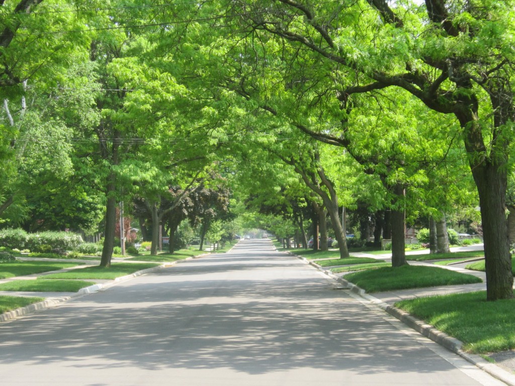 This is what most people in Burlington want; a gorgeous urban tree canopy that shades our streets, improves property values and gets some of the pollutants out of the air. But at the same time people want to be able to cut down a tree on their propeerty if they don’t like them. We can’t have it both ways – can we?  It was a beautiful tree, magnificent, resplendent – but it was cut down allow for the construction of a retirement home. The analysis in two years will conclude there is no justification for a private tree bylaw city wide.
Council needs to revise the pilot program immediately.
Jim Feilders has been a strong environmental advoate for decades and thinks the city has got the pilot private tree wrong,
 By Pepper Parr By Pepper Parr
February 4th, 2019
BURLINGTON, ON
The Mayor’s State of the city address last week before the Chamber of Commerce was a first for Marianne Meed Ward. She will get to do this three more times before she has to go before the electorate who will decide if she has heard what the city wants and has made measurable strides in getting there.
She spoke at length last Wednesday, she did not get a standing ovation and there were a few issues – climate change and the private tree bylaw – that got a clap or two from a tree hugger or a “this is a hill to die on “ environmentalist.
She was a little off her pace on a very few occasions – but at the end of the session when people were getting their coats and preparing to step out into some very cold weather there were a number, a rather significant number of people who were lined up to say a few words to the new Mayor and hang around to have pictures taken.
The Gazette has published State of the City address for the past eight years they aren’t the kind of thing that people dig out of the archives. We publish them for the record.
The Meed Ward address had a lot of information that has to be teased out and looked at in a larger context. The Gazette will be doing a series of articles in the next few weeks drilling down into what she had to say and suggesting as well as we can what we might expect from our Mayor.
 Mayor Meed Ward chatting with one of the people who attended her State of the City address.We have been watching Meed Ward for more than ten years; we sat in on several of her early campaign meetings when she first ran for the ward 2 seat in 2010.The issue that will overshadow all the others is the Region’s decision to return the Official Plan. Here is what Meed Ward had to say on that: “As a result, I am bringing forward a motion to re-examine the policies of the Official Plan that was adopted, though not officially approved, in April of 2018, and review matters of height and density. Halton Region has also recently identified areas of non-conformity, so this motion seeks to gain the time to address those issues.
“Once the Region identified areas of non-conformity, that stopped the clock on approving the new Official Plan and opened the plan up for any other matters of discussion. This allows our new City Council the time to define what areas we want to study, undertake that work, consult with the community, and send back a comprehensive plan. We expect that plan to truly reflect the needs, best interests and vision of the community and its elected Council.
“The motion will also provide absolute clarity to staff and to the community that the City of Burlington staff are not to use the adopted 2018 plan in evaluating current/new development applications and the existing Official Plan is still in full legal force and effect. Multiple analyses by staff in assessing development applications, downtown in particular, have made it clear we do not need to over-intensify in order to meet our obligations under the Province’s Places To Grow legislation.
“Further, we will immediately discontinue use of the “Grow Bold” term and related branding to ensure we are absolutely clear on our direction.”
There are some critically important phrases:
this motion seeks to gain the time to address those issues.
 She is focused on putting her mark on city hall. stopped the clock on approving the new Official Plan and opened the plan up for any other matters of discussion.
The motion will also provide absolute clarity to staff and to the community that the City of Burlington staff are not to use the adopted 2018 plan in evaluating current/new development applications and the existing Official Plan is still in full legal force and effect.
Meed Ward knows exactly where she wants to go and has a council with five new members that has yet to find its footing – they will follow her lead – it is what they based their individual election platforms on.
 Deputy city manager Mary Lou Tanner. The really strong differences of opinion between the Mayor and the Deputy city manager are so wide and have been that way for a long time – one of them has to go – not much guesswork on who will be clearing out a desk before the end of the year.
The Planning department is going to have to come into line very soon with the thinking that is taking place at council.
Roman Martiuk, failed to advise council that there was going to be a $9 million budget surplus in 2011 – that cost him his job.
Martiuk used to tell council he was there to “serve the will of council”. Interim city manager Tim Commisso is going to have to determine just what the will of council is and then ensure that the departments fall into line.
 Director of Finance Joan Ford There are several departments that have been doing a fine job for some time: Finance, Capital Works and Information Technology are worthy of bonuses. Planning is a mess; Transportation is so far behind in several of its critical reports that are holding up a number of other initiatives.
The world of municipal administration has to be in tune with the political changes that take place in a community. There are some at city hall who appear to have tin ears and don’t understand the change that took place last October when the ballots were cast or they don’t care and will continue to do what they have been doing since those ballots were marked.
Meed Ward has made it abundantly clear – the times have changed – get with the plan.
There are some very smart and dedicated people in the Planning department. For about a dozen their career paths have been inhibited by the organizational mess and the leadership failure within the department; the place isn’t the planning mecca it could be.
 Let’s look at this again in a year and see if there have been any real changes. Let’s look at this again in a year and see if there have been any real changes.
Right about now one can ask: Where is the Work Force Plan that Tim Commisso will have to put before city council at some point in the near future. What we learn tends to come out of the Mayor’s office.
Salt with Pepper are the views, opinions and reflections of the Gazette Publisher
By Staff
January 31st, 2019
BURLINGTON, ON
The construction of the second tower on Brock Street is going to mean a detour for Burlington Transit route 300 from Feb. 4, 2019 to June 2019
 The second Molinaro tower (shown in white) in the area fits in well and adds to the need for accommodation. The detour is on Ontario St. between Maple Ave. and Nelson Ave. Construction will begin on the second Molinaro tower in the area. The site is minutes away from Spencer Smith Park.
Detour Dates: February 4, 2019 to June 2019
Route: 3
Proceed to stops:
• On Maple Ave.
• Ontario St. east of Nelson Ave.
Stops not in Service:
• 765 – Ontario St. at Maple Ave.
• 766 – Ontario St. at Brock Ave.
• 775 – Ontario St. at Nelson Ave.

By Pepper Parr
January 28th, 2019
BURLINGTON, ON
City Council meets this evening to put the official stamp to issues that were discussed at the Standing committee level earlier in the month.
We will learn who Council wants to see appointed to the numerous Advisory Committees the city has in place. There were a number of people who thought the way Advisory Councils were formed, staffed and funded needed a full re-appraisal – won’t happen this year; perhaps next.
There is a new committee that is taking a look at the way the city is going to structure the matter of Development Charges – that is the sum of money developers pay – up front- for the cost of building new or adding to existing infrastructure. A major major concern to the development community.
 Mayor Marianne Meed Ward  Councillor Paul Sharman Mayor Meed Ward and Councillor Sharman will head up the Development Charges Consultation Committee.
Later in the week they move into some heavy duty budget discussions and begin to suss out what the final tax rate is going to be.
Burlington has borne the brunt of close to consistent 4% increases for the past eight years – numbers like that are neither economically or politically sustainable – where the cuts are going to take place is an unknown at this point.
This council did ask the Finance department to tell them what would have to go if there were a 2%, 3 % and a 3.25% tax increase. There is a link to the answer staff gave at the bottom of this article.
The Finance people set out a number of scenarios but none of them made mention of significant cuts in the staff compliment.
In 2017 the city spent $106,729,690 on Human Resources
In 2018 the budget for Human Resources was $115,341,659 and the actual $112,655,298
The budget for 2019 is pegged at $120,828,358 – that is an increase of $14 million over a two year period which looks a little steep.
During one of the recent Council Workshops Angelo Bentivegna, Ward 6 City and Regional Councillor coined a phrase that we can expect to hear frequently. He wants council to come up with ways to re-think, re-tool, and re-invent how we do business.
The Gazette tried to get Bentivegna to expand on this line of thinking – the Council member suddenly went mute. We are going to have to listen closely to what the Council member has to say in public if we are to get the full measure of the man.
It is fairly clear that this council wants to pass a budget that results in a lower tax rate. The problem is that other than the Mayor and Paul Sharman, Councillor for Ward 5, none has any experience with a municipal budget.
 Councillor Lisa Kearns Chair of the Budget Committee, ward 2 Councillor Lisa Kearns is doing fine so far keeping things on track and moving the agenda forward. If she stays on her current trajectory she will turn out to be a very efficient and knowledgeable budget chair. There is just a lot to learn and her background with things municipal is thin.
When Councillor Sharman was first elected in 2010 he took to financial matters like a bull in a china shop – while he didn’t make any friends he did push his colleagues to produce a 0% increase that year.
Will he do something similar this year? Don’t bet on it.
Sharman will be supportive but don’t expect him to lead – that doesn’t fit in with his longer term objective. Recall that when Sharman first filed nomination papers with the City Clerk in 2010 it was for the Office of Mayor. He withdrew those papers when Rick Goldring filed papers for that job and came back with nominations forms for the ward 5 seat that Goldring was about to vacate.
Rick Goldring once said that Paul Sharman was one of the best strategic thinkers he had ever met. Don’t expect Sharman to put that reference on his Linked in page but keep it in mind as we watch how this new council evolves.
Related news stories:
Budget – the big picture.
Where can council cut spending? Here, here and here.
 Statement by Mayor Marianne Meed Ward Statement by Mayor Marianne Meed Ward
January 25th, 2019
BURLINGTON, ON
Well that didn’t take long.
Tom Muir made some scathing comments about a development meeting that took place earlier in the month.
That was followed by an opinion piece by three Aldershot residents who asked the city to clarify just what the city was using in the way of an Official Plan.
Mayor Meed Ward issued a statement this morning making it very clear what she had in mind. The Grow Bold tag line the Planning department had fallen in love with was out – and council will be looking at the “approved” Official Plan that the Regional government returned as deficient.
Here is what Her Worship had to say:
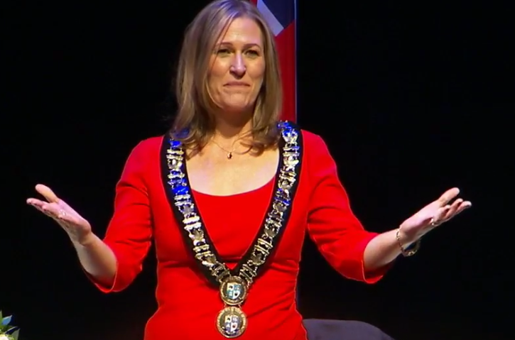 Mayor Marianne Meed Ward moments after being sworn in. “Burlington residents have consistently raised concerns about over intensification and development in our City. During the 2018 election, they made their voices heard and clearly indicated the need to review the scale and intensity of planned development, especially in the new Official Plan.
“As a result, I am bringing forward a motion to re-examine the policies of the Official Plan that was adopted, though not officially approved, in April of 2018, and review matters of height and density.
“Halton Region has also recently identified areas of non-conformity, so this motion seeks to gain the time to address those issues.
“Once the Region identified areas of non-conformity, that stopped the clock on approving the new Official Plan and opened the plan up for any other matters of discussion. This allows our new city council the time to define what areas we want to study, undertake that work, consult with the community, and send back a comprehensive plan. We expect that plan to truly reflect the needs, best interests and vision of the community and its elected council.
“The motion will also provide absolute clarity to staff and to the community that the City of Burlington staff are not to use the adopted 2018 plan in evaluating current/new development applications and that the existing Official Plan is still in full legal force and effect. Multiple analyses by staff in assessing development applications, downtown in particular, have made it clear we do not need to overintensify in order to meet our obligations under the Places To Grow legislation.
 “Further, we will immediately discontinue use of the “Grow Bold” term and related branding to ensure we “Further, we will immediately discontinue use of the “Grow Bold” term and related branding to ensure we
are absolutely clear on our direction.
“A timeline will be discussed at the next committee meeting.”
What we are seeing is a Mayor with her hands firmly hold the tiller on the ship of state.
The then Director of Planning for the city, Mary Lou Tanner, told city council that after polling people in the city they had decided to go with the tag line: Grow Bold, Grow Smart, Grow Beautiful. The words got placed on the door to the space on Locust Street that was rented for the Planning staff to work out of.
With the tag line gone – are the people that created it far behind?
|
|


