By Pepper Parr By Pepper Parr
October 21st, 2017
BURLINGTON, ON
The city’s Planning department have said in a report to city council that they can live with a 23 storey tower across the street from city hall
They want something in the way of Section 37 benefits and they will require the developer to sign a Residential Development Agreement.
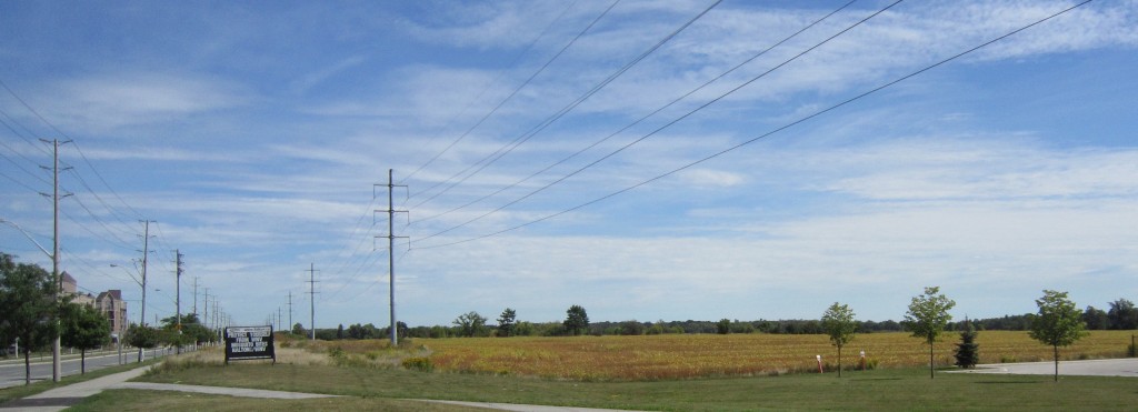
 The Planners are recommending a mixed use development consisting of a 23 storey building with a maximum of 169 residential apartment units, a minimum of 365 square metres of office space and 900 square metres of commercial retail space which will rise at the corner of Brant Street and James Street. The Planners are recommending a mixed use development consisting of a 23 storey building with a maximum of 169 residential apartment units, a minimum of 365 square metres of office space and 900 square metres of commercial retail space which will rise at the corner of Brant Street and James Street.
The city’s Sustainable Development Advisory Committee is onside. In their report to city council they say: “We support the general concept of this building design if the New Official Plan determines this is where Tall Buildings should be built in the future.”
The report is more than 70 pages long and has six appendices – it will take more time than we have today to get through it all and then report.
The recommendation will be debated at a Planning and Development Standing Committee meeting November 1st.
The direction development in the downtown core will be determined by how city council votes on this application.
Where does the public sand? In the appendices there are a number of comments that range from:
The Growth Plan has been around since 2006. This is bigger than one lady in “the Pink Palace”. There has always been an understanding that that each municipality should accommodate its fair share of growth. I find it astonishing that people continue to refuse to face this reality. Burlington is going to grow. Ratcheting up the rhetoric does not help the situation and does nothing but lead politicians to suggest that they support down zoning. And where do they want this down zoning? In the core of the City! The downtown. The “Urban Growth Centre”!
Like it or not, Burlington is going to grow – ESPECIALLY in the downtown.
to
My wife has just handed me a flyer regarding a proposed 27 storey mixed use building in our downtown core. I also see that there was a meeting and comments due by the 7th of this month.
If the City has lost their minds and approved this project I would like to know who specifically is responsible for allowing this to go ahead. Hopefully the Burlington residents have been respected.

By Pepper Parr
October 19th, 2017
BURLINGTON, ON
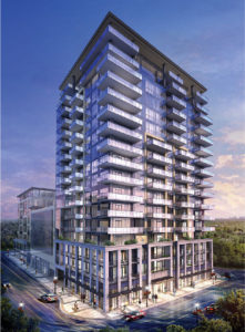
The serious discussion about just what is going to get built along Brant Street will begin on November 1st when a city council standing committee debates the Planning staff recommendation for the 421 Brant Street application for Official Plan and Zoning By-law amendment to permit a 27- storey mixed use building with retail, office and residential units (including 1-storey rooftop amenity area) in a structure that will be right across the street from city hall.
Planners will put their modified recommendation before city council debate on November 1st. The proposal is for 179 residential units; 870 square metres of office space; and 1,019 square metres of ground floor retail / commercial uses fronting onto Brant Street and James Street. There is to be four levels of underground parking, with 183 parking spaces, accessed from John Street.
Planning department staff will be recommending modified approval of the amendments to the City’s Planning and Development Committee of Council on November 1, 2017 in the evening.
When the Carriage gate Group first took this proposal to the public they brought in number of consultants who set out what was about to happen to Burlington in terms of the way development was going to roll out.
The need to intensify the way land was used was now at the top of the agenda. The province requires the city to grow its population.
Where are those thousands of people going to live? Burlington doesn’t have a lot of land that the traditional bungalow can be built on – and it didn’t appear to have all that much interest in the number of monster houses that were being built on small properties.
If you can’t go out – then you go up – which means high rise buildings.
There are those who define high rise as eight to maybe 12 storeys. The cost of land doesn’t make a 12 storey building economically feasible.
The question then is – how high will the new buildings be and where will they be located?
Robert Glover, one of the smarter urban designers in the province, explained to the audience when the development was first taken to the public that Brant Street should be seen as the spine of the city.
 Robert Glover Glover put a large graphic on the screen that showed just where the high rises in the downtown core were located – there were few that were actually on Brant Street – and Glover, who has worked as a planner for both the public and the private sector, was suggesting that some thinking needed to be done about where high rise buildings should be located.
Glover is well aware that Burlington is not Toronto and he thinks that Burlington has a charm of its own that can and should be developed. Cities need a structure – a backbone that keeps the city together.
“The backbone gives a body structure, strength – something that other parts of the city can be linked to, said Glover.
He added: “A spine gives a city a focus – a center and if done properly development can be staged so that the street that serves as the spine does not become a canyon.”
 Robert Glover argues that Brant Street should be seen as the city’s spine. The bulk of the tall buildings are t the east and west of Brant. There are applications for at least half a dozen buildings that will reach well above the 20 storey height that seems to be what the planners favour. His view is that a 27 storey structure will not hurt or harm the city hall – a high rise, if done properly will enhance the city hall – “place buildings around it that feature city hall and the Civic Square”.
Glover realizes that making that happen is what the delicate art of planning is all about – it needs to be thoroughly thought through – “they just don’t plop a building into a space because a developer has assembled a number of properties”.
Members of council are making decisions now that will impact the city for the next two to three decades – there is just the one chance to get it right.
What does work on Brant street now? Not much actually. The Burlington Downtown Business Association continually talk about the “vibrancy” of the street – they seem to feel that if you continually call an area “vibrant” it will become vibrant. It doesn’t work that way.
 City hall can’t hold all the staff on the payroll – several departments are in the Simms building across the street. City Hall itself is no longer an efficient building and doesn’t meet the city’s space requirements – a significant amount of space is rented in the Sims building across the street from city hall.
The city’s Tall Building Design Guidelines put in place in January after a rather rushed process with very little in the way of public input.
The Bridgewater development, on Lakeshore at the bottom of Martha, is rising several feet each day. The Berkeley on John Street is doing the same thing. That kind of development attracts other developments and before you know it you have a city with a significantly different look and feel. Change of that kind isn’t something the public takes to easily.
If Glover is right, and his success with previous projects suggest he knows what he is talking about, there is an opportunity to bring some real vibrancy to Brant street.
 Interestingly – the Planning department hasn’t had all that much to say on what they think Brant could become. Interestingly – the Planning department hasn’t had all that much to say on what they think Brant could become.
Their response to the 421 Brant Street development will give the public a first look at what the planners think should be permitted in terms of height.
That is the question city council has to ask: How high and where?
We are about to find out.
By Pepper Parr
October 17, 2017
BURLINGTON, ON
 The owners of Elizabeth Interiors, on he left,are reported to have an offer from a developer – and Kelly’s on the right is also closing. One of those usually reliable sources tells us that the Elizabeth Interiors retail location on Brant Street opposite city hall has an offer for the property that is to close on November 7th.
Our source was not able to say if it is a firm offer or just an option. The firm said to be prepared to put real money on the table is Reserve Properties, a very active residential developer who has been active in the Beach part of Toronto.
421 Brant – opposite city hall is waiting for the Planning department report that will go to city council with a recommendation. Burlington’s Planning department is in the process of going through an application for both Official Plan amendments and a zoning change to put up a 26 story mixed use high-rise currently known as 421 Brant – just across John Street from Elizabeth’s.
The furniture operation moved out of the space a number of months ago and is now located on Fairview east of Guelph Line.
There probably isn’t a piece of property on Brant Street that doesn’t have a developer looking over what the possibilities are.
Let’s see what happens on the 7th of November.
In the meantime city council is getting ready to receive the first of the Grow Bold Mobility Hub recommendations – the first will be the Downtown Mobility hub – the boundaries of the hub include both properties.
And Kelly’s Cup Cake location is said to be closing – that property is also reported to have been sold.
And, let’s not forget the Elgin Promenade that is being built at the south end of the Cup Cake shop.
Downtown is going to become a construction site.
By Pepper Parr
October 12th, 2017
BURLINGTON, ON
Two men, both from Aldershot, delegated at city council earlier this week – both had similar comments and both had problems getting their material into the record – no one knew what happened.
 Greg Woodruff, who ran for Chair of the Region in the 2014 election, had comments to make about the development planned for 35 Plains Road. While he didn’t like the idea of an additional two floors of density being given to a site that is zoned for six storeys – that wasn’t his biggest concern, Greg Woodruff, who ran for Chair of the Region in the 2014 election, had comments to make about the development planned for 35 Plains Road. While he didn’t like the idea of an additional two floors of density being given to a site that is zoned for six storeys – that wasn’t his biggest concern,
His objections to the 35 Plains road development were that the building is not of pedestrian scale. It is important he pointed out that we not create buildings which tower over the pedestrian walkway
Woodruff pointed out that the building does not comply with employment usage. This application he said seeks to remove employment space requirement and still want the “mixed use” designation.
The building is close to a transit hub, which allows people to commute to Toronto and would also allow people to commute to employment uses in Aldershot. There are people doing that now in Burlington.
Woodruff thought that 70% was a good requirement because it would create commercial pedestrian densities if enforced. “We are far better served with creating employment usage in the area than just residential. There is no vibrancy or transit enhancement created by people commuting to Toronto and gone from the area all day. Vibrancy requires people here all day – which employment usage properly creates.
 Woodruff then added that the 35 Plains Road proposal does not comply with the Aldershot Village vision. The vision calls for sites that have large landscaping and large generally open spaces. Woodruff then added that the 35 Plains Road proposal does not comply with the Aldershot Village vision. The vision calls for sites that have large landscaping and large generally open spaces.
Woodruff wants to see a minimum amenity area maintained. Zoning minimums are required because buyers can not asses reasonable levels. Creating a large number of small inexpensive low amenity units create a building were the major selling feature is low cost. Though this looks attractive at first long term it creates problems.
The developer wants the parking spaces reduced from a required 130 to a proposed 100 and have visitor parking reduced to 17 from the required 28 spaces.
Reduction of commercial parking is a mistake. While it is generally available vendors do no keenly enforce it.
Thus a shopper can park at once place and walk the near other businesses. At this site you can see someone using it and the adjacent bank without moving their car. However if customers cannot park easily vendors will enforce it – this requires movement of cars for every trip to every store.
We all know how this has worked out at the parking space at the No Frills plaza on Brant Street.
Woodruff told council of comments made by Brent Toderian at a public meeting. Toderian is a Vancouver based consultant who has done a considerable amount of work for Burlington who was asked:
How do you make density something that communities welcome?
 The Toderian line of thought – make sure that you’re spending the value on things that make density successful. Toderian responded: “I don’t support stupid density. I sometimes have as much concern about the YIMBY [Yes In My Backyard] movement as I do about the NIMBY movement. I don’t buy an absolute not-in-my-backyard, but I also don’t buy the argument that we should get rid of our zoning codes and have at it, build as much as we can. Both of those are the extreme.
Toderian was then asked: Explain density bonusing.
Toderian: “You have a base density, but [a developer] can increase to a higher density by negotiating amenities that make that higher density more livable. The key is to make sure that you’re spending the value on things that make density successful. Doing this “… gives the community a sense that the additional density is translating into something that’s going to support quality of life. They can see a connection between the additional density and amenities their community needs, but probably won’t be able to afford.
Woodruff doesn’t think the Planning department has taken to heart the Toderian line of thought. He suggested to Council that they were paying more attention to what the developer was asking for than they were to the zoning in place and the policies that had been adopted.
 Tom Muir recognizes the difference between evidence-based policy-making, and policy-based evidence making. Tom Muir, who has been delegating to city council for more than 25 years saw the same kind of thing happening but chose different language to make his point.
“In my 45 years of policy and issues analysis I learned to recognize the difference between evidence-based policy-making, and policy-based evidence making. This looks to be the latter – decide what you want first, and then pick the evidence.
Oftentimes, sections of the Policy Framework said to be used, are selectively chosen that support the recommendation to approve. Other parts raising issues of approval are sometimes stated, but not followed up on. As a result, the viability of existing business and commercial economic development is being sacrificed by planning recommendations such as this one. What I continue to find disturbing is the continued de-commercialization of Aldershot.
Muir made it clear that both the Provincial Policy Statement and the city’s Strategic Plan point to the need for commercial uses to be planned for and increased not reduced and the needs of existing business to be accounted for, not sacrificed. “But the proposal” said Muir, “contradicts what the policy calls for. It talks about complete communities, but goes in the opposite direction
“Aldershot is losing retail to residential builds. We are told there needs to be more residents to support retail, which is not generally true except for a grocery store. However, if you get the residents, but no longer have the land supply to build retail/commercial, and a cost structure that is not competitive, you still don’t get the commercial.
What seems to be missing is any representation of the present reality, of the real businesses, with real business value, real jobs with real employees, and real customers, who are being plowed under, forced to leave and maybe drive more. This is happening at an increasing pace. Who of you speaks for these folks? The only one around this table that made sense of this is Councillor Meed Ward.
 Tom Muir: Its pie in the sky to me, promising a Mobility Hub utopia where the business dead will rise again. Muir argues that “we are told that the mobility hub plans will take us to another place with everything we want, and that we should celebrate, although here fanciful speculations are blurring proper judgement more and more, with each new proposal that comes along. Its pie in the sky to me, promising a Mobility Hub utopia where the business dead will rise again. I can hardly call this “good planning”.
Delegations are made before the meat and potatoes part of city Council meetings.
Council voted 6-1 in favour of the 35 Plains Road development that will be eight storeys in height with the first six floors being basically flush to the sidewalk – no set back and no trees.
Councillor Craven held a community annual meeting last week at which he brought his constituents up to date on the numerous developments taking place in Aldershot – the Gazette will report on that event soon.
By Pepper Parr
October 2, 2017
BURLINGTON, ON
The Burlington that many people want to stay just the same as it was thirty years ago have just a few days to enjoy an ice cream cone at Easterbrook’s on New Street.
Word from staff at the location is that the property has been sold.
 Easterbrook’s as it is today. Easterbrook’s as it is today.
Someone will be getting bold and asking the city to give them height and density the city needs.
Times they are a changing indeed.
 This is what the city planners think the Guelph Line – New Street plaza COULD look like.  This is what the Guelph Line – New Street plaza looks like today. The Guelph Line New Street location isn’t part of one of the mobility hubs but the planners have high hopes and great expectations that something van be done with the plaza on the east side of Guelph Line – adding residential to the mix of that commercial site.
By Pepper Parr
October 2nd, 2017
BURLINGTON, ON
The process a development proposal has to go through is complex – there are dozens of hoop a developer has to go through and each step is expensive.
The developer is at significant risk – they are putting their money on the line and every penny is lost if they don’t get the approvals they need.
The large 20 storey plus projects draw a lot of attention. The smaller developments raise the ire of the neighbourhood they are to be built in but they don’t get the exposure the big ones get.
The city is compelled to grow its population. The province dictates the growth level and the Regional government does the fine tuning that decides how many more people are to be housed in a community or how many new jobs are to be created.
Burlington has focused on the residential development – the Economic Development Corporation does entice some new jobs to the city – but we aren’t celebrating that many new jobs.
There is a development in ward 5 that is drawing a lot of attention in that part of the city.
 The level of intensification is evident in the drawing. The developer is seeking permission to construct 22 residential dwelling units consisting of 8 semi-detached residential dwelling units and 14 townhouse units on Upper Middle Road where five properties have been assembled. These lands are hold outs from the previous subdivision development that surrounds these properties. These lands are located on the north side of Upper Middle Road, east of Appleby Line. The total area of the development is approximately 0.5 hectares (1.23 acres).
To the north of the subject properties are low density (single detached) residential dwellings; to the east are low density (single detached) residential dwellings; to the south is a high school and vacant employment lands (Bronte Meadows); and to the west is a stormwater management pond and a townhouse development. Description of Applications
There was a community meeting in May of this year –comments from that meeting appear below.
The meeting taking place at city hall tonight is a Statutory Public meeting – something the city is required to hold. It gives the public an opportunity to express their views on the suitability of the project.
The report will be received and filed and then be brought before the Planning and Development Committee on October 10th where the real debate takes place. Then it goes to city council where a final decision is made.
The purpose of the report that will be presented Monday night is to provide background information for the statutory public meeting required under the Planning Act for Zoning By-law amendment applications.
The report provides an overview of the proposed application, an outline of the applicable policies and regulations and a summary of technical and public comments received to date.
 The report sets out the start of the “ticking off” of the boxes. The report sets out the start of the “ticking off” of the boxes.
The report relates to the following objectives of the City of Burlington Strategic Plan:
A City that Grows
Targeted Intensification
Higher densities in key intensification areas (including mobility hubs, downtown, uptown and along major roads and commercial plazas) that will build neighbourhoods that are environmentally friendly, infrastructure-efficient, walkable, bikeable and transit-oriented.
Focused and Directed Population Growth
A City that Moves
Increased Transportation Flows and Connectivity
A Healthy and Greener City
Healthy Lifestyles; every resident of Burlington lives within a 15-20 minute walk from parks or green spaces.
All these are set out in the Strategic Plan the city spent more than a year creating and putting in place. That Plan is a hoop that has to be gotten around if not over.
The application got to the Planning and Building Department on May 4, 2017 to permit 22 residential dwelling units consisting of 8 semi-detached residential dwelling units and 14 townhouse units. The townhouse block includes three separate buildings ranging from four to six units.
The semi-detached dwellings are proposed to be freehold units fronting directly onto an extension of Georgina Court. The townhouse units are proposed to be condominium units that would front onto an internal condominium road that would be accessed from the Georgina Court extension. The townhouse condominium is proposed to include five visitor parking spaces. The townhouse blocks will have access from the proposed internal lane; however, the southern blocks would have frontage and pedestrian access directly to Upper Middle Road.
Technical Reports
Another set of hoops that had to be gotten through included a Cover Letter, Zoning By-law Amendment Application, a Conceptual Site Plan Layout, a Planning Justification Report, an Urban Design Brief, a Building Height Certification, a Noise Impact Assessment, a Traffic Brief & Parking Study, a Functional Servicing & Stormwater Management Report, an Environmental Site Screening Questionnaire; a Land Use Compatibility Assessment, a Phase 1 Environmental Site Assessment, and a Tree Inventory and Preservation Study.
The application along with these materials have been circulated to various departments and agencies for technical review.
The next set of boxes that are going to have to be ticked off are various policy framework documents. The proposed Zoning By-law amendment application is subject to the following policy framework:
The Provincial Policy Statement (PPS), 2014;
Places to Grow, Growth Plan for the Greater Golden Horseshoe, 2017;
Halton Region Official Plan;
City of Burlington Official Plan, Orchard Community Secondary Plan
City of Burlington Zoning By- law 2020.
 Provincial policy determines what a municipality can and must do. The subject lands are designated in the zoning bylaw as Residential – Medium Density.
According to the Residential Areas policies, residential areas are intended to provide housing and other land uses that are part of a residential environment, and may take forms ranging from detached homes to high-rise apartment structures.
One of the objectives of the Residential designation is to encourage new residential development and residential intensification within the Urban Planning Area in accordance with Provincial growth management objectives, while recognizing that the amount and form of intensification must be balanced with other planning considerations, such as infrastructure capacity, compatibility, integration with existing residential neighbourhoods, and protection of the natural environment.
 This is what most of the Orchard community is today. Another objective of this designation is to provide housing opportunities that encourage usage of public transit, pedestrian and bicycle transportation networks and decrease dependence on the car. The designation also encourages the integration of a wide range of housing types and tenure, while requiring new residential development to be compatible with surrounding properties.
 OLYMPUS DIGITAL CAMERA Medium Density designation, either ground or non- ground-oriented housing units with a density ranging between 26 and 50 units per new hectare shall be permitted. Within the Orchard Community, there are site specific policies which permit the following housing forms within the Residential – Medium Density designations: townhouses; street townhouses and stacked townhouses; semi- detached, duplexes, three-plexes and four-plexes. This designation also permits detached dwelling units up to a maximum of 15 percent of the total housing mix on each property.
Draft New Official Plan
The city has been working on a new Official Plan that was presented as a Draft document on April 6, 2017. The document communicates Council’s vision and establishes strategic priorities for the City’s growth management, land use and infrastructure.
 The draft new Official Plan designates the subject lands as Residential Neighbourhood Areas, and more specifically Residential – Medium Density. The Residential Neighbourhood Areas are intended to provide for housing and other residential supportive land uses that are part of an urban residential environment. New residential housing within the Residential Neighbourhood Areas shall be accommodated primarily through infill or intensification, of existing areas, where compatible. The draft new Official Plan designates the subject lands as Residential Neighbourhood Areas, and more specifically Residential – Medium Density. The Residential Neighbourhood Areas are intended to provide for housing and other residential supportive land uses that are part of an urban residential environment. New residential housing within the Residential Neighbourhood Areas shall be accommodated primarily through infill or intensification, of existing areas, where compatible.
On lands designated Residential – Medium Density, ground and non-ground oriented dwellings including single-detached and semi-detached dwellings, townhouses, street townhouses, stacked townhouses, back-to-back townhouses and low-rise residential buildings may be permitted. Lands within this designation shall be permitted at a density of 26 to 75 units per net hectare,( it was 26 and 50 in the current Official Plan) with a maximum height of three storeys for ground- oriented dwellings and four storeys for non-ground oriented dwellings.
Draft new Official Plan policies were brought to the public and Council for consultation over the spring and summer of 2017. The draft new Official Plan is scheduled to be presented to the Planning and Development Committee and Council in the fall of 2017 for adoption.
Orchard Community Secondary Plan
The Orchard Community Secondary Plan final report, dated February 1995, identified three key elements of the community structure as the transit corridors, residential neighbourhoods and a connected open space system. At the time, the Orchard Community was expected to develop at generally higher densities than those found throughout the existing suburban areas of Burlington.
 The subject lands are located in the southern portion of the Orchard Community and were identified as Residential – Medium Density. In Medium Density Residential areas, either ground or non-ground oriented housing units with a density between 26 and 50 units per hectare shall be permitted. This designation permits housing forms such as street, block and stacked townhouses, semi-detached, duplexes, three-plexes and four- plexes. The designation also permits detached dwelling units up to a maximum of 15 percent of the total housing mix on each property. The subject lands are located in the southern portion of the Orchard Community and were identified as Residential – Medium Density. In Medium Density Residential areas, either ground or non-ground oriented housing units with a density between 26 and 50 units per hectare shall be permitted. This designation permits housing forms such as street, block and stacked townhouses, semi-detached, duplexes, three-plexes and four- plexes. The designation also permits detached dwelling units up to a maximum of 15 percent of the total housing mix on each property.
City of Burlington Zoning By-law 2020
5219 Upper Middle Road is currently zoned ‘Development (D)’, while the remaining properties subject to this application are zoned ‘Medium Density Residential (RM3-138)’ with a site specific provision. The ‘D’ zone only permits a single detached dwelling. The ‘RM3’ zone permits a variety of dwelling types from a detached dwelling to an apartment building, as well as a retirement home or community institutional use. The site specific provision applying to the vacant parcels (138) sets out zoning regulations for detached dwellings, semi- detached dwellings and street townhouse dwellings, and limits a maximum of 15% of the total of all dwelling units located within all lots and blocks zoned ‘RM3-138’ to be detached units.
The applicants are proposing to amend the Zoning By-law by changing the zoning of the subject properties from ‘D’ and ‘RM3-138’ to a site specific ‘Orchard Community Residential to permit the proposed semi-detached and townhouse development.
Technical Review
On May 5, 2017, staff circulated a request for comments to internal and external agencies, including Halton Region. Agency comments will be addressed in the subsequent recommendation report.
Burlington Economic Development Corporation (BEDC):
BEDC has no comments.
Halton District School Board (HDSB):
HDSB has no objection to the proposed application, as submitted.
Halton Catholic District School Board (HCDSB):
In response to the application which seeks to permit the development of 8 semi- detached and 14 residential townhouse units, the HCDSB has no objection.
Parks and Open Space:
Adequate parkland is available to accommodate this development as Brada Woods Park and Orchard Woodlot are located within the 0.8km distance for a neighborhood park and the 2.4km distance for a community park. As such we recommend cash-in-lieu of parkland dedication be applied for this development.
We note a driveway in the east side of the proposed development. This driveway is immediately adjacent to the existing service road/walkway access around the storm water pond facility. The city will not permit snow to be deposited on the storm pond lands and or trail. We would recommend a buffer between the development and the city storm water facility be incorporated to ensure there is space for snow disposition. We will also require a chain link fence be placed on the city side of the property line. Please note gate opening through the fence will not be allowed.
Site Engineering:
Prior to providing a recommendation, Site Engineering requires further information to be submitted for review.
Finance Department:
Property taxes must be paid in full, including all installments levied.
Transportation Planning:
Transportation Planning has reviewed the Transportation Brief for 5219 Upper Middle Road & 2004-2005 Georgina Crt and is satisfied with the Conclusions.
In response to feedback received at the neighbourhood meeting (May 23rd 2017) regarding the potential for a traffic signal at the intersection of Quinte Street and Upper Middle Road, Transportation Services staff conducted a traffic signal review for this location. Based on the traffic data available for this intersection (taking into account the estimated number of trips proposed to be generated by this development in the AM and PM peak hours), it was determined that a traffic signal is not warranted.
City Forestry / Landscaping:
Urban Forestry has no objection to the rezoning of this site. Additional tree planting should be provided where possible, and tree and landscape planting on site should be carefully considered within the context of the site.
Halton Region:
Regional staff has no objection to the above noted application, subject to the provision of a holding provision, until such time that as servicing and environmental matters have been addressed to the Region’s satisfaction.
All the boxes up to this point have the tick in the box.
That’s how intensification development gets done.
 The developer took this … It was done in the Queensway where six properties were turned into 58 housing units.
 … and put up this. The Burlington that once was – isn’t going to be for much longer.
Not really very much that can be done to prevent it.
By Pepper Parr
September 25, 2017
BURLINGTON, ON
Part 1 of a four part series on the city’s Grow Bold initiative.
When a developer takes an application to the Planning department there are close to a dozen different studies that have to be provide an Urban Design Brief, Noise Study, Shadow Impact Assessment, Pedestrian Wind Assessment, Transportation Impact Study, Parking Study and TDM Options, Functional Servicing Report,
Environmental Site Screening Questionnaire, Geotechnical Engineering Report, Hydrogeological Investigation Report and a Phase 1 Environmental Site Assessment
 Some developers engage a consultant to provide an opinion on the relevance of the development and how it will impact and fit into the long term plans the city has. It is not unusual for a report from a consultant to question some of the information the city has published and to offer a different analysis of the data. Some developers engage a consultant to provide an opinion on the relevance of the development and how it will impact and fit into the long term plans the city has. It is not unusual for a report from a consultant to question some of the information the city has published and to offer a different analysis of the data.
These reports are a healthy part of the city building process.
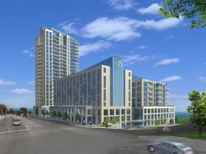
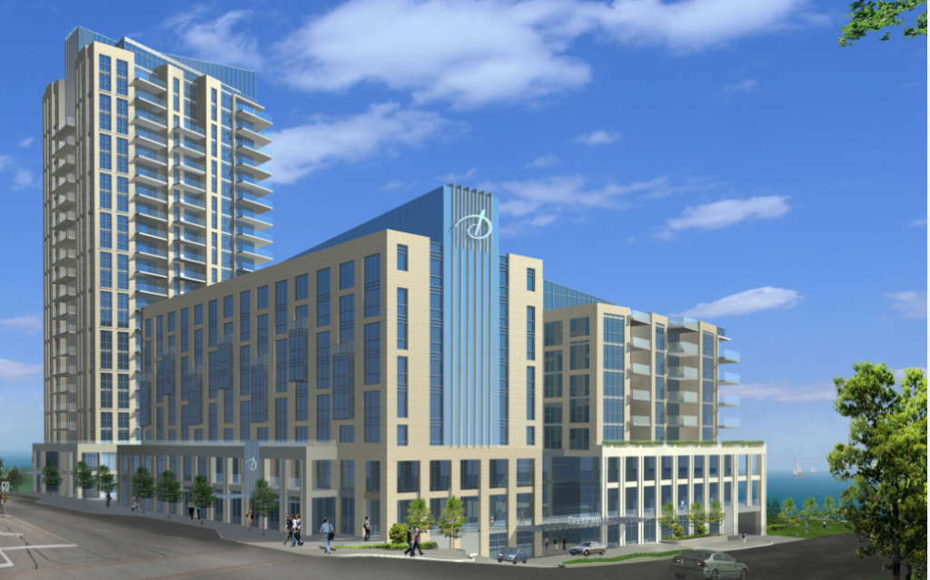
Architectural rendering of a proposed 26 storey tower across Brant Street from city hall. The Carriage Gate group has an application for a proposed 26 storey mixed use development with 179 residential condominium units, street-related retail uses and second storey office space.
At times these reports don’t get public exposure – they aren’t secret but sometimes they don’t get a solid public debate, which is unfortunate for the report that was prepared by the Altus Group, an economic consulting organization that was retained by 421 Brant Street Inc., to offer a different perspective, sets out just what they think the city is looking at with its Grow Bold initiative.
The report runs more than 60 pages and it is complex but there is some very solid evidence that we feel should be available to the public.
If you care about what happens to your city and the kind of growth it is going to go through in the next two decades read on. We set out the views expressed by the consultants with some analysis as to just what this is going to mean in a larger context.
The Altus report explains the development in relation to the various pieces of provincial and municipal planning policies applicable to Burlington.
The intensification Burlington is going through is determined first by the province that determines where future growth should go and then assign a population number to each part of the province.
The Halton Region Official Plan allocates 8,086 new units to be achieved in the built-up area of Burlington over the 2017 to 2031 period.
According to Altus, on an annual basis, the target is 33% higher than the amount of intensification achieved in Burlington over the 2006 to 2016 period.
They add that the scale of the high density building proposed for 421 Brant Street is modest relative to the Halton Region target.
Then they add this astonishing statement:
At least 45 new buildings of similar scale would be needed within the built-up area of Burlington over the 2017 to 2031 period to achieve the 8,086 new units required under the Halton Region Official Plan.
That is an astounding statement that doesn’t seem to have seeped into the public debate even though every member of Council was given a copy of the report. The Planning department has copies and they aren’t likely to ignore a report from a firm with the enviable Altus Group reputation.
 The city has broken the downtown core into precincts and set height levels for each. These have yet to be approved by city council. Provincial and municipal planning policies require that a significant share of Burlington’s population growth and residential intensification occur in the Downtown Burlington urban growth centre. Those same policies require that the Downtown urban growth centre achieve a minimum density target of at least 200 residents and or jobs per hectare by 2031 or earlier.
The 2017 Growth Plan allocates 220,000 more residents to Halton Region by 2041, over and above the 780,000 residents provided for in the current Halton Region Official Plan. The minimum intensification targets in the 2017 Growth Plan are substantially higher than the minimum intensification targets in the Halton Region Official Plan.
Over the period leading up to the next Regional municipal comprehensive review, optimizing the use of land in locations that offer convenient access to jobs, stores and services, transportation options and public service facilities will help set the stage for the accommodation of the additional amounts of intensification required under the 2017 Growth Plan.
The residential component of the 421 Brant development is to include:
• 34 one bedroom units;
• 108 two bedroom units; and
• 37 three bedroom units.
The Altus report examines the economic and housing implications of the proposed development in the context of provincial and municipal planning policies. They don’t make a recommendation – they just lay out the facts as they read them and point out the implications.
By Pepper Parr
September 15th, 2017
BURLINGTON, ON
Revised
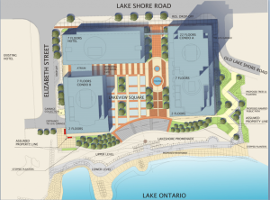
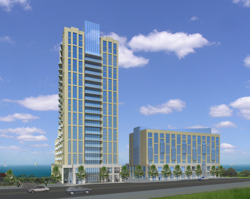
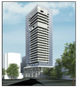
There is word that the recommended re-development of the Waterfront Hotel property will allow two towers with maximum heights of 17 and 25 storeys.
 The 8 storey Mariott Hotel is on the left side of this picture. The Waterfront Hotel parking lot is to the right (west) and then the Waterfront Hotel. The plans have been to demolish the existing building and put up two towers. Heights of 17 and 25 storeys are reported to have been recommended. We have yet to get conformation – our information is from a usually reliable source who however has a vested interest in what gets permitted in the downtown core.
 Three structure project has been the “in the works” since 1995 when developers were given the right to build a 22 storey plus building on the property where the Riviera Waterfront Motel used to exist.  An aerial rendering of the Bridgewater project. The Bridgewater development to the east of the Waterfront Hotel is going to top out at 22 storeys – something that was approved in 1995 – assembly of that land had begun in 1985
 The site would be completely redeveloped with two towers – 0ne 17 storey and a second 25. Not much more than a recommendation at this point. The city’s Planning department has been holding public presentations and workshops seeking public input.
City planner Mary Lou Tanner in a response to our piece on the height limits of the proposed redevelopment of the Waterfront Hotel said: “Your information is not correct. We are only part way through a process with the community. We held two public workshops and a stakeholder workshop yesterday. We received valuable feedback and commentary from over 60 community members. We have not formulated any recommendation because we need to review and incorporate the feedback into the analysis. To repeat we have not formulated any recommendation.
Tanner adds that the “Waterfront Hotel site is a complex public planning process. I strongly believe we must respect the process and the members of the public who give their time and views. That includes providing accurate information as to where we are and what has been decided.
We are only part way through this process and no recommendations have been formulated. I was so pleased with the feedback last night and the many comments we received. We must be partners with the community in an honest process.
By Pepper Parr
September 13th, 2017
BURLINGTON, ON
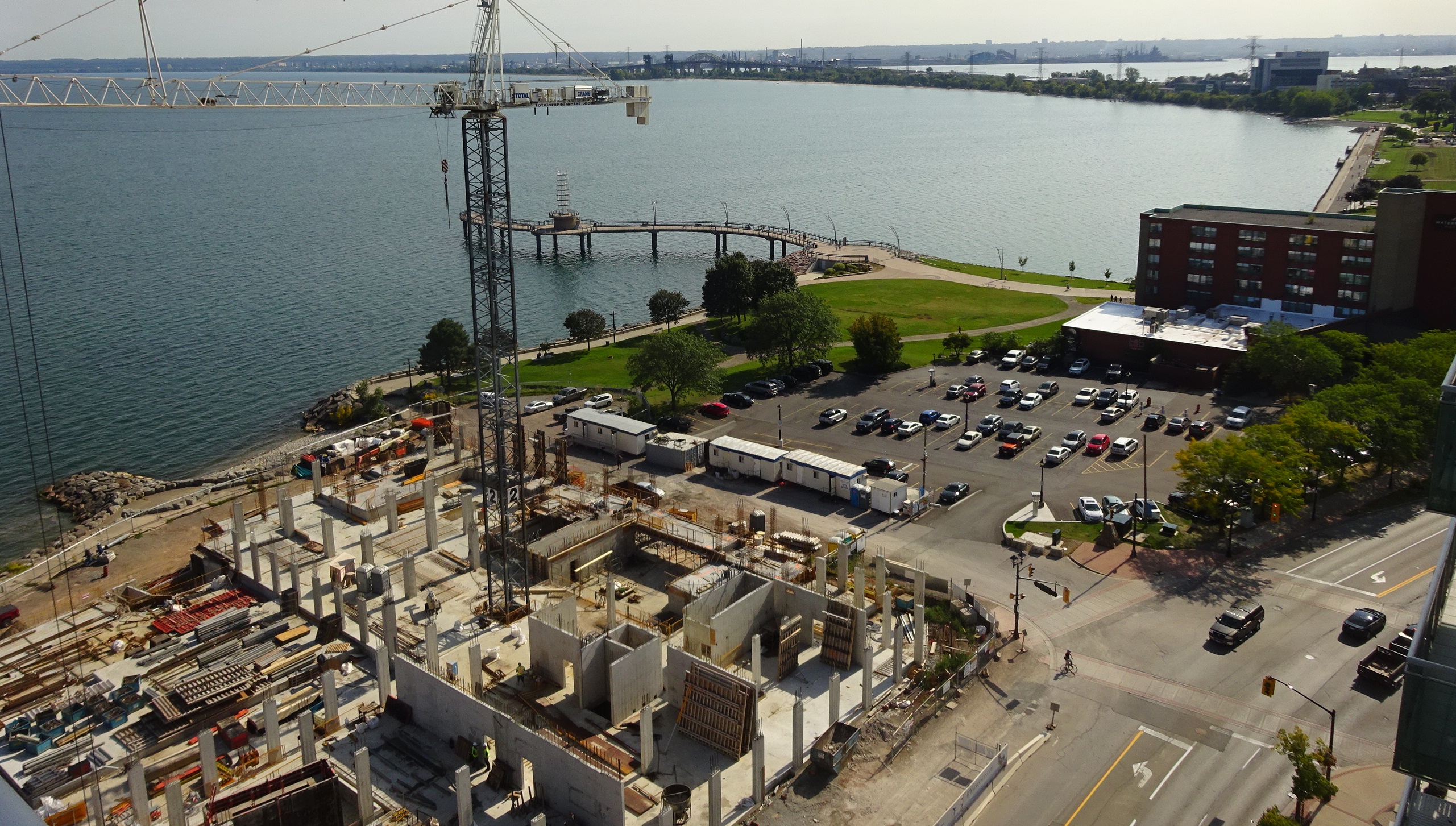
While the citizens of the city are asked to sit in on public sessions to discuss how we are going to Grow Bold and where all the high rise condominiums and apartment buildings are going to be located – the cranes towering above the city swing in back and forth and up and down with huge buckets of concrete as the development projects underway rise floor by floor.
 The Bridgewater as it will look from Lakeshore Road. That space on the left is not what the final view will look like. The Bridgewater on Lakeshore Road is now well above grade, the Paradigm on Fairview has three of the five towers on that development well underway – with sales reported to be very brisk.
The Berkeley on John Street is also well above grade.
The Molinaro project on Brock Street is getting ready for public review and the Carriage Gate project that is to be built opposite city hall is waiting for whatever the recommendation from the Planning department is going to be.
There are another couple of dozen projects that are in various stages of development; one a three tower structure on Brant Street at the Ghent intersection.
While all this happens the school board heads toward the actual closing of two of the city’s seven high schools and the city works at deciding when they should be pumping more money into transit.
The project that is going to have a significant impact on how people enjoy the waterfront is Bridgewater. The three structures are going to change how the way Lakeshore Road works and how people get to enjoy some of the eastern part of the downtown core waterfront.
The space between the 22 storey condominium and the eight storey hotel is going to be all people will be able to see from Lakeshore Road.
The opening between the two buildings is a bit bigger than we expected – but it isn’t wide open.
The public will be able to walk from Lakeshore Road through what is going to have to be well graded land. The original plans call for a reflecting pool in the middle.
Add to all this the development thinking being done on what will happen to the existing Waterfront Hotel and the plans the owner has to develop that property by demolishing the current structure and putting up a building that will be in the 20 storey plus hotel and a possible two other structures.
All this is putting some oomph behind that Grow Bold phrase.
Aerial view of the hotel part of the Bridgewater project that will be on the corner of Lakeshore Road and Elizabeth and the Waterfront Hotel property to the west.  Bridgewater project from what will become the bottom of Elizabeth Street overlooking the lake.  The existing Waterfront Hotel wants to redevelop their property and put a much taller building on the site and add an additional stricture. There are issues to be worked out regarding the land south of the hotel that is to a large degree made up of landfill.
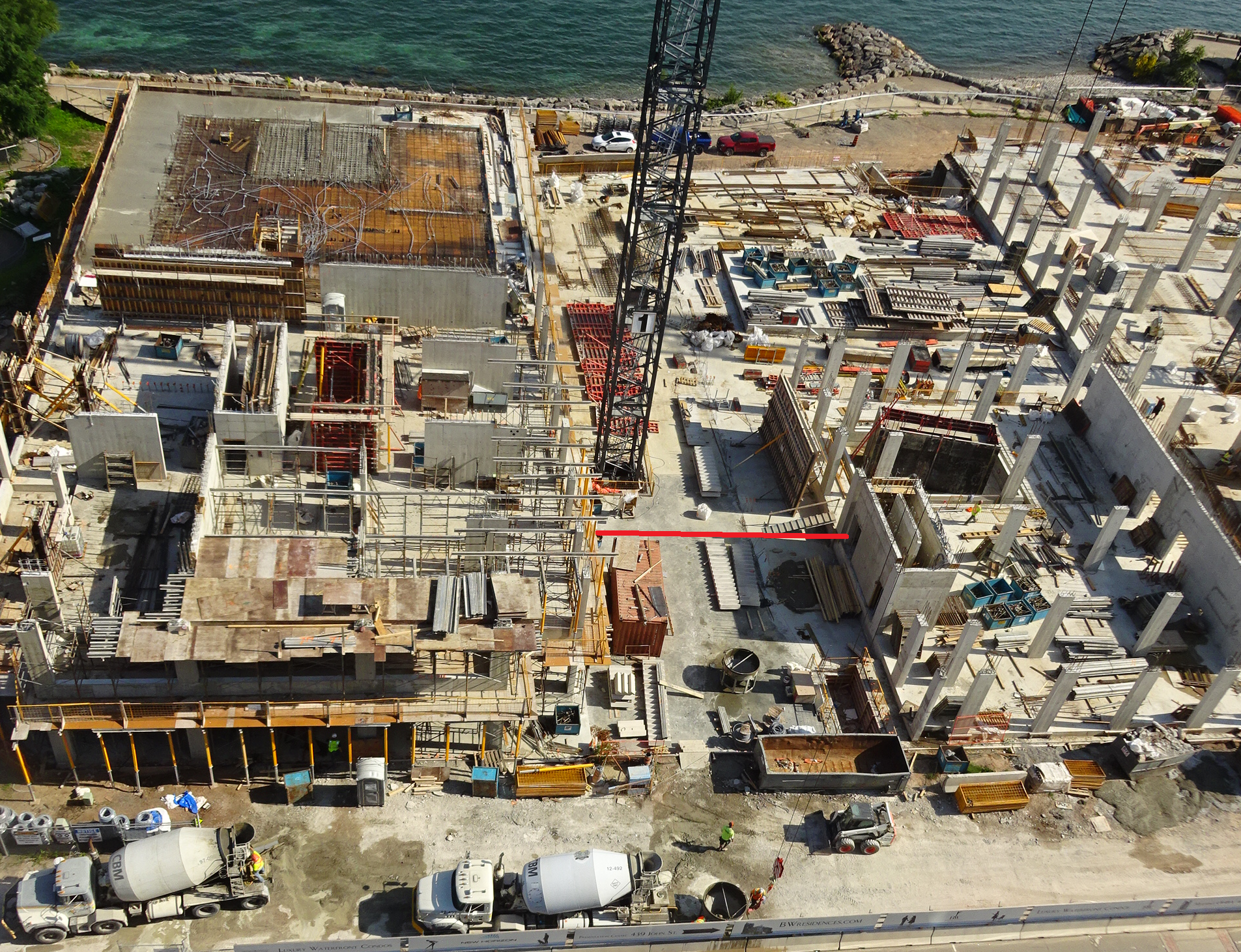
 An aerial view of the Bridgewater construction project. The red line between the buildings is the width of the opening the public will b able to walk through to get to the waterfront.
By Staff
September 8, 2017
BURLINGTON, ON
 Suzanne Mammel Executive Officer Hamilton Halton Home Builders Association Suzzane Mammel is a pretty direct woman; trained as an engineer, she was dealing in planning matters before a city council committee when she made the point that her association Hamilton Halton Home Builders, “can’t be supportive of this OP, because it doesn’t provide the information our members need to do business here.
“We applaud the efforts to have a new Official Plan that meets the needs of all parties, this isn’t it.
This was basically the theme that came through her presentation to city council – it isn’t complete – far from it and the time line in place to get it complete is far too short.
Mammel, the Executive Officer of the Hamilton-Halton Home Builders’ Association, explained that they spent considerable time reviewing the document, meeting with staff, and providing comments, both on big picture and detailed issues.
Mammel was telling city council and staff that “the OP is important to how the City grows in the future, and it’s very important to get it right.”
“We are very supportive of the City’s initiative to create a new official plan that guides how our City continues to grow in the years to come, and addresses the new realities the City is facing: growth via intensification versus the greenfield type of developments that have dominated in recent decades, and new mandated growth targets and densities imposed by the Province to meet the Growth Plan.
 The city has a lot on the go – many are asking if the Planning department has bitten off more than they can chew. “We recognize that this is a bit of a daunting task. The policies need to firstly meet these mandated targets, and those from the Regional OP, while at the same time attempting to balance the needs and desires of the City’s businesses and residents, residents like me. In a letter to this committee in June, I noted that “we believe that the title of the document “Growing Bold”, and its correlation to similar themes under the City’s strategic plan are applaudable but must be unapologetic, and guide future applicants to successfully provide economically feasible, quality developments that are in keeping with big picture City goals, and that marry the City’s vision with the growth targets mandated by higher order government.”
Our membership need a strong and solid document that directs how growth should occur.
There are many moving parts, and it is not as easy as an outsider may think. She added that the mandated time frame staff was given to bring this draft forward resulted in an OP that is incomplete.
 Burlington city manager James Ridge “One of the initial comments and concerns we raised, and the biggest concern with this draft document, was a lack of critical information: information that if absent in the OP, does not provide the level of detail required by any applicant to understand if they are in conformance with an OP. I asked for it formally and in writing of staff. I noted it in a meeting I had with the City Manager and Director of Planning in June, and I noted it in my formal submission to this committee at the end of June.
“ What population growth has been achieved to date (relative to the targets set in the Regional OP and the densities set for urban growth centers and mobility hubs in the original and updated Growth Plan), what remains to achieve these targets and where will that growth occur. We understand this information is being developed but believe the information is absolutely critical before finalizing the mobility hub Area Specific Plans or the Official Plan”
“To date this information has not been provided, nor am I aware that it is available” she said. “There has been an attempt to address it – we’ve been referred to reports done to support specific OMB appeals with respect to downtown, and anecdotally we’ve been told such things like – we’re confident we’ll reach the numbers.
A critical document – are we getting it right? This just isn’t good enough. It is critical to getting this whole thing right and therefore should be foremost in the approach to the OP and included in it in a clear and obvious way, like it is in the Official Plans of our neighbours like Hamilton and Oakville.
While there is a lot of policy and vision included in the document, what good is it if it fails to achieve the mandated growth? It begs the question: why was it not included?
This is a new and full OP, and should be the document in which this information is contained. It will be the document of reference in the future. It generally indicates that growth is to be directed firstly to the downtown – being the urban growth centre, the three remaining mobility hubs, uptown, and then corridors, and to a lesser extent, modest intensification into existing neighbourhoods. What it fails to answer is those critical questions I noted a couple minutes ago, including what portion of growth should and will be apportioned to each of these areas.
The approach of directing growth to the areas chosen is a good one. We are mandated by the Province to have a minimum level of density in the urban growth centre, and mobility hubs – it is economically appropriate to direct densities to those significant investments. But the big picture numbers to make these areas successful are not available.
How can we move forward with detailed studies, like is happening in the mobility hubs, without knowing if those concepts are achieving the required minimum targets we are expected to achieve?
 Mary Lou Tanner, educated as a geographer and now the Chief of the Planning department has more on her plate that many in the development business feel can be done within the tie frames in place. She explains a point to Councillor John Taylor Which refers me back to the daunting task. Some have and will say, the City has put the cart before the horse. The process taken elects to do things concurrently, which in theory may be fine. I acknowledge that we are in a state of flux, but that is not justification for not including any substantiating detail.
But without these big picture numbers, there is no ability for an applicant to understand if they are in conformity with the OP, if decisions made by a proponent on densities proposed are appropriate, too much, or too little, or what the justification is for a decision made by the City when advising an applicant has got it wrong.
When you combine these with the provincial landscape, changes to the Planning Act that prevent an OP amendment to be submitted within two years of the date of this OP being approved, and the likelihood of changes to the OMB which would limit appeals to those decisions which lack conformity to the OP, it is even more critical that this base information be provided.
 The mobility hub concept was to be the way the Official Plan would be implemented – some developers think the city has put he cart before the horse. Detailed land use permissions are being envisioned through the Mobility Hub study – which is essentially a secondary planning process. This is appropriate. This is a finer level of detail than an OP. The draft document itself says “the Official Plan provides high level direction on land use, built form and density ranges”, which I note are not provided.
 An aerial look at the west side of the city with Hamilton Harbour in the background. However, in many instances, the document strays from this intent and as noted numerous times above, is lacking in critical information, at other times it delves into the minutiae of development issues, that are better left for such documents as a site specific zoning bylaw or a site plan guideline.
Sometimes a little dose of sarcasm is needed to make a point. Mammel pointed out that the level of detail in an OP could render an application out of conformity, and with no recourse to amend or appeal, given the current situation we are in, details such as site lighting, fencing and loading dock locations, are “I hope we can all agree, not Official Plan level issues.
The reality said Mammel is that “we can’t be supportive of this OP, because it doesn’t provide the information our members need to do business here, to understand what will be required of them.
 Andrew Smith the planner tasked with the writing of the Official Plan that is currently in draft form. The time line they have given Smith is seen as far too tight. Staff require more time to put together a fulsome document. But there seems to be a systemic problem here – the approach and timelines currently being applied to all significant changes being undertaken by the Planning Dept. It is frankly too rushed.
We have respectfully asked for details, rationale, and justification through many of these processes, including the Official Plan. But time hasn’t allowed, and the formal documents are rushing forward. The concern is this: whether it be the OP, concepts for Mobility Hubs, or any other document introduced to the public, the public perceives it to already have that substantiation and justification complete and available. And it isn’t.
“We are asked to comment and consult, yet the information we require to do a proper job isn’t available to us. It puts us in a very difficult position. And it is making our members feel that their input and comments are irrelevant – because the end product is made public before that background information can be reviewed and vetted.”
In summary, “while we applaud the efforts to have a new Official Plan that meets the needs of all parties, this isn’t it. We are not able to support a document that has the significant gaps and concerns this one currently does.”
Mammel is pleased that there is going to be a second draft – “today is the first time I heard that – we’d previously been told the next step is intended to be the final document”
The only firm date is that the final version is to be approved is November 28th.
Not only is the HHHBA not prepared to support the OP as it stands – she advised council that, her association would appeal the plan unless considerable amendments are made in advance of it being approved by this committee and council.
That would be a line drawn in the sand.
Pepper Parr
September 6, 2017
BURLINGTON, ON
It was one of those Receive and File reports – it was hundreds of pages long and it focused on the new Official Plan that is being created by the Planning department with input from anyone in the city who has a comment.
The Tuesday meeting was time for the building industry to speak along with Burlington’s Sustainability Committee that is made up of citizens who advise city Council.
The time frames that have been put in place are extremely tight; the planners want city council to pass whatever the Official Plan is going to be done by the end of November.
The development industry thinks there is some information that should be in the document – specifically, what the population of the city is going to be and where those people are to be housed.
The population of the city is determined by the province – and they are telling us that Burlington has to grow. The province gives the Regional government a number – the Region decides how that number is going to be divided between Burlington, Oakville, Milton and Halton Hills.
Region Official Plan allocates 8,086 new units to be achieved in the built-up area of Burlington over the 2017 to 2031 period. The breakdown is 2,758 new units over the 2017 to 2021 period, 2,669 new units over the 2022 to 2026 period and 2,659 units over the 2027 to 2031 period
 This is where growth can take place in the downtown core.. The development community thinks that growth should take place along Brant street. In the Adi Development report “Staff recognized that the Urban Growth Centre needs to accommodate a total of 22,800 people and jobs by 2031 in order to reach the minimum target set out by the Growth Plan.”
The staff report goes on to say that: “When the estimated 15,417 residents in the Urban Growth Centre as of 2013 are added to the 736 anticipated residents and 702 estimated jobs resulting from recently approved and upcoming developments, the estimated number of people and jobs in the Urban Growth Centre within the next several years is 16,855.
This figure is 5,945 short of the minimum density target. (22,800 – 16,885 = 5,945)
The Places to Grow Growth Plan was put in place ten years ago. Planning staff calculates that, with developments in the approval pipeline included, the Urban Growth is approaching 74% of the minimum density target for 2031.
If we divide the approximate 5,945 people and jobs by the 17 years remaining to reach the target of 22,800 we get an average annual target of approximately 350 people and or jobs per year that will have to be created for each of the 17 years remaining between now and 2031.
Some members of city council will tell you that we are at the 75% point of that growth target. Some in the development community say the number is at the 66% level.
With the need to grow very clear the developers are beavering away at what they do – building housing. What kind of housing – not single family detached homes – the city managers claims we aren’t going to see a net increase in single family dwellings – for a number of reasons.
One – we have no more land on which to build and the cost of those homes is getting to be well beyond the ability of young families to be able to afford.
 Upper Middle Road looking east towards Burloak – prime commercial. No takers. Developer wants some of the land converted to residential use. Add to that the – the tussle over land in the city that is zoned employment lands which the developers want to build houses on. That stretch of land along upper middle Road where it curves into Burloak is seen as land that should have residential land.
If not single family detached homes then apartments or condominiums.
Mark Bales, one of the decision makers at Carriage Gate, the company that is currently building the Berkeley at the corner of Maria and John street where there 17 storey condominium, is part of a development that is to include a parking garage and Medical Centre.
Bales told council that Carriage Gate wanted to support the draft Official Plan but couldn’t do so because it wasn’t complete enough.
 Graphic of the downtown core boundaries. City Council recognizes that new growth is to be directed to a series of nodes (especially the Downtown) and along important transportation corridors within the Built-Up area.
The new Draft Official Plan is in many respects a characteristic urban structure plan with growth being focused to a series of nodes that are knit together by connecting corridors. The success of the plan will be contingent upon the ability of the Urban Growth Centre, the other mobility hubs and transportation corridors to accommodate assigned amounts of growth by 2031. “We agree with this focus” said Bales, but the draft of the Official Plan fails to propose effective growth management strategies and the policy framework necessary to bring the Plan to life.
Bales added that the draft was released in March and that Carriage Gate has submitted comments. Staff said we would receive responses yet to-date we have not received a response, said Bales.
During the council meeting the planers did say that answers would be forthcoming.
 Mark Bales Bales wants to see a plan that does more than simply paint a pretty picture of what the City might generally like to achieve. He said: “Municipalities are required to encourage and facilitate residential intensification.”
For Bales and other delegations the draft of the Official Plan fails to assign population and employment distribution targets to each of the Mobility Hubs and the Downtown Urban Growth Centre in particular.
“No one can figure out how much of what is intended to go where. Even if we knew, the guts in the Plan to make it happen are missing” said Bales.
“Without assigned population and employment targets for each of the mobility hubs and the corridors, it is impossible to determine whether or not the underlying principles and policies of the Plan are appropriate or if success can be reasonably achieved.”
Bales went on: “We recognize that redevelopment and intensification projects within existing urban areas can be some of the most challenging that a city will experience. This is precisely the reason that new planning policies must focus on matters of “fit” and not sameness. “The current Draft Official Plan fails in this regard” he said.
“To be successful, the new Official Plan must not only provide clear policy directions for new development but must also foster an environment that will bring it to life.”
Bales brought to the attention of council that city planners said at a recent Ontario Municipal Board hearing that Burlington is 66 percent of the way towards meeting its required minimum target for 2031. Staff also confirmed that the existing planning policies for the Downtown will not enable the City to reach its required minimum population and employment targets by 2031.
Ward 2 Councillor Meed Ward said she believed the city has “blown past” what it needs to have achieved in terms of meeting the 2031 target.
Bales is concerned that the city’s incorrect messaging continues and that the city’s additional growth requirements have yet to be presented to Council and the public.
“You may ask why this is so important” said Bales. “It is important because not only are appropriate planning policies required for the Downtown, but these policies may impact other Official Plan policies and those being developed for other mobility hubs, nodes and corridors – in other words, the policy framework being prepared for the entire Plan may be flawed.”
Flawed or not – the construction of the high rise in the downtown core is well underway. Set out below are the projects underway,before the planners or in front of the OMB.
 The Bridgewater development is under construction – it is a done deal approved in 1995.  The Berkeley is under construction. Another done deal. 421 Brant – in the hands of the planners who will issue a report in the near future.  The Nautique – the OMB hearing has taken place – report might be seen before the end of the year. Council and the planners appear to be prepared to settle for an 11 storey structure – developer wanted 28. Bales made reference to a consulting report Carriage Gate had done that sets out some mind boggling numbers. The Gazette will report in detail on that document. To give you a sense as to what it had to say Bales told council the report concludes that within the Built-Up area, 45 new tall buildings are required between now and 2031 with 23 of those to be located within the Urban Growth Centre/the Downtown.
To put this into perspective, said Bales, the residential housing supply in the Downtown is required to expand by over 40% between now and 2031.
The report adds that “In addition, we are challenged to find any locations in the Urban Growth Centre that are currently designated and zoned to reasonably accommodate this scale of redevelopment.”
23 new tall buildings – you can guess what that is going to do to the look and feel of Burlington.
Looks like an election issue to us.
By Pepper Parr
September 5th, 2017
BURLINGTON, ON
“We are done!”, said the city manager.
 City manager James Ridge In addressing the Planning and Development Committee City manager James Ridge said that in his talks with people he points out three facts that Burlington is up against.
The city is not only going to grow – it has to grow- “we are mandated to do that” he said.
We are looking at between 15,000 and 18,000 new people every decade.
There is not going to be any net new supply of single family homes
And there are not going to be any new roads built for the next hundred years.
Ridge then said that this could put an additional 50,000 cars on the existing roads at some point – and if that happen “We are done!”
Ridge seldom gets excited about anything – but there was a sense of foreboding in his voice.
 Even in their wildest imaginations – the Alton family would never have thought those farm fields would look like this – imagine the increase in value. He could see the apocalypse coming and he knew what the impact would be – but he wasn’t sure that the public he has to deal with can see or wants to see what our future as a city is going to look like.
Ridge was speaking at meeting that had more than 250 pages of material to wade through.
Much more to write about.
Question we have is: Is there a difference between “we are done” and “we are toast” and if there is which is the more serious?
Sounded like done to me.
By Pepper Parr
September 5th, 2017
BURLINGTON, ON
The debate on the construction of a 26 storey mixed-use development at the corner of John and Brant Street opposite city hall is getting tied up in the debate over the Grow Bold discussions that are ongoing.
There is a meeting Thursday evening at the AGB, that will look at the public reaction to the plans for what gets done with the downtown mobility hub.
The city prepares the 3D renderings as part of its engaging the citizen’s program. The 3D renderings give viewers a sense as to what a community would look like when a development is completed.
The view is close to what you would expect from a drone that was flown over a community. It will take several viewings to see what is being proposed.
Click for a fascinating view of what is being proposed.
By Pepper Parr
July 26th, 2017
BURLINGTON, ON
They just wanted a retirement home.
In a nice quiet community – not too far from the downtown part of the city.
Their daughter was a real estate agent and was able to help them out with the purchase of the home they bought in the west side of the Tyandaga neighbourhood.
They bought, arranged to have some renovations on their new home done and were beginning to get a sense of the neighbourhood they had chosen to move into.
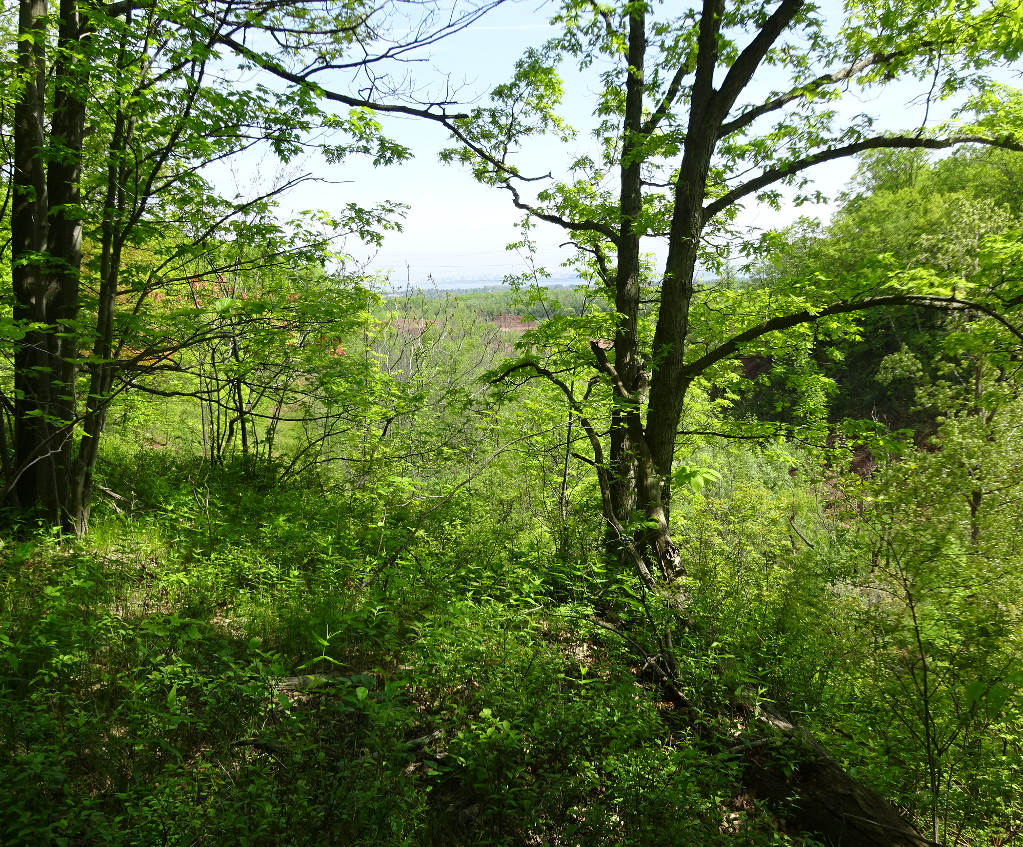
The road into the neighbourhood cuts through a small section that has nicely treed property on either side of the road. You have no idea if that land is public or private – it’s just there.
You come around a bend in the road and the street stretches out before you with a bit of a gradual slope that lets you see the city, the bay and the bridge almost as if it was a picture framed by the houses.
It was while the renovation work was being done that Heather found a letter in her mail box from a company that was doing some quarrying in the area.
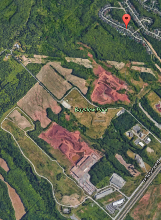
 The homes are shown upper right. The quarries are above Bayview Park with the brick manufacturing operation below the park. “Quarrying” asked Heather. “Where is the quarry – and why didn’t I know this when I bought my house?”
Those questions were the beginning of a process that has brought a community into pretty direct conflict with their Mayor, the city council member, the province and a corporation that is a major manufacturer of a vital construction product – clay bricks.
This berm is about 25 yards from the back yard of the homes on the west side of West Haven Drive. That quarry was just behind a huge Bern that had been built behind the homes when they were initially built in the late 1990’ss.
Heather wasn’t the stereotype suburban dweller who tends to pay little attention to what the city does as long as the garbage is picked up and the roads are plowed in the winter and the tax rate is reasonable and the streets are safe.
She wanted to know more – and she made it her business to learn more and then gather her neighbours together and begin asking questions.
And learn more they did.
The notice Heather got from the mining company was from Meridian Brick advising her that they were going to begin a shale quarrying operation in the eastern cell of their property. There are three cells: western, central and eastern. The western cell is reported to have 3 to 5 years of production left; the central cell has 6 to 8 years of production left. The direction is evident – the eastern cell will need to be opened up in the not too distant future – and that eastern cell is less than 100 yards from the back yards of the people on the western side of West Haven Drive.
To do that excavation mining they would be cutting down most of the some 9000 trees in the area.
Heather sent letters out to the 80 some neighbours asking them to meet. Close to a dozen showed up. Out of that meeting came TEC – Tyendaga Environmental Coalition Inc.
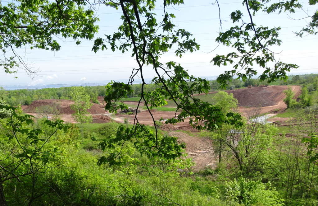
 Part of the quarrying operation couple o hundred yards from West Haven Drive homes. These were not a bunch of people who didn’t fully understand the issues – these, for the most part, were professionals who had succeeded in their careers – they’d have had too – the homes in the community aren’t cheap.
They were smart and had connections – and they knew how to make things happen.
The created an organization – asked each member to pony up $500 – 30 did – so there was now a bit of a war chest.
They then hired David Donnelly to help them through the bureaucracy.
Donnelly was the lawyer that PERL – Protecting Escarpment and Rural Land – used when they fought the expansion of the Nelson Quarry on Colling Road. That case went before a Tribunal hearing that found the Jefferson Salamander, an endangered species, lived in that part of rural Burlington – more aggregate mining could not take place.
 In the middle of the picture some of the shale mining quarry can be seen – Burlington Bay can be seen on the horizon, When the TEC took their concern to the Mayor and the city Councillor they were told that the company had a permit and that there was a notation on their deeds and they should have known that some mining was going to take place.
In a media release the Mayor said:
“After extensive review by staff in several city and regional departments, we have come to understand that Meridian Brick is within its legal rights and that the Province of Ontario, not the City of Burlington, has jurisdiction over this matter.”
There is a reported notation on the property deeds that: All purchasers are informed of the following warning clause registered on title:
“The purchaser acknowledges the presence of a future extractive industrial land use to the west and that extraction may take place during the daytime only.”
No one with property deeds could find any notation on their documents about any rights the mining company had.
That a company had the right to mine a hundred yards or so from their homes and that there was a notation to this effect on their property deeds which they couldn’t see was more than enough to mobilize the neighbourhood.
These people got serious – especially when they learned that the mining company had a permit – given to them in 1972, to mine for Queenston shale, the only type that is used for brick making in Ontario. And there aren’t many places left where that shale can be extracted.
The TEC people say the issue is that they “… need, at a minimum, to have the Ministry of Natural Resources and Forestry (MNRF) decision (to issue the original quarry license) to be re-evaluated in the light of the ‘HERE and NOW – 2016’. We appreciate that the MNRF does not have a history of reviewing their decisions but in this case we believe that the area under question has undergone such a dramatic change in the last FORTY-FOUR YEARS with the enormous growth in industry, schools, residences, traffic, etc. that it would warrant an exception to their rule.”
Brick making had been taking place in North Aldershot since the early 1900’s and it is now a large industry and a significant tax payer.
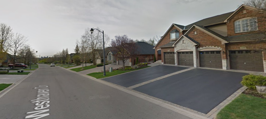
 West Haven Drive looking south. The West Haven Drive point out that the assessed value of the 141 homes on the street (these are million dollar homes) is just as big as that assessed value of the mining lands – and that residents pay higher tax rates than a mining operation.
The two politicians, the Mayor and the ward Councillor may come to regret the way they blew off the residents.
This is going to be an ongoing story – there are a number of interests at play – one being the importance of the brick manufacturing operation to the economy of the city and its importance to the residential construction industry in the province. Meridian manufactures an estimated 55% of the clay brick produced in Canada and 45% of that is made in Burlington. Tough to fight an industry with that level of market penetration.
Related story link:
What’s going on at West Haven Drive?
By Staff
July 25, 2017
BURLINGTON, ON
The Councillor got that one right – this “clearly is a major redevelopment proposal.”
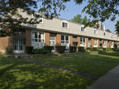
 The all rental community is about to undergo a very significant change. Georgian Court Estates, in east Aldershot, has disclosed the details of its redevelopment plan for this 20 acre site. The plan has not been submitted to the City yet, but was shared with existing tenants of the rental complex.
The owner is proposing major intensification, specifically replacement of the current 288 townhouses with 1,450 new rental units including townhouses and apartments.
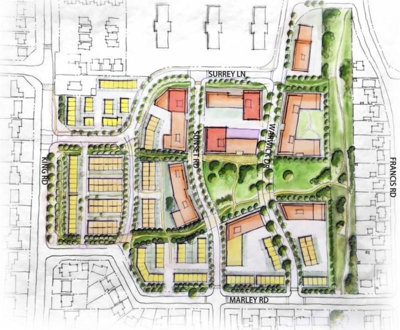
The plan calls for one 23 storey building, one 18 storey building, one 15 storey building, eight 8 storey buildings, six 6 storey buildings, five 4 storey buildings and a series of 3 storey townhouses.
 Architects rendering of re-development plans for the Georgian Court Estates – originally developed 50 years ago the plan is to demolish everything and create a new community with considerably more density. The plan also includes a central public park and a variety of amenities. Further it proposes to extend Sunset Road north to Surrey Lane. Spokespeople for the owner say the entire project, if approved, will take about ten years to build.
Ward 1 Councillor Rick Craven is working with the Warwick Surrey Community Association to establish a Neighbourhood Advisory Committee to examine this plan in detail and ensure existing tenants are protected.
When the city receives the application, perhaps in July, a full, formal consultation process will begin.
Craven explains the plan in a short video
By Pepper Parr
July 4th, 2017
BURLINGTON, ON
The changes the city is talking about with their Go Bold plan – not something that is going to happen tomorrow but rather a long long term plan for the growth of the city – runs up against the day to day reality of the commercial world.
Property values are increasing. What made sense for a lot on Brant Street 25 years ago doesn’t make that much sense today. Owners see an opportunity to cash out and they are doing just that. Land prices preclude opening up a retail shop on land that has been purchased at today’s prices.
 Thousands of Burlington homes were decorated and furnished by Elizabeth Interior. What happens to the property next? What would the Go Bold thinking at city hall want to do with such a property? Elizabeth Interiors, on the corner of James and Brant, is now all but empty. They decamped and are now on Fairview; still some inventory in the Brant Street location along with a smashed window on the James Street side. One doesn’t often see any vandalism on Brant Street.
 Doors closed and the last of the inventory being readied for moving. How many homes in this city has the place furnished? What is to become of the property that is one of the biggest in the downtown core? It isn’t going to be a restaurant location and it is very unlikely that the property will be something in the six story range favoured by the ward Councillor.
 Double plate glass meant that entry wasn’t made into the building. This type of vandalism is rarely seen in the city. One developer active in the city explains that putting a building on that location with just six to eight stories means the developer is going to have to create large units with very hefty prices – in the million dollar range – and people who live in that type of unit tend not to add very much to the life and vibrancy of a city.
Something will be done with the property – no one has much to say at this point.
By Pepper Parr
July 4th, 2017
BURLINGTON, ON
How did some people decorate their home to celebrate Canada 150?
 The residents of this building were, for the most part, showing their colours. There is a building in the downtown core, on the corner of Pearl and Pine with a bit of a view to Lakeshore Road.
If you look up a laneway from Lakeshore Road one could see the large Canadian flags hung from the balconies – it will be interesting to see what the residents do next year when the word gets out that we will be around to see if every balcony is draped with a Canadian flag.
The Gazette was out doing its check up on various construction projects in the city.
The Bridgewater project has now poked its head above the street grade – soon the public will get a sense as to the impact the two buildings are going to have on the way we see that part of Lakeshore Road and how much of the lake you are going to be able to see.
The city currently has three projects under construction south of the QEW with a number of others that are ready to get taken to city hall for approval.
The city that people experience today will be significantly different within five years. all were approved before the city released its Grow Bold plans which are currently being reviewed by citizen groups.
 The opening from the Lakeshore Road into the public area that will be between the hotel on the west and the 22 story condominium on the east will be about where the crane tower is shown in this picture.  Architects rendering what what the Bridgewater project is going to look like when it is completed in 2019. The project will consist of a condominium on the right, a hotel on the left and a smaller condominium south of the hotel. There will be some surprises when people realize just how small the opening to the lake actually is – progress.
By Pepper Parr
June 22, 2017
BURLINGTON, ON
A little over 70 people took in an overview of what the Planning department wanted to put before the public as it works its way towards what will be created in the way of a design concept for the Downtown Mobility hub, which is the buzz word being used by the planners put a name on the Grow Bold directive that has been agreed upon by city council.
 It wasn’t a very large audience – but it was one of the most significant meetings held by the Planning department this year. As significant as what gets done with the downtown core is – it wasn’t enough to draw full council attendance. Councillors Sharman and Lancaster didn’t make an appearance.
The evening was part presentation and part workshop.
The presentation part was what the planners had come up with based on the input from the public at an April meeting. That public input got worked on by the consultants the city has hired and what the planners took away from the public comments.
All that was boiled down to two concepts – both considerable different.
 Director of Planning Mary Lou Tanner explains a point to ward 3 Councillor John Taylor. Director of Planning Mary Lou Tanner said the concepts were not a recommendations – they were concepts – something that people would discuss at length – or at least that was the hope.
One attendee wondered why there were just two concepts – and why were they both linked to the height of a building approved more than 20 years ago.
It is going to take several articles to cover just how much is involved.
One attendee said the concepts that were put before the audience would amount to “blowing up the downtown as we know it and starting all over again”.
A critical part of the thinking was the way allowable height was going to be determined. Everything would be place on a scale and made relative to the height of the Bridgewater project that is currently under construction on Lakeshore Road.
 Concept 1 at the top with concept 2 beneath. The cross street are Lakeshore Road, Caroline, Ghent and Prospect. That project, referred to as the city’s Legacy development when it was approved in 1995 – the assembly of the property began in 1985 – reflected what city council wanted to do at that time. Times have changed and the intensification the province has imposed on the city are a lot different today than they were in 1995.
Pauline, who was at the meeting had this to say: “Last night the City and its consultant team presented and obtained feedback from the public on two options for “the ultimate build out” of the Downtown. At a glance, it is difficult to see why so many of the unique an special attributes are shown as being replaced or eliminated – Village Square especially comes to mind, our only grocery store is to disappear and ALL of the parking lots are to disappear.
“The suggestion that John Street could be recreated into a new central spine sure has me scratching my head. In addition, to accomplish either of the options presented, the Downtown would be blown up and redone with low rise buildings.
“I don’t know how many sites were noted on the options but it has to be at least 50. Is this realistic? How much growth is proposed to be included in the Downtown? No one told us that! Wouldn’t it be better to limit the disruption and have fewer strategically located tall buildings?
“At least this way, the key elements that make Burlington special will be kept. I sure hope that there is more public consultation on this. It sure is complicated and Planning Department staff have a lot of questions to answer.
Another attendee was more detailed and specific.
“Two concepts were presented at a public meeting for the development around the Downtown Mobility Hub.
“Why two? Why not five? It reminds me of the old sales closing technique…..….”alternate choice close”. Ask the customer if they want the bungalow or the two storey and by forcing them to choose you make the sale or at least it’s a move closer to the sale! But you can make it even more sinister. Make one choice so unattractive, by default, the customer gravitates to the least worst alternative.”
What could the city look like when what was put in front of the audience look like? The following two videos are a visualization of each concept.
CLICK for Concept 1:
CLICK for Concept 2:
By Pepper Parr
June 20th, 2017
BURLINGTON, ON
A comment from an experienced staff member of a developer doing some work in the city highlighted a concern that many have.
“There are so many concurrent planning activities going on in the City, it is quite something” said this well-placed source.
 The Downtown mobility hub sits in Councillor Meed Ward’s political turf – some of the outcome of the community engagement exercises may not square with the way she thinks the city should evolve. Quite something indeed and quite a bit more than the average person can handle.
There is an Official Plan that is being circulated.
There are mobility hub proposals that are getting a serious look – all four of them
There is a transportation study that is also going the rounds.
The Go Bold statement that came out of the planning department some time ago has turned out to be more than just a tag line added to media releases.
 Planners are besieged with questions from a public that wants to be engaged and wants to understand the bigger picture as well. The work has to be stressing the planning staff; it certainly has the development community watching carefully.
There are a number of development proposals that are sitting in planner’s limbo while the Planning department works on the bigger picture.
 Is this to be the epicenter of the downtown mobility hub? There are developers who feel they have shabbily handled who claim the planners have gone back on their word on projects that were progressing quite well – at last the developer thought so.
Add to all this are the Ontario Municipal Board hearings that relate to some of the ADI Development Group Projects. Things were never tight with the Adi people and the city – when Tariq Adi said: “Oh yeah, absolutely. “Look, I’m not going to sugar-coat it, I know what’s going on here.” and added that “… what happened at Martha absolutely has something to do with this. That’s fine, that’s part of doing business. We’ll just deal with it.”
Any good will that might have existed between the city and this developer went up in smoke with not much more than bitter feelings left on the table. Adi will want to describe the Mayor as biased and unfair – words the Gazette has heard before.
Spat between the Adi Group and the city over the Alton project.
Community meeting that had planners listening to the public.
A closer look at what the public had to say about a Downtown mobility hub
There are said to be two development options for the Downtown Mobility Hub that will be presented to the public on Wednesday evening at the meeting scheduled to take place at the Art Gallery of Burlington at 7:00 pm.
What will the city have in the way of surprises for us?
By Pepper Parr
June 19th, 2017
BURLINGTON, ON
When Robert Glover, a professional Architect, Registered Professional Planner and an Urban Designer with over 35 years of professional experience told a public meeting that Brant Street should be seen as the spine of the city – just what did he mean?
Glover was explaining the rationale for locating a proposed 28 storey tower on Brant Street opposite city hall.
While he was the planner hired by developer he was asking his audience to look at the bigger picture and decide what they wanted Brant street to become.
 He put a large graphic on the screen that showed just where the high rises in the downtown core were located – there were few that were actually on Brant Street – and Glover who has worked as a planner for both the public and the private sector was suggesting that some thinking needed to be done. Much of his work as a planner in the public sector was with the city of Toronto. He put a large graphic on the screen that showed just where the high rises in the downtown core were located – there were few that were actually on Brant Street – and Glover who has worked as a planner for both the public and the private sector was suggesting that some thinking needed to be done. Much of his work as a planner in the public sector was with the city of Toronto.
Glover is well aware that Burlington is not Toronto and he thinks that Burlington has a charm of its own that can and should be developed.
 Will it dwarf city hall or will it add some majesty to Civic Square? Downtown will never be the same – and that is probably good news. His view is that a 28 storey structure will not hurt or harm the city hall – a high rise, if done properly will enhance the city hall – “place buildings around it that feature city hall and the Civic Square”.
Cities need a structure – a backbone that keeps the city together.
“The backbone gives a body structure, strength – something that other parts of the city can be linked to.
“A spine gives a city a focus – a center and if done properly development can be staged so that the street that serves as the spine does not become a canyon.”
Glover realizes that making that happen is what the delicate art of planning is all about – it needs to be thought through – “they just don’t plop a building into a space because a developer has assembled a number of properties”.
There is a lot of development taking place along Lakeshore Road and south of it.
The impact this has on the feel of the city is critical – Burlingtonians know what their waterfront is about and they aren’t going to give up as much as an inch if they don’t have to.
But what about Brant Street – what works on that street? Not much actually. The Burlington Downtown Business Association continually talk about the “vibrancy” of the street – they seem to feel that if you continually call an area “vibrant” it will become vibrant. It doesn’t work that way.
City Hall itself is no longer an efficient building and doesn’t meet the city’s space requirements – a significant amount of space is rented in the Sims building across the street from city hall. The politicians love to refer to city hall as an iconic building.
There is a report in a file at city hall that sets out what the city’s office space needs are and it beleived to have some recommendations on what to do with the existing building – doesn’t appear that report is going to get any public attention for some time. So much for transparency.
 It seemed to take forever for this three structure project to get shovels into the ground. When completed it will bring some much needed life to John Street. The Carriage Gate group is currently constructing the Berkeley at John and Caroline where they have a three part project that includes a future medical centre, a parking lot and 20 storey condominium.
Getting that property to the point where they were able to get a shovel into the ground took a lot longer than they thought – determining who was going to pay for hauling the hydro lineup the street from Lakeshore revealed some bothersome problems with what Burlington Hydro was expecting of developers.
Their proposal for the property opposite city hall forces everyone to look at Brant Street and do some serious thinking about what the planners think it should look like and what the public thinks it should be.
The city’s Tall Building Design Guidelines put in place in January after a rather rushed process with very little in the way of public input.
The public focus is on the waterfront. Few appreciate that the five structure Paradigm project on Fairview will have 2000 residents when it is complete – that’s a small village yards away from Brant Street.
Further south on Brant there is a proposal for a buildings at the intersection of Brant and Ghent where the Burlington Square, one of the taller buildings on Brant, is going to be enhanced.
That kind of development attracts other developments and before you know it you have a city with a significantly different look and feel. Change of that kind isn’t something the public takes to easily.
 Brant Street comes to life when there is a major event taking place. Which brings things back to the Glover view that Brant can be made the spine of the city. If Glover is right, and his success with previous projects suggest he knows what he is talking about, there is an opportunity to bring some real vibrancy to the street.
The Planning department has released design of what intensification could look like on Waterdown Road in the west, Appleby in the east, along with some ideas for the plaza at Guelph Line and New Street and some ideas for what Fairview east of Guelph Line could look like.
Interestingly – the Planning department hasn’t had all that much to say what they think Brant could become.
There is never going to be any commercial development to the west of the Brant – that is a solid residential community that watches what smaller developers want to build. It has to be very good to get past those residents.
But there is significant opportunity for both Brant and John, a street that has yet to figure out what it wants to be.
 They are historic and when they were built they were tall buildings – what are they today? Glover thinks that if you treat Brant Street as the spine of the city a fundamental premise is in place that can guide future developments. There are parts of Brant Street that haven’t changed at all in 75 years.
The proposal for the high rise opposite city hall is now in the hands of the planning department – they will be sending their recommendation to city council in the fall.
Will a different look for Brant Street be part of their recommendation; it’s an opportunity that shouldn’t be missed.
|
|


 By Pepper Parr
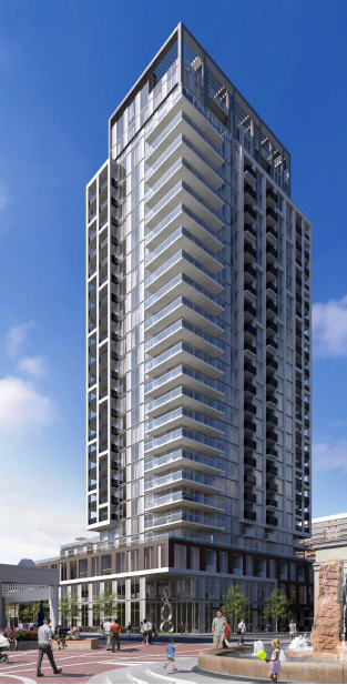 The Planners are recommending a mixed use development consisting of a 23 storey building with a maximum of 169 residential apartment units, a minimum of 365 square metres of office space and 900 square metres of commercial retail space which will rise at the corner of Brant Street and James Street.

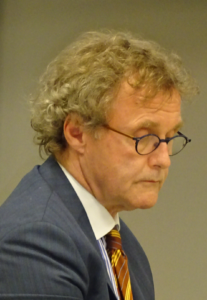

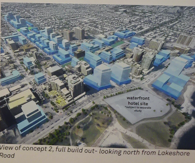 Interestingly – the Planning department hasn’t had all that much to say on what they think Brant could become.
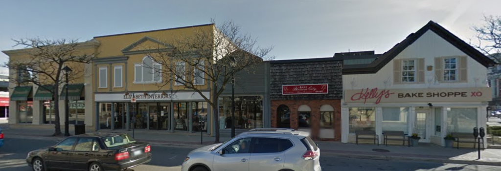
 Greg Woodruff, who ran for Chair of the Region in the 2014 election, had comments to make about the development planned for 35 Plains Road. While he didn’t like the idea of an additional two floors of density being given to a site that is zoned for six storeys – that wasn’t his biggest concern,
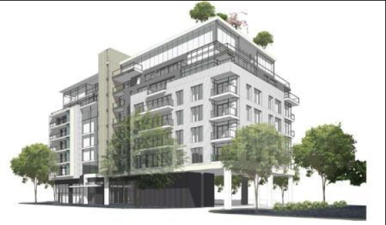 Woodruff then added that the 35 Plains Road proposal does not comply with the Aldershot Village vision. The vision calls for sites that have large landscaping and large generally open spaces.
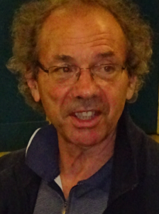
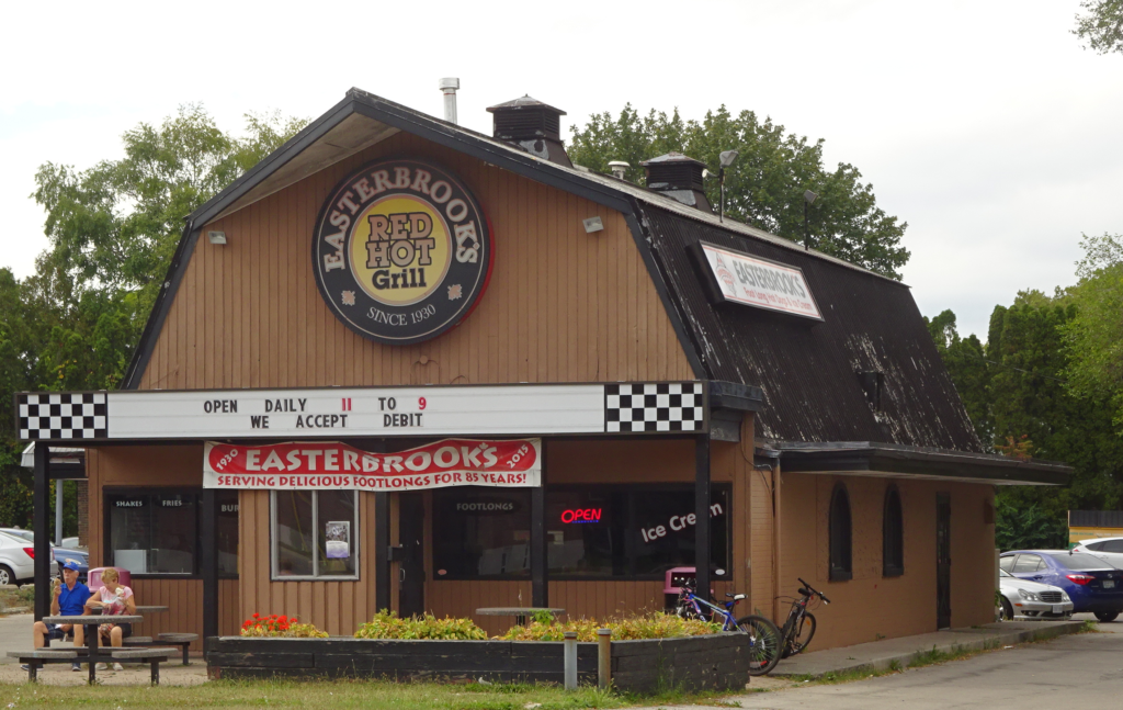 Easterbrook’s as it is today.
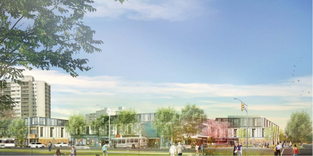
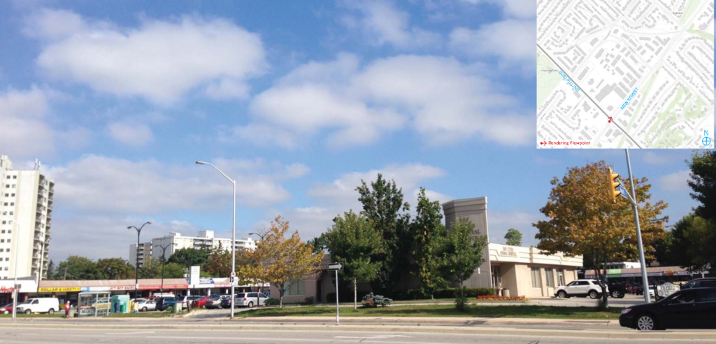

 The report sets out the start of the “ticking off” of the boxes.
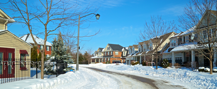
 The draft new Official Plan designates the subject lands as Residential Neighbourhood Areas, and more specifically Residential – Medium Density. The Residential Neighbourhood Areas are intended to provide for housing and other residential supportive land uses that are part of an urban residential environment. New residential housing within the Residential Neighbourhood Areas shall be accommodated primarily through infill or intensification, of existing areas, where compatible.
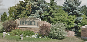 The subject lands are located in the southern portion of the Orchard Community and were identified as Residential – Medium Density. In Medium Density Residential areas, either ground or non-ground oriented housing units with a density between 26 and 50 units per hectare shall be permitted. This designation permits housing forms such as street, block and stacked townhouses, semi-detached, duplexes, three-plexes and four- plexes. The designation also permits detached dwelling units up to a maximum of 15 percent of the total housing mix on each property.
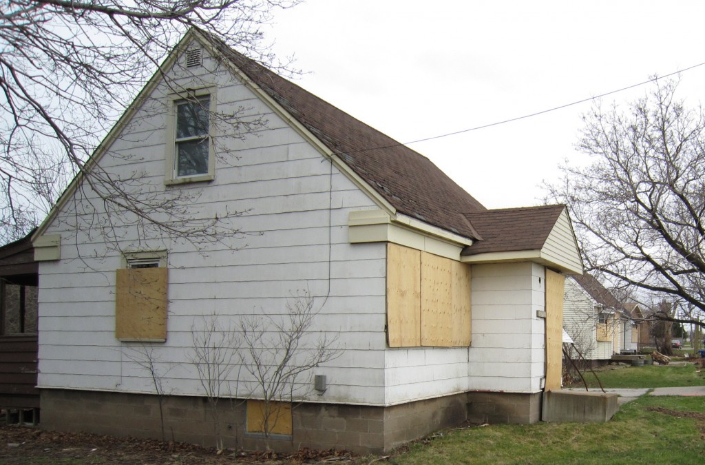
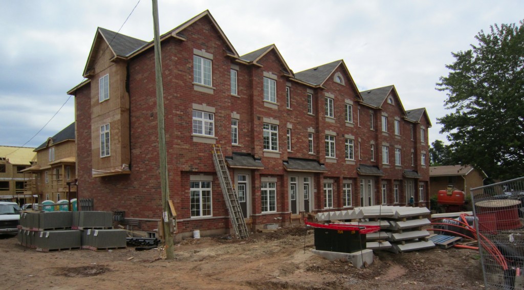
 Some developers engage a consultant to provide an opinion on the relevance of the development and how it will impact and fit into the long term plans the city has. It is not unusual for a report from a consultant to question some of the information the city has published and to offer a different analysis of the data.