 By Pepper Parr
March 28th, 2021
BURLINGTON, ON
Part 2 of a series.
Statutory Meetings are part of the development approval process.
During the Statutory meeting held March 2, 58 people delegated – each had 10 minutes.
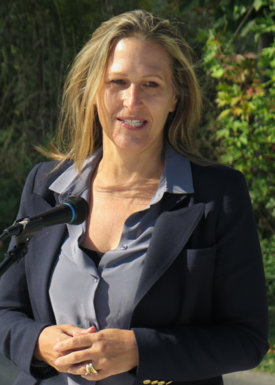
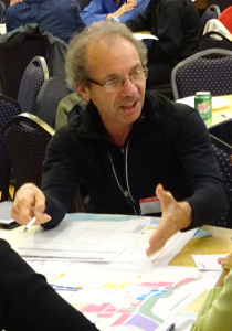
Glenn Wellings, the planning consultant for the developer spoke and answered questions.
A transcript of his delegation and the questions answered by follows.
Wellings chose to focus on four matters in his delegation – they were:
Public vs. Private Open Space
Land Use Compatibility
Future Phases of Development
Maintenance Building Relocation
Glenn Wellings (GW)
Thank you Mr. Chairman, Committee members.

Glenn Wellings
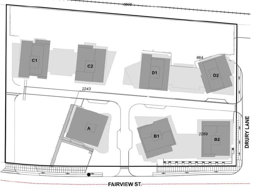
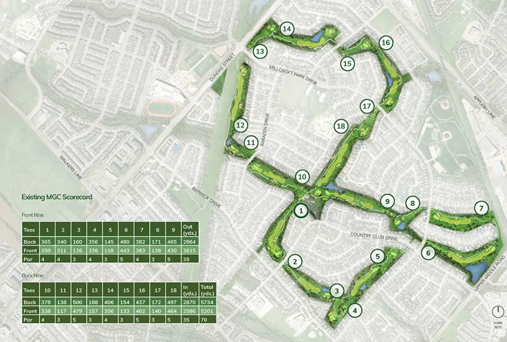
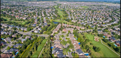
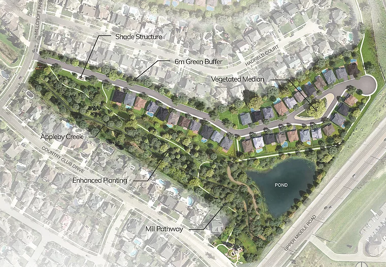
Starting with the area of public vs private open space. When the Millcroft community first developed, the city acquired a significant dedication of parkland and open space. It is important for the community to understand that the golf course lands were not considered nor credited toward the contribution of public parkland and public open space. The city instead took its full complement of park and open space lands independent of the golf course. The golf course was private open space when it first developed over 30 years ago and it remains private open space today. The golf course is not considered part of the city’s parkland system.
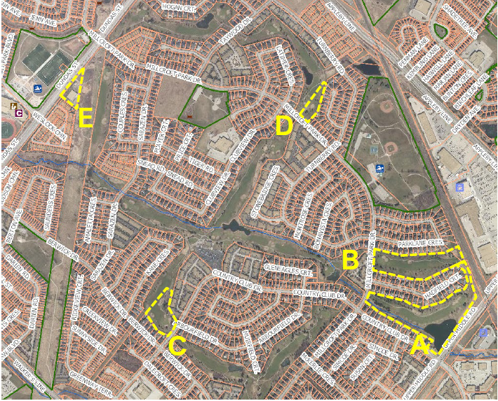
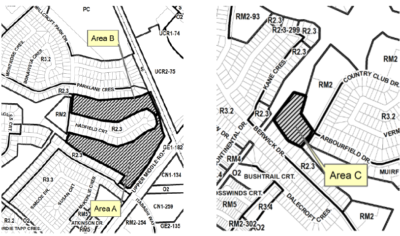
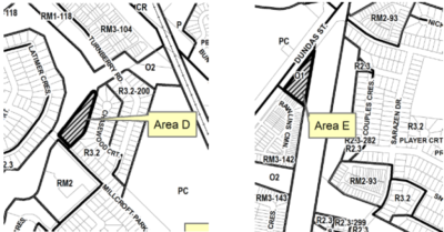
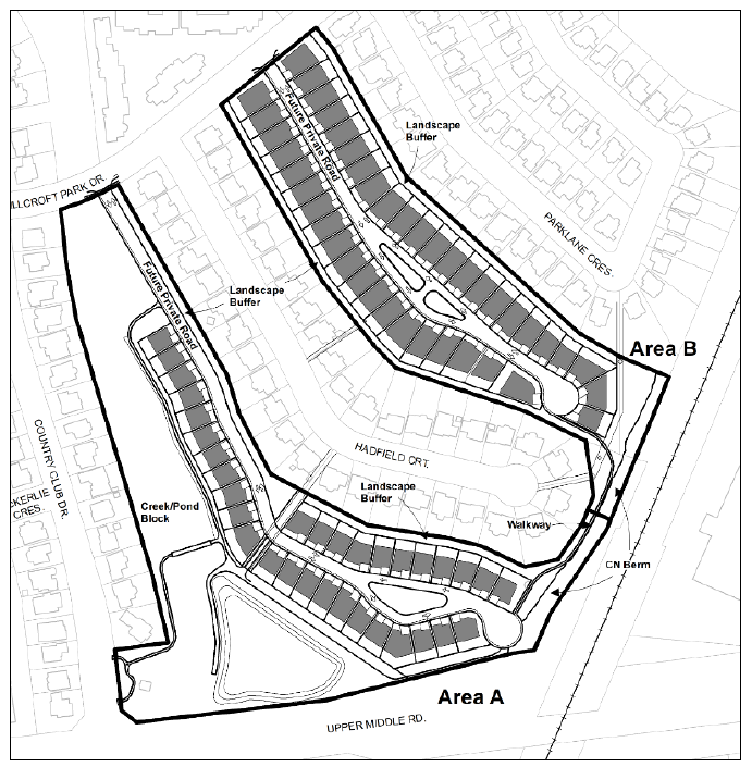
Turning to the next point, Land Use Compatibility. Compatibility does mean identical or the same as. Compatibility is an assessment of the co-existence and impact between land uses. Millcroft Greens has chosen a built form that is compatible with abutting land uses. In the case of Areas A through D, large lot single detached dwellings are proposed adjacent to large lot single detached homes. This occurs already throughout the Millcroft community even in cases where the lot sizes are not identical. With respect to Area E, the mid rise built form was chosen as it is situated along a major roadway, that being Dundas Street and the building could achieve a significant separation from the townhouses to the west without impact. In the case of all development parcels, Millcroft Greens has taken the added step of proposing a six metre landscape buffer between existing and proposed land uses.
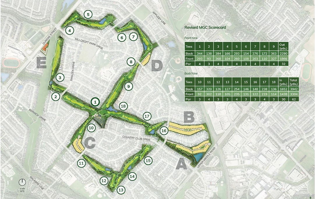
Turning to future phases of development, there has been plenty of speculation regarding additional development of the golf course lands beyond these applications. MG decided very early on in the process that maintaining the existing golf course would be an integral part of the proposal. Therefore, to speculate what might happen in the future is not relevant to the applications before Committee today. To reiterate, the MG proposal before the city is to consider the development of five parcels of land with a retention of an 18 hole golf course in a reconfigured format. There would be significant investment in the golf course redevelopment.
A final point dealing with the maintenance building relocation, due to the proposed redevelopment of Area A, the plan is to remove the current maintenance building and build a new smaller maintenance building closer to the clubhouse. The maintenance building would be approximately 40% smaller than the existing facility. The new building would be designed to architecturally complement the design of the existing clubhouse. The maintenance building relocation does not require planning permission provided the current zoning by-law setbacks are complied with. These setbacks include a minimum 15 metre setback abutting a residential zone together with a nine metre landscape buffer.
Before moving to the video presentation, a few housekeeping matters.

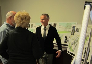
Glenn Wellings during his March 2nd, delegation.
First, Millcroft Greens (MG) has no concern with the staff recommendation to extend the period to process the applications. In terms of further public consultation, MG is planning to hold a virtual drop in open house some time in later April. Due to the continued limitations on gatherings and concerns with public safety, this will need to occur virtually. More details are expected shortly in this regard. And finally, MG team of consultants is available in the waiting room to answer any questions of Committee. We have Frank Bond, the Project Manager from MG, we have Dave Leighton, the consulting engineer from Urban Tech, Ash Baron, the ecologist and arborist from Beacon Environmental, Aaron Wignall, Traffic Consultant from Crozier & Associates, and Steven Johnson our golf course expert from TGA Partners.
In addition, any responses to new questions from this afternoon and tonight’s public meeting will be provided on the MG website, www.millcroftgreens.com as on the bottom of the slide. Thank you for listening. I’d be pleased to answer any questions following the video.
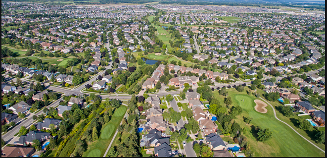
The development, created in the mid 1980’s with a golf course in the middle of it. It quickly became one of the most desirable communities to live in. Residents now feel threatened ny plans to add 98 home and a six story apartment.
QUESTIONS from members of Council
Mayor Marianne Meed Ward
MMW Mayor Marianne Ward : This question is around the recommendation you did touch on it Glen but I want to elaborate a little bit, the recommendation to allow staff to work on the file and you said you were ok with that. Of course as we are all aware, when we go past the provincially legislative time frames for rendering a decision, we expose ourselves to a potential appeal to the LPAT for non decision. So I’d like to get a sense of your intent. Will you be filing a non decision appeal after the 120 days if we allow this recommendation to go through. Then I’ll have a follow up.
GW: Good question. The LPAT process is complicated and I think Your Worship you understand that. Just to be clear, we are in support of the staff recommendation which would extend it beyond the 120 days and as long as we’re moving forward in a positive manner and there is no hiccups in the process and then we don’t have an intention of filing an appeal for non decision but at the same time we need to protect that right your worship and if things do go off the rails, then that option needs to be available to MG but just to be very clear I think MG has shown a cooperation and willingness to work with the public and city staff to move this forward and engage with the public so that is still the goal. At this point in time there has been no decision to file an appeal of these applications. Hope that clarifies.
MMW: Thank you for that. Caveats noted that it could come. Second question is a follow up to that around your expectation of time lines. So where do you think you’re at and what are your expectations in terms of when you are expecting staff to provide a recommendation report for council decision?
GW: I was a little bit surprised by the presentation by planning staff that the report would come back in September 2021. That’s not information that we had before today’s meeting. Also I can say that as we will continue to work with staff, there is a lot of public agency comments we have not received, so we’re waiting for some feedback from public agencies as well as city departments. Once we get that feedback, we’ll probably have a sit-down with staff and work through the concerns and comments. So it’s a little bit early to start speculating on time lines other than that we’re prepared to work with staff and try to have a report to committee as early as possible.
MMW: Ok, so just a quick follow-up on that. The September 2021 is that a concern for you? You said it was a surprise today. Are you troubled by that or are you prepared to work in that projected timeline?
GW: Tough question. We’re certainly prepared to work within those timelines as long as we’re moving forward in a positive way. I can’t stress that enough. If this goes off the rails then things could change but right now where we stand and where we sit in the process we are working cooperatively to work through the issues and the process with city staff and we’ll continue to do so. So I think I’ll reserve judgement on the September 2021 timeline right now until we get further feedback and have further dialogue with staff.
AB Councillor Angelo Bentivegna: Thanks Glen. Wondering if we can go back to the video that had the two fences side by side with the buffer in between.
GW: I’m not in control of the video and based on our technical difficulties today, I’m scared about going back.
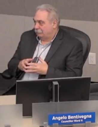
Ward 6 Councillor Angelo Bentivegna
AB: Ok, that’s ok. If we can visualize the two fences and all the greenery in between, I’m getting these questions over and over again, that is going to be a condominium area that will be maintained by I’m not sure who at this particular point, and will those fences be, what will they look like? I think we saw chain link fences. What will that look like when people are looking at their backyards. What are they going to be seeing?
GW: Good question. Right now the plan is to provide a six metre landscape buffer strip between existing and proposed development and at this point in time the six metre landscape strip is intended to be managed and maintained by the condominium corporation for each one of the parcels and that’s certainly a matter that MG is willing to discuss but the intent is to provide a fairly robust planting strip where there would be a screen between existing and proposed development. The details still need to be worked out and certainly we’re receptive to any comments in that regard.
AB: The biggest concern I keep hearing is that if the condominium level of service is typically being paid by one side and not the existing residents who are already there, it will affect the visual upkeep of their back. That is their big concern. What is the intentions of MG to make sure that doesn’t happen?
GW: Couple of things, first of all it would be zoned for protection. The draft zoning bylaw that’s been provided to the city does provide an open space zone within the 6 metre landscape buffer. As far as the condominium corporation is concerned, the mandate of that corporation would be to maintain that 6 metre landscape buffer strip in perpetuity and have proper reserves to ensure that maintenance. That’s the plan now but we’re certainly open to any comments or alternatives that may come forward to discuss how that landscape buffer unfolds.
AB: Second question. Is the maintenance shed that’s going to be relocated, I understand it’s 40% of the existing, and it’s going to be where the clubhouse is and it’s going to take the look of the clubhouse. Is that building going to be above ground or in the parking lot or grass area and is there any digging downward that needs to happen to construct that?
GW: The precise location of the maintenance building has not been determined but you’re correct, it would be 40% smaller than existing. The existing facility up on Dundas is pretty large and it’s much larger than what they require. In terms of the relocation of that, it’s expected that it be in close proximity to the clubhouse off the parking lot but the precise location and the building details really aren’t known at this stage.
Ward 3 Councillor Rory Nisan
Ward 3 Councillor Rory Nisan (RN) : Thank you First question relates to your response to the mayor about possibly appealing. So you say if things go off the rails, you might appeal, and as long as they are proceeding in a positive manner, are you deciding that if you think you’re going to get approval you’ll stick around but you may appeal if you get a report you don’t like? What does that mean?
GW: We’re starting to get into a legal discussion and to be honest I’m not prepared to go into that today because we’re just speculating in terms of what may or may not happen. The Planning Act is pretty clear as to when you can appeal an application or decision and at this point in time I’m not prepared to come before you and suggest that MG will give up any of those rights. But I can tell you that MG has every intention of working with this council, with city staff and the public on further dialogue. I had mentioned the open house that we’re planning to hold in later April so that dialogue and engagement will continue in a cooperative fashion but Councillor Nisan, I do appreciate the question, I just can’t speculate on what may or may not happen if there is a future LPAT appeal.
RN: So thank you for that. I just want to make sure it’s understood that you cannot make any promises about an appeal at this stage.
GW: No promises.
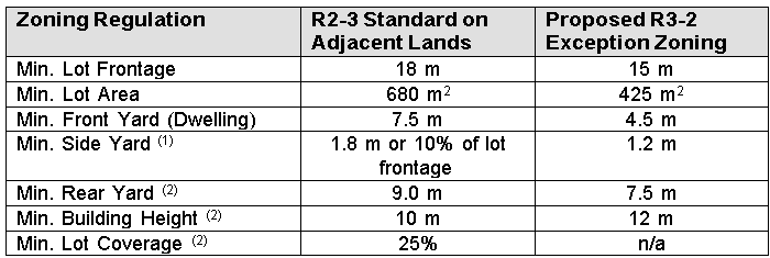
RN: Ok. That’s fine. That’s your prerogative, I understand. But it’s important for us to understand that as well. I have a second question. I know this one quote you had where you said you’re proposing large lot single detached homes beside other large lot single detached homes. So point taken there, but I want to know why you’re asking for so many changes to the R3.2 regulation. So you’re asking for a change from open space and obviously that’s a major thing to be considered by all of us, but within the R3.2 regulation you’re also asking for exemptions there and you’re asking for more exemptions than you’re willing to follow the requirements. For example, front yard down to 4.5 metres when it’s supposed to be 6, reductions to the rear yard, the side yard, the street side yard, lot covefage, dwelling depth, building heights where you want to be able to build a flat roof 12 metre structure where we only allow 7, if I’ve got that right, two stories, so why are you asking for all those changes and why aren’t you just asking for a bunch of townhouses here?
GW: A lot in those questions. First of all, townhouses were not considered as I mentioned about the compatible built form and MG thought that singles adjacent to singles made the most sense in terms of Areas A through D and with respect to Area E, the mid rise building being proposed. With respect to the zoning and the number of changes, I think Committee members need to realize your zoning by-law is extremely out of date. It’s not current and it’s not reflective of the built form today for single family homes so there was a number of suggested changes. I would imagine when the City does get around to updating its zoning bylaw, that it will reflect more current standards but your by-law is really out of date and that’s one of the reasons for the number of changes being requested through the draft zoning bylaw. And we’re certainly prepared to discuss that draft zoning bylaw with City staff as well as Committee members as we move forward.
Ward 6 Councillor Paul Sharman
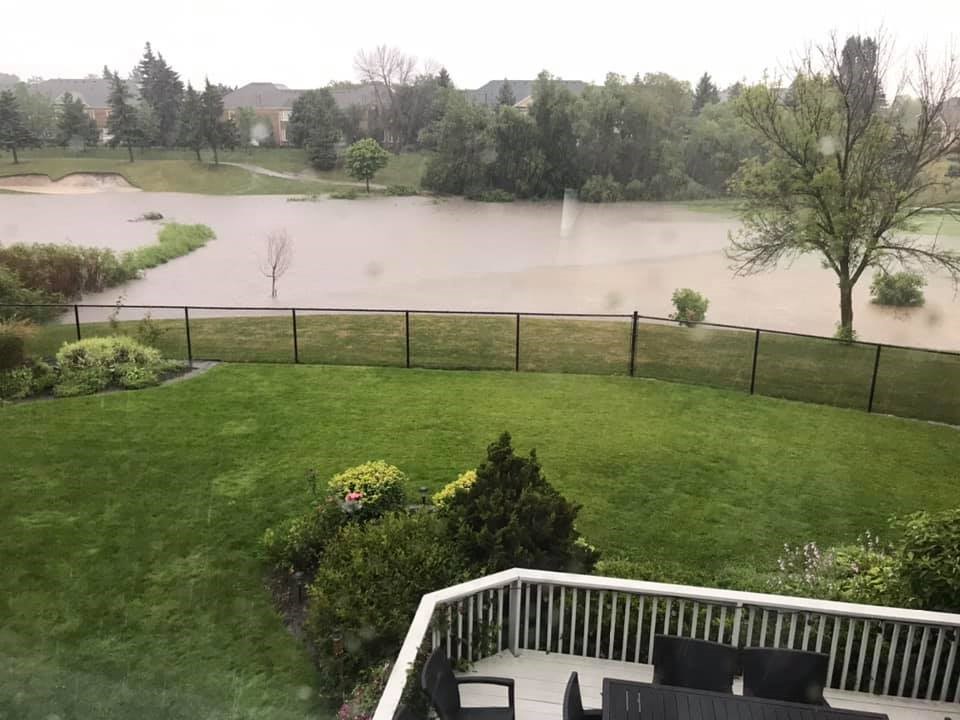
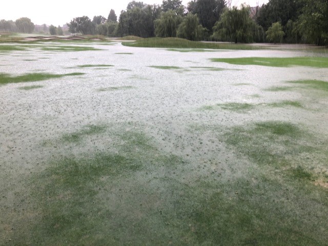
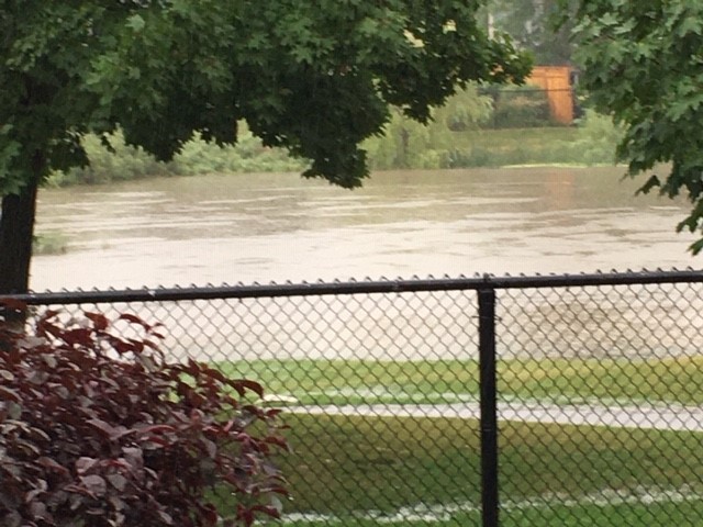
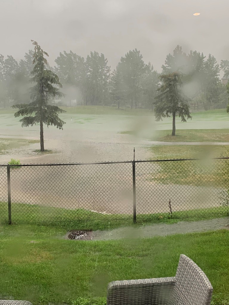
PS Councillor Paul Sharman (PS): Thank you for the presentation Glen. Question about the concerns from the community about flooding. We’ve seen a series of photographs of storm impact and water all over the golf course. We’ve seen a number of effects on peoples’ properties. So as you are now into the process and you have engineers looking at that, what plans are there to mitigate the risks that they have concerns about?
GW: I’m going to have to rely on Dave Leighton (DL) to respond to that question. So I think he needs to be brought out of the delegate room to respond to the concern of flooding. Sorry for the awkwardness Councillor Sharman but I’m just not an expert on storm water management.
PS: No it’s fine. I appreciate having the experts, the professionals to talk about it. Thanks you.
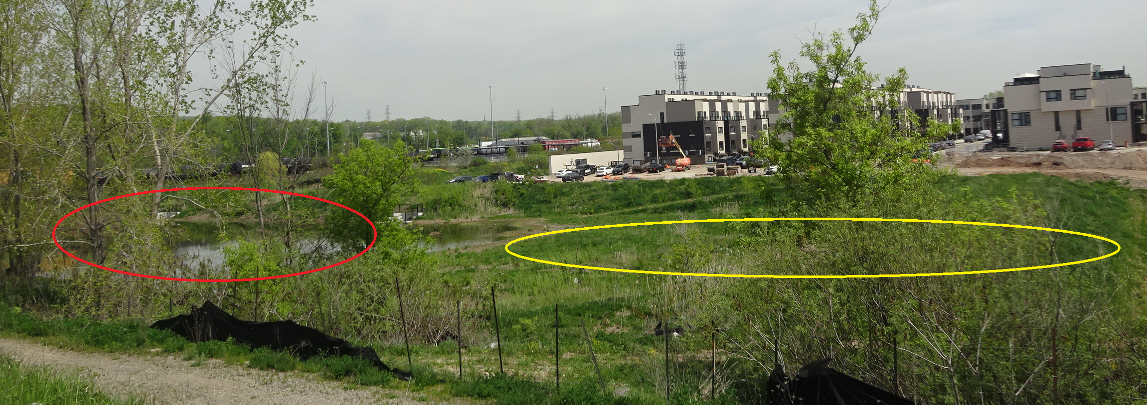
DL: You’re correct. The Millcroft community was designed to flood. The golf course was designed to flood to protect the residents of Millcroft. Our application, we cannot increase flooding. We cannot aggravate flooding. We have to secure a permit from Conservation Halton and approval from the City of Burlington, so we can’t make any existing condition any worse and our goal is actually to improve it.
PS: Thank you for that. From a technical perspective, can you talk about the kind of mechanisms available to you please.
DL: Absolutely. We have our hydraulic models that we received from the conservation authority that calculate flood levels. We’ve gone out and done detailed topographic surveys so we have all the correct elevations. Some of the mitigation methods that we’re using, those who are familiar with Appleby Creek and specifically down by the existing pond, that is used both for irrigation for the golf course and as a water hazard, there is a concrete weir on the north side of Upper Middle. Through removing that weird, it was artificially backing the water up. With removing the weir, and reshaping the flood plain, we are actually going to be lowering the water levels in that region of Appleby Creek between Millcroft Parkway and Upper Middle Road. So we have certainly used all the stormwater and technical tools available to us to assess the existing flooding and what is our proposal to reshape the flood plain and ensure that we don’t aggravate or increase any flood levels upstream or we wouldn’t be able to secure any approvals from any of the agencies.
PS: Can I ask a question for clarification. Do I understand you to say that you’re actually improving the current condition of the Millcroft neighbourhood as a result of the actions you’re taking with the weir?
DL: Yes, we are. With the lowering or the removal of the weir, there’s two benefits. One is the opportunity for ??? upstream and the lowering of the flood plain so our submitted functional servicing report does show that water levels have lowered.

Ward 2 Councillor Lisa Kearns
Ward 2 Councillor Lisa Kearns (LK) : My question centres around the public engagement and the vast amount of communication that has come through all of our offices and is captured within the report before us today. My question for you is can you give two demonstrable examples of where you’ve taken that community feedback and have changed or modified the plans before us from per-consultation or preliminary concept to what was finally presented. Can you demonstrate at all that that community feedback has been taken into account to make any changes? (**hear someone in background say “that’s so funny”)
GW: Good question. I need to take that one under advisement. I don’t have the answer off the top of my head but it’s something that I’ll go back and have a look at but there were a number of comments that came out of the September meeting that did inform the applications that were filed. I just don’t have an answer at my fingertips.
LK Ok, then maybe just as a follow up question. How would you define what we should be looking out for as indicators that MG has worked with the community, worked with council, worked with staff to bring about a plan that works for all of those stakeholders? What should we be looking for if we’re not able to identify modifications at this point in the evolution of the application? What should we be looking for?
GW: I think you should be looking for opportunities. Has there been an opportunity to engage. Has there been an outreach by MG which there certainly has been, and a dialogue with the public and I think as a councillor that’s obviously pretty important to focus in on pubic engagement and whether that informs any changes to the applications, that’s a completely different matter. If there is some constructive comments that we feel would benefit the applications, it’s certainly something we’d take into account.
LK: My second question is of the 800 pieces of literature we’ve received and the numerous comments that have come through your office what would be maybe the top two constructive recommendations or interest that MG would say maybe has some value to explore for further consideration?
GW: I think we’re still looking for some constructive feedback because all we’ve heard from many people is “we don’t want it” and frankly that doesn’t help. If there is constructive comment on how if this were to move forward and how this could move forward in the best possible way, those are the constructive comments, quite frankly we haven’t received a whole lot of and we’re open to receiving those comments and see if that can inform. I think change is really difficult and we all understand that and appreciate that but residents as far as change is concerned, they are fine with change if it’s in someone else’s backyard and if it’s in their backyard, they tend to resist it. Change is inevitable.
RN: Point of Order Chair . This is going off the rails and not on point of the application.
Chair Galbraith: I agree.

Ward 1 Councillor Kelvin Galbraith – Chair of the meeting
Kelven Galbraith – Chair of the meeting and Councillor for ward 1. (KG): I’m going to jump in with a first question before we go to second time questions. Thanks for the presentation Glen. We’ve heard some concerns about safety of the current golf course and how the changes are going to improve on that. Can you just elaborate a little bit on how that will happen?
GW: I’m probably better to direct that comment to Mr. Steven Johnson. (SJ) He is our golf course expert that’s available.
SJ: So if I heard the question right, it is what modifications have taken place in order to rectify some of the safety concerns. One of the key things when you’re getting into the changes is when you’re modifying the golf course is basically the landing areas and the distances. So basically, par 3s, when you change from a 4 or 5 to a par 3, you mitigate the dispersion patterns and therefore just by doing that alone, will impact and improve safety. From the point of view of the tee boxes, locations and modifications in that regard, they will also change safety precautions because right now the centre lines will change under the new program and therefore the landing areas will move the ball away from, as best they can, into areas that will be larger landing areas away from backyards. You’re never going to mitigate all issues. But this plan definitely makes the proposed course much more safety factor from balls going into backyards.
KG: So shorter course, safer course, basically.
SJ: And also centre lines. So shorter course, safety, that’s number one. But also changes in centre line and tee areas into landing areas also changes and creates safety. It’s the same as when you see any community that’s being built with a golf course, you see trees and buffers going up and sometimes you find it going up after the fact. With this you find that you’re already able to move some of the tee decks and (a) shortening the hole but (b) changing the centre lines you also make it safer as well because of dispersion patterns. And then when you take longer clubs out of your hands, the dispersion factor changes as well.
KG: yes, noted. Thank you. Second time speaker, Councillor Bentivegna.
AB: The question has to do with roads and the new roads that we’re putting down. I just want a visual here. We’re going to have a road and we have a row of homes and in behind there will be another road and another row of homes and the question is when a home is between two roads, are these roads standard width roads and because it’s private property I don’t know how it works and I can ask staff that as well but what is the width of that road in front of the homes and behind the homes and is it legislated?
GW: These are condominium roads that are being proposed and the width of the condominium roads, the paved surface, is roughly equivalent to the paved surface of a local road without the extensive boulevards so they would serve the same purpose and there are other condominium roads within the Millcroft community and servicing some of the development parcel so they would be similar to those roads.
AB: So can cars park on the street on those condominium roads, in front of their homes?
GW: The intent is on one side that there would be some on street parking. That is the intent. What you need is to make sure is you keep 6 metres free and clear for fire access and emergency access purposes.
AB: Second question. Has to do with air quality compatibility. And I know one of the 30 plus studies you did talked about air quality. When we do air quality, and again I’m new to all this, do they take into consideration 30 years of golf green spraying? And obviously those chemicals are no longer in use anywhere else other than in golf courses, we know that. Is that taken into consideration when they do those tests?
GW: Shorter answer is I don’t know. We’ll have to take that one back. We don’t have our air quality expert here today but we’ll certainly take that one back and put a response on the MG website and share it with city staff.
MMW: Follow up question. I wanted to ask you a question about the distinction you made in your presentation between public open space and privately owned open space and try to understand a little better sort of what you were getting at there. The lands of course are privately owned, nobody disputes that, but they are zoned, the vision for them in terms of the use in the city’s OP are for open space, in both the OP and the zoning, so regardless of ownership tenure, the vision is to keep that open green space. So can you just talk to me about what difference it makes, what you were trying to get at in your presentation, what difference it makes that it’s not publicly owned at this point, still zoned as green space?
GW: I was simply trying to make the distinction that these were not taken as public open space and parklands through the consideration of the Millcroft community when it first developed. They were not accounted for or considered as parkland or public open space. So it was just making the distinction between ownership and to me there is a difference.
MMW: So that’s what I’m trying to understand. Can you tell me what the difference is on ownership?
GW: In terms of ownership, if it were publicly owned then the City certainly has control over the use of those lands currently and in the future when they’re privately owned, the City can zone those lands and of course an owner of those lands can bring forward an application for consideration of a different use so it was really just trying to distinguish between public vs. private ownership.
MMW: Right, sorry, I think the question was more around what difference does it make for the ongoing use given that regardless of ownership public or private, the use as defined in our OP even at the time of this development is for open space, in both the OP and the zoning. That’s the vision for this in our plans.
GW: That is what the OP and zoning bylaw do with the exception of Parcel E. Parcels A through D is open space. I do acknowledge that, but MG has made an application to propose a different use of portions of those lands with the retention of the golf course and they’re asking for those applications to be considered. If they were publicly owned lands, these applications wouldn’t be on the table.
MMW: That wasn’t my question but you’ve kind of touched on it so that’s fine. I gather that you’re still waiting on comments from the regional OP. Their plan also, on page 10 of the report, their plan designates this as Regional Natural Heritage System in Section A of A to D. E is completely different so we won’t talk about E. But A is definitely Regional Natural Heritage System and any alteration of the components of a Regional Natural Heritage System are not permitted unless it’s been demonstrated there will be no negative impacts on the natural features or areas or their ecological functions. So have you heard back from the Region whether they are even on for that in Section A? Feel free to answer why is this not also a regional OP amendment. I guess they do their comments through our process, I guess that’s why. But what have you heard from the Region?
GW: We haven’t received regional comments so I‘m hoping those will come soon but it’s important to note that the whole golf course is not a Regional Natural Heritage System, it’s just a small portion of it – the vicinity of Appleby Creek and the pond are considered Regional Natural Heritage System. So these lands are in the urban area under the Plan; they’re in the urban surfaced area. And of course municipal services are available to these lands and to the community so we will see what the region has to say. I’m not going to speculate. No answer yet. There’s quite a few comments still outstanding.
MMW: Sometimes because of the time delay between the report and a meeting like this there could be a time delay so I’m trying to ascertain if they have provided anything in the interim. So yes it’s just Area A, but it is one of the areas being proposed for redevelopment, so thank you for that.
RN: Coming back to the zoning bylaw for a second, and the reason I brought up the townhouses is that it seems like all the changes that you’re proposing reflects more of a townhouse form than a detached form. I’m certainly not suggesting that townhouses aren’t a good idea here, far from it, but I’m just wondering can you provide comments at some point about why you think these are appropriate using neighbouring zoning bylaws because you’ve asked for no maximum lot coverage. Is there precedent for that?
GW: Zoning is complicated and in terms of lot coverage yes there is precedent for zoning bylaws that do not have lot coverage and the reason being is the coverage is actually controlled through different means, being setbacks from the side, the rear and the front. So sometimes the controls result in a lot coverage yield. What we’ve done in terms of the zoning bylaw, and certainly Councillor Nisan, we’re prepared to spend much more time on the zoning bylaw and discuss with City staff, is we’ve also provided for the opportunity of bungalow product in the zoning bylaw but I do want to remind you and committee the proposed lots through Areas A through B are 50 foot lots so that’s a large lot in the urban surfaced area, so I would not equate these in any shape or form to townhouses. But the zoning bylaw is prepared in draft form, it’s submitted to the City, the City is reviewing it and I expect to have comments back on it, so there is some provision that will warrant further discussion.
RN: I’ll have more questions for you and staff about that and I’ll save my comments on it for later. Just getting back to Councillor Kearns’ question, which I thought was a very pertinent question, you mentioned that you’ve mostly heard just opposition but I’ve heard very specific opposition for specific reasons, so I don’t think it’s fair to dismiss those concerns as just being opposition, so I want to know what you’ve done to mitigate concerns that have been raised.
GW: By no means are we ignoring public concerns and I want to be really clear on that point. I spent last night going through a couple of hundred submissions just trying to get a handle on the public concerns, so it’s a process that’s going to evolve, we’re going to go back and look at the public concerns. A lot of those concerns are common. Some of them are a little bit different. So the goal of the MG group is to take those public concerns, evaluate them and discuss them with city staff and if there are some solutions or changes that could be brought forward, we would do that, but the public comments are important, as what we are going to go through today is important in hearing the feedback from the public and there has been lots of correspondence I know. Councillors, you have all received that correspondence. It’s pretty daunting. There are a lot of letters and materials to go through and we will go through them and provide an assessment.
RN: Thank you. I would just note that is the point of the pre-consultation meeting that we had months ago. Chair, I have two more questions if the board is clear and then I’m also finished.
Chair: Yes, I’ll just remind committee that this is delegate 1 of 57. Go ahead with your questions councillor.
RN: Promise not to be as hard on the rest of the delegates in the community. In E, is it going to be a six storey building or a seven storey building because the staff report says seven. And what will be the actual linear height of that building?
GW: The proposal is six storey. As far as the linear height, I don’t have that at my fingertips but I can certainly follow up on that. It’s on the plans, I just don’t have them in front of me.
RN: Well just to clarify, the report says Unknown Linear Height so I’m wondering why you didn’t know at the time or perhaps I’ll ask staff why this wasn’t presented at the time of the report and it says seven storeys, not six, in the report so something’s not right here.
GW: I think staff will have to confirm that CN, because it’s definitely a six storey building as far as I’m concerned and if you want a metric equivalent to the six storeys, we’re happy to provide that, I just don’t have it at my fingertips.
RN: That would be great, thank you. Final question, why are you offering compensation to homeowners? It’s unusual to do that. Why aren’t you just presenting the plans to go ahead. Why are you offering compensation?
GW: First of all, the offer of compensation, the principle of compensation is something that was put forward by MG and it’s something that’s still on the table. Because it’s not a planning matter, it’s not something I’m prepared to discuss at today’s public meeting. It is a matter between MG and the adjacent residents.
RN: Well it was in your video, so is there someone on the line that could respond to that?
GW: No there isn’t, Councillor Nisan, and that’s not something we’re going to discuss today.
RN: You brought it up. It’s in the video. So you brought it up. So that’s why I’m bringing it up.
GW: Councillor Nisan, I think you’ve heard my answer.
Chair: I think the answer’s clear,
RN: Yes it’s clear. I don’t understand it, but you’re right, it’s clear. Thank you very much.
Chair: OK, thank you Glen. I see another question from Mayor MW.
MMW: One final question on the public engagement piece and two excellent questions earlier, so just to follow up on that. One of the requirements that our planning department has, and it may be somewhat unique to Burlington, it’s why we do a pre-consultation public meeting is so that the applicant can demonstrate that they modified plans in respect of the public input they heard and we’ve heard very similar comments at the pre-consultation public meeting as are in, certainly some of the comments now as residents have seen some of the public reports are much more detailed, but certainly some of the same themes. So I did want to go back and give you a chance to say how you have satisfied that city requirement in your plan to take into account and modify your plans in respect of the information that you heard from the Community, partly through the pre-consultation process which was quite extensive.
GW: It’s not something I have at my fingertips tonight. I can tell you that the pre-application meeting had a number of comments. There was also comments from the BUD, the City’s Urban Design Review Panel and those were all sort of gathered and looked at in terms of the submission. In terms of pinpointing, your Worship, on specific areas where changes occurred, I’m going to have to just take that back and follow up on that. I just don’t have it at my fingertips.
MMW: Ok, that was the answer. However, my understanding was that the Planning Justification Report that would be submitted is required to show those things in the actual report and as the author of that report, that’s why I’m asking you the question. So, granted it may not be off the top of your head, and I’ve looked at the Planning Justification Report and I can’t find it there either, unless it’s sort of woven in, but it’s a requirement that it be documented when you apply for the application so I guess I’m just asking where to find that and if that requirement has actually been met. I don’t know, but …
GW: Yes it has your Worship and what is required of city staff on a pre-application meeting is that detailed minutes be prepared, there was actually a transcript prepared and the latter part of the Planning Justification Report does go through the areas that were raised through that pre-application meeting. But I think you’re wanting to know how some of those comments facilitated change and I’m saying I don’t have that at my fingertips. It’s something I’m prepared to come back with.
Mayor Marianne Meed Ward
MMW: Ok, that would be extremely helpful and I will also ask staff as this may be something we need to make even more clear to applicants that they are required to be quite clear in their application how they’ve addressed those. That’s the intent of the policy framework that we have and we have followed for some time. But I suppose there’s more to come all around. There are technical comments to come and you’ve certainly heard from us that that’s really something we need to see. Thank you.
Chair: Ok, thank you Glen.
The meeting then went on to hear other delegations.
The Gazette and Wellings Planning Consultants are involved in a libel dispute
Part 1 of the series.


 By Staff

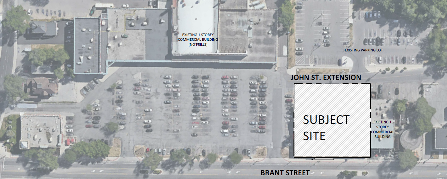
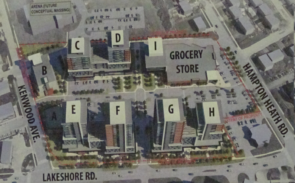
 Rambo Creek runs through the back end (east side of the plaza property) – the plans call for the creation of a walking trail with park benches and the shifting of the No Frills supermarket closer to Brant Street with large scale (17 storey) housing and underground parking.

 Much of this was well before Kearns began to care a hoot about what happened in the ward.


 While much of the planning is a numbers game, there is room for community values and growth aspirations.

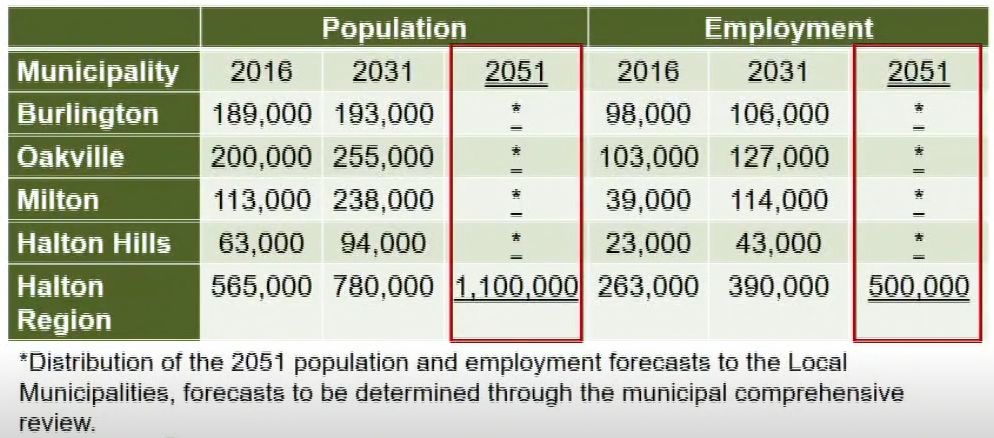
 Just where they will live and where will they work were the issues driving a very in-depth, detailed study that Region Planner Curt Benson took council through this morning.
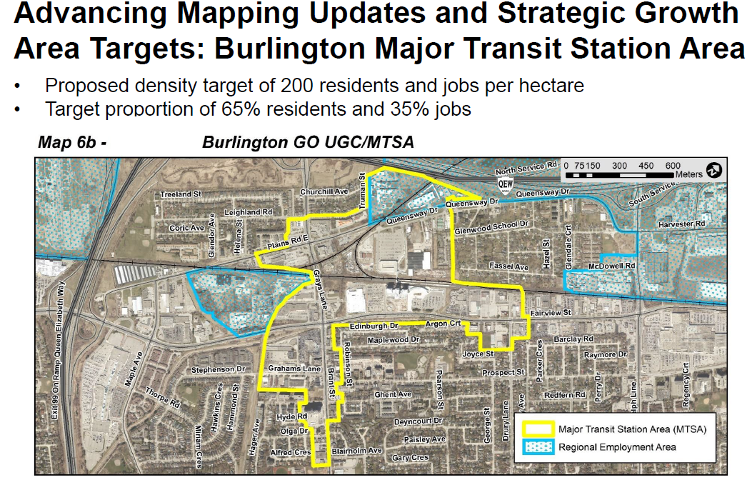
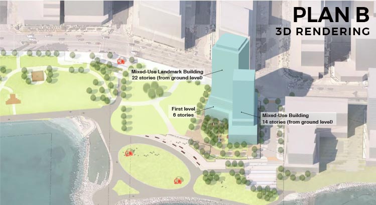


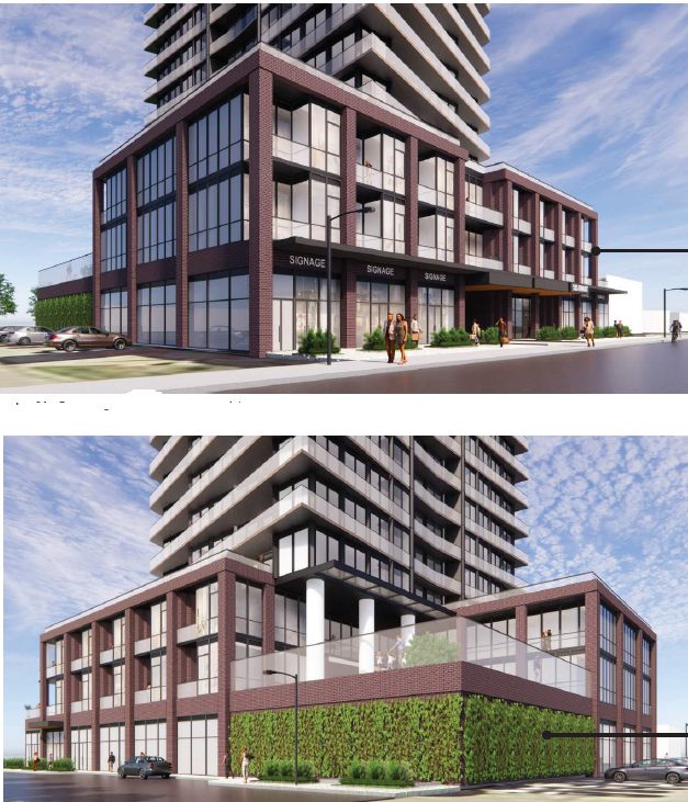
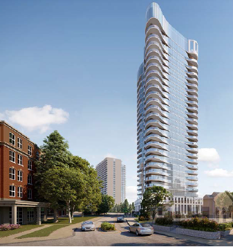
 If Burlington is going to have high rise residential towers – and they are planned for properties around the GO stations – could they at least be interesting, inviting and innovative?